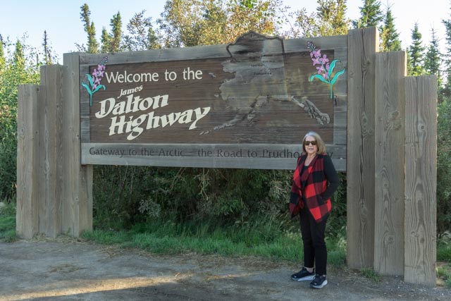
We headed up the Dalton Highway towards Prudhoe Bay and the Arctic Ocean. We left Fairbanks at 6 AM and the sun was still rising by the time we got to this point.

The scenery alongside the Dalton was in full bloom and outstanding as the mountains and valleys appeared.

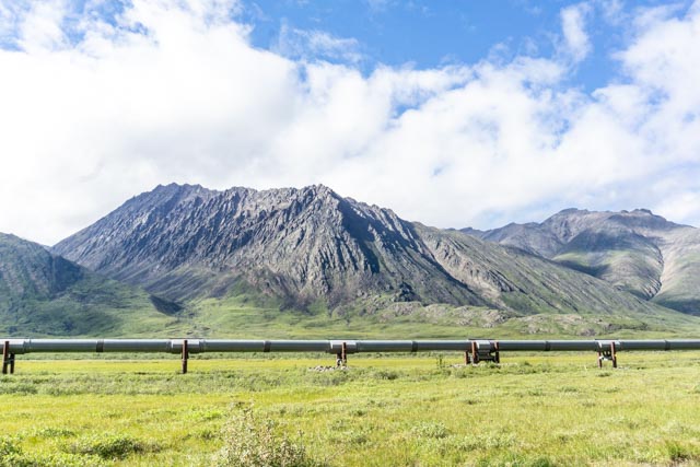
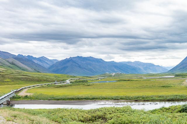
We also got our first sighting of the Alaska Pipeline. Each time we saw it we became more amazed at what the workers accomplished in a little amount of time.

Cathy and me at the Arctic Circle waypoint. We have been through here several times before but have never taken a photograph. Luckily we met another couple who took this for us.
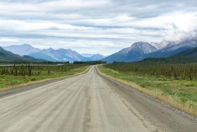


- The Dalton is mostly dirt and gravel. If there was pavement, it was usually 20 mph or slower going. The weather creates heck for pavement!
- Our first crossing of the pipeline. We were able to get very close to it here.
- The pipeline traversing the tundra.
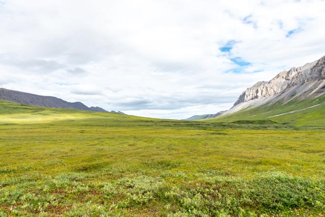
- One of the many, many tundra valleys on the 510 mile journey north.

I captured this photo of the sun rising and the three ranges of mountains we were crossing.
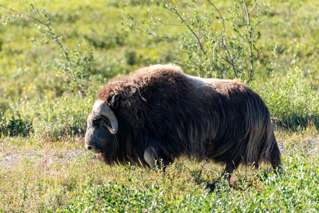
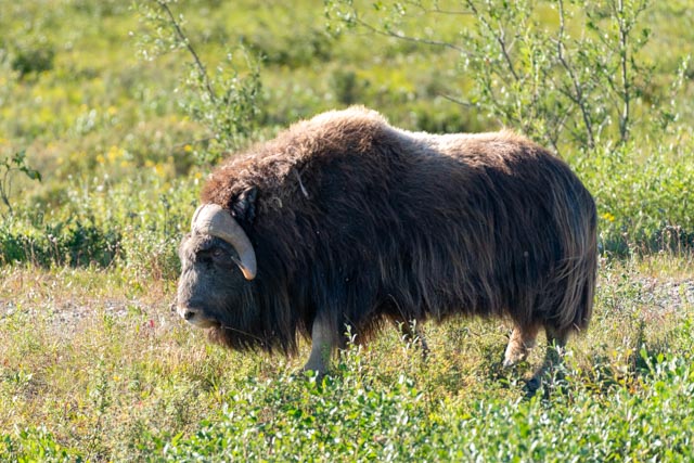

We saw this musk ox in the wild. This is one animal I had hoped to see on this trip. I realized, after several photos that I had absolutely no cover in this now treeless world, against one of, if not the most dangerous animal in Alaska!
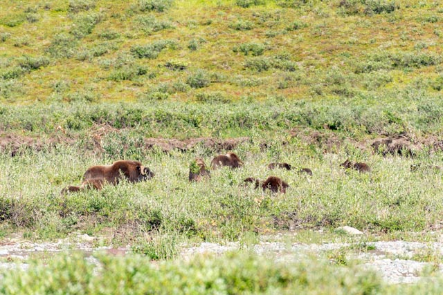
While I was dancing with the big fella, Cathy spotted this group of (at least) seven musk oxen across the road.

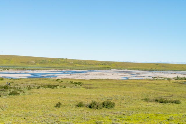

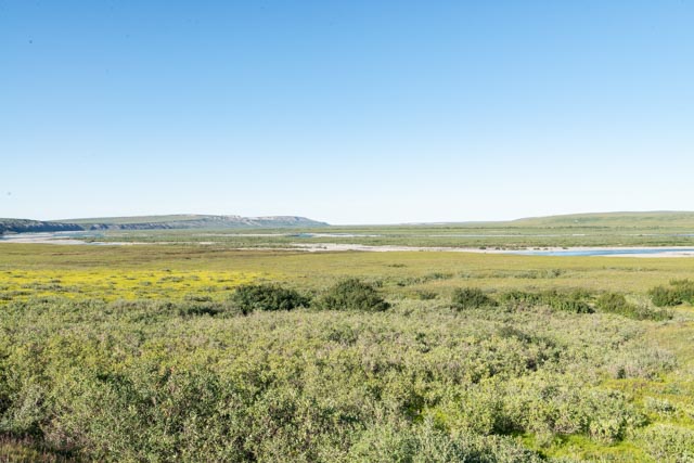
These are some random shots of the incredible treeless tundra after we left our final layer of mountains nearing the ocean.

We saw a musk ox just outside of our sleeping quarters, a fox in the parking lot, a grizzly bear sleeping just down the road and two bull caribou near our swimming location. I tried to take a photo (left center) of the grizzly but he was laying pretty flat in the grass and I only had my small camera.

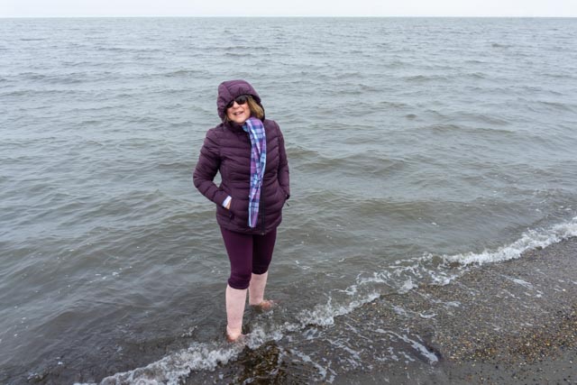
Cathy and me enjoying our dip in the Arctic Ocean. The outside temperature was about 38 degrees and windy, water temperature was about 33 degrees. It was cold and we are the only Americans (in our group) to get in the water at all! Most of the other visitors either stayed in the bus or huddled together for a short time and then got back in the bus. Cathy and I were the last ones back.


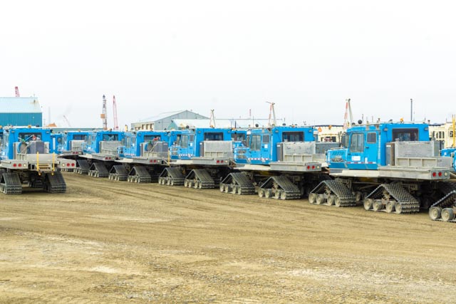
I took some random photos of worker accommodations in the area. The white unit is actually on wheels, very large wheels, so it can be moved. The brown units are three stories high and the last photo is of something used in oil exploration and extraction. There were too many giant machines to identify.
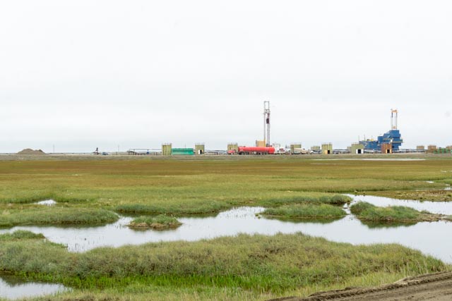
Some more random photos, the first one is showing the very first oil well at Prudhoe Bay, the blue building on the right. I was close to the security checkpoint and they did not allow pictures, so I took this one from a “safe” distance
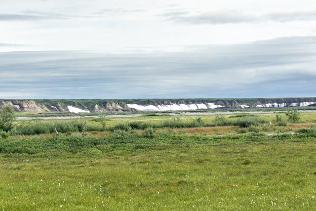
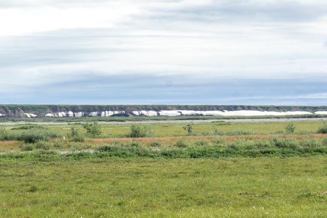
The next two photos are of the banks of the river covered in snow. It took us a while to identify it, our first thought was some sort of plastic film, but that made no sense.

Cathy spotted these caribou feeding in the tundra. They are part of the Porcupine herd that we saw near Dawson City on a previous trip. Unfortunately, they were headed towards a campsite of bow hunters several miles up the road.
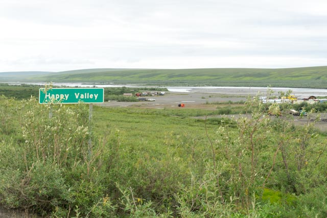
Yes, there is a Happy Valley in Alaska. This one of the original Alaska Pipeline construction camps.
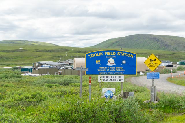
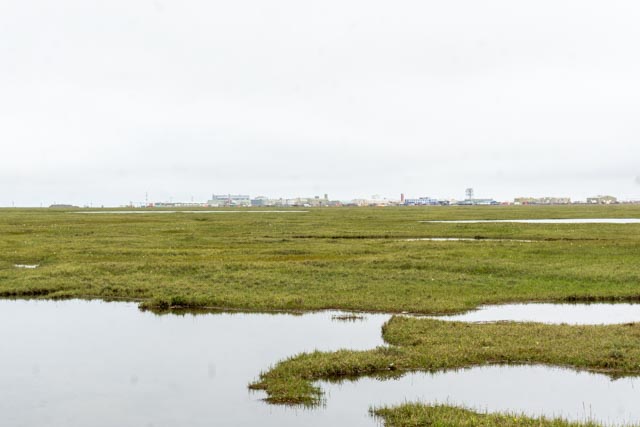
On the way back to Fairbanks, we took a side road to see what the Toolik facility was. We noticed it in the distance on the way to Prudhoe. It was operated by the University of Alaska-Fairbanks and allowed absolutely no admittance.
Galbraith Lake would be the next stop, we drove to the outlet where Jason caught his first Arctic Grayling several years ago. Time changes everything, now the “little” outlet is much larger and had a much heavier flow.
We parked at Atigun River #2 wayside and I hiked to the left, up a hill, towards ANWR, under the pipeline, and through tussocks (up to three feet deep) and ultimately wetlands. (The Atigun River flows through Galbraith Lake). Photo is looking south, toward Atigun Pass, down the pipeline. The Dalton is out of view on the right.
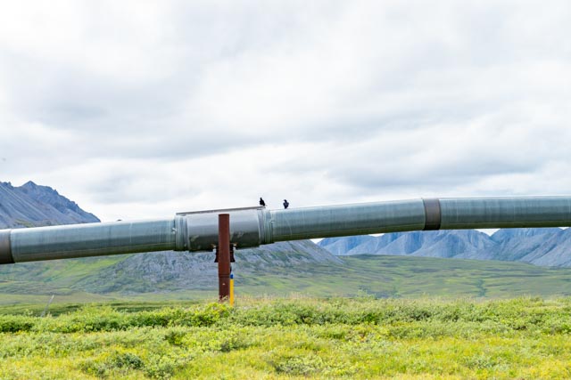
These two fellas were squawking at me as I approached the pipeline. There was no evidence of humans in this area, as few hike here. These guys were probably upset at me encroaching their grounds.
This is the entrance to ANWR. It is incredible hiking through the tussocks and mosquito attack bases (wetlands). There are no existing trails.

I managed to get this photo of the mountain at this entrance to ANWR before giving in to the mosquito brigade.

This pretty much says it all! This sign was at Coldfoot, northbound.
I decided to drive all the way back to Fairbanks as daylight would remain to almost midnight. We made it back to camp in less than 12 hours. It took us over 13 hours to get to Prudhoe Bay, so we did about 25 hours of driving out of a 42 hour trip (on 1,020 miles of mostly dirt roads)! We were the only visitors at the hotel who drove the distance, all the others flew at least to Coldfoot. (Maybe they were smarter?)
Side note: Gasoline in Coldfoot was $7.49/gallon and was much cheaper in Prudhoe Bay at $7.29/gallon!

expensibe gas prices! Love all the wildlife pics!
LikeLike