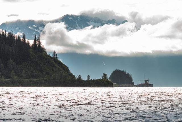
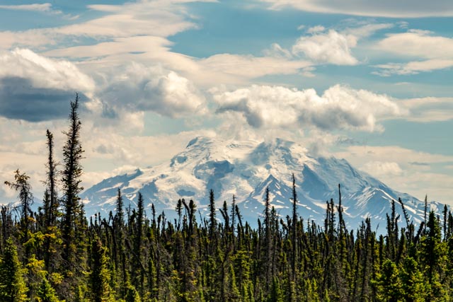
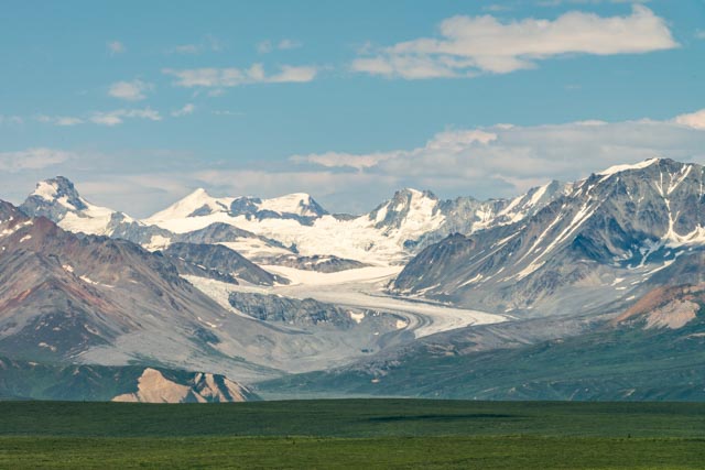
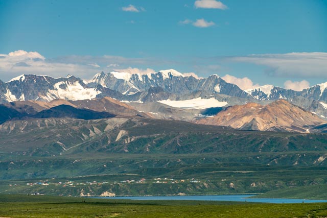
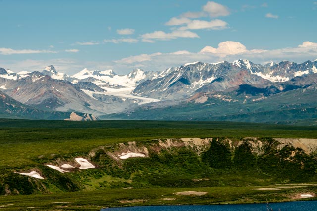
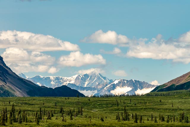
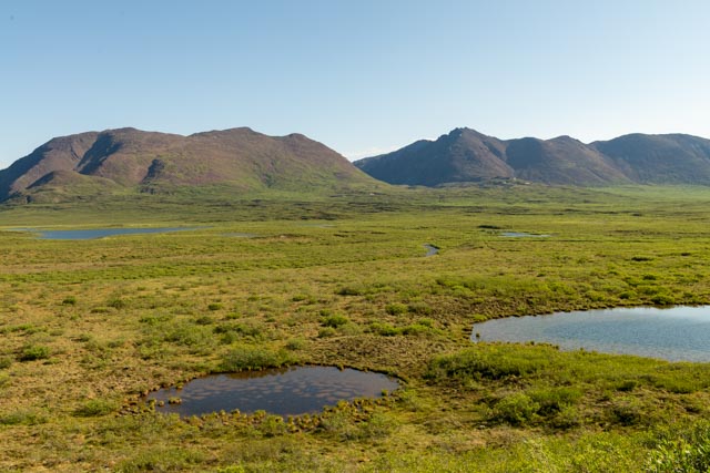
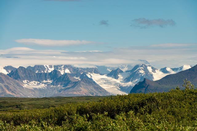
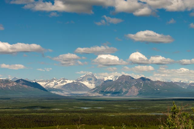
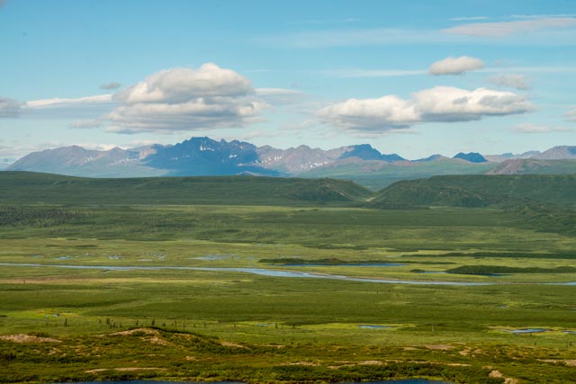
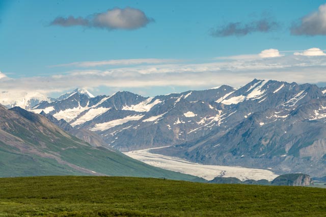
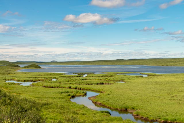
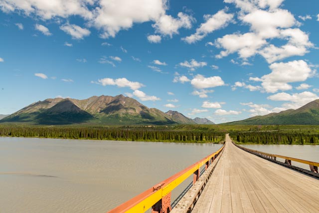
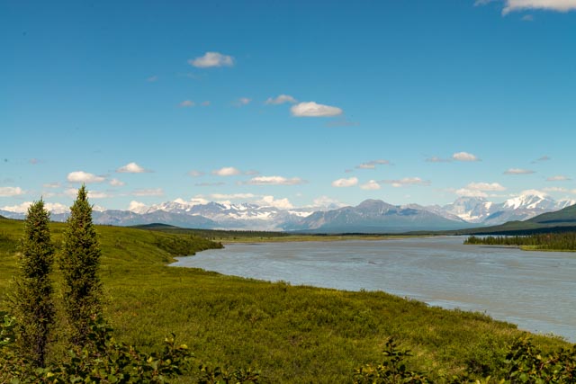
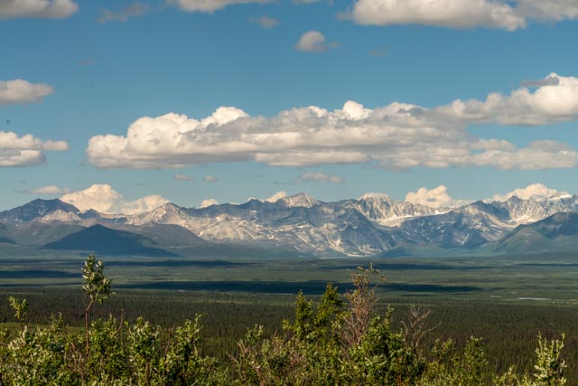
Cathy and I decided to make one more ride to the Solomon Gulch Fish Hatchery, trying to catch the high tide. These guys can only swim into this area with the high tides as the shelf here is rather shallow.We managed to watch the antics of the Stellar Seals as they were feasting on the salmon run.Anytime you have the seals or the bears munching on salmon, you have the scavengers. Sometimes these birds actually tried to pull a salmon from the seal’s mouth!The sun was setting so I took one last shot of the Alaska Pipeline Terminal at the port of Valdez.Heading up the Richardson Highway we were stopped for road construction so I took a photo of Mt. Drum from the roadside, between Glenallen and Paxson.Once we reached Paxson, we turned onto the Denali Highway towards Cantwell and Denali National Park. This highway was the original route to Mt. McKinley (Denali), opened in 1957 and was the only road link to the park before the Parks Highway was constructed in 1972. It is 134 miles long and is paved for 21 miles at the Paxson side and 3 miles at the Cantwell side. This is a view of the Maclaren Glacier. The Maclaren River flows into the Susitna River.A view of the Alaska Range from the Denali Highway.The views from the highway were incredible. We saw numerous glaciers, high mountains, and tons of snow.Another view of the Maclaren Glacier with one of the lakes in the Tangle Lakes Archaeological District. The District contains more than 500 archaeological sites indicating that ancient peoples inhabited this area for at least 10,000 years.At northern latitudes, there is a short, cool growing season followed by a long, cold winter. Trees that survive under these harsh conditions have stunted growth caused by permafrost, climatic conditions, elevation exposure and other factors. These boreal forests, called taiga, are dominated by spruce trees.Numerous small lakes and depressions in the areas were formed when chucks of ice broke off of retreating glaciers and were buried in the glacial debris. The ice eventually melted, leaving circular shaped depressions called kettles.From the Maclaren Summit, we had this view of Mt. Hayes and the Maclaren Glacier. Mt. Hayes is over 13,800 feet but several other significant peaks are visible, including Auroa Peak, Mt. Shand and Mt. Geist. The Maclaren River flows into the Susanna River, past Talkeetna be fore emptying into Cook Inlet, above Anchorage.We were able to see several named glaciers, including Black Rapids, Maclaren, Susanna, West Fork and Nenana.This is Landmark Gap, a glacially scoured cut in the mountains that formed during the ice age more than 10,000 years ago. The Nelchina caribou herd still migrates through this area. Peaks visible through the gap include McGinnis Peak (11,400 feet) and Mt. Moffit (13,020 feet).There was a deep “amphitheater” between the Alaska Range and the highway. We got to witness several of our pilots make ultra-sonic passes up this valley. We really didn’t see them because they were too fast but could see their contrails and felt the ground shake with the booms. We spent the first night here, in a wide spot in the road with this view. The notch in the lateral moraine in the distance was created when a glacial stream cut through the moraine. We actually drove through this notch the next day.This is Clearwater Creek. We stopped to take a look, as the water was crystal clear. There was arctic char and grayling in the river but we did not take the time to fish. I did walk through the brush on the left bank but decided, after a few hundred yards that it probably was not entirely safe, as I did not carry my bear spray, so I quickly returned to the car.We spotted this little fella on the road ready to slapshoot a skateboarder shoe off the roadbed. We had to wait until he took the shot.This is the Susanna Glacier. We had a really good view of the ice field coming through the valley.We spotted this guy taking a dip in a roadside lake but by the time we stopped he was already headed for the brush.These waterfowl lakes are everywhere, aided by the beavers in the area. They are loaded with ducks, geese, grebes and shorebirds.Here we are driving on an esker, a sinuous ridge of silt, sand, gravel and cobbles that were carried and deposited by a stream that flowed within the glacier, confined by walls of ice. When the glacier melted away, these deposits were left as elongated mounds. Eskers on the Denali are considered some of the finest in North America. This part of the drive was exhilarating, as both the right and left side of the roadbed had steep drop-offs.This is the bridge over the Susitna River. I stopped and walked back to get a couple of shots, hoping to see the Valdez Creek Mine on the hillside in the background. The mine produced over 495,000 ounces of gold but was shut down in 1995. The land was restored, well enough to prevent us from really seeing where it was.Here is the view looking upstream on the Susitna. The river is not floatable because of the Devil’s Canyon rapids located just downstream from this point.It was hard to keep track of the views, mountains, mountains and more mountains. We spent our second night on Brushkana Creek at a BLM campground. The creek is noted for it’s fly fishing but was far too swift for me to use conventional spinners so I quickly gave up. Besides, the mosquitos were swarming me and I had heard that they we carrying away small children.


Beautiful photos, looks like a great trip. Happy Travels!
LikeLike