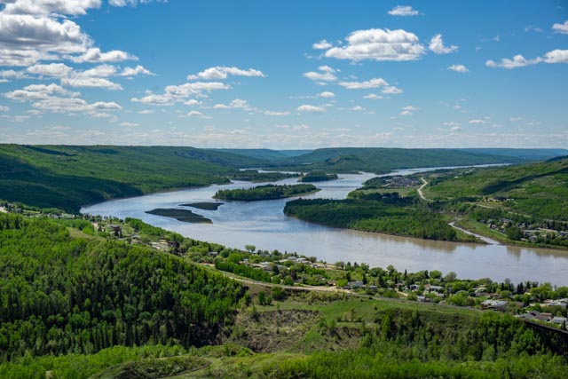
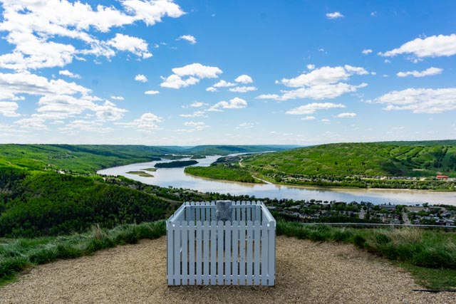
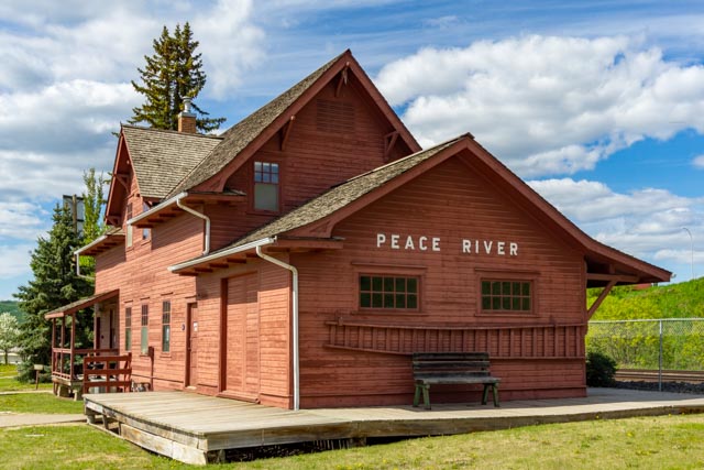
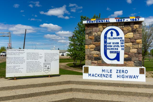
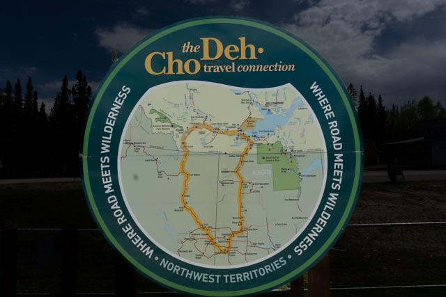
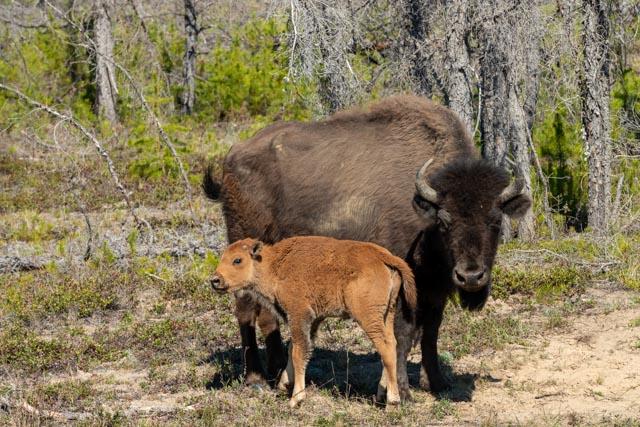
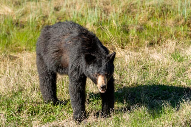
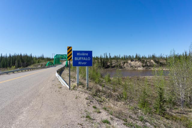
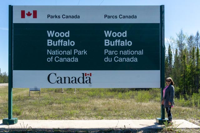
Leaving Edmonton, we headed towards the start on the DehCho route through the Northwest Territory. Our first stop was in the town of Peace River, located on the banks of the Peace River.This is the grave of Twelve-Foot Davis, a local prospector and entrepreneur that made his fortune on a claim he staked between two other existing claims, a width of just twelve feet. It pays to be lucky!The Peace River Museum is housed in the historic railroad station, built in 1916. We also walked over a bridge to the other Peace River Museum, which holds the archives and exhibits on Sir Alexander Mackenzie, and local history. It was closed ‘due to Covid’.We made the short drive over to the town of Grimshaw, the actual start of the Mackenzie Highway. There was a construction crew working on this site, installing some concrete for a patio and I engaged in conversation for a short bit.This is the Mackenzie river. It looks silty as the area had experienced several days of rain and flooding.We crossed the 60th Parallel on the way to Enterprise and the Twin Falls Gorge Territorial Park, our next stop. The visiter Centre was closed ‘due to Covid’. Actually, it was due to open when the season starts, after the schools close for summer break, around the end of June.We found this map which shows the general route we were taking. We have over 500 additional miles of “side trips” planned.Entering the Northwest Territories, we started to encounter animals. We stopped taking pictures (generally) of bison as they were numerous in this area.This was one of 38 black bears that we saw, either in camp, on the road or blocking the road!This was the first waterfall we visited in Twin Falls Gorge Territorial Park / Louise Falls Campground. Again, due the recent heavy rains the water was silty, the water in this area contains minerals that permanently color the water in coffee colors.This is the second waterfall in the park. We hiked to this fall on a nice trail, but alone. We did see a HUGE black bear who had two cubs the next morning in the area.About 50 miles into the drive to Fort Resolution, we crossed the Buffalo River. We would travel at least ten miles between cars! Most of the traffic were highway workers, as this is the time they repair the roads from the winter damage.This is our first look at Great Slave Lake. We were very surprised to find a lot of this large lake still frozen over. The ice visible is several feet thick. The lake covers more than 11,000 square miles and is the fifth largest lake in North America. The water is usually clear and deep, more than 2,000 feet.We asked permission at the Northwest Territories Envioronmelental Center to use their dock to take a couple of photos of the lake. They unlocked the gate and gave us free reign to walk around!Our next stop would be the Wood Buffalo National Park, the largest National Park in Canada, located in both the Northwest Territories and Alberta.While in Fort Smith, we stopped by their Cultural Center to get some information. All First Nations flags were at half mast due to the recent findings of up to 10,000 remains in mass graves located in the “First Nations’ ” residential schools. We did walk around the original site of the mission which was established in 1876 on the site of a Hudson Bay post.Built in 1911, this was the official residence of the Bishop of the Mackenzie. It was upgraded to indoor plumbing in 1961. It housed three separate floors, the bottom was the bishop’s residence, the second floor was occupied by the priests and the third floor was for the brothers of the Oblate, who did the manual labor. The storage shed in the background was built to house goods purchased in Edmonton for resupply to residents from the Arctic Ocean south into central Alberta.
The bishop owned and operated a large farm about twenty miles west of Fort Smith from 1911 to 1928. They grew oats, wheat, turnips, cabbage, carrots, beets and potatoes. They also raised chickens and cattle. Meat came from fishing, hunting and raising domestic cattle. The cattle operation was shut down in 1928 due to interference with the bison herd that was reintroduced in the nearby national park.
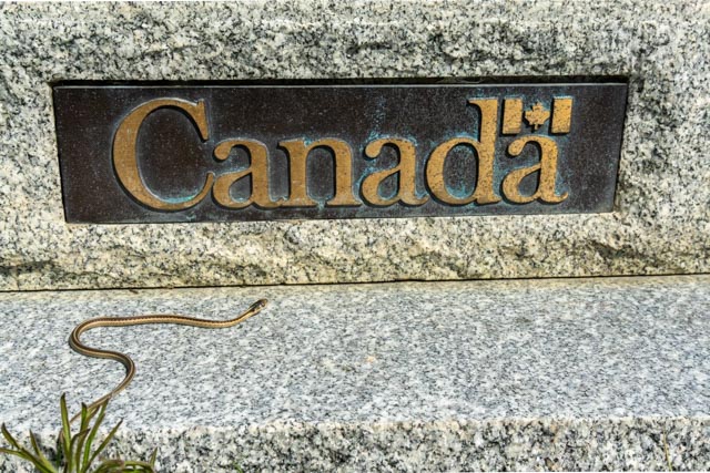
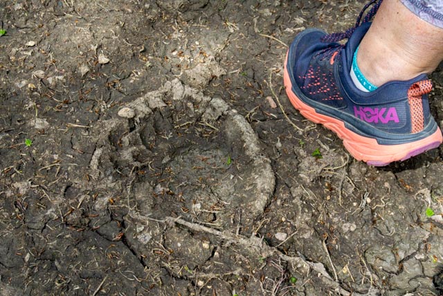
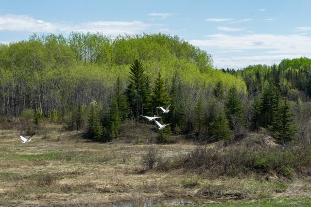
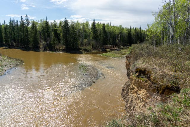
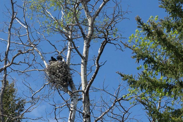
This is the maintenance shed where they repaired farm equipment. The door was open so I, of course, went inside. It was relatively undisturbed and there was a deep mechanics pit to allow easy access to the undersides of the trucks and the farm implements. We were surprised to find proof that snakes do exist in the northern latitudes!We drove a long dirt road to reach the Salt River Cliffs. There were several trailheads at this point but since we were alone we decided to take one of the shorter hikes. Cathy noticed these bear prints on the trail as were were hiking. They were virtually everywhere. Pelicans are one of the birds you look for on the Salt River and we stumbled on to this flock. Once they noticed us, they decided to move on the the next calm spot.As we hiked on, we noticed this bridge over the creek. It was part of a longer backpacking route. We went down the muddy hillside the see what was there.From the bridge, we could see another trail upstream. If only we had the time.These guys were serenading us during our walk. Maybe the reason for the statement “Crows Nest”?We drove another dirt road from Fort Fitzgerald to find a way to see the cassette rapids. We wound up in a farmer’s field and the trail ahead was underwater and we were getting eaten alive by the mosquitos so we turned back. The Slave River, one of the largest in the world at 120,000 cubic feet/second has four sets of rapids in the immediate area – Pelican, Rapids of the Drowned, Mountain Portage and Cassette. We saw three of the four. It is considered one of the world’s greatest kayaking areas, with difficulty ranges from Class I through Class VI, which is un-runnable.We saw these sleek looking aircraft at the airfield in Fort Smith. I inquired as to their purpose. Apparently these are used to direct firefighting operations in the surrounding wilderness. There have been massive forest fires that go pretty much unchecked. We traveled through miles of burned out forests.


Glad you are having good weather in your travels! Stay away from those bears and stay safe!!
LikeLike