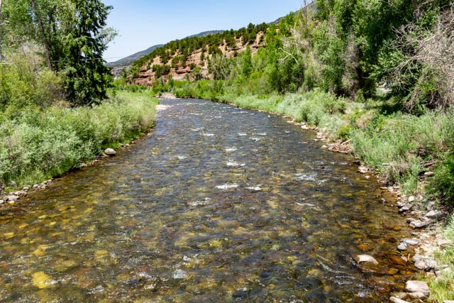
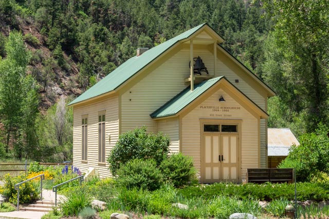
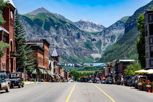
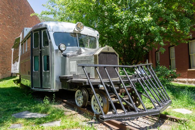
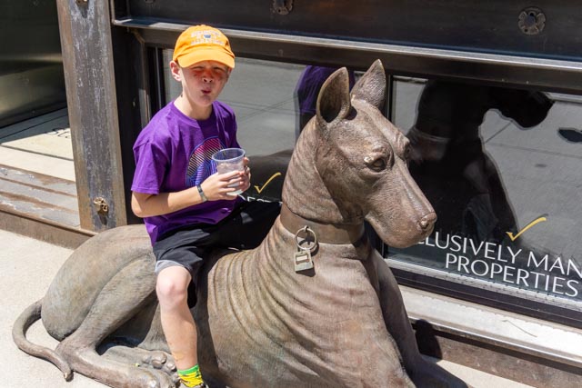
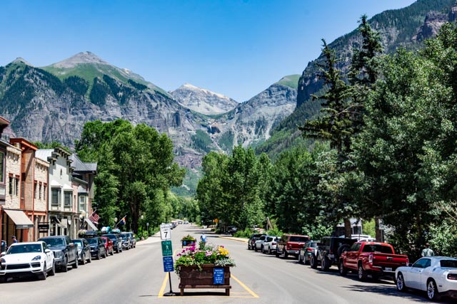
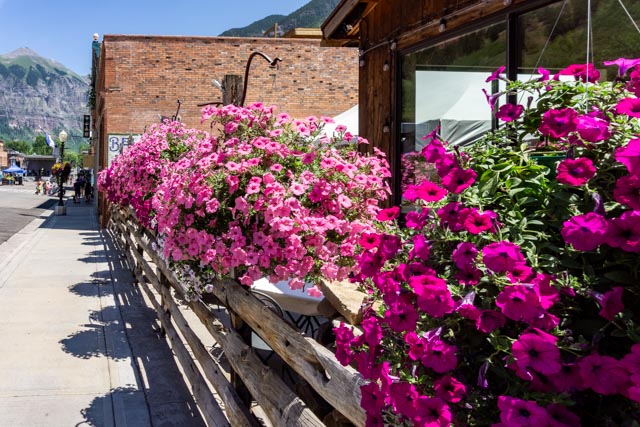
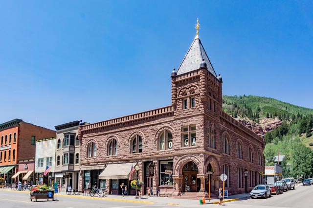
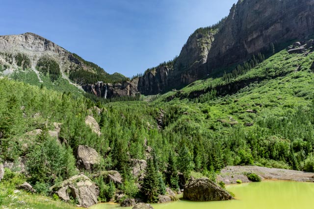
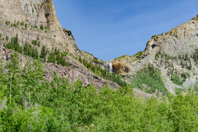
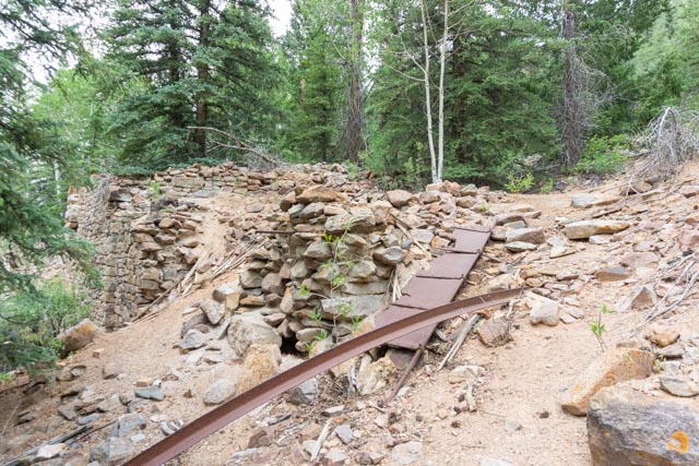
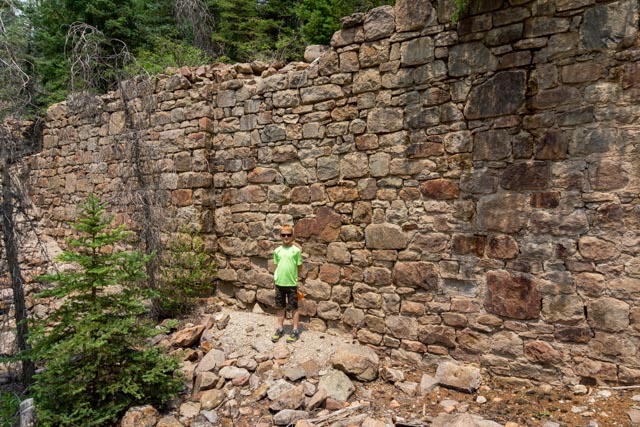
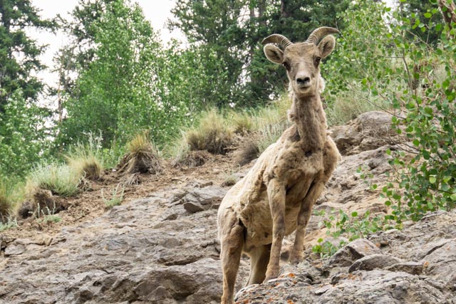
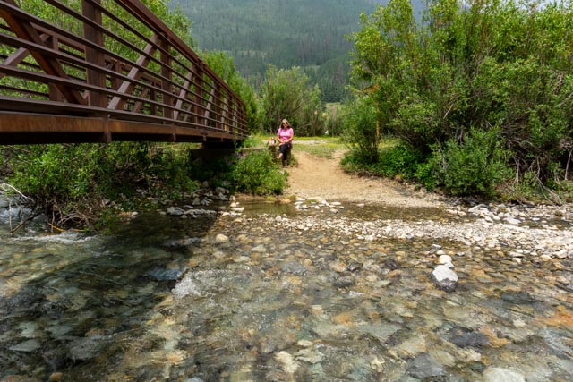
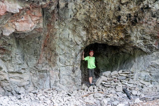
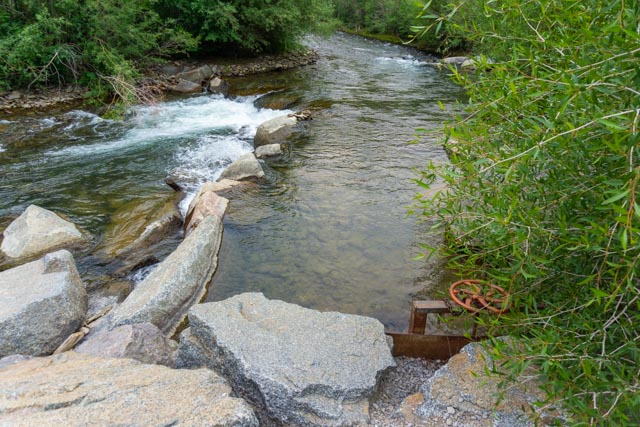
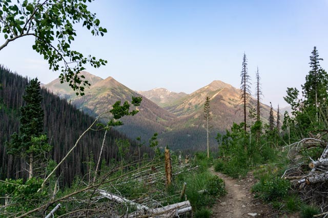
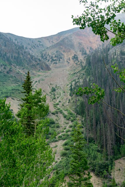
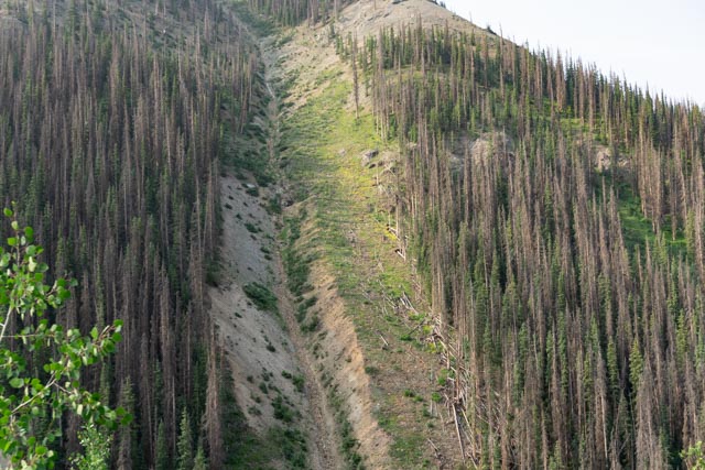
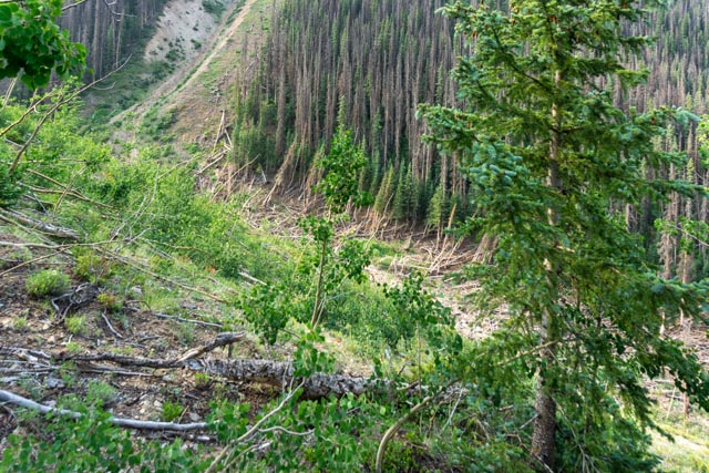
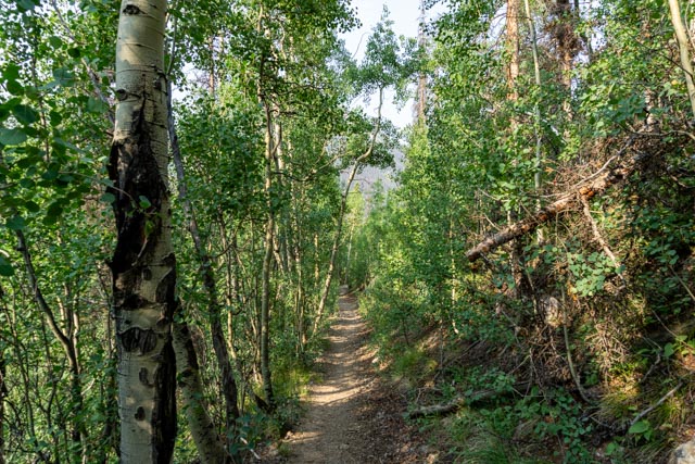
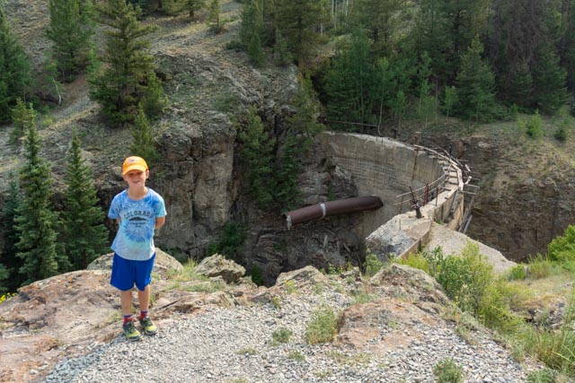
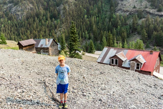
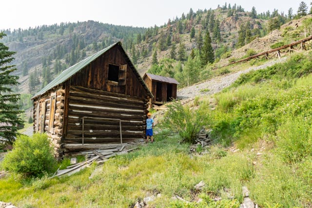
While staying in Montrose, we decided to take drive over to the nearby town of Telluride. We have never been there and I saw a turnoff on the way to Ouray. We took SR62 out of Ridgeway and turned towards Placerville (SR145) into Telluride. It took about two hours. We stopped at this general store, the only store in Placerville and Jason got an ice cream. While Jason and Cathy were enjoying their ice creams I went across the highway and scouted this river.We took a short (one block) drive through town and turned around at this one-room schoolhouse.Approaching Telluride, we startled a herd of elk grazing in a grassy area. There were dozens of them and they took off running when I approached them with my camera.The town was pretty nice, a little pricy though not as upscale as Aspen. We walked the entire business district and then drove around the main street to the mountains you see at the end the street.This was part of the original transportation system back in the day . . . Jason is enjoying an iced drink while sitting on a stray dog he found.This is the main street, leaving the business district, heading for the hills.They were in the process of setting up for the famous Telluride Music Festival in the next week. I am glad we missed that crowd!There were some neat floral displays street side.I took a couple of photos of some of the original buildings erected during the mining boom.This is the San Miguel County court house, built in 1887.Ingram Falls (left) and Bridal Veil Falls(right) appeared at the end of the road. The little peak you see between the falls is Ajax Peak (12,785 feet). Yankee Boy Basin is just over the mountain on the left and the pass we started up, Imogene Pass (13,114 feet) is directly behind the waterfalls and is one of the more difficult drives in the area due to its steep, loose slopes. We could have driven to the power plant building on the cliff but we decided not to chance it as we were 70 miles from Montrose, it was getting late in the afternoon and it would have added a couple of hours to our day. It would be a good trip to come back and run all of the scenic back roads in the immediate area; Cinnamon Pass, Engineer Pass, California Pass, Hurricane Pass, Black Bear, Red Mountain and Imogene Pass. These are all considered part of the Greater Alpine Loop OHV travel routes. They can be accessed from Lake City, Ouray, Silverton or Telluride.There was a small pea-green pond in the basin below us. Since we were directly below the Idarado Mill site, it may have some relevance.There were multiple waterfalls on the cliffs surrounding Telluride. Coronet Falls is pictured above.This is the valley between Telluride and Mountain Village where we saw the elk.On our way out of Montrose, I saw an event going on in the fairgrounds so I found parking for the motorhome and we went inside the arena for a short time to watch the event (I still don’t really know exactly what we were watching).We saw a coyote cross the road in from of us so I pulled over and walked back to where he was. I could not find the guy but did find several gravesites hidden in the brush.This was part of the “Old Spanish Trail” and who knows who was buried here. This is also very near the site of one of the most notorious events in Colorado history, the Alferd Packer event . . . I won’t elaborate but you can look it up.After setting up camp in Lake City we took a drive towards Cinnamon Pass to the trailhead of Sunshine and Redcloud Peaks, two 14ers, I was interested in climbing. Jason spotted this guy off to the side so we pulled over and took a couple of photos.We took a side road (off the 4×4 road) to the ghost town of Sherman. Sherman was destroyed by an avalanche and flood more than a hundred years ago.Jason and I explored some of the remains of the buildings, including this mill and several cabins.This is the original mining road and access to the town in the late 1800s. I found the roadbed by hiking to the base of the cliffs where it had to be. I don’t think it is used much anymore.There were about a half dozen of these guys in the road so we stopped to let them cross. Cathy took this from the truck as the group slowly climbed the rocks. We have seen more bighorn sheep on this trip than we had imagined. We stopped at the Redcloud (14,034 feet), Sunshine (14,018 feet) and Handies (14,048 feet) trailhead to have a picnic. These are three 14ers almost together. I climbed Handies Peak last year and was planning on trying both Redcloud and Sunshine this year.That’s Sunshine with Redcloud directly behind it.We stopped at the top of a cliff to see the townsite of Sherman from above and met this fella grazing around. He came almost right up to us, so close that I put Jason behind a sign to keep him from getting rammed. He was pretty close and probably did not appreciate us interrupting his meal.After getting back to Lake City, Jason and I went for a bike ride on some bicycle trails that roughly follow the Engineer Pass OHV road. We rode by several remnants of old hard rock mines.This mine had been sealed to keep people out. The bicycle trial was in really good shape, and following the canyon, it was pretty flat for the most part. This is the diversion area on Henson Creek from which Lake City gets most of it’s water.I was at the trailhead for Redcloud and Sunshine at 6 AM This photo is from the trail looking at the short route down form Sunshine. It’s a couple of miles of scree.Looking back, I can just see Handies between the three nearer and smaller peaks. Being smaller, there are unnamed at this point.As I got closer to Sunshine, the down trail is coming into sight. This is not a recommended ascent route and not recommended for a descent as it is very dangerous loose rock. A little further up the trail, when we hit snow I was told they expect severe thunderstorms this afternoon and these hikers were going to turn around. Since the double would have taken all day, I decided to turn around. There was a drenching downpour in the next several hours, I am glad I turned around!This avalanche chute was created two years ago during a big snow in the area. There are hundreds of these areas along the mining roads.This is the bottom of the avalanche chute and you can see the force event and how it carried the trees downstream. The wind it created uprooted many trees on the side of the canyon and blew down thousands. The forest crews have done a good job of clearing the trails.This is me, heading back to the truck after failing to complete my double.Our approach to Cottomwood Creek, upstream from San Cristobal Lake.Since I returned to camp in daylight, Jason and I went fishing in nearby Cottonwood Creek. That is a 16″ Brown that Jason is holding. We caught several of these but released them all.In the morning we took Jason to the Ute-Ulay Mine to do some exploring. This was the original dam built to power the mining operation. The dam has since been breached and the cliff behind Jason goes straight down to the creek bed.This is downstream from the dam and you can see part of the wooded flume on the right hillside. The buildings further downstream are original mining buildings that have been reused by the state reclamation. This area is under renovation and preservation by the Colorado Division of Reclamation, Mining and Safety, but there was a trail that allowed you to get near some of the buildings and machines. This head frame is over a hard rock shaft that goes down so deep you cannot see the bottom. The state has done a pretty good job of securing the shaft to keep people out. Jason is perfecting his “sweet kid” pose. You almost have to wonder, what does he have in his hands?Water is being diverted and held in the tank. It is simply labeled “Storage Tank”.One of the many remaining buildings is pictured above. You can see the wooden waterway leading to the tank in the previous photo.Jason is sunning himself on the porch of this dovetailed log cabin.


Telluride looks like a beautiful town. You did some great exploring on this trip!
LikeLike