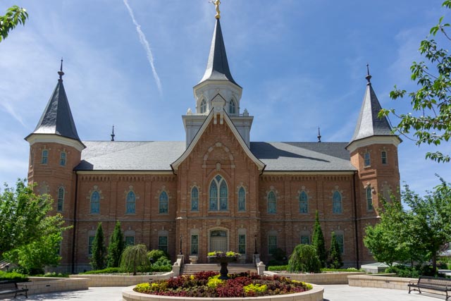
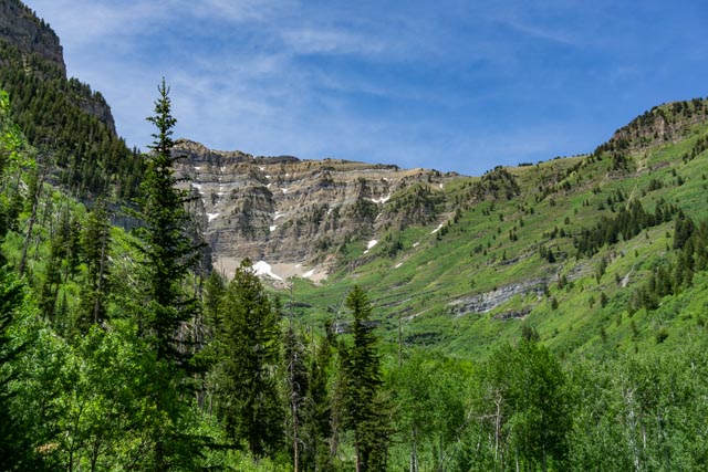
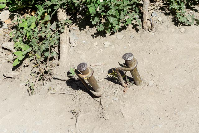
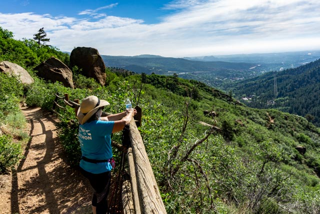
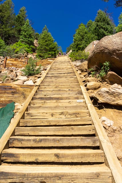
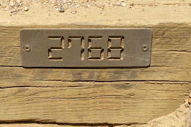
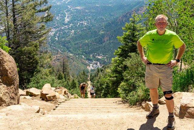
In the morning we decided to take a walk through downtown Provo. This temple was in construction on our last visit in 2016 and is now complete. The grounds surrounding the building are immaculate and the gardens and fountains are beautiful. We met a young couple who gave us some insights and details on the temple.This was the finish area for the marathon, half marathon and 10K. The transformation from the previous day was amazing. Clean, clean and clean. It was hard to recognize from raceday.This is a side view of the temple. You can see some examples of the myriad of gardens and features that make these grounds stunning.These were the original offices of Brigham Young Academy, founded in 1875 by Brigham Young, president of the Church of Jesus Christ of Latter Day Saints. It now houses the city library. The entire university was housed in the “square” that encompasses this building. This building was across the street from the current library and housed the BYU women’s gymnasium.Imagine going to a football game with this view of the Wasatch! During football season the mountains in the background are covered in snow.This waterfall was the destination of our hike. Cathy is dousing her toes in the water. I tried it but it was very cold, actually numbing cold so I pretty much stayed on dry land. The hike was a little over two miles in, two miles out and just a little steeper than we thought.Originally there were either cables or chains on the trail to assist hikers in some of the steeper areas.Cathy taking the easiest route over some rocks with a very steep drop-off to her right. Of course she made it with ease. Is she part mountain goat?On the return hike, I found this field in the middle of an aspen grove. We passed several recent avalanche areas where the aspens were laid prone. I needed to get out of the rocks for a moment. In the morning we will be heading east, through the Uinta Mountains and the Uinta and Ouray Indian Reservation. We took an alternate route once entering Colorado, leaving I-40 at Dinosaur and taking SR64 through Meeker and up through Craig.This arrow points to the spot, one and a half miles in the distant, where U.S. Indian agent Nathan Meeker and his male employees of the White River Ute Indian agency were “killed” by the Ute Indians. The (white) women and children were captured during the battle on September 29, 1879 and were later released . . . As always there are two sides to every story and the two books I have read about this event leads me to believe the Ute side.I convinced Cathy to take a little hike on the Barr Trail, leading up Pike’s Peak. This is the trail that I ran for 13.1 miles on the Pikes Peak Ascent two years ago. We are waiting for the Cog Railway train to come up the incline as it had not operated for the past several years.The Manitou Incline, a steep stairway leads about a mile up the mountain. This stairway was closed last year for renovations and I have never been around when it had been open. It just opened and there were no more excuses. I made the climb (and later found out you are really supposed to reserve a time slot). There was a lot of green fabric laid down to prevent erosion on the steep sections and about every 30 steps there were buttresses of large timbers on the left side to provide a flat spot to rest as it was too steep to try to rest on the right side of the staircase. The individual steps are held in place with cables. It was pretty neat how the entire staircase was engineered. There was some abandoned mining equipment scattered in the brush on the way up but believe me, I made NO attempt to investigate.It looked fairly easy, how hard could a few stairs be? Pretty hard, I found out. It was in the lower 90s and at this elevation climbers were struggling to get up the stairs. We watched a lot of people using their hands and legs to climb the steeper sections. We were told that there was a black bear visiting the start area in the morning, that would get you going! Notice the two hikers in front of me? That is a false summit in the picture, the finish is several hundred more steps up over the rise.This is the last step on the staircase, stair 2768. I was count ing each and every one while making mental adjustments on the climb, but finally made it!Yes, that is the same two hikers struggling to finish! I had another hiker at the top take my picture to prove that I actually made the climb. It was only a mile but a very tough mile. I jogged the 3+ miles back on the Barr Trail as I did not relish the thought of going DOWN the stairs.This is one section through the rocks that you have to navigate on the much easier Barr Trail.


Nice to see Cathy in her beautiful hat. I would just as soon see neither of you be mountain goats though!
LikeLike