We started off in Cody by walking ths shops and having lunch at Irma’s Cafe. Irma was the daughter of William “Buffalo Bill” Cody. We visited the Chamber of Commerce and found a delightful and enthusiastic lady who told us about some of the different places to visit. We took her advice and had a great time exploring the unique side of Cody. I asked her if there were any trails up Heart Mountain and she looked at me like I was nuts! She assured me it was an all day, very strenuous hike. We returned a few days later and thanked her for her advice on the sites we visited. We visited the Heart Mountain Internment Center, hiked Heart Mountain, and visited the historic irrigation systems; including the Shoshoni Syphon, the Buffalo Bill Dam and the Diversion Dams and tunnels that allowed the farmland to be irrigated in the early 1900s.
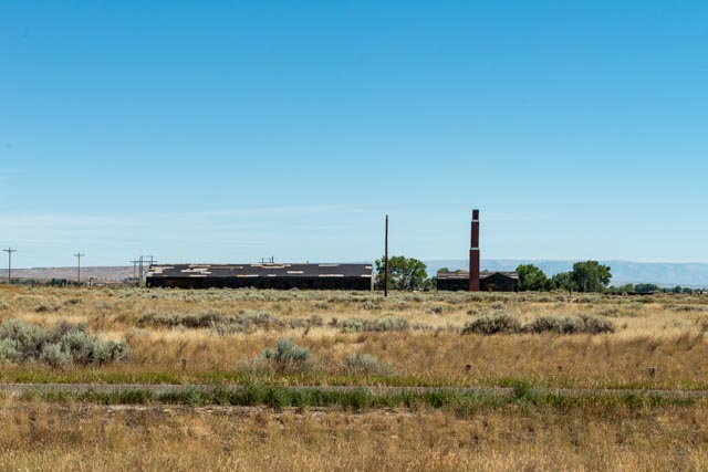
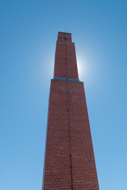
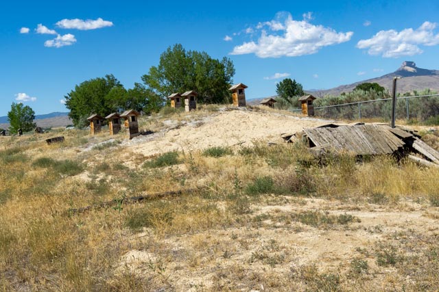
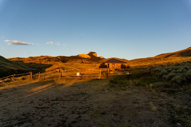
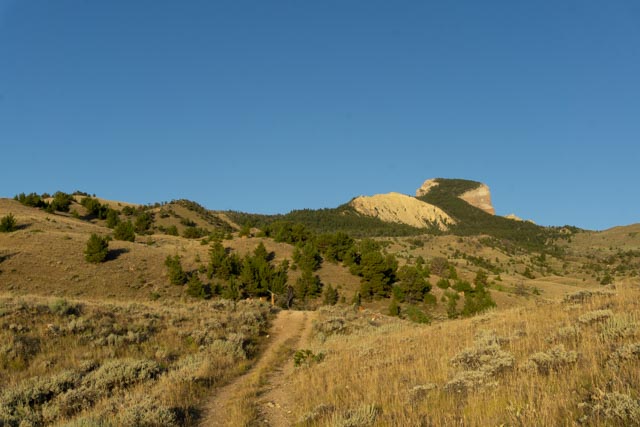
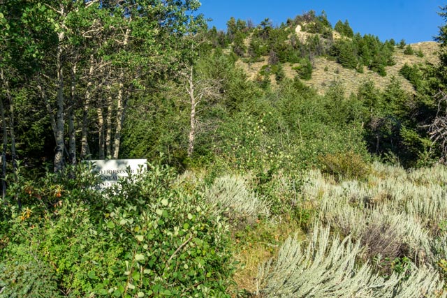
The Heart Mountain Relocation Center was an internment camp for Japanese nationals and citizens during World War II. It was one of many such camps spread throughout the Western States. It held up to 14,000 detainees.We spent several hours walking the site. The green patch in the center of this picture was the swimming hole that was dug for the children. In the winter it froze and was used for ice skating.These are the original foundation posts from the administration building.The small concrete building in the field is all that remains from the Heart Mountain High School. It is the room where student records were stored. In the background you can see Heart Mountain.This is the central memorial area for the internment camp. There were many informative plaques throughout the area. The stone at the flagpole is a listing of all of the Japanese men who fought for the allies during the war. They were both volunteers and draftees from this camp.This is the power plant for the settlement. There were several hospital buildings still standing but most had fallen down.The brick smokestack had tilted about 15 degrees and had to be reengineered several years ago to keep it from collapsing.They had a volunteer fire department for the facility. I saw this fire hydrant in the field, covered in the prairie grass.This is one of the original watchtowers that covered the perimeter of the detainment center. They were manned with machine gunners, spotlights and the perimeter was barbed or razor wire. There were eight of these guard towers.This is the only remaining root cellar, which was located on private property. Somehow we managed to both find it and photograph it.This is the end view of the root cellar. The Japanese out-performed the locals in farming and actually produced a surplus which was sent to other internment camps and sold locally.After visiting the internment camp, we drove up to the trailhead to Heart Mountain. Due to Covid, the cabin was closed, but the trail was open.I got up early to be at the trailhead by sunrise. I barely made it on time, but quickly discovered I was alone. Heart Mountain is in the background, about an eight mile round trip hike away.Heading up the trail, it started pretty easy. The mountain loomed in the distance. There were signs warning that there was a grizzly mother and two cubs spotted on the mountain. This is a dangerous combination. Evidently due to its proximity to Yellowstone, the bears sometimes come here to raise their young.Hike in groups of 3 or more. I was the ONLY person on the mountain. Make noise. I did that! Avoid thick brush (see next slide). Carry bear spray and know how to use it. I carried it. Stay on maintained trails (see next slide).
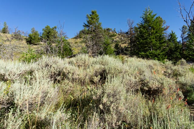
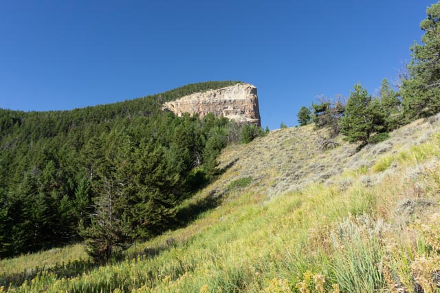
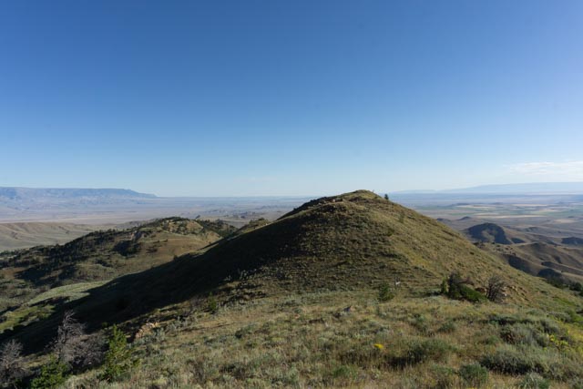
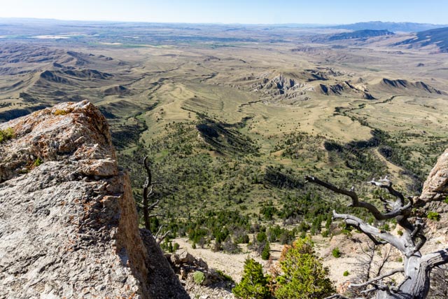
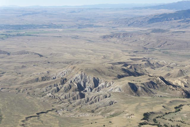
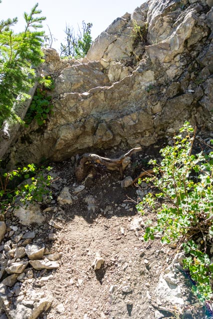
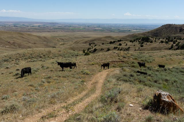
The trail went straight into the brush!Sometimes you may need a hint.I was getting closer to the destination, Heart Mountain.The gap between the distant mountains is the Big Horn Basin as seen from midway up Heart Mountain.These are the Beartooth Mountains as seen from midway up Heart Mountain.The “pointy” mountain is Pilot Peak. Sugarloaf Mountain is to the right. The black mountain to the left of Pilot is Dead Indian Mountain, as seen from midway up Heart Mountain.Enough of the surrounding mountain ranges, I have to get back to the mountain.I passed several caves trailside.This was the first inkling that I was nearing the summit. I came out of the forest to this view. A couple of more steps and it was straight down for several hundred feet.My destination was still up the trail.I had to take a selfie as I was the only one on the mountain. The small knob behind me is in the next photo. it looked doable from the ground but up close it was a booger to reach. I passed on any attempt.I saw some strange formations in the hills below. The town of Cody is visible as the darker area in the upper left of this photo. I filled out the Heart Mountain register but managed to get the date wrong.Here is a verification of the height of this mountain. I started at a trailhead elevation of about 5,200 feet. It took me two hours and 47 minutes to reach the top, and after a brief rest and breakfast I headed down. I got back to the truck for a total round trip time of 4 hours and 9 minutes for the 7.8 miles.Heading down I had to apply the brakes as I rounded the bush near the point ahead. This was pretty steep and a slide here could be a freefall.I forgot that there was a small amount of scrambling to get to the top but quickly remembered when I had to go down the scrambles. This is actually the trail!Back on the range I had some trail partners, at least for several minutes.I spotted a couple of these guys running in the brush. This was the fattest pronghorn I have ever seen. The eating must be good here!
After finishing the mountain hike, I went back to the motorhome for lunch, then we headed for the historic Reed Corbett Diversion Dam where I “took’ several photos of the waterfalls and then headed off to the National Civil Engineering Landmark, the Buffalo Bill Dam. I “took” several great photos of the dam, the surroundings and the reservoir. When we got back to the motorhome, I noticed the card for the camera was still in the computer. I did not “take” any pictures.


Thanks for sharing the internment camp. Been to Cody twice and have never seen it. Glad you had bear spray on that hike!
LikeLike