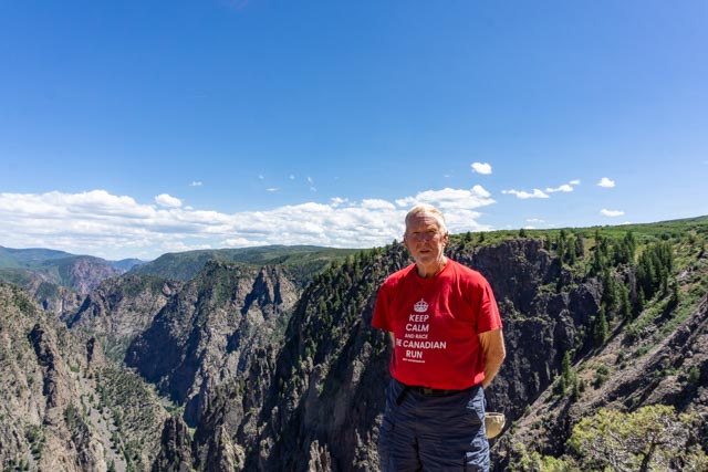
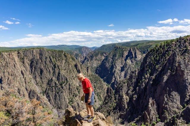
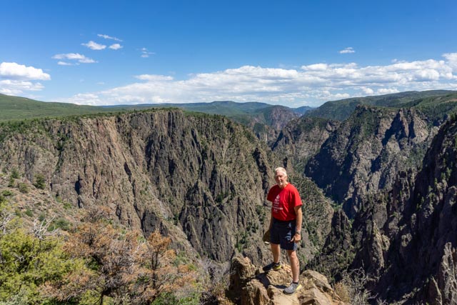
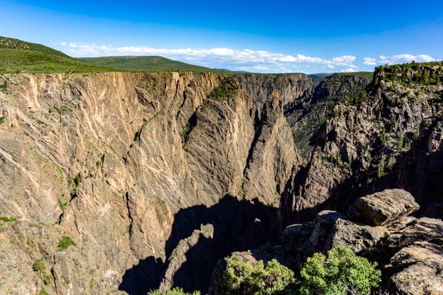
After leaving Lake City we headed back to Highway 50 to Montrose. We traveled alongside Blue Mesa Reservoir for the first few miles. The deep blue contrasted with the landscape and made for wonderful scenery.After acquiring a campsite in Montrose, we headed to the Black Canyon of the Gunnison National Park which we spotted heading into Montrose. Our first stop was the Rim Rock Trail and we hiked onto the rim of the canyon. It was indeed black and very, very deep with vertical sides. It was pretty impressive.Of course, I had to pose on the edge!After stopping at the visitor center, we headed for a drive (and walks) along the South Rim of the canyon.We hiked to Tomichi Point to take in the view and take some photographs.
Is it really that far down?
Oh well, I am already out here!
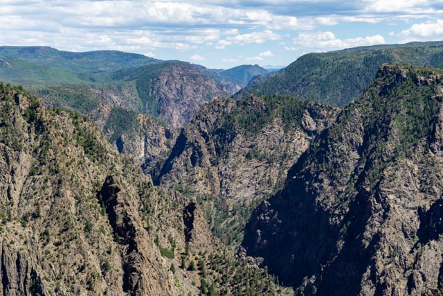
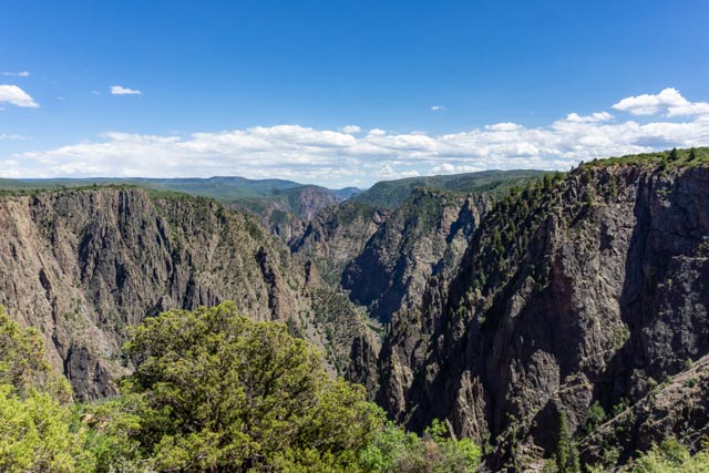
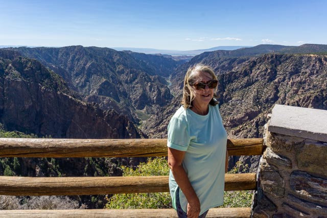
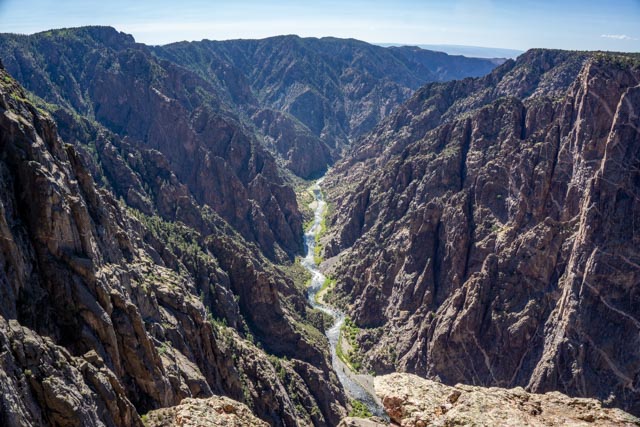
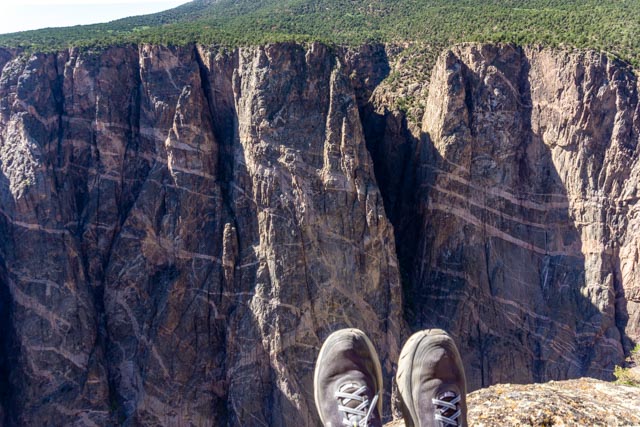
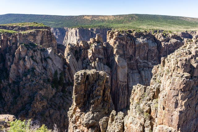
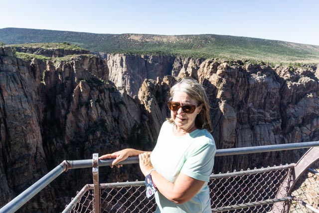
That is the Gunnison River deep down into the canyon. It has been cutting its way through the rock for over two million years. Geologists indicate the bottom of the canyon has yet to be reached.As we drove through the park, we continually saw the far-away San Juan Mountains, towering above the 8,000 foot rim of the canyon.Cathy has become quite the climber. Here she is posing about 1,700 feet above the river below at Chasm View.The river below Chasm View continues to chisel away at the rock.I saw this Pinon-juniper alongside the trail and had to stop, rest and take a photo.This is the Painted Wall. Veins of pink pegmatite run horizontally through the canyon walls of dark blue-black gneiss. The molten pegmatite was squeezed (intruded) into the fractures and joints in the existing gneiss then cooled and hardened creating this three-dimensional “Painted Wall”. At 2,300 feet vertical, it is the highest cliff in Colorado, twice as high as the Empire State building!I found a perfect place to rest my weary feet. In retrospect, it was kind of sketchy and no one tried to join me.This sign was placed for Jason. Since the trailheads to the bottom are purposely kept hidden, this kind of identifies one route. I talked with a ranger and they keep the three trails to the bottom unmarked and only let the serious people know where the trails start. They want to keep knuckleheads like me out of danger. I managed to procure a hiker’s trail map from the ranger (who was also a runner) with detailed trail descriptions and decided NOT to try to reach the bottom.The sun was getting low in the sky making it more difficult to capture the depth of the canyon. This area is know as the Cross Fissures.It is hard to see the depth, but there are three canyons in this view of Rock Point. The first canyon is in the foreground, the second can be seen through the notch in the first wall and the third canyon can be seen above the second wall. It seems kind of confusing but spectacular when seen in person.Cathy “white knuckling” the view of the three canyons. Her thoughts are probably on the canyon floor, about 1,800 feet straight down.As we left the park, we took one last view.We probably should have taken this photo entering the park like most others but we found the early evening far less crowded.


Pretty scenery and great pictures. I am glad you decided to go down the “safe” trail though! Looks like you are having a great trip in Colorado.
LikeLike