We left Haines early in the morning to avoid traffic (ha ha) and enjoyed the wonderful views of the mountains on the way back to Haines Junction.


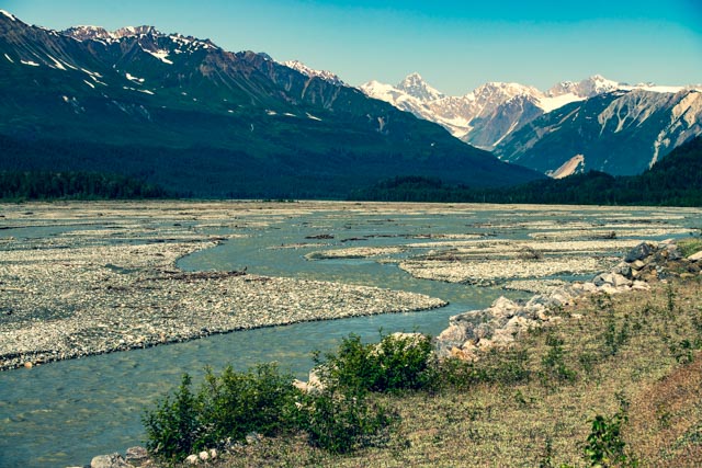
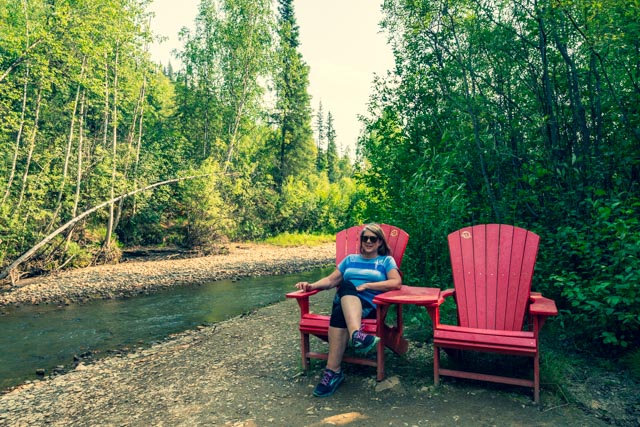
This is the braided Chilkat river. It is very shallow due to the many braids. The eagles were feasting.
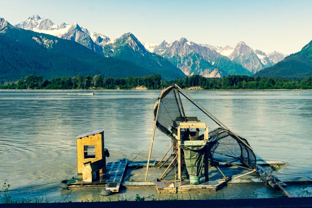
We passed a couple of fish wheels on the way out.
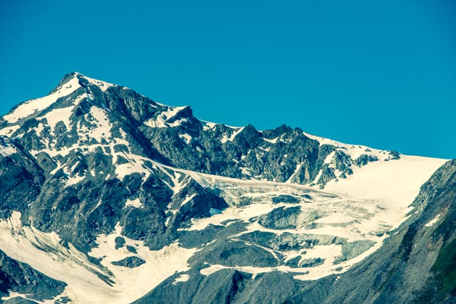
The view of the valley and the mountain range that we will travel soon is lovely.

There are many glaciers and ice falls. As a result of years of ice grinding on the rocks, there is a lot of very fine silt or sand directly below the icefalls.


These semi-flat valleys had a lot of glacial created ponds and lakes. Some of these are a result of large chunks of ice being left behind, which slowly melted and filled the depressions caused by the shear weight of the chunks.
At Kluane Lake National Park in the Yukon, we stopped and watched several Dall sheep traverse the mountain in the background. This is the area where the northern-based and southern-based Alaska Highway construction crews met each other, officially completing the ALCAN.

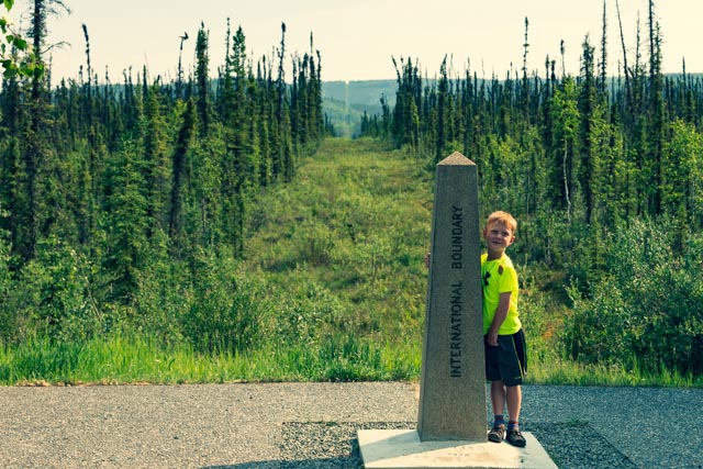
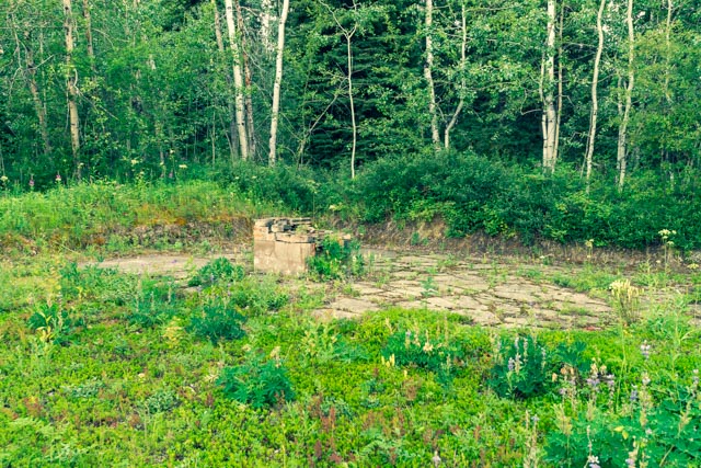
Jason posed at the official international border crossing. You can see the border line cut in through the trees in the background.
This view is looking back at the Yukon, from which we came.

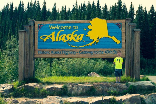
We are looking forward to a couple of months in the 49th state.
We camped in Tok, Alaska for several days and elected to leave the motorhome in camp while we headed for the Taylor Highway and Top-of-the-World Road. We passed a forest fire the previous day in the Yukon wilderness and the resultant smoke obscured the sun somewhat as we set out. The Taylor Highway is open from about April to mid-October and driving conditions can range from good to poor, depending on weather conditions.

There is a famous chicken at the townsite of Chicken, about 70 miles down a chip-seal and gravel road.

The dredge that was hauled up the hill from the river below still remains. This was an important gold-producing area in the early 1900s and there is still active mining being done in the area.

As we climbed Top-of-the-World Road, the views became precarious but stunning. There was actually nothing to keep a car from ending up in the river below, no guardrail and not large trees or even brush. We would come back on this road in the rain and saw a motorhome and car in the ditch, where they slid off the slick road.

This is Jack Wade Junction, where the Taylor veers off to the left and Top-of-the-World-continues into Dawson, Yukon Territory.

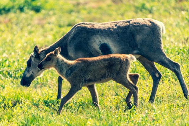
We were on the constant lookout for wild animals and finally hit the jackpot. We spotted a herd of caribou on a high ridge over the road, so we found a wide spot to park and Jason and I went to a very large meadow to wait for the herd to descend. We assumed they were headed along a game trail. Here are some of them running down the hill.

They were getting close to us but we were both seated in a small clump of high grass and remained unnoticed.

Quickly, we were surrounded by the dozens of animals. They were getting very close so we stood up so they would notice us and not get frightened unnecessarily. As you can see, they took notice, but continued as is we were not there. They obviously did not see us as a threat.
At one point we were positioned between a baby and her mother. Cathy saw the baby coming up the road and warned us. The mother came over and got her baby and continued on without issue.

We continued to sit while the major part of the herd filed past us, keeping a wary eye peeled at all times. They showed interest but no aggression.
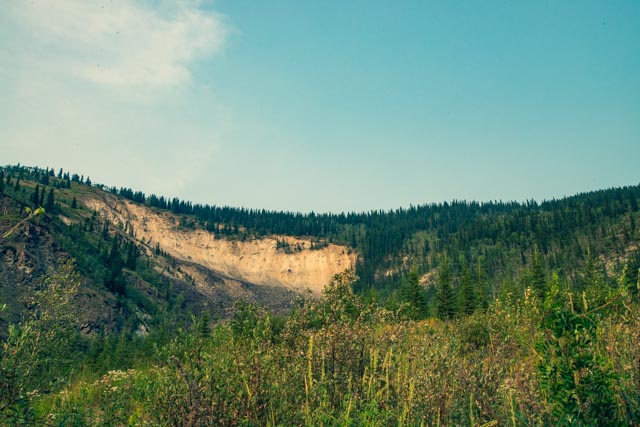
The first thing you see as you start descending to the Yukon river is this large landslide, which is located just above Dawson City. This landmark was caused by a landslide about 17,000 years ago and not caused by any recent mining operations. We managed to get up to the base of this feature looking for the remains of a foot bridge that was built 100 years ago.
We took the ferry across the Yukon. The current was very strong, pushing the small ferry sideways. We wound up far below the gravel exit area and had to power upriver to reach it. These ferries operate in all weather conditions during the summer months. The river is frozen during the winter and the breakup signals the start of ferry season.

We saw the end of he the Yukon Quest, a 700KM boat race from Whitehorse to Dawson. There were categories for kayaks, canoes and stand-up boards. Here is a two-person kayak racing a four-seat canoe to the finish.

There is a paddle wheeler taking tourists up and down the river.

We visited the site of the gold discovery on Rabbit Creek (now named Bonanza Creek). There was only one other car at the site so we pretty much had the area to ourselves.
This is the actual location on the creek where George Carmack, originally from Contra Costa county, California and Skookum Jim Mason, a Native American, discovered gold and set off the Klondike Gold Stampede of 1898. This became one of the major contributing factors to the early development of the Alaska frontier. Their original claims, Claim #1 and Claim #2 are on this site. George moved to his ranch in Modesto following the discovery. Cathy is comfortable watching Jason prospect for gold, or at least throw rocks in the creek.

We followed an interpretive trail which discussed the gold discovery and Jason led the way, pickup up every other rock looking for gold. It was hard to convince him that that had already been done, thousands of times.
After the basic methods of gold extraction were executed, the miners brought in the gold dredges, devastating the canyon, very similar to what was done in the Folsom area of Northern California.

Jason had fun, running from abandoned equipment to abandoned equipment. There was plenty to be had.


We had dinner in Dawson. We decided on Joe’s Sourdough based on a local recommendation and were not disappointed. I had fish and chips, Cathy enjoyed seafood stew, and Jason stuck with a hamburger.

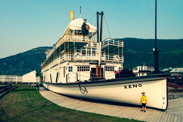
The next morning, we made it to the first tour of the Keno, the sister boat to the Klondike that we saw in Whitehorse. The Keno is a Canadian National Historic Site. We never managed to have the time to get Jason on the other boat so we made sure that he had a chance to see this one. The tour was operated by the Canadian Park Service.
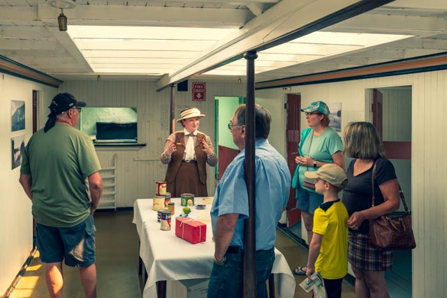
Below deck, we are getting a lesson on what to expect as a passenger in the dining room.
After the tour, we were invited to complete postcards and the postage was paid for by the park service. Jason is taking advantage and using the onboard desk to fill out a couple of cards.

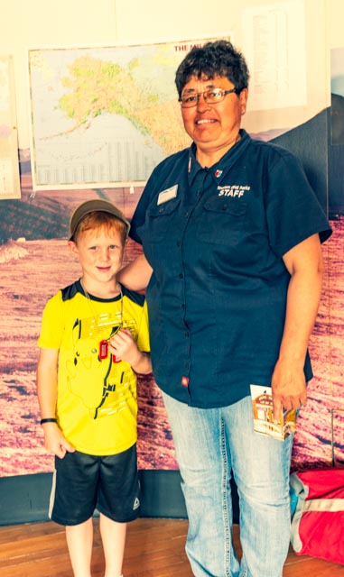
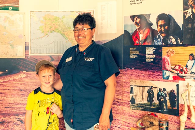
We visited the Northwest Territories Visitor Center to gather some information for a potential future trip to Great Slave Lake and the Dempster Highway to Tuktoyaktuk and the Arctic Ocean. Jason befriended Miss Dawn, an Inuit who spent time teaching us about Inuit culture and customs. She also went into a good deal of detail about the differences between indigenous and Inuit people. The Inuit have inhabited this area for about 40,000 years. We have met many docents in our travels, Dawn being at the top of the list as an engaged teacher who truly enjoys her work.

There was a power interruption in Dawson City which totally shut the town down so we headed out to drive part of the Dempster. The turnoff for the highway was about 30 miles out of town and there would be a card-lock fueling station at the intersection. When we got to the fueling station, it was shut down due to the same power outage. It must have affected most of the northern Yukon. Because we could not get fuel, we turned back to Dawson, as I only had enough gas to get back to Tok. Damn! We were so close to Inuvik…

Back in town, we took a tour of the side streets to see some of the more unique buildings.
The Masonic Temple

The Commissioner’s residence


And some interesting homes still stand. They are former residences of three authors, all living within a block of each other; Pierre Berton (white, square house), Jack London (with adjacent museum), and Robert Service (cabin).
Heading out of town on the 7am ferry, we immediately hit rain and fog. The fog got so thick we were sometimes traveling at 5 mph. A foggy and muddy, narrow and guardrail-less road was not a good combination.

The view crossing back into the United States at Customs was still foggy. We had a wait time of about fifteen minutes.

Once we arrived back to Jack Wade Junction, we decided to take the 130 mile round trip run to Eagle and see the end of the road at the Yukon River. There were multiple small rocks on the road due to the recent rainfall and we were successful at dodging them until I came across a couple of large ones. I was moving the large ones to the side of the road when a truck pulled up and activated flashing blue lights. Crap, I thought I was in trouble but the highway worker just helped me move the rocks. He was surprised I was doing it myself but I figured that I would be the one to hit it on the return trip.
Jason and I got out to look at this junction of two rivers, one heavily silted and one running clear. This was a whirlpool caused by the currents as they met and you can see the clear water on the left of this shot. This does not do the actual sight justice.

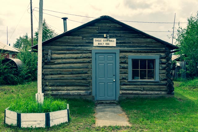
We arrived at Eagle in time for lunch, it took much longer than anticipated. We enjoyed our lunch watching the swallows flying around us, sitting on a bench in the park at city hall, next to this church. Eagle was organized by miners in 1897 and by 1898 had a population of 1,700 living in more than 500 cabins and tents.

Since the ground below Eagle is frozen, digging wells in to frozen ground will only result in frozen water. We watched as townspeople pulled up to this water station and filled their containers (sometimes as large as several hundred gallons) using a gas-station type of nozzle.

This is the court house. It was built in 1901 by Judge James Wickersham. The second floor contains his original courtroom, his first in Alaska and is maintained with the original furnishings and fixtures. Mining activity shifted westward and by 1904 Judge Wickersham moved his court to Fairbanks.

We found Fort Egbert (US Army). In 1898 the Secretary of War set aside a military reservation that included Eagle City and construction began on a military camp, which was named for Brigadier General Harry C. Egbert, who was killed in Manila. Cathy is reading some of the history in the entrance to the Quartermaster Storehouse.


This is the granary, which was built in 1903 to hold feed for the livestock, mainly mules. Without adequate feed to hold them through the harsh winters, the animals later starved to death.
This is the water wagon shed, which provided shelter for the fort’s fire system and water supply wagons. We spotted a large, red fox walking behind this building and strutting into the woods in the background.

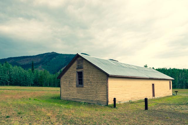
This is the mule barn, or quartermaster stables and was built in 1900 at a cost of $550. It would hold 53 animals and the names of some of the mules still hang over the doors. This barn was used until 1911. The second floor hayloft was added on in 1901 and allowed the handlers to drop hay directly into the individual stalls.

On the side of the stables were nineteen sled-dog kennels. The dogs belonged to Billy Mitchell, who brought 80 dogs, 40 harnesses and 16 sleds to the fort in 1901 to pull equipment and supplies for the military as they explored and marked the route for the hundreds of miles of telegraph line across the frontier. Yes, this is the same Billy Mitchell that would later become a proponent of military air power and the “Father of the Air Force”.

This is the only remaining NCO (non-commissioned officers) house on the site, it was one of three originally built. Unlike the stables, it was not insulated for the extreme winter weather. Cathy looks cold even looking at it!

Conveniently located next to the NCO housing was the fort’s bakery. Only a part of the oven remains.
In 1911 Fort Egbert was abandoned, except for an Army Signal Corps contingent, which operated the telegraph and wireless station until about 1925. We were hanging out, talking with the docents at the fort, Jason was picking and eating wild strawberries and we were reminded that it was a almost five hour drive (in good conditions) back to Tok. We left shortly. Looking at the long, winding, steep and muddy road, it was going to be a late arrival back in Tok.


Thanks Steve and Cathy for all the pictures. Give Jason hugs and kisses from me.
LikeLike
We enjoy following your travels. Thank you for sharing all of the wonderful pictures. Please say hello to Cathy!
LikeLike
Thanks, I will tell her. It has been few and far between for WiFi so our postings have been sporatic.
LikeLike
How is your family doing?
LikeLike
Our daughter Michelle had dinner with Mario Batali ? and his wife. Kinda like Chef Boyardee to me.
LikeLike