After arriving at Minden and setting up camp, we headed for Carson City, the capital of Nevada. Cathy and Jason posed in front of the State Capital. The park surrounding the capital was awesome. There was a large event near the capital which drew us in. It was the bib/package pickup for the Tahoe Rim Trail 100 Mile Endurance Run. They also had “lesser” runs of 55K and 50 miles. The events were run on single-track trails and dirt roads within Spooner State Park and on the Tahoe Rim Trail located within the state park and on national forest land all at or above 8,000 feet of elevation. Damn, if only I had known (ha ha).

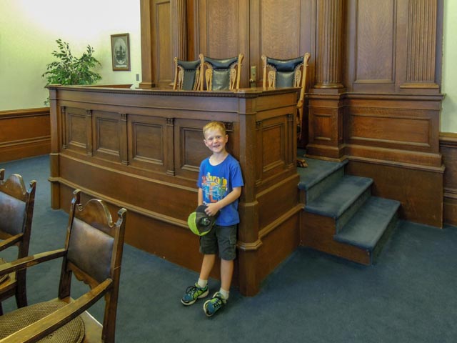
We entered the capital and made our way upstairs to the Supreme Court. The door was open so in we went. Jason is ready to argue something. . .
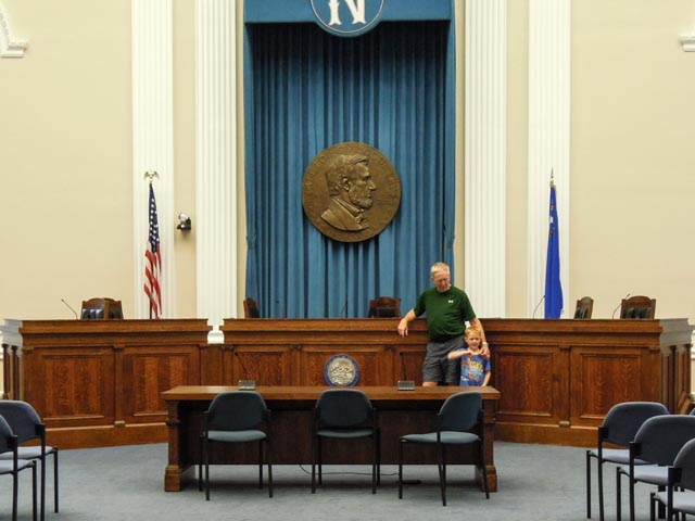
We then tried our hand at the Assembly. The microphones on the table were “live” and Jason had some fun before we could stop him.
Outside, walking over to see if we could get any race “freebies”, we passed this statue of Kit Carson. In the winter of 1843-1844 Kit Carson and John C. Fremont’s expedition explored this area seeking an easy route though the Sierra Nevada mountains. Kit Carson was tracking for Fremont and was considered one of the best mountain men of the day. Carson City takes its name from the Carson River, which Fremont named to honor Kit Carson.

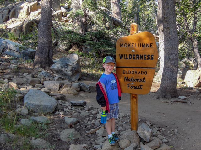
We left Minden early in the morning to make it to the top of Carson Pass, on State Hwy 88, just South of Lake Tahoe. We found room to park, gathered our water and trail snacks and headed up the trail, joining the Pacific Crest Trail just beyond entering the Mokelumne Wilderness. We were ahead of most of the day hikers!
Jason spotted this tree, and climbed up, just as Michael had done many years ago. It does look comfortable!

About 1.9 miles up the trail we came to our initial destination, this rock*, located just west of the PCT, in a field of flowers, overlooking Caples Lake in the distance.
Caples Lake has over 600 acres of surface area, sits at 7,806 feet and is up to 52 feet deep. You can see the smoke from the Ferguson fire, west of Yosemite National Park, hanging over the lake in the distance.

Here are some views of the area surrounding the rock.
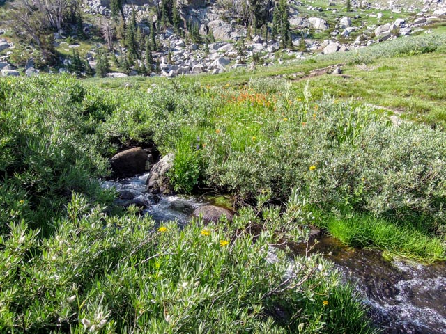
This trail is listed among the top four wildflower trails in the Lake Tahoe region. Jason still had energy so he wanted to continue on up the trail to Lake Winnemucca, about a 600 feet elevation gain from the trailhead, which is at 8,500 feet. As soon as we continued, we immediately came to this “flat” meadow that was absolutely covered in wildflowers. The flowers were sometimes higher than Jason. 10,381 ft. Roundtop Mountain is in the background, directly behind Jason.

We took a side trail to this spring, which is flowing with clear,cold water. There were plants available that can be plucked, stripped and will serve as straws, but since it had been many years since I have done that, and I don’t remember exactly what plant has the hollow stems, we didn’t take that option. Jason did clean his water bottle in the stream, though. Jason is standing beside the outflow of the spring with his water bottle in the second shot, with 10,000 ft. Red Lake Peak to the right of Jason, the saddle just above Jason’s cap bill leads to Weiss Meadow and on to South Lake Tahoe.


We made it to the spot where the lake drains into Woods Creek, about 2.75 miles from the trailhead. The ground is saturated from the melting snow just behind Jason and he was busy watching the trout swimming in the creek at his feet. Winnemucca is in the background, and there was a neat waterfall descending from the snowfield out of the picture. We passed two skiers on the way out that were headed for this area for some summer skiing. Too much work for me. The second shot is Woods Creek, complete with visible trout.

Oops, we did not take an elevation reading at the top but did once we started down from the lake. It is 9,052 feet at the descent.
We passed by Frog Lake on the way down from Winnemucca and Jason led the way to this little landlocked lake. It was about 100 yards off the main trail. He immediately took up his favorite pastime, throwing rocks.

When we returned to the trailhead, we continued on to Silver Lake’s Stockton Camp. My family has been going to this camp for more than 50 years and we met by sister Barbara there. Barbara is on the Board of Directors for the camper association. After giving Jason a quick tour we headed for a feature called Porthole Gap. I had hiked to this area, uphill from the campground more than 50 years ago but we decided to take an unmarked “jeep” road just down the highway. After a rocky, bumpy and dusty drive, going through two cattle fences, we made it to the gap. This is the view of the (apparently volcanic) feature from downhill.

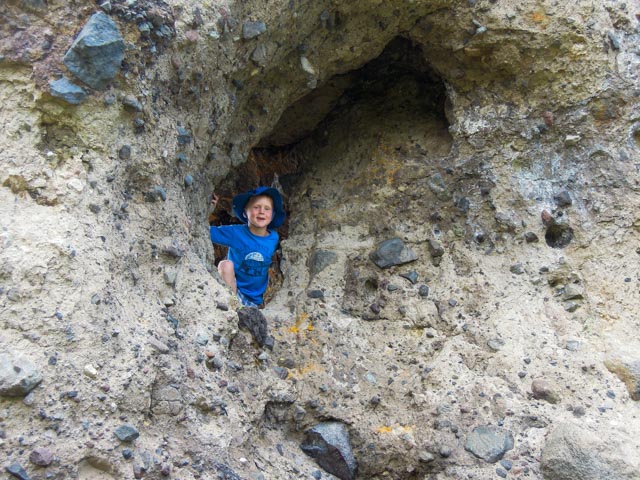
Jason decided to look through the gap.
Here is the view of Silver Lake, with Treasure Island in the center, and Thunder Mountain in the background (somewhat obscured by smoke from the Yosemite forest fire).

Back in camp, we showed Jason the “Schingler” cabin, which used to be the “Stockton Record” cabin. Our family took over sponsorship several years ago. It is the only cabin that has three separate rooms and a fireplace! Jason is showing off his geode from Iowa, which was cracked for him upstairs at the lodge.

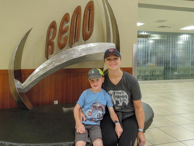
After picking up Lauren (Jason’s mom) from the Reno Airport, we went back to Carson City for dinner.
We drove straight into the middle of the Carson City “Taste of Downtown” event. Carson City, founded in 1858, has a population of more than 55,000 residents and originally was located in Ormsby County. In 1969, the county was abolished, and its territory merged with Carson City to form the Consolidated Municipality of Carson City.
The main street through Carson City was closed and the event was in full swing. There were live bands, an orchastra playing big band style music, food, wine and brewery offerings, street painting, and thousands of people. We managed to park relatively close to the restaurant, Garibaldi’s Ristorante Italiano. This was probably the finest Italian food we have ever tasted! We saw horse mounted officers from the Carson City/County Sheriff’s office. It was dark and I did not use flash (may startle the horses) so the photo is a bit blurry, but I believe you will get the idea. The horses were equipped with flashing red and blue lights and reflective foot bands.

We received a little bit of rain during the evening and fully expected to see clear skies in the morning. This is a view from near our campsite of the Carson Pass area. The mountains are pretty high and relatively close but you could barely see them due to the Ferguson fire.

Lauren and Jason, getting ready for their multi-stop return flight. It was going to be a long day!
*The rock is a very special, Schingler family place.

Did Jason get to take his geode home?
LikeLike
Yes, he took it on the plane, which was delayed / cancelled / a mess. . .
LikeLike