We have not had WiFi for about a week now. We went to Sunriver Monday and waited until 10:00 for the library to open only to find out it was closed on Mondays, We tried LaPine, it was also closed on Mondays, but we did find a library open in Bend, about 30 miles away. We we got there and set up, the power (and WiFi) went down for the entire area. I am in Sunriver’s library today (Tuesday) and finally able to update. Sorry for the delay.
Sunday
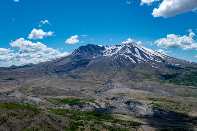
After leaving early in the morning, we decided to take some extra time and take Jason by the Mount Saint Helens National Volcanic Monument, in the Toutle Mountain Range, upriver from Castle Rock. The road to the monument actually follows the Toutle River and you can see some of the devastation caused by the eruption. In this photo, you can see that the entire side of the mountain is missing/has slid down into the valley below. You can barely make out the remains of Spirit Lake in the distance, to the right in this picture. The area below the mountain is being reforested courtesy of the migrating elk herds . . .
After spending several hours at the monument and visitor center we continued on to our next destination, Fairview, in the Columbia River Gorge near Portland, Oregon.
Monday
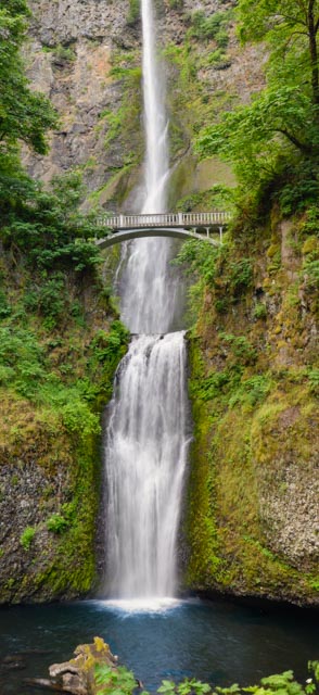
First things first. My goal was to hike to the top of Multnomah Falls then get a photograph of the Multnomah Falls from the bridge pictured. Upon arrival, we found out that the trail to the top of the falls was closed and the bridge leading to the bridge shown was burned out. The historic highway at the base of the falls was also closed and all were considered unsafe. I was kind of relieved that we could not make the trip to the top (it was a steep hike) and arrived early the next morning to take this shot of the falls from the viewing area. By arriving early the parking areas were empty and I was the only one at this location for a series of photos and a period of 30 minutes or so.
After satisfying my goal of the photo, I went back to Fairview to pick up Jason and Cathy to head out to Mt. Hood. This is a shot of the finish of the ski/snowboard route coming down from the mountain. Skiing is available here almost year-round. I waited for a while to get a shot without skiers and snowboarders in the picture.
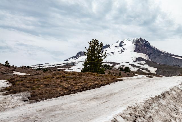
Looking out you can see 12,287′ Mt. Adams in Washington from 11,217′ Mt. Hood. Mt. Saint Helens is no longer visible, the eruption took several thousand feet off the top, reducing it to “only” 8,356′.

After returning from Mt. Hood, we took a trip up the Gorge to see the fish ladders/hatchery, locks and power plant in the Bonneville Dam complex. The dam was part of a series of dams (including the Coulee) that were built during the depression to provide employment and hope, and harness the power of the Columbia river in the 1930s. It is located about 40 miles upriver from Portland. This is one of the original structures near the sturgeon ponds at the original fish hatchery.

We went down to view the Columbia River sturgeon from below. The sturgeon in this river can reach lengths of 11+ feet and can weigh over 1,000 lbs. They are pre-historic looking fish! The largest one in this pond is named “Herman” and weighs about 480 lbs.
This is one of the many ponds on the grounds of the fish hatchery and Jason was busy feeding the trout here.

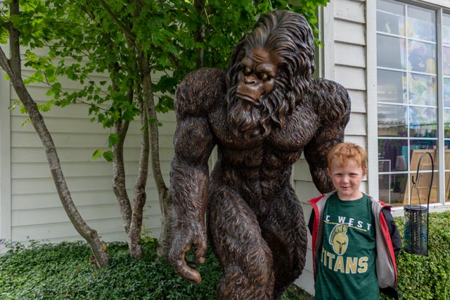
Sasquatch does exist; this is a life-size cast of one that was found on the grounds . . .just kidding!
Jason enjoyed the fish ladder. You really cannot see the fish in this photo but there were about 50,000 salmon and 50,000 shad passing here daily.

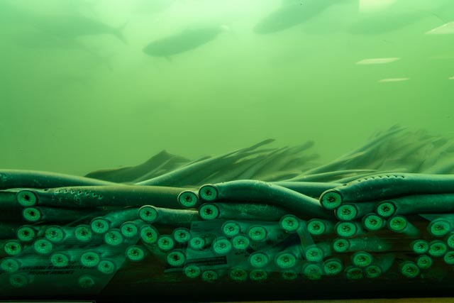
There were also a lot of these passing through. This is the goofy looking Pacific Lamprey, which is not an eel. They are anadromous, meaning they can live in salt and fresh water. These are returning to spawn. After spawning, they die, leaving up to 100,000 eggs to potentially hatch.
A few years ago the Great Lakes fishery was nearly devastated by the Atlantic Sea Lamprey but the efforts to rid the lakes of these invasive creatures has been somewhat successful.
This is the view of the fish in the ladder from the fish level.

Jason at the damsite, goofing around. One photo is him beside one of the smaller water-driven impellers used to turn the generators which provide the electricity. Jason kind of understood this process.
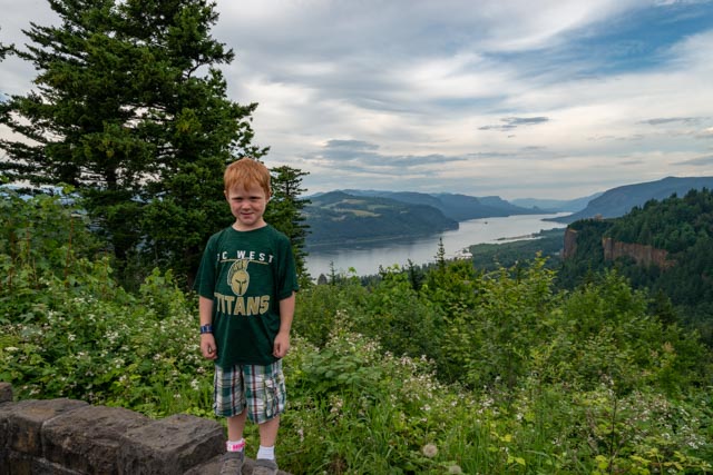
Leaving the dam, we drove to the top of the gorge and stopped at the Portland Women’s Forum Scenic Viewpoint. You can see Crown Point beyond Jason to the right.
Our next stop was at Vista House on Crown Point with a similar view. I am at the top of the structure looking down at Cathy and Jason
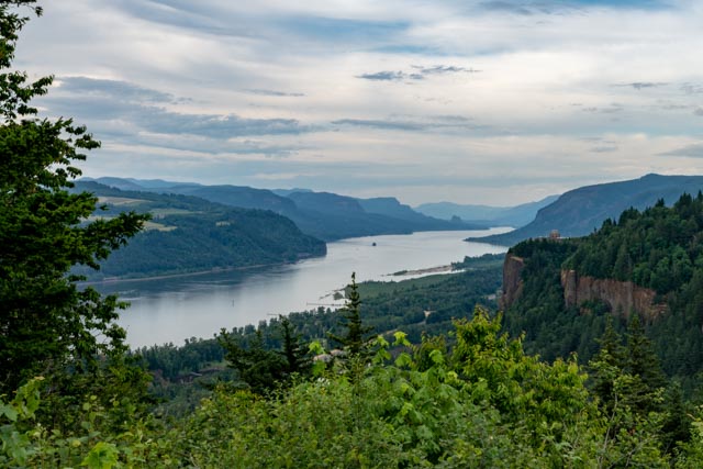
This is the view of the gorge, under cloudy conditions, looking upstream, downstream (into the setting sun) and across the river into Washington.
Tuesday
We took it easy on Tuesday, taking Jason for a swim in the Sandy River. I walked across the trestle and almost managed to get a couple of insulators off of abandoned poles but the blackberry bushes bit my legs and kept them (the insulators) safe. Jason made a new friend and the two dug in the sand and splashed and dug and splashed for hours. A couple of trains passed overhead on the main line through the gorge. There were a lot of rafters, tubers and kayaks coming down the river.
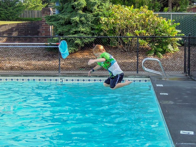
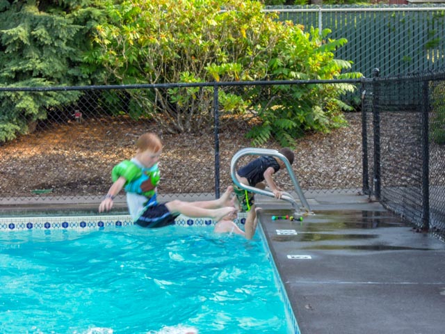
After returning from the swim at Sandy River, Jason wanted to continue so we took him to the pool at the campsite. He was shown how to correctly execute the infamous “cannonball” and practiced, both forward and backward?
Thursday
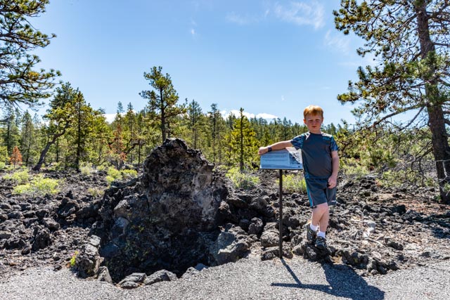
On Friday we decided to visit the Lava Cast Forest, located within the Newberry National Monument near Sunriver. This is an area where a fairly recent (within 10,000 years) rapidly moving lava flow trapped some trees and hardened, leaving circular tree “casts” where the trees originally stood. It is unusual that the trees did not immediately disintegrate due to the heat, but these casts are pretty sobering reminders of the power of molten rock! Jason is standing near the first cast that we came across on the 1 mile+ trail. We encountered a geology group from a nearby college doing fieldwork and walked with them for a short time.
There were casts that were large enough for Jason to explore:
There were casts too far from the path to reach:
There were casts too small for Jason:
There were casts too deep for Jason:
This is a cast of a fallen tree, with Jason looking into the tree from about the center. The second photo is the end of the tree.
These are remnants of “twisted” trees. These trees have adapted to the harsh environment by finding small pockets of soil to root in. The spiral patters distributes water and nutrients ta all parts of the tree. It is amazing how nature can react and adapt!
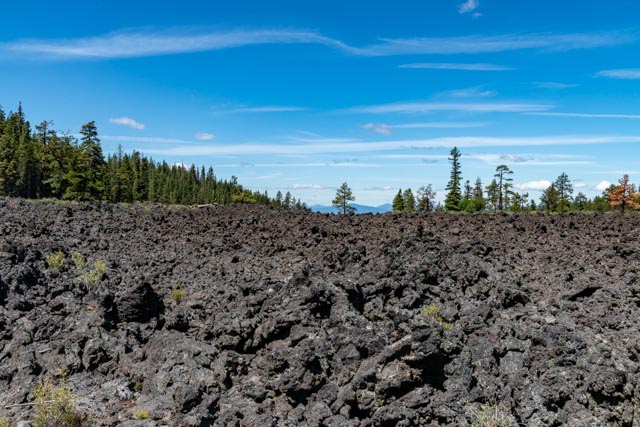
This is the view from the lava fields. The snow-covered peak on the left is Mt. Bachelor and the series of peaks on the right are part of the Sisters group, all are located in the Cascade Range and about 30 miles distant. Sunriver is about ten miles away, directly between Bachelor and us.

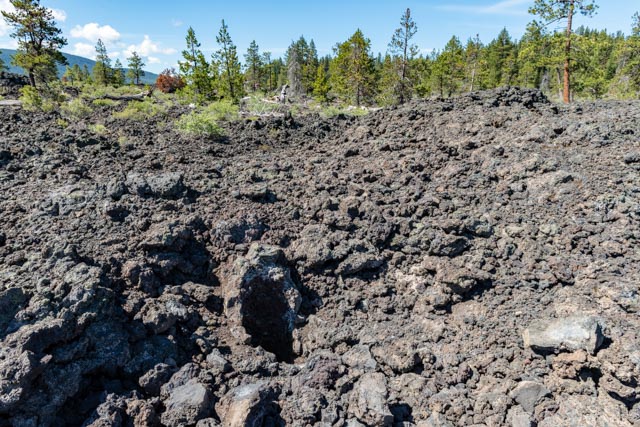
A parting shot of the lava fields.
Friday
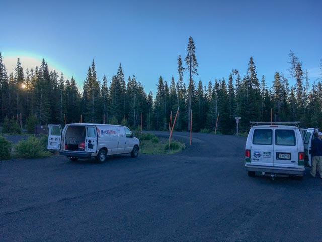
Friday morning was race day for me. After Cathy and Jason dropped me off in Sunriver (at 5:30!) to catch a bus to the start line, we made the 20+ mile ride to the top. The sun was just starting to rise and it was cold! I was on the second bus leaving Sunriver and immediately joined a very cold group in the snow shed at the Wanoga Snow-Park, at Mt. Bachelor and verified my presence with the officials.
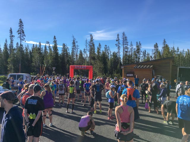
Once the sun (and temperature) rose, I ventured outside to watch the start of the 50K with about 50 participants. There were about 200 runners for the 28K (17.4 mile) trail run that I would be participating in. I have never seen such a “fit” group! These were serious trail runners.
The trail consisted of 90% single track, with rocks, scrambles and climbs galore. If there were no rocks, it was because the sand, stumps and roots covered them. There were plenty of reasons for a face-plant but I managed to make it, upright! Once we got closer to Sunriver we encountered some horse trails that became deep, dusty paths before reaching the paved walkways alongside the Deschutes River, approaching the finish at Sunriver.
This is one of the uphill rocky sections.

This is the trail and some of the rocks we had to navigate over. The runner is not me but a person I was running with for a while. There were times that I went over a mile without a trail marker or another person in sight. We had to sign in at the start so they could account for everyone at the finish. This kind of set the tone for the run. They did promise to search for anyone that may become lost and not arrive at the finish line in a reasonable time so not to worry. Hmmm.
The scenery changed as we approached the finish at Sunriver:

Saturday
After the race day, we relaxed and went to nearby town of Sisters, located 18 miles west of Bend in the Deschutes Forest. It derived its name from the three snow-capped peaks that are just to the west, in the Cascade Range. The town is famous for its annual quilt show which attracts over 100,000 visitors to the area. That would make this area a little too crowded for my tastes, complete with time-consuming traffic backups on the approaching highways. Myrna, Barbara, Cathy and Jason posed for a picture.

Sunday
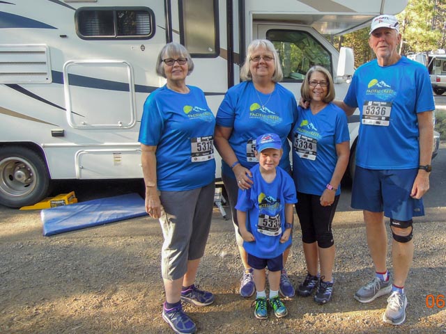
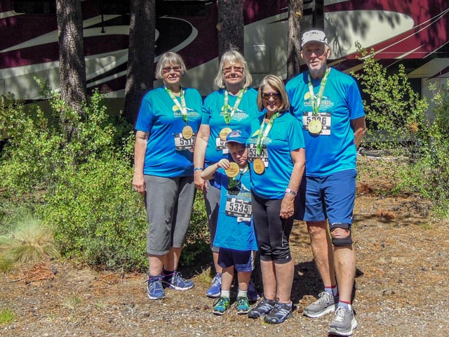
Saturday morning we all participated in the Sunriver 5K race, run on the very nice paved bicycle paths that wind throughout the village. There are more than 50 miles of paved paths at this location. We all look pretty fresh here because this is a pre-race photo.
Post race, back at camp sporting our “bling”. Jason ran the entire distance, his second 5K of the trip! This was Myrna’s (left) first race and Barbara’s (behind Jason) third run. Cindy, Myrna’s daughter (taking the photo) did not run in the race. She may have been the smart one!
Sunday afternoon was spent at Robin and Dan’s home in LaPine. Robin is Myrna’s daughter and we had a chance to meet her family and Jason’s “cousins” for the first time in years. Jason immediately befriended Easton who was four years old.
Monday
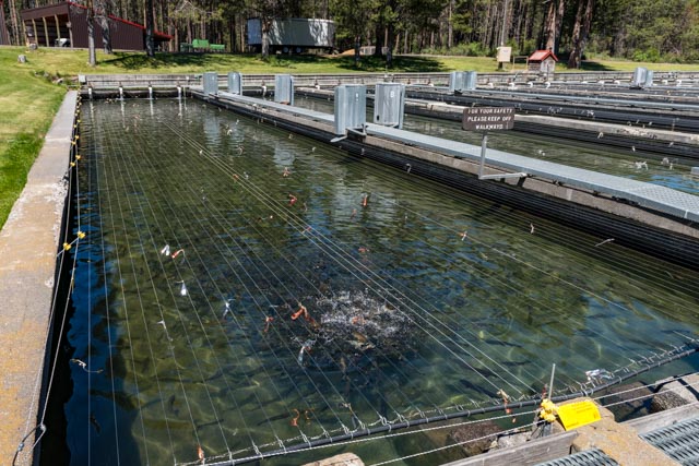
Another “off” day so we took a trip to the Fall River Fish Hatchery. This is a state-operated unit and has one full-time employee. All of the tanks held rainbow trout, with two distinct breeding stocks (but I cannot remember from which two lakes these stocks derive from). They all looked the same to me but I was assured that there are subtile but distinct differences. After spending 50 cents on fish food, the employee gave Jason an entire cup of fish food. I spent some time talking about the process and the area with the state full-time employee and the seasonal employee. Both were very knowledgable about the area and directed us to the “tubes” on the Fall River (unmarked) which we went to our return. Jason is feeding the one to two-year-old trout and you can see their reaction in the second shot.

This is a view, upstream of the portion of the river that is diverted around the hatchery. Fishing is off-limits here but there were plenty of trout visible in the crystal clear water.

This is looking downriver at the hatchery. There were many, very large rainbows visible in these waters, which are heavily fished year round. They place about 40 large and 100 “legal” or 12″ rainbows in the section every other week. It was the middle of the day so we did not see any fish caught.

This is looking upstream, at the crossing, and downstream at the recommended “tubes” section of the river. The country around the river was gorgeous and green, the surroundings were high desert.


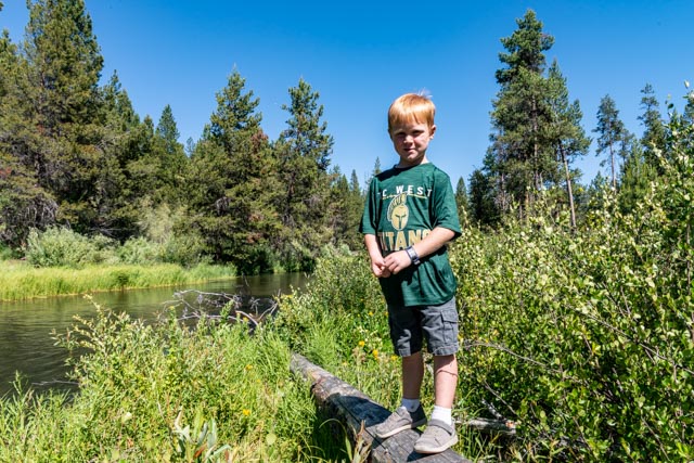
I balanced out on a log to take some pictures and Jason followed me. It looks like we are over land but in reality, the river is running through the brush beneath us. Trout can be seen everywhere.

Beautiful
LikeLike