We arrived in Flagstaff midday, after the short drive from Camp Verdi. The weather was snowing and when we disconnected the truck at camp, we discovered that the bracket holding the 8′ mud flap at the rear of the coach had sheared off and the flap was dragging. There was no physical damage to the flap so it must have happened as we pulled into our site. Nevertheless, we made the trip to the hardware store and purchased the necessary parts and I crawled under the unit (in the snow) and made the repair.
After a quick lunch we decided to make the drive to Sunset Crater Volcano National Monument. It was raining all the way there and we did not expect to see much, but it began to clear somewhat as we neared the volcano. We stopped at the visitor center and were told that climbing the mountain has been prohibited for several years. Scratch my goal of climbing to the top. Anyway, we drove to the Bonito lava flow, which you can see was immense and went on for miles.
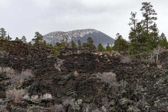
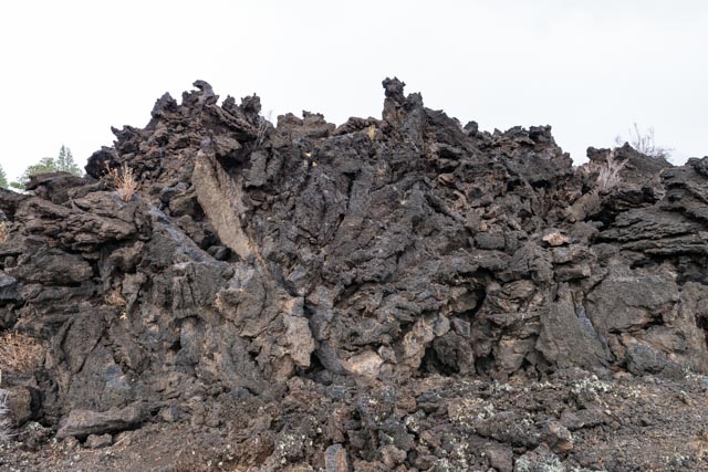
This volcano erupted between 1040 and 1100 AD and is the most recent volcanic activity in the Flagstaff area. As the volcanic rock breaks down into soil, the trees and plants are beginning to make a comeback. There were some pretty cryptic areas where the lava appeared to bubble up and solidify in place. All of these were very sharp.
As cinders erupted from Sunset Crater they blanketed older volcanos, creating cinder domes. Here is the view of the cinder domes across the valley. There were multiple volcanic vents in this area.

It was almost clear when we looked back at Sunset Crater.

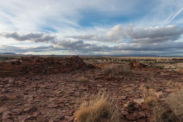
A view of the Painted Desert is in the distance as we began do descend into the valley leading to the Wupatki National Monument. The Painted Desert is on the Navajo Indian Reservation.

We saw these three pronghorns as we neared the Wukoki Pueblo. (We saw 10 more leaving the area at dusk but just watched and did not attempt to photograph.) Unfortunately, I only had my wide angle lens at the time . .
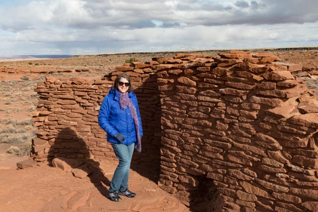
The Wukoki Pueblo, below, was home to two or three prehistoric families during the period 1120- 1210. Wukoki is a modern Hopi word for “big house”. The unusual three-story height, combined with its position on top of a Moencopi sandstone outcrop suggests that it may have been one of many lookouts of sorts for the main pueblo at Wupatki.
Cathy on the ledge at Wukoki.
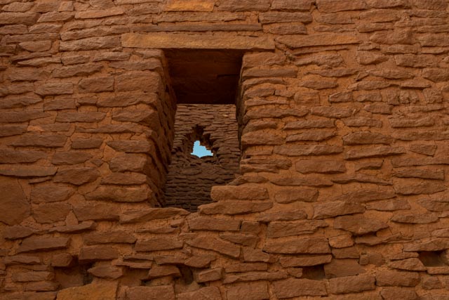
Looking at the view out of one of the windows in the upper floor.

The roof has been gone for some time. This is looking skyward from the main room.

Viewing the window through the window.
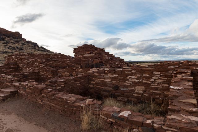
After leaving the Wukoki, we headed to the Wupatki Pueblo. This is the largest Pueblo in the area, with over 100 rooms.
Sometimes it was probably easier to build around an obstacle rather than try to move it.
This is the Ballcourt at the pueblo. Ballcourts were common in Southern Arizona from 750 – 1200 AD but relatively rare in Northern Arizona. This may indicate that the people of Wupatki intermingled with their southern neighbors, the Hohokam who may have borrowed and modified the ballcourt idea from earlier contact with the Indian cultures of Mexico.

This is a blowhole, a crevice in the earth’s crust that appears to breathe. These respond to changes in barometric pressure and when it is cold outside, they blow air out, when the air temperature warms, it sucks air in. The breathing effect is more dramatic when the opening is small, in this case, about one square foot. There is a pretty good breeze going on here!

Cathy sneaking around the Wupatki.
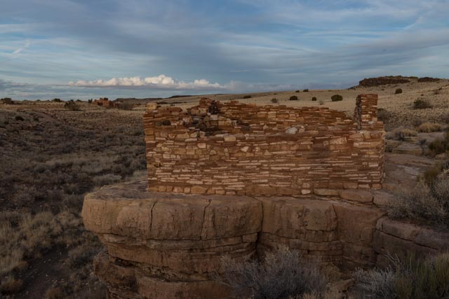
Next, we explored the Nalakihu, a modern Hopi name meaning “house outside the village”. This is located at the base of the Citadel Pueblo, named because it sits entirely on top of a rock outcropping.
The Citadel.
The “Citadel” is the modern name given to this structure, as it is built straight up from the rock at the top of this knoll. It covers the entire knoll and would have been a good defen=sive position, but there is no evidence it was used for that purpose.
We climbed to the top of the Citadel and enjoyed the view of the valley below.

The structures at the very top have deteriorated, basically only rubble is left.
Cathy at the edge of the sinkhole adjacent to the Citadel. It would be quite a drop from the height of the Citadel to the bottom of this sinkhole.

Leaving the Citadel, we made the run to the Lomaki Pueblo, a grouping of structures stretching for a mile or so up a canyon.

This unit is cliff side in Box Canyon. You can barely see another to the left in the distance.
As I continued to walk up the canyon, I found several more examples, this one was also cliff side with units below that are similar to basements, but they would be at water level during a storm?

You can see the basements here, just above the canyon bottom.

This is another structure at the edge of Box Canyon.

Now that I have been drawn deep into the canyon, the sun was setting fast. It is time to make it back to the truck.

The sunset over the cinder domes in the distance, taken from the road on the way back to camp.
We did not expect to see much early in the day and wound up returning to camp in the dark . . . again.
So much to see and so little time . . .

Very good post and great pictures !
LikeLike
Thanks Phil
LikeLike