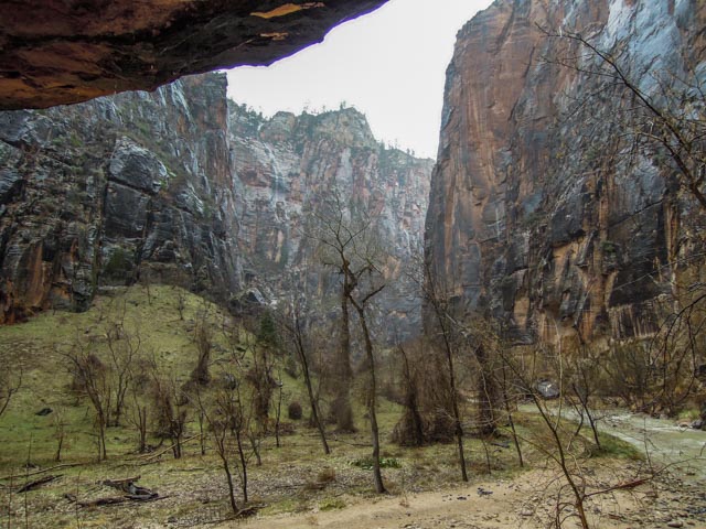
It started raining last night but we decided to make the trek into Zion early in the morning. We stopped at the Visiter Center to get information about some of the local day hikes. There were three cars in the parking lot when we arrived and by the time we left the lot was full around us. We stopped at the Zion Inn for a few moments then on to the trailhead. We took the Riverside Walk upstream. The Virgin river has cut this spectacular, ever narrowing canyon. This park receives about 15 inches of precipitation yearly so we were lucky to see small waterfalls at almost every turn. This is the canyon looking back towards the trailhead.
My sister Barbara (from California) met us in Hurricane last night and went on this hike. Here she is tempting fate under a boulder . .

Just one of a myriad of seasonal waterfalls evident along the trail system:

This is a spur trail leading to the river. We were plenty wet enough from the constant rain, we did not elect to go closer to the water.

I did climb down to river level at the end of the trail to capture this image. The canyon becomes very narrow upstream.

This is the rock formation know as “The Temple of Sinawava”.

We met two birdwatchers on the trail who have traveled the world looking at birds. They were fixated on this black bird, known as an Ouzel (American Dipper). It was interesting to watch. It would dive into the swift water and come up in another place, looking for food. They apparently like both swift and cold water. You do meet interesting people on the trail. In the pictures below, it’s a “now you see him, now you don’t!”. It is our only native American songbird.
We walked (almost) behind this waterfall. It is located adjacent to “Weeping Rock”.
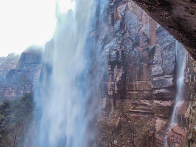
I was in the space to the right of the falls, just below the gray and white striated rock when I took the above shot. This was about 1200 feet from the trailhead.

Another of the (unnamed) waterfalls:

This is “The East Temple”, an arch in the making. It is visible from the overlook trail off of the Zion-Mount Carmel Highway. There is a fairly long tunnel (that is pitch black) just to the right of this formation with a trailhead leading to an overlook of the entire valley.

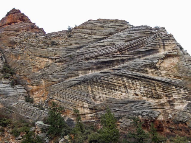
This is a rather gnarly looking rock formation at the west end of the tunnel. (“gnarly” is a geologist term).
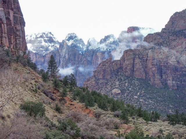
We didn’t realize it until we got to the top of the pass that it snowed last night at the higher elevations. Prickly Pear cactus and snow, what a combination. From the spring through fall, this entire area is closed to private vehicular travel. Travel must be in park operated shuttle buses.

Spectacular!!
LikeLike