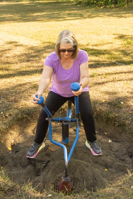
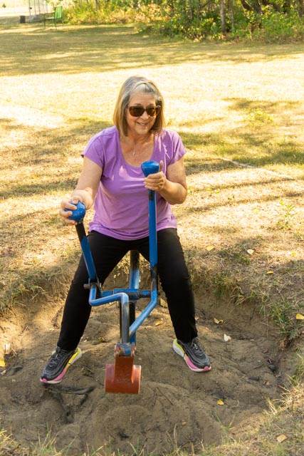
We decided to take a drive south of Dawson Creek to see the countryside. We stopped at Sudeten Provincial Park, which was closed for the season. Undeterred, we parked and walked in. The land for this park was donated to the people of British Columbia by Henriette Herold of Tomslake. The park is named for the region in Europe where many of the settlers in this region originally lived. Cathy is having fun in the child’s park, attempting to master the model backhoe. In addition, there were camping sites, a covered picnic pavilion and walking trails.
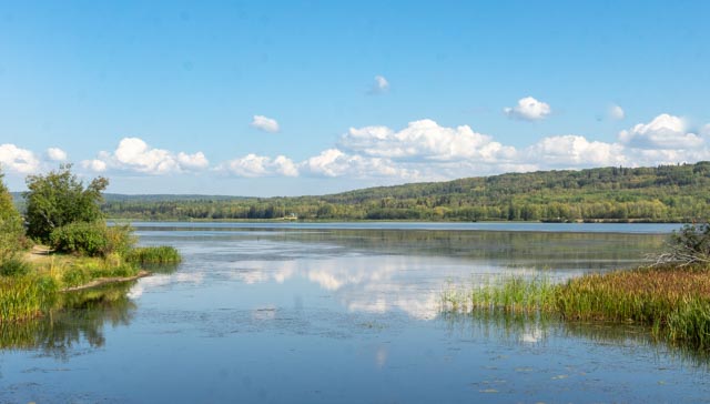
We crossed the highway from Sudeten Provincial Park to Swan Lake. The lake was crystal clear and we basically had it to ourselves. There was a free boat ramp, a swimming beach, and several species of fish available, including northern pike and walleye.
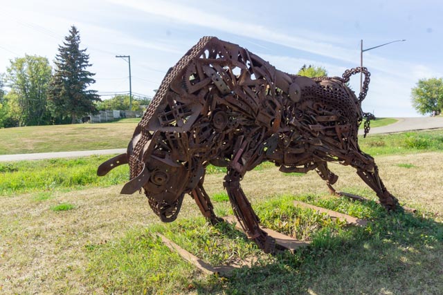
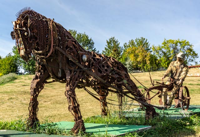
We drove to the town of Pouce Coupe. We detoured several times to take portions of the original Alaska Highway but returned to the modern highway to continue on. A good amount of Pouce Coupe residents moved closer to Dawson Creek when it started to develop around the new railroad. We stopped when we saw these sculptures near the roadway, they are made from scrap iron of all types.
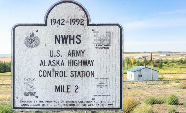
This is one of many relay stations along the original route of the Alaska Highway. Messages regarding everything from traffic to supplies were relayed up and down the roadway construction corridor during highway construction, as there was no traditional communication apparatus in place. This control station was the first in line just outside of the town of Dawson Creek, at about mile 2 of the Alaska Highway (ALCAN). There was an informational sign but it was sunburned and had faded to blank.

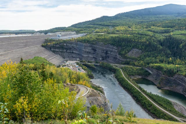
The next day we drove north on the ALCAN , to the town of Fort St. John. Fort St. John is the location of Charley Lake, where several U.S. military workers drowned when their boat capsized while crossing the lake. There is a memorial to the accident at Rotary Park, at the south end of the lake. Once leaving Fort St. John, we traveled up the Peace River valley to the town of Hudson’s Hope. As we neared the pass, I took a little “off road” up to the top of a hill to capture this photo of the terrain below. You can see the road winding down to the river then turning to the right, towards Hudson’s Hope, about 50 miles upriver. We saw several deer during this drive, one roadside on the way down the hill and several more in the field below.
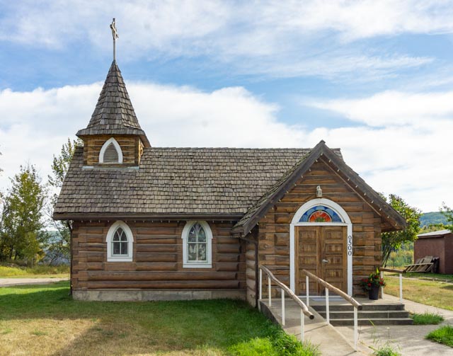
This church, located in Hudson’s Hope is a little different. St. Peters is a shared ministry church, used by the Anglican, Lutheran, Presbyterian and United denominations.
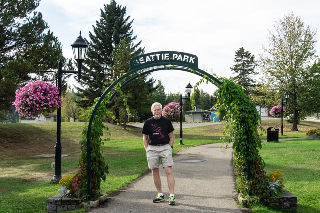
I stood under the archway leading into Beattie Park. The Beattie family was one of the first families to move into Hudson’s Hope in 1914. They outgrew their original log home and in the 1930s built a larger home in Gold Bar. In 1934 it was fitted with running water, a virtual mansion in this area. The Beattie farm was by far the most valuable property along the Peace River and they were frequently visited by great numbers of travelers moving up and down the river. Eventually the farm was sold to BC Hydro and was flooded by the W.A.C. Bennett Dam.
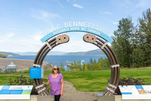
Cathy standing at the W.A.C. Bennett Dam-site. The area just below the earth-filled dam is carved from the bedrock and clearly shows veins of coal. It replace a coal mine that was originally built in 1903 and later supplied coal to troops building the Alaska Highway. The lake created on the Peace River is supplied by a drainage area twice the size of England. The coal mine was sealed off during construction and is now part of the dam.
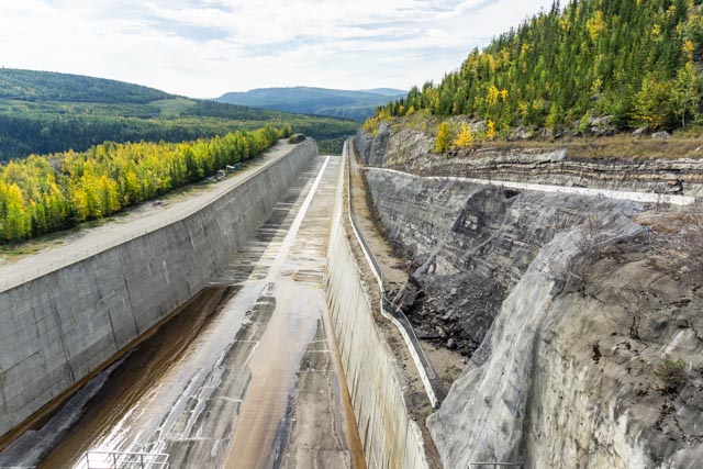
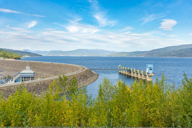
This is the main spillway from the dam. Notice the natural rock (and coal veined) wall behind the concrete. The dam is landfill, using over 1 million tons of material, moved by a conveyor belt system from a nearby donor mountain. Overall, this was a very impressive layout. It is one of the largest landfill construction projects in the world!
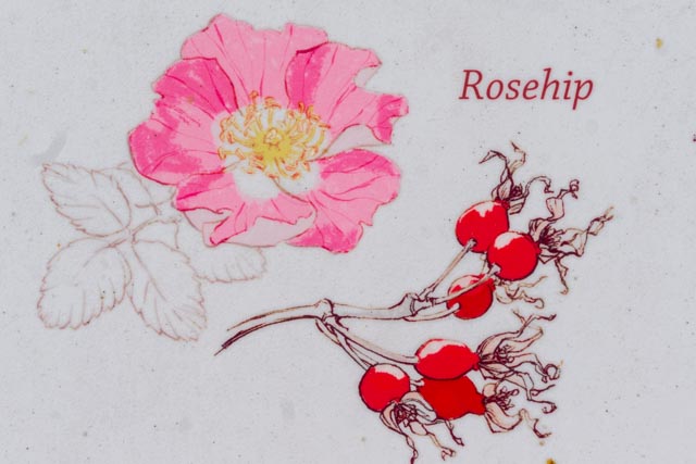
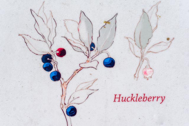
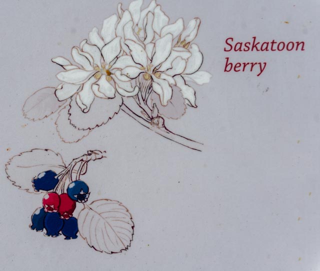
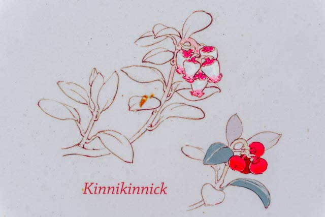
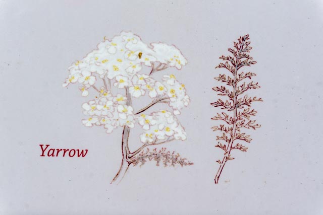
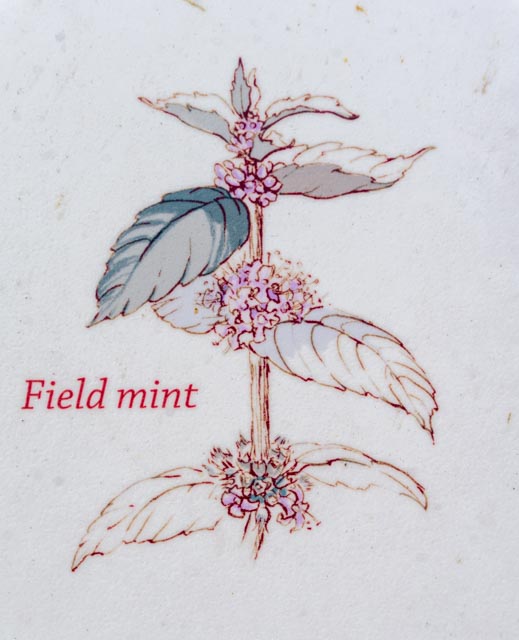
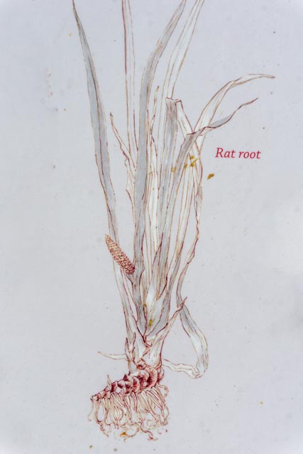
Above is a sample of some of the common medicinal and food plants found in this area. First Nation people (who had lived in this area and were displaced by the dam project) used these plants for years. Celery, peppermint and muskeg tea, along with the berries, Saskatoon, huckleberry, cranberry, blue berry and wild strawberry grow wild here and can be used for flavorings and food, while traditional medicine plants including rose-hip, rat root, mountain ash, young popular trees, yarrow and Kinnikinnick. BUT the signage also warn us NOT to pick or eat the plants!
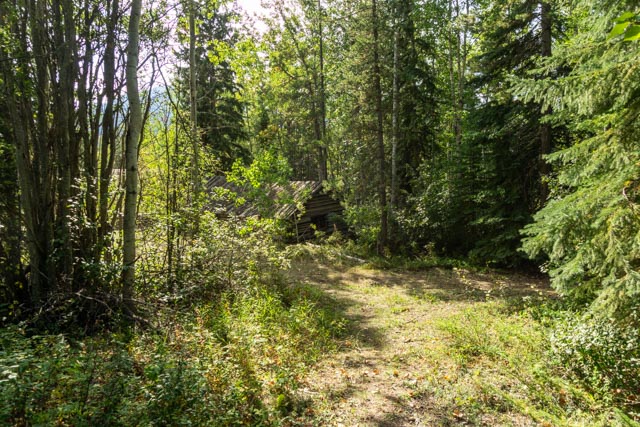
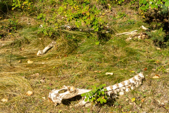
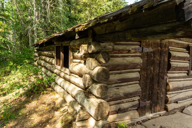
I saw this path through the woods upon leaving the dam area. Parking, I walked down into the bush and found an abandoned cabin and moose bones, apparently subsistence hunting.
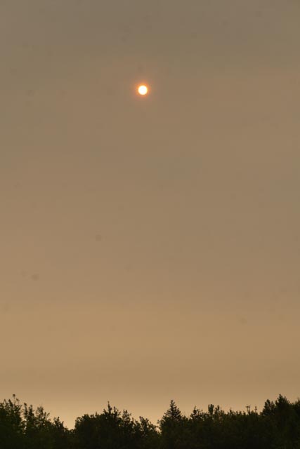
This is a moon-rise over a smokey Dawson City valley. Again, this smoke comes from fires in the Northwest Territory, hundreds of miles north.
