
Our next stop was in Dawson Creek, B.C. We woke up to a smoke-filled valley in the morning. Wary of wildfires on this trip, we inquired and found out that the smoke was from a fire in the Northwest Territory, to the far north. It was located in an uninhabited region, inaccessible except by air (no roads). It was basically left alone to run its course.

We took a planned side trip west to the Tumbler Ridge Global Geopark, where they have discovered a lot of dinosaur bones and artifacts.

As we entered the park we decided to stop to take the required photo. We started a chain reaction as others stopped behind us to do the same thing.

We were surprised to find out the Tumbler Ridge is more than a park out in the woods, it is a actual town. It is relatively new, incorporated in 1982. We made our first stop at the visitor centre to inquire about the waterfalls. We picked up several trail maps but most of the geosites (including mountain peaks, alpine meadows, glaciers, canyons, waterfalls, caves and karst formations and of course, dinosaur trackways and fossils) required hikes longer and steeper that we anticipated for a day trip, with trailheads up to 119 km from town and hiking distances up to 66 km.

This wood carving was just outside of the visitor centre.


We drove to this trailhead as it appeared at first to be relatively easy. After hiking a while in the 80+ degree heat (unusual for us this trip) we came across this viewpoint of the trail destination. The trail became steeper and the destination was way in the distant valley.
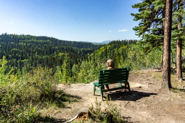
This looked like a great turn-around spot and we took full advantage.


We decided to visit the Tumbler Ridge Museum to find more about the boys who discovered the tracks and about the artifacts found in the area. The first photo is of the boys, Mark and Daniel, applying a white powder to illustrate and identify the tracks. The second photo is of them applying a plastic mixture to make a mold of a track. I have to ask, how is it that these two young boys were tubing a creek in the wilderness alone? Times have changed!
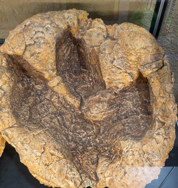
This is a cast of a footprint of the very imposing carnivore, Acrocanthosaurus, found locally. This animal existed 110 million years ago, predating the iconic Tyrannosaurus Rex by about 37 million years.

In 2017 British Columbia’s first dinosaur skull material was discovered beside Flatbed Creek. This was found in some rip-rap that was quarried 20 km away. It is part of a skull of a tyannosaurid like Albertosaurus of Gorgosaurus, and is about 75 million years old.

Contrary to what we have been told, horses had their origin in North America, from there they spread across much of the earth. Horses did become extinct in North America about 10,000 years ago. There were no horses on the continent until they were brought back by the Spanish. Here are two horse bones found in the region, a femur dating about 13,000 years ago which was found during the excavation of a borrow pit. The smaller bone is a phalanx (toe bone) that came from a horse that lived about 30,000 years ago. It was found beside a local river.

This bison skull was recovered in a gravel pit in 1986, near Hole 9 at the local golf course. It has been radio-carbon dated to 12,400 BP (Before Present). It was studied at the Simon Fraser University and was used in a 1993 graduate thesis. This was an exceptionally large male. The horns were much larger than the surviving horn cores. This is merely the forehead and upper eye section of the face.
After the study, the skull fell into the hands of private collectors and its whereabouts unknown for a time. It was later procured at an auction by SFU Professor of Archaeology at an auction for the sum of 10 dollars. (Canadian)!
In 2014, it was donated to the Peace River Palaeontology Research Centre and returned to the community from where it was discovered almost 30 years before.
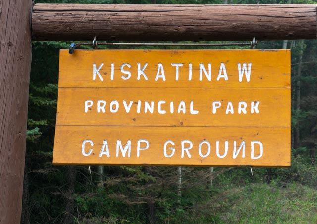
The next morning we woke to even more smoke in the air so we decided to stay close to town. We drove about 20 miles back on the Alcan, to a section of the original highway. We took the original highway to this historic curved bridge over the Kiskatinaw river.

This is a (smokey) view of the Kiskatinaw River, far below the bridge center. The water is very low as British Columbia, western Canada and Alaska are all in the midst of a drought. Previously we drove over the bridge but it has been closed to vehicular traffic for several years now.
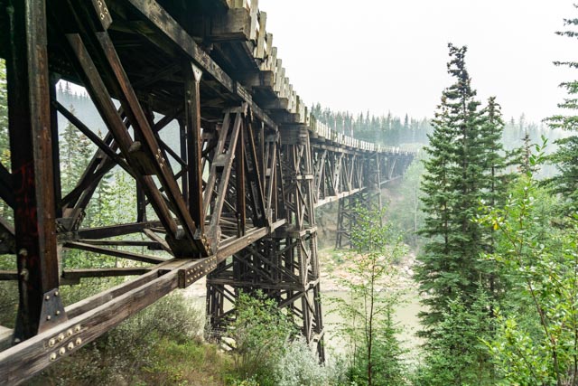
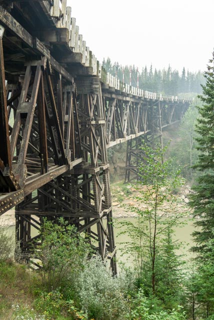
The bridge, built for the Alaska Highway in the 1940s, was constructed of wood. I had to go down a steep trail to get some photos of the underpinnings. It is amazing what a wartime Army Corps construction team can accomplish if necessary.

Cathy at the north end of the bridge, looking at the river.

They stack hay a little differently in B.C.
