
The next morning we continued on our trip, heading north from Whitehorse. We side-tracked on an original portion of the Alcan and found ourselves in the town of Champagne, home of the Champagne and Aishhbk First Nations. We had passed this area several times before, but never stopped. The multiple fire-caused road closures allotted us more time to make side trips.
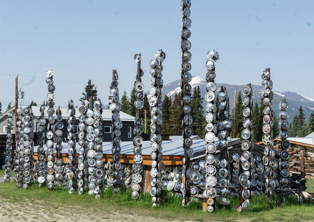
Their version of the signpost forest? We saw a lot of hubcaps roadside due to the severe potholes in the chip seal after a winter. The road crews were busy!

The historical signpost and a description of the town. Most of the original inhabitants perished as result of diseases that were transmitted by the construction personnel to the local population, which had no immunity.


The town was mostly in disrepair. There were still a few inhabitants left but we were the only people visible. We did not see any signs of life on this entire stretch of the original highway.

These three tricksters watched my every move and followed me around the town site.
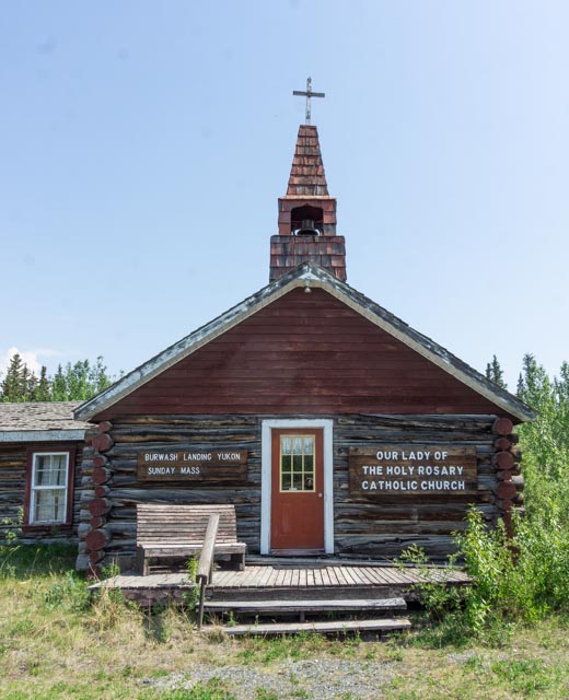
We made another side trip on our way north. This time we drove into the town of Burwash Landing, on Klaune Lake to see Our Lady of the Holy Rosary mission, built in 1944. It was the first Catholic church northwest of Whitehorse on the new Alcan highway. Father Morisset, then auxiliary chaplain to the U.S. Army at the road construction camps was asked by local residents to start a mission and day school. Land was donated by Eugene Jacquot, the local trading post owner. Building materials came from the Duke River camp site and included an unfinished Army mess hall and a log cabin which form the two arms of complex. The day school closed in 1952. The church opened with Christmas Eve mass in 1944 and is still in use today.

This “Our Lady of Kluane Lake” grotto was behind the church.

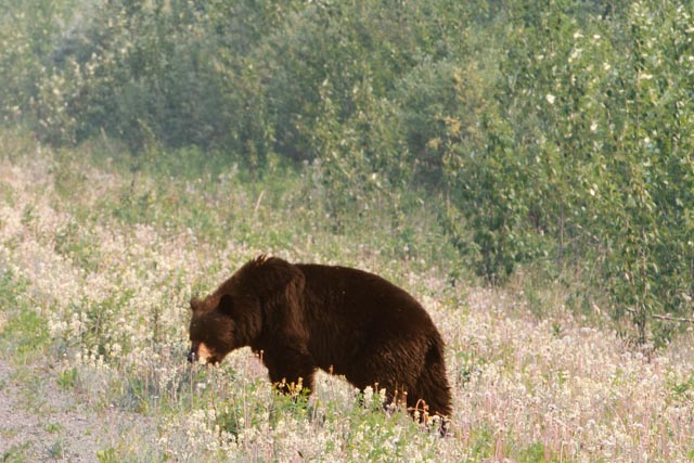
Another roadside bear. Since it was early in the year, we saw a lot of these, in both brown and black (no blonds yet). They were munching on the roadside flowers.
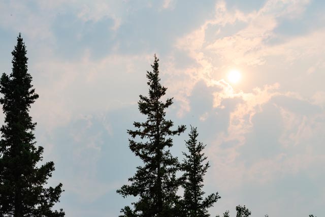
This was taken in the afternoon, as we crossed the border into Alaska. The smoke from the many fires blocked out the sun for days.
At one point, we were told that we could not travel any further into the state as the Alcan, the Taylor, the Glenn and the Parks highways were closed. We contemplated on taking the 125 mile dirt road, the Denalli Highway, as a detour but found the Glenn to be open and passable, to our relief. The Denali Highway would be rough on the motorhome!
Since we arrived near Tok a day early, we spent the night with other fire-displaced campers in a roadside rest near Tetlin junction.
The next day we arrived in Tok, received real road information from the visitors center and spent the next couple of nights in town. The next morning we took a drive up the Taylor Highway, heading for the Jack Wade Junction, but detoured to the town of Chicken. It was originally called Ptarmigan (a chicken-like bird common to these parts) but the miners had trouble spelling it, so the name was changed to Chicken.

This is the suspended bridge over a creek in town. We must have missed this on previous trips to the area. Hmmm . . .
We had originally planned to spend two days in Dawson City and Tombstone Territorial Park, further up the Taylor and Dempster highways, but the international border was closed due to wildfires.
