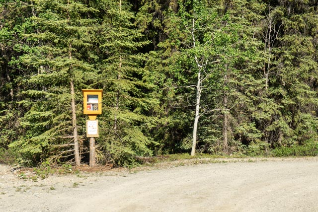
For our third day in Whitehorse, YT, we decided to head out to the historical town of Carmacks. Driving on the original Alaska Highway, we happened upon this Little Library; a small gem in the middle of nowhere.
George Carmacks founded a trading post at this location in the 1890s, went bankrupt and moved on to Dawson City where he sought his fortune gold prospecting. He set up Camp Creekside, later naming it “Bonanza” Creek, and within a year extracted about a ton of gold, resulting in the 1898 gold rush to the territory.
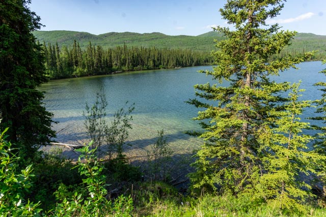
Traveling on the Klondike Loop, we passed several pristine lakes, both large and small. We did not see boats on these lakes, as you would on ours.

Another of the many lakes on the Klondike Loop Highway.

We stopped at the Braeburn Lodge, about 55 miles off the Alaska Highway. This lodge is famous for its cinnamon bun that supposedly can feed four people.

We met Steve, the longtime resident and owner, and his three dogs. He scolded one of the dogs for bringing her chew bone; it was a calf foot. At that point, we knew we were in country! We had a enjoyable conversation with Steve and ordered a cinnamon bun. Steve insisted that we have it warmed up and of course we followed his instructions.
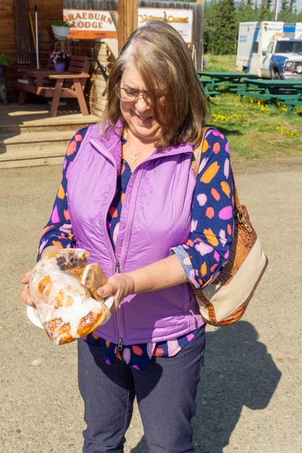
Cathy is holding the remains of the bun after we did our best to devour it, to no avail. It was good the following morning, though.
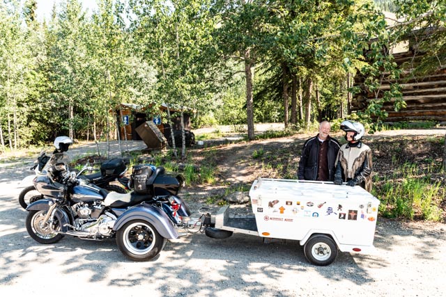
This is a couple we saw at the Braeburn Lodge and luckily we met them again at this rest area, which happened to be the site of the Montague Roadhouse. The bike was converted to a trike, and the trailer was custom built. It converts to a queen size bed, inside seating and lots of storage. They have traveled extensively with it and had no issues. It was a very clean setup.

This is what’s left of the original roadhouse. The roadhouses supplied a change of horses, meals and sleeping facilities for those traveling to and from the goldfields; in this case, Dawson City. This roadhouse held 12 rooms.

This is a storage building located behind the roadhouse.
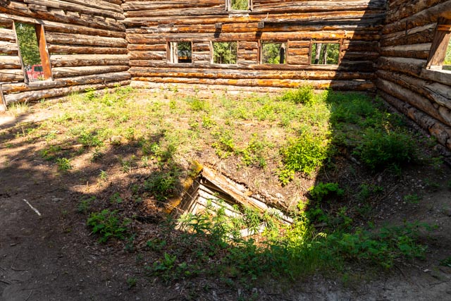
Climbing inside the roadhouse, we noticed this depression in what was the floor. Probably some sort of basement or safe location?

I had to take this picture. It is an ambulance from Inuvik, NWT, 456 miles up the Dempster Highway (a dirt road) and about 95 miles from the Arctic Ocean. Inuvik was until recently the end of the Dempster, but the highway now continues on to Tuktoyaktuk.
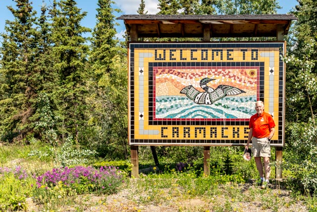
The is the “Welcome to Carmacks” sign, a mosaic that was created by First Nations people.
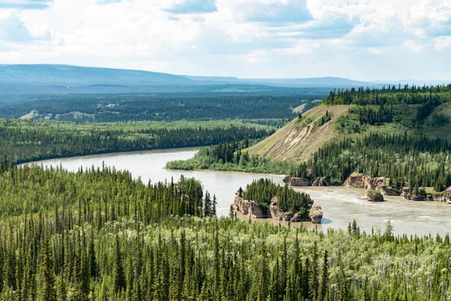
We drove through Carmacks and to the viewpoint for the famous “Five Fingers” series of rapids that hindered paddle-wheelers on their way to Whitehorse. Of the five possible ways through these rocks, there is only one way that is navigable. Most boats used a winching system to navigate these rapids.
We followed the interpretive boardwalk alongside the Yukon River. This is what is left of the White Pass and Yukon Route stable, across the road from the Carmacks roadhouse.

This was the Carmacks Roadhouse. These roadhouses were built at 30 mile intervals along the stage route.
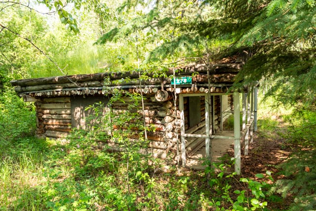
Across the river, I climbed down to the home of Hazel Brown. Hazel was the daughter of Courtland Mack. Courtland and his brother came over the Chilkoot Pass in 1898 to prospect and mine in the Carmacks region. Hazel purchased the Carmacks Roadhouse in 1922.

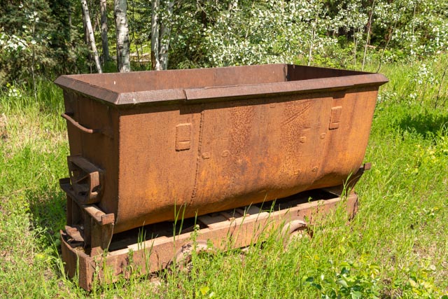
These are a couple of coal cars, leftover from local coal mining operations at the nearby Tantalus Butte Mines.
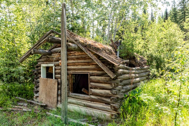
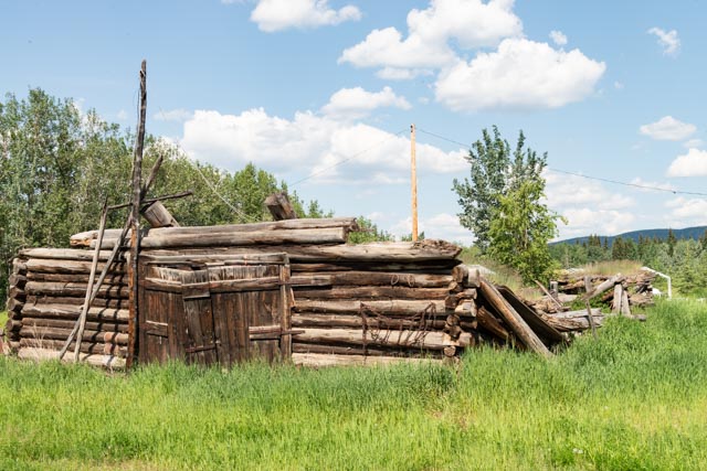
This is the Orloff King cabin. Orloff was a prospector who roamed the country, building this cabin in 1920 as his “town house”.

This is the bridge leading from Carmacks to Five Finger Rapids, a few miles downstream from Carmacks.
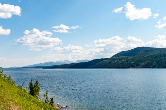
I stopped and took this picture of one of the larger roadside lakes. Again, notice the absence of boats!
