
This is the historic Cottonwood House on the 51 mile route to Barkerville which follows the original Cariboo Wagon Road. This was built to accommodate miners and stagecoach passengers in 1864.

This is the grave site of Charles Morgan Blessing, who was murdered in 1866 on his way to Barkerville. The murderer, James Barry, took a gold nugget stickpin from his body and gave it to a Barkerville dance hall girl who immediately recognized it as Blessing’s. Barry was the first (and only) white man to be hanged in Barkerville.

The first buildings you see entering the town are the Wesleyan Methodist Church (foreground) and the St. Savior Anglican Church (background).

This pump organ was donated by Baroness Angela Burnett Couts in 1885 and is still used today.

Cathy on the steps of the St. Savior Anglican Church.
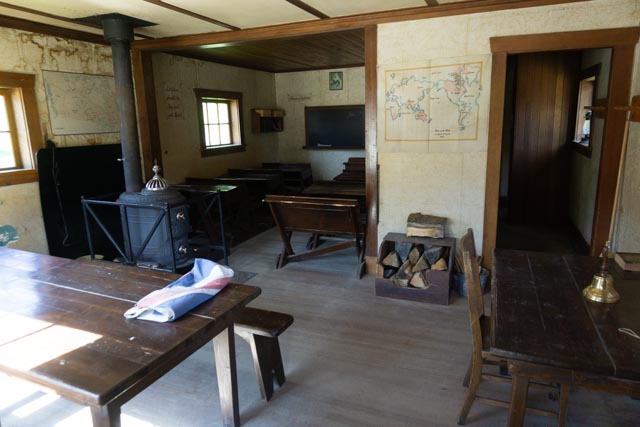
A photo of the interior of the Victorian School.

The school teacher rising the Union Jack in the morning in front of the Dooby House (Victorian School).

A view of Barkerville looking down the main street. For a short time, Barkerville was the most populated town in North American above San Francisco and West of Chicago. We arrived early and it was relatively uncrowded . . . for a short time.

Cameron & Ames, the town blacksmith’s shop.
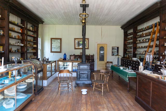
The interior of the drugstore. There were period medicine bottles lining the walls.
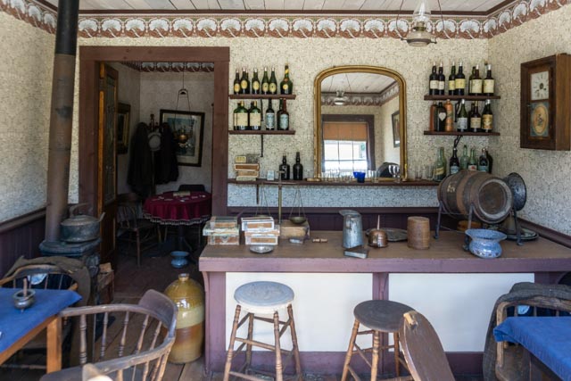
The inside of one of many local drinking establishments. Notice the “backroom” card table. Apparently there was as much wine consumed as hard liquor.
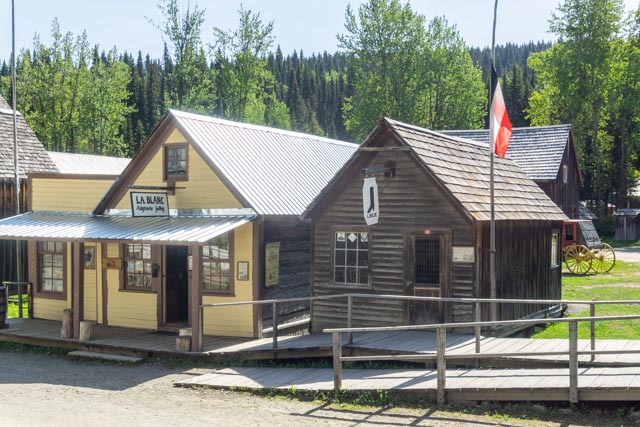
I inquired about the origin of the flag. Apparently, the original owners, a Prussian family, occupied this cabin and proudly presented the flag of their home country.

Indigenous Interpretation was available at the Kelly Hall. Cathy and I enjoyed talking with the First Nations gentleman there.
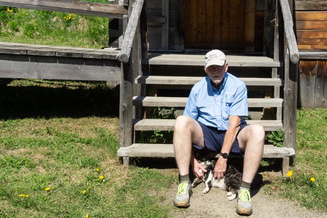
The town “feral” cat came running to me when I sat down. He lives here year round and has been seen playing with and eventually eating an ermine last winter. He seem pretty tame to me. He is a feature on the town website and is is pretty popular with the locals. His name is “Bubba”.

I took this shot in Chinatown (at the far end of Barkerville) because of the wildflowers, only to find out that the Chinese cut terraces to encourage multiple plantings.

This Cornish waterwheel and flume that was used for mining operations. The diverted water here powered a type of ingenious elevator that moved crushed rock from the deep, underground mines to the surface. The offset wooden rod on the wheel operated a type of plunger. An other example of this can be seen adjacent to the wooden footbridge in Quesnel.
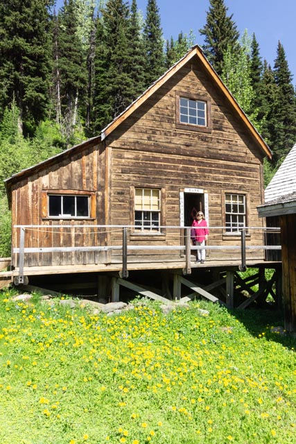
Cathy standing in front of the Kwong Sang Wing home. The owners had a storage facility (you can just see the edges in the right border of this photograph) for their store.
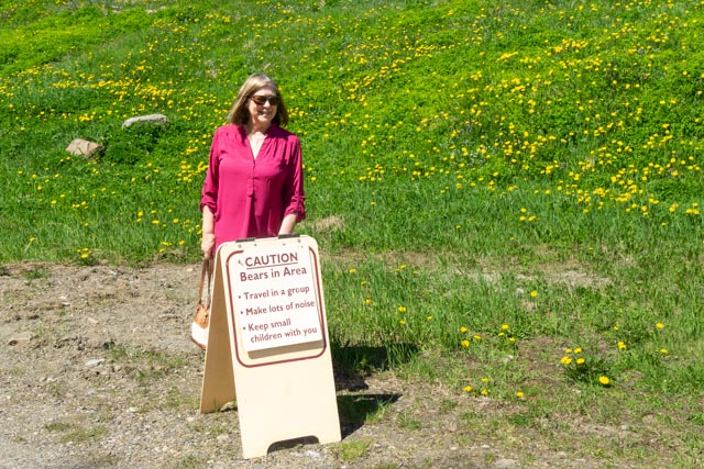
Cathy at the end of the road for us. To go further, you had to hike a narrow trail and we opted out. Something about bears?


I took a short drive on the original Cariboo Road and came across the Barkerville graveyard. There were approximately 600 burials here and only about 200 are verifiable (as records were not originally kept). It is interesting how large trees were growing out of some of the graves that had fencing around them.

I stopped and walked back to this random lake to take a picture. The water was so clear here, you could see the bottom. Unfortunately, this is not visible in the photograph.

On the way back to the truck, I spotted this guy near the truck. I was about a hundred feet away and without any protection. This could have been a dicey situation.

The bear walked across the road and sat in a field watching me. What was he thinking?

I found out when his buddy came out of the brush, too close for comfort. He still had flowers in his mouth. They must taste good because all of the bears we saw were eating them. I, nevertheless, scrambled back into the truck to avoid any possibility of becoming his supper.
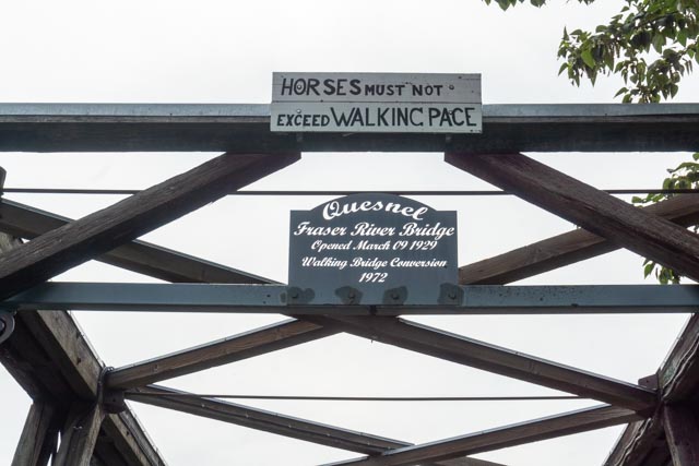


After dinner Cathy and I took a walk on the Quesnel Riverfront Park’s Fraser River Footbridge, the longest wood truss walking bridge in the world!
From here, we headed up to Prince Rupert, then to Dease Lake on the Cassiar Highway as the ALCAN was closed due to wildfires. We stopped briefly at Jade City and made it to Watson Lake in the late afternoon. A 940 mile detour in a day and a half!
