Upon driving across Ontario we began to notice the large number of moose warning signs along the highway. Normally, when we see signs warning of wildlife we notice that we see no wildlife. It is kind of like the animals read the signs too! Unfortunately, a very large moose appeared on the side of the road as I was going about 70 KPH. He looked at us and proceeded to trot in front of us. I hit the brakes (hard) and our motorhome skidded down the highway, in the middle of nowhere, with a lot of the items moving rapidly from the back of the motorhome to the front. As my ice chest made its way to the front, the kitchen chairs fell over, the items in the refrigerator were a mess, and the moose just kind of smiled at me and kept trotting. It appeared that he told me, “read the signs, stupid”! We came close, but no contact. We drove on.
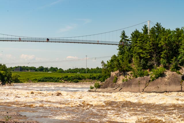
This is the pedestrian bridge overlooking Chaudiere Falls, near Quebec City. There is a paved bicycle trail starting in Parc des Chutes-de-la-Chaudiere and ending in the town of Levis and views of Quebec City.
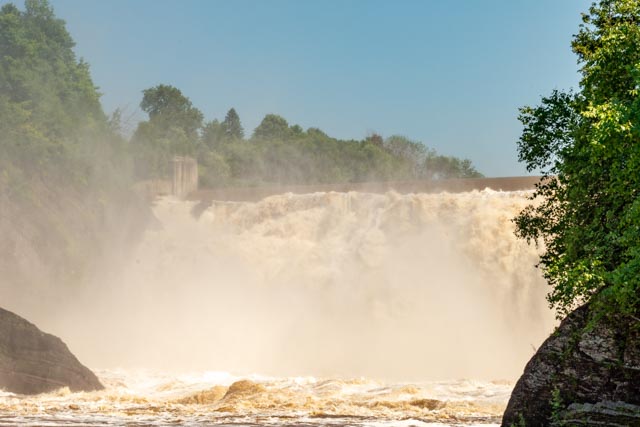
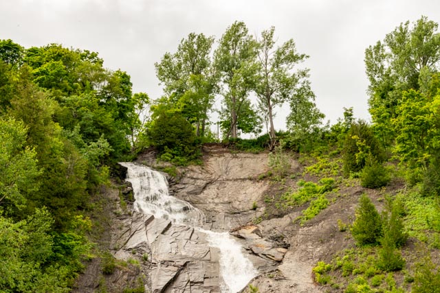
Chaudiere Falls is near Levis, Quebec.
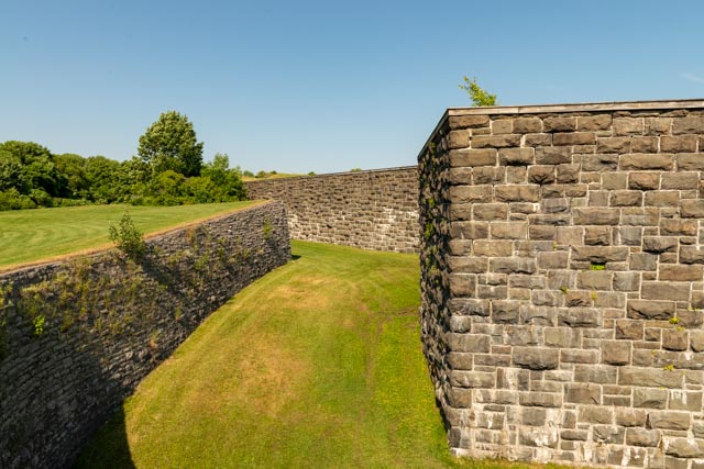
We drove to Fort Levis #1, only to find out that it was closed. Locked up tight! (haha). We decided against jumping down into the moat (about 12 feet) then climb the 20+ foot walls to enter, we would just wait a day until it was open.
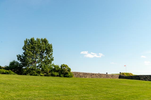
The grounds surrounding this fort were well groomed. We visited the Plains of Abraham instead.

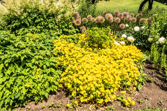
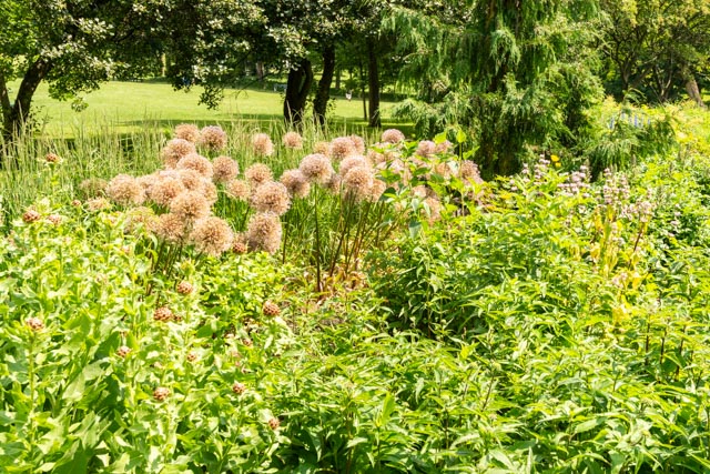
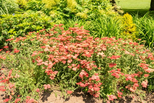
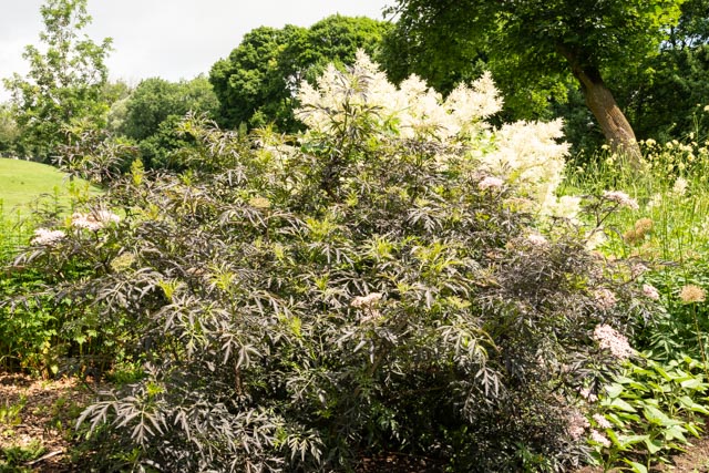
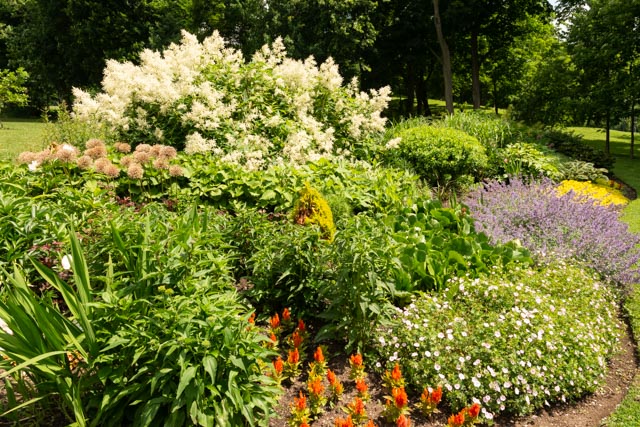
The grounds of the Plains of Abraham were outstanding, from deep forests, to manicured lawns, flower beds galore and paved paths everywhere, making it a joggers and bikes wonderland. We had to stop and “smell the roses” at this roadside grouping.
The Plains of Abraham are a historic area within the battlefields in Quebec City. The fate of New France was decided here on September 13, 1759. The Battle of Quebec was between the French and the British, with both sides losing their commanders during the battle. Causalities were heavy for both, with the British suffering 658 killed or wounded and the French somewhere between 644 and 716 killed or wounded and 350 taken prisoner on these grounds.
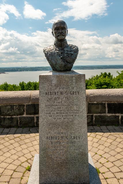
Albert Grey was the Governor of Quebec who was instrumental in establishing the Plains of Abraham a National Battlefield site in 1908.
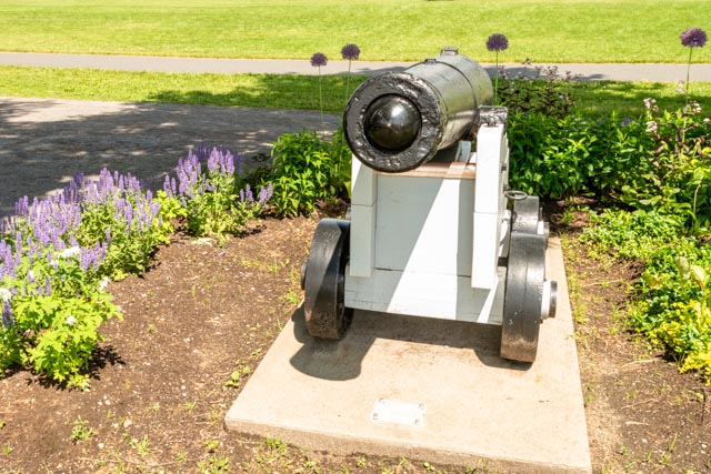
The guns were collected over the years and reunited with the battleground.
There were numerous designs, capacities and sizes on guns used and on display.
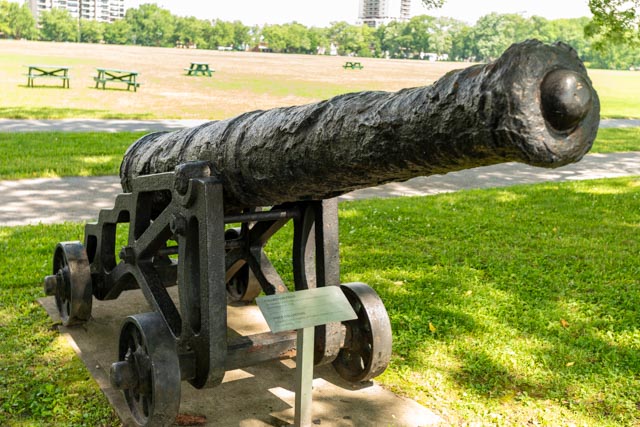
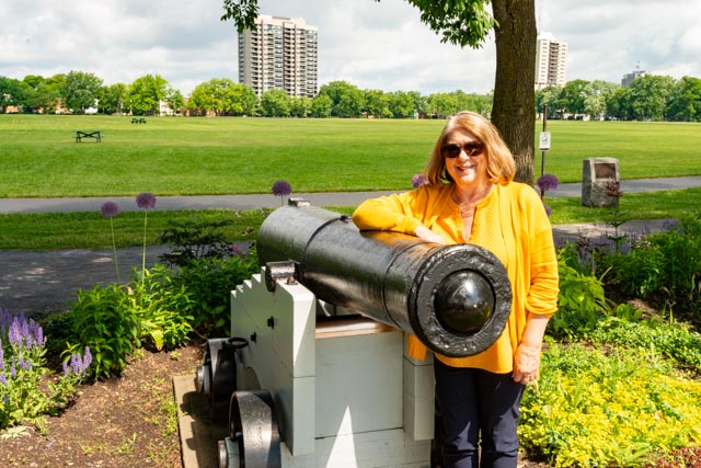
I like this big guy that was dredged from the nearby Saint Lawrence River.
This is the overlook on the Saint Lawrence River from the Plains of Abraham. If you look closely you can see Cathy (in yellow) reading the signage. The Albert Grey bust was located here.
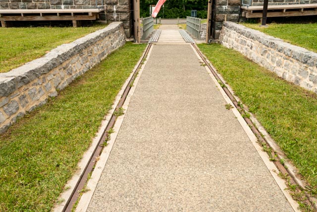
This is the entryway to Levis Fort #1 (of 3 Forts). The unique roll up entryway it to deny any potential intruders entrance.
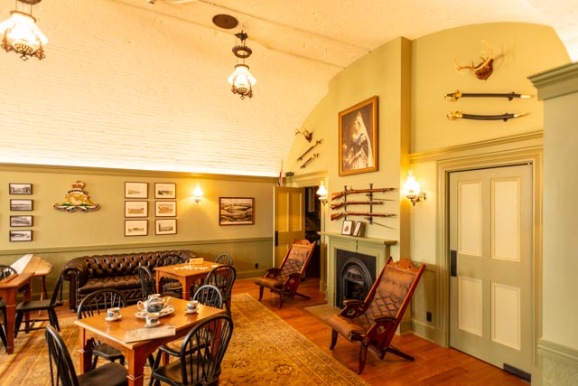
The recreation room for the garrison in the fort was more elaborate than those we saw in other forts. This room was built inside the thick walls of the main fort and considered to be relatively safe. They appeared to have plenty to occupy the crew.

Walking on the rim of the main fort, we met a young man from Labrador. After talking about his home (unreachable by roads) we discussed Canada’s role in wars in the past. Then we noticed the darkening of the skies. He assured us that it would pass and move to the right of us, but Cathy and I headed for the truck and just barely made it before the sky broke loose. He admitted he was wrong and headed for cover as well.
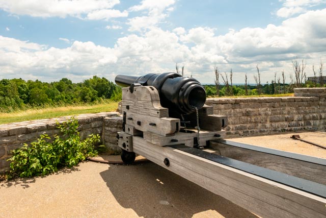
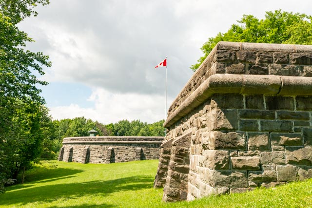
This is one of the larger guns protecting this fort. It had the newer rifled barrel allowing it to shoot further and more accurately. Unfortunately, newer naval designs made this type of gun obsolete. We learned that this was one of three forts built in 1865 to protect Canada from its enemy – the U.S. There were supposed to be five forts total, but funding was withdrawn as relations warmed up.
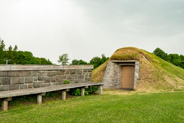
Ammo storage was designed to blend in with the overall design of the complex.
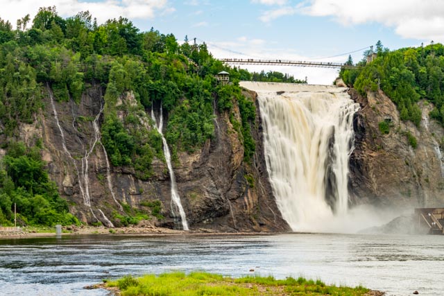
We took the drive out to Montmorency Falls. It took us two tries to get there. The first attempt was using the Garmin in the truck, but it directed us to the falls we had just visited. On our second attempt, we used common sense and immediately found the location
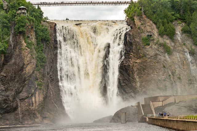
We HAD to get a little closer that the standard viewpoint. There were zip-liners heading to the small building on the left of the falls and a Via Ferrata on the right wall of granite. I would have to go with the Via Ferrata, (maybe next time). Bottom line, this was a highly commercial area. From Google: A via ferrata, iron path in English, is a route with fixed protection that aids travelers in moving safely through the mountains.
I saw this small water feature on the road out of the main falls and made the small hike up, near enough to take a photo. I don’t believe this has a name.
