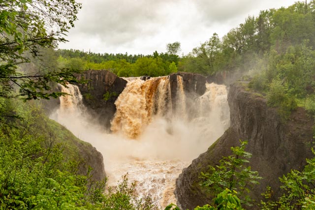
This waterfall is a short hike from the border crossing station, on the American side of the Pigeon River. At 120 feet, High Falls is the tallest waterfall in Minnesota. I tried to get closer but due to the heavy rains, the misting was immense. I had to go downstream to get this photo without soaking my camera.

This is Katabeka Falls in Ontario. It is a drive off of the main highway but well worth the trip. We stopped at Fort William Historical Park on the return for a double!

Cathy at Kakabaka Falls.
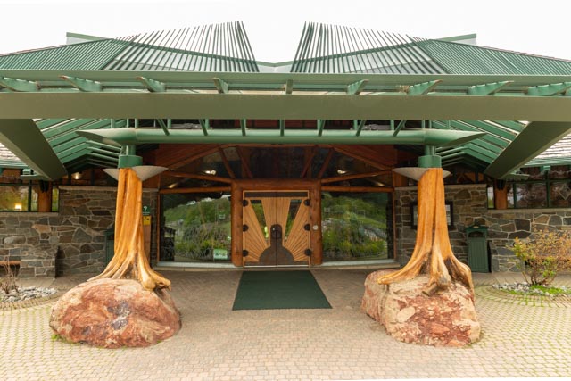
This is the entrance to the visitor’s center for Fort William. After the French revolution the Americans demanded that the North West Company relocate out of US territory. They decided to move and consolidate with the other half of the company and decided on this combined trading post at Fort William, Ontario in the 1830s.

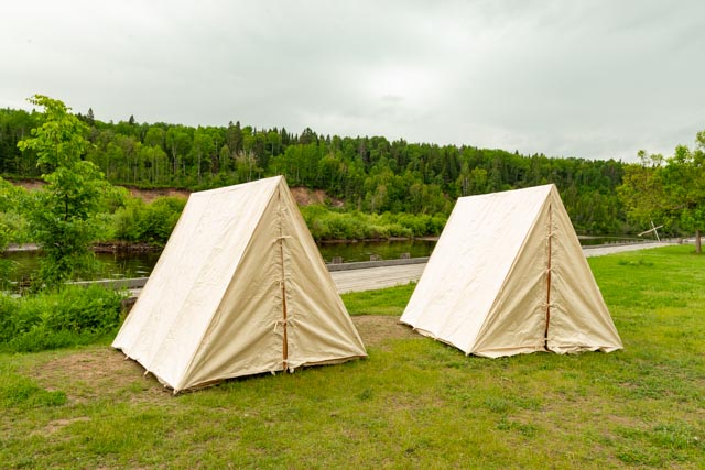
The First Nations peoples decided to encamp on the outside of the fort for personal reasons. This is an example of their camp.
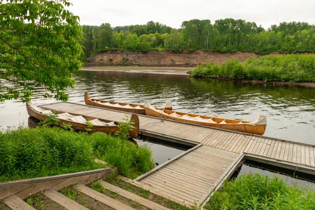
Canoes dockside, made from birch bark, stand ready for adventurous paddlers. These are rentals for later in the season. It is best to keep the bark moist to prevent drying out and splitting seams.
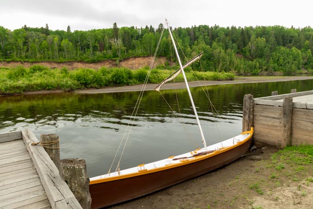
There was even a period small sailboat for use on the river. It is several miles to the lake-shore and the original site of this fort..
The voyageurs generally stayed outside of the main facility.

This is the main gate, facing the water. All persons enter and exit through this single point.

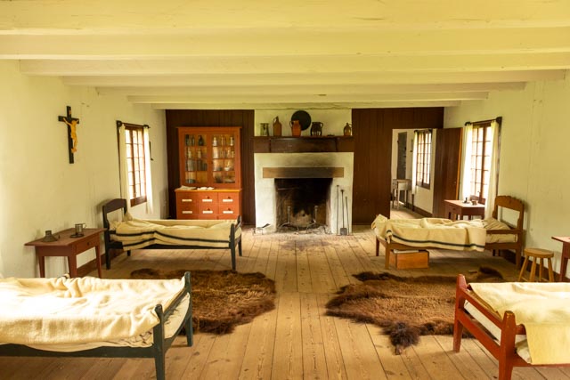
There were children playing out in front of the Great Hall, This was part of a summer school program. What a great introduction to history!
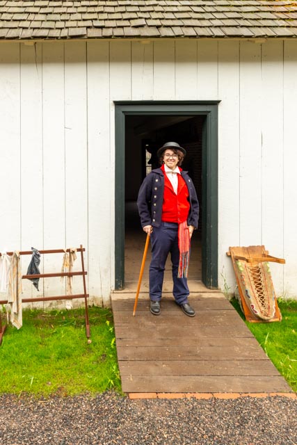
This “Captain” met us as we entered the facility. He was in costume and was definitely “in period”. Everything that was said was in period! It was amazing the amount of knowledge these folks had about this fortification and trading post.

This was the store for the facility. It was built rather stout, able to withstand who knows what.

Inside the tin smith’s home is a display of his handiwork. Tin was a very popular trade item among the natives.

Above is the trading center for the voyageurs.

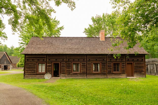
The grounds of the main square are surrounded by various buildings.

This looks more devious than it is. This is a manual press to compress bundles of skins for travel.

This is the powder magazine. Notice the earth depth around the base, mainly to direct any blast skyward. There are very small, barred windows high on the sides. I would imagine that security was pretty heavy around this building.
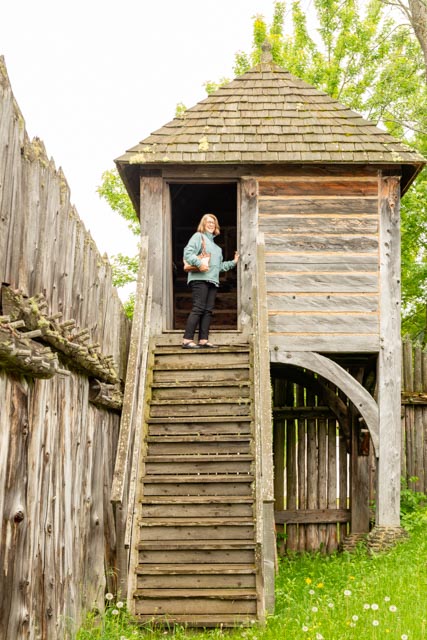
Cathy is on top of what appears to be a guard tower at the front corner of the fort. Notice the spiked dowels that were used in the construction of the perimeter fencing. They face inward and outward; dual purpose maybe?

This was the quarters for the upper-class traders. Notice the coats made from blankets. The blankets look very similar to Hudson’s Bay blankets and upon inquiry, I found out that they were made by the same manufacturer. These were listed in the catalogue as simply HB Blankets as there was a great rivalry between the two companies.
This was the hospital.
I would not like to get sick here. A lot of the medicines in the case in the back left are not recognized as medicines today. There was a prominent crucifix on the wall, probably for good reason.
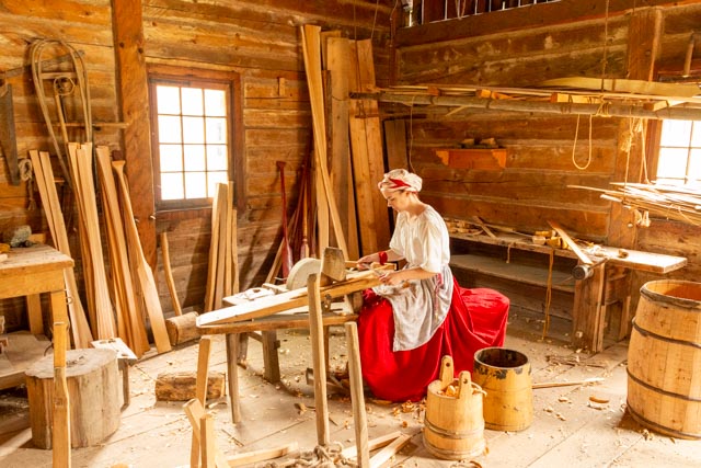
This young lady was using a draw knife to make kindling out of cedar to start fire in the fireplaces. She told us that this was the first time she used a draw knife and it really wasn’t very difficult.

Look closely, this is a 1830s version of convection cooking. Meat was hung from the black wheel at the top of this reflector. When placed in front of a fireplace, it created radiant heat, the drippings from the meat collected in the pan at the bottom for later use. The meat was left in place until cooked – by radiant heat!

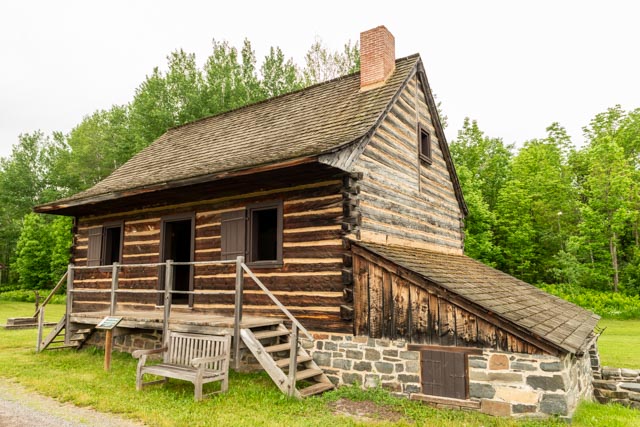
This was a tradesman’s house.

This is Trade’s Square. Each of the three building was dedicated to a single skill set.

This was a typical garden plot. The building to the right in this photo was the jail. NO Windows, NO light, NO bed and a dirt floor. You didn’t want to be a prisoner in the early 1800s.
This was the dairy yard. This building was both the Dairy and Ice House.

Free range chicken were everywhere and were almost approachable.

The sheep came running when we approached the fence line. They were raised for their wool and were probably tasty too!

This ewe is just a funny looking guy! What can I say?
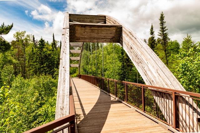
We took the “Off the Beaten Path” route to Quebec. We made it down to Ouimet Canyon Provincial Park, near Dorion in Ontario. This canyon is 3K (1.9 miles) long, 152M (500 feet) across and 107M (361 feet) deep. Flora on the floor of this canyon are typically found about 1,000KM (621 miles) to the north of this location. We drove with the motorhome as far as we could on a very narrow road and were forced to leave it in a small parking area so we could take the truck the final mile or so. There was no way to turn around at the bottom as it was our only choice. We got a lot of odd looks while going in.
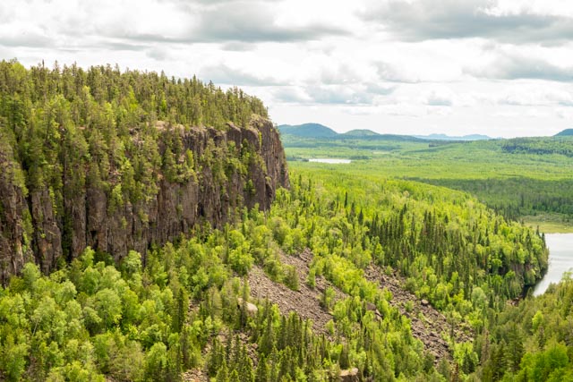
Looking out at the end of he canyon you can see mountains in the distance.

Cathy, after looking down at the treetops far below.

Looking up the canyon.

A neat spire was emanating from the sheer wall. Those are full grown trees below!
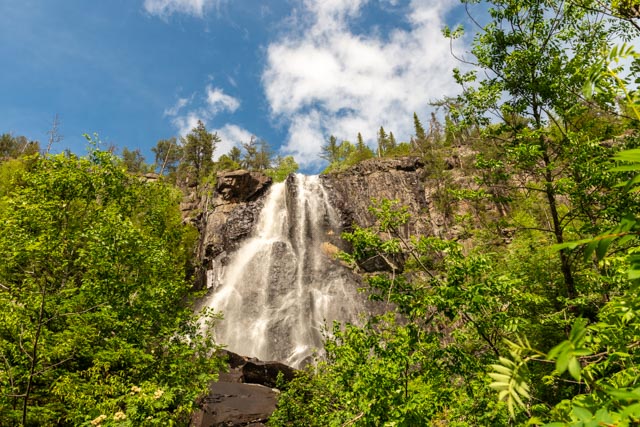
I saw this from the road so I parked a ways away and climbed to the base of the falls. It was a little slippery and a little muddy but I made it. This is called Pijitawabik Palisades.

Sunset at our rest stop campsite was beautiful.
