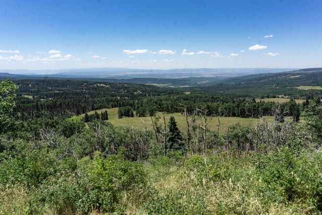
We left Colorado near Pagosa Springs and took a back road to Taos. We traveled many miles without seeing another car, farm or dwelling of any kind. You cannot see any signs of human existence for a far as the eye can see.
We stopped a wide spot in the road and walked to take in this view.

This is a photo of the sunset west of Taos, out near the Rio Grande river.
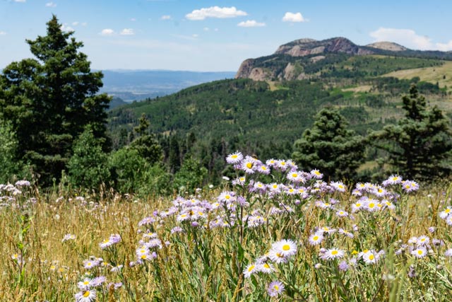
We visited the Rio Grande del Norte National Monument, located near Cerro, New Mexico. It was about a 20 mile drive through the park to the visitor center. The ranger there recommended a circular drive through the park, which we followed.

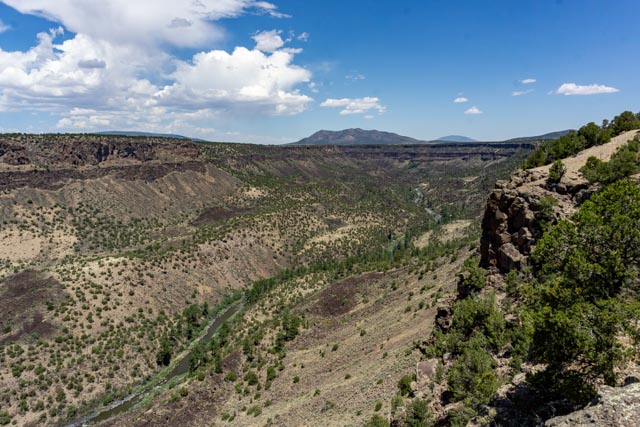
At one point, there was a trail switchbacking down to the river. There is a fisherman’s camp at the bottom of the gorge and evidently the river has some great trout fishing. The trail was closed due to damages caused by the heavy winter in the area. I walked down partway to take this photo.

On the trail I spotted what initially appeared to be brick, but was actually a layer of natural basalt blocks.
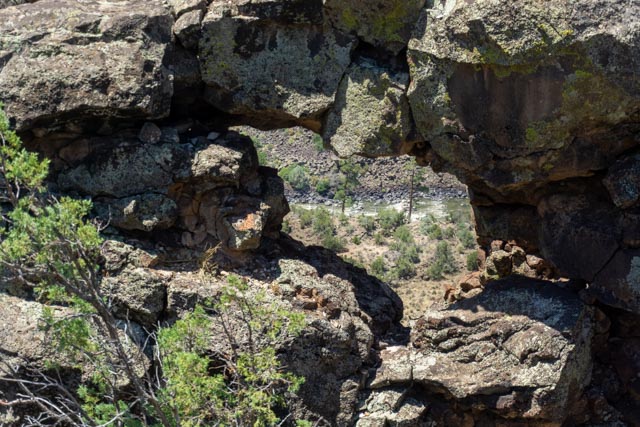
The ranger recommended we go to the end of the trail to see this “porthole” in the basalt formation. If you look closely, you can see the whitewater of the Rio Grande river far below. It took me a while to find it as it was pretty well hidden.

We saw the natural basalt buttress at the top of the cliff.
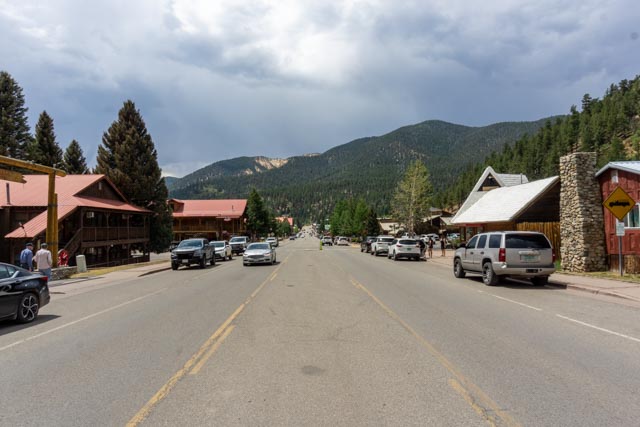
We drove the Enchanted Circle near Taos, New Mexico. This is a circular route out of Taos, north to Questa, then west to Red River, home of a ski resort and many ORVs (photo of downtown above), it turns south to Eagle Nest, continues to Angle Fire, home of a ski resort and a Vietnam War Memorial (below), then turns back west to Taos. It can be a full day if you stop in the small towns along the way.
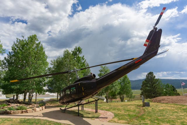
This a Vietnam era Huey known as “Viking Surprise”. It was one of the first helicopters in country. It was shot up in 1967 during a rescue operation and had 135 bullet holes when it was repaired.

This was the first major Vietnam War Memorial in the United States. The memorial grounds and chapel (below) were envisioned by Dr. Victor and Jeanne Westphall to honer their son, 1st Lt. David Westphall, who died in combat in 1968.


We decided against attempting to summit Wheeler Peak, but were encouraged to hike the Wheeler Peak trail to Williams Lake. The trailhead is at Taos Sky Valley. We drove through the small town of Arroyo Seco on the way and made a quick stop. There was lot of construction going in the ski area, I guess they have to get every thing done before winter. We walked past this small pond on the way up the trail.

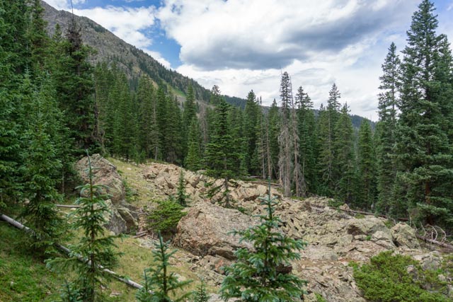
We crossed several of these rock fields on the way to the lake. It was about a 2-1/2 mile hike with a pretty good elevation gain.

Here we are entering the Wheeler Peak Wilderness.
Oh boy! There was another rock field to cross.
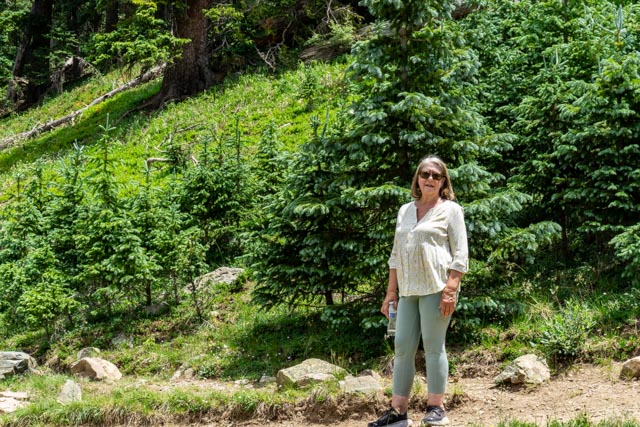
Cathy is taking a rest after the rock field. The avalanche areas were rapidly regaining their ground and tree cover.
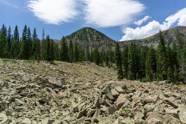
There was yet another rock field to cross.
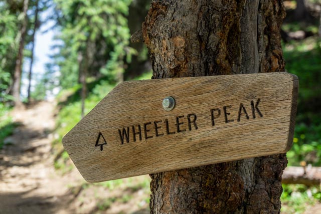
This the turn off on the trail; left for the Wheeler Peak, right for Williams Lake.
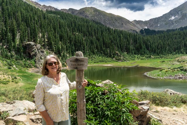
Cathy posed at our destination, Williams lake, elevation 11,040 feet. We actually crossed a ridge several hundred feet higher than the lake before dropping down into this basin.

Williams Lake sits is a basin surrounded by high mountains. There is no outflow from this lake and a small waterfall feeding it at the southwest corner. It is very shallow and totally freezes up during the winter so there are no fish in it.

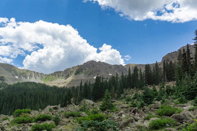
This is Wheeler Peak as seen from the lake. We watched a group of hikers on the ridge to the left of the peak going for the summit. It was pretty late to be on the mountain still going up but we surmised that they had a camp set up at the directly in front of us in the woods, back from the lake. We met other hikers on the way out who also planned on staying at the lake to shorten their climb the next day.
This is the view from our vantage point looking due south from the lake. Taos is just over the mountain and down in the valley.

This is another view from lakeside looking west.
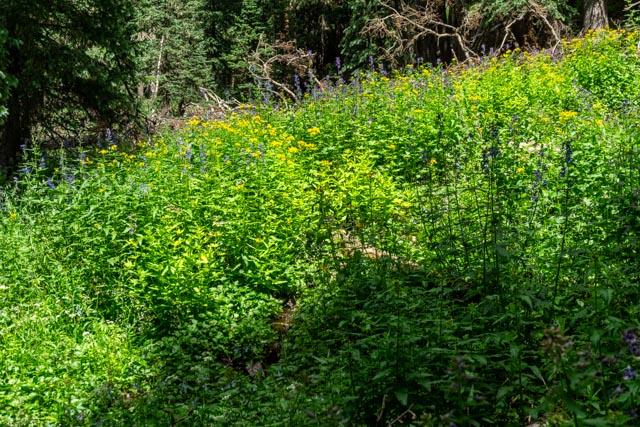
There was a small creek under these wildflowers. You could hear the creek, but it was hard to see. I imagine it drys up when the snowmelt gives away.

We missed this guy on the way up. He is watching the trail.

We visited Earthship Biostructure which is located just west of Taos. Earthships are self-sufficient sustainable homes that encompass the basic need of humanity; food, energy, clean water, shelter and waste management. They are totally off the grid but they do pay some taxes.

This is the Rio Grande Gorge Bridge leading into Taos from Chalma on Highway 64.
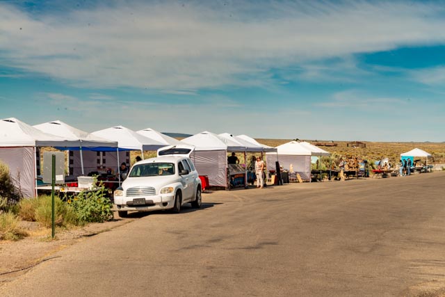
These are the native Zunis selling their crafts at the bridge rest area.
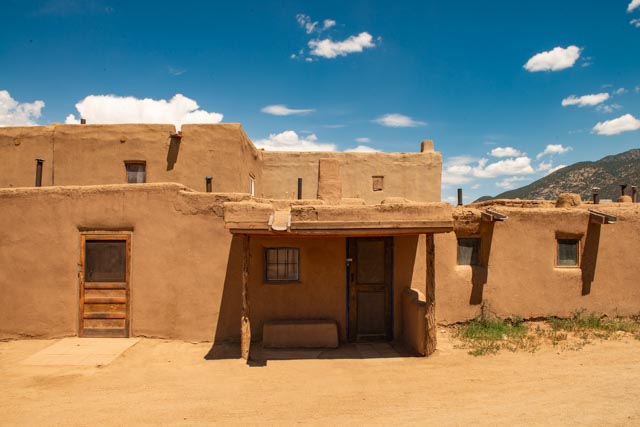
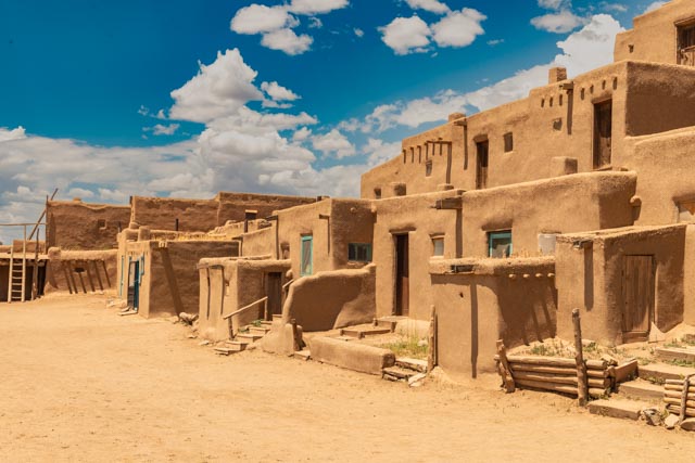
We stayed an extra day to visit the Pueblo. They were closed Monday, Tuesdays and Wednesdays. These are people’s homes and their privacy is asked to be respected. There is no electricity in these buildings. They use propane for cooking and lighting.

There is a Catholic Church in Taos Pueblo.

I tried to get a photo of the Pueblo buildings before the tourists arrived. It was hard to time it right.

This is a typical oven; most of these were closed off when not in use (presumably to keep tourists from messing with them). There was some nice pottery sitting next to it.
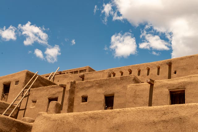
I had to take a photo of the neat construction. These were the original high rise buildings. They are the oldest, continuously occupied buildings in the United States.
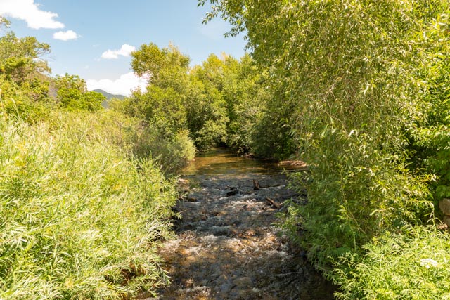
This creek originates at the Sacred Blue Lake. No one is allowed access. It is truly sacred to the Pueblo people .
This is a close up view of the converted Pueblos. They had added doors and windows over the years but they are still pretty bare inside.


The above three photos relate to the San Geronimo Mission and I included the brief history in the middle photo.
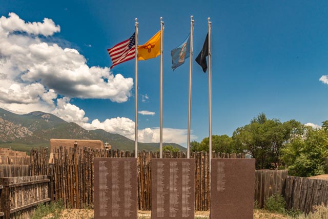
This is the Pueblo Memorial to our armed services. The three tablets list the names of native casualties from the wars, while there are two smaller tablets to the side which list the native survivors of the Baatan Death March and the history of the Taos Revolt.
