
We were ahead of schedule and going to arrive a day early in Portland, so we slowed down a bit and made a side trip to Joseph. The town was named after Chief Joseph of the Nez Perce and is located at the entrance to Wallowa Lake State Park. I last visited this area in the mid 1970s with my sister Myrna and her husband Rich.

We arrived in Joseph about lunchtime and just happened to find this coffee shop and bakery, “The Blythe Cricket – Bakery and Bistro”. I saw the Pyrex behind the counter and took a photo and sent it off to Michelle. She is a Pyrex nut.

I had to try their raspberry and rhubarb coffee cake. It was pretty good!

Since parking was an issue we decided to leave our rig at the end of town and walk it end to end.

There were a lot of these statues , usually one on every block. This one was named “Springtime” by the artist.

The same artist that made “Springtime” above created this one. It is called “Rolling Thunder”. I wonder why?

This artist used my cat as a model, I’m not kidding.

Finally, a statue of Chief Joseph, dead center in town!

I could not find any information on this guy but here he is.
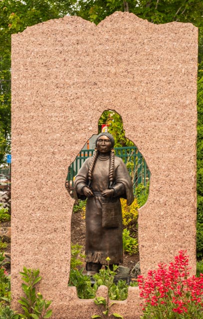
This statue was kind of unique. The bronze lady is several feet behind the opening in the wall It is called “The Return” by the artist.
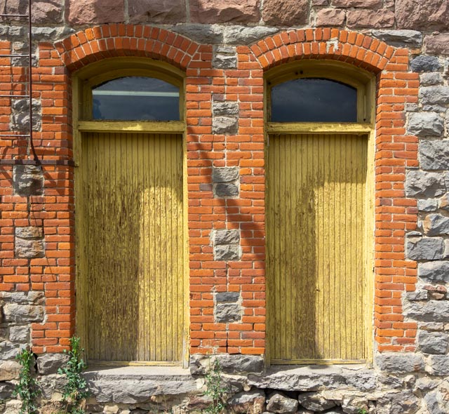
We departed Joseph and headed towards Portland, on the back roads of course. We happened on this detailed brickwork in Elgin, across the street from Mountain Women Mushrooms.
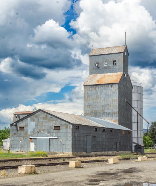
I took this photo of the grain tower in Elgin on the way back to where we had to park the motorhome.
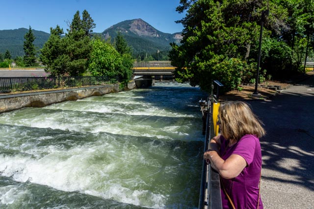
We stopped at the Bonneville Dam on the Columbia River, 40 miles east of Portland to watch the salmon run. The Chinook, Coho and Sockeye salmon (and other species, including trout, shad and Lamprey eels) to climb more than 60 feet to continue their run to the spawning grounds. It was interesting (and fun to watch) the way they jump the steps on the way up. Construction started in 1933 on first powerhouse and continued in phases until 1943. A second powerhouse was added during the period of 1972-1986.
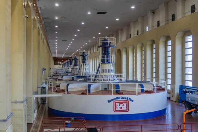
This is original powerhouse. It is originally fitted with 1 – 4,000 KW (thousand watt) generator and has been upgraded with two additional 54,000 KW and 8-60,000 KW generators. We went into one of the the power houses and viewed the exhibits that were on display. The second powerhouse holds 2 generators at 13,500 KW each plus 8 generators at 76,000 KW each. Total generation of the facility is 1,227,000 MW (million watts). By comparison, The Dalles (also on the Columbia) produces 2.1 million W, the John Day (also on the Columbia) produces 2.2 Million KW and the Grand Coulee, further up the Columbia has the potential of over 10 million KW. Currently the Columbia produces 20,732 MW.
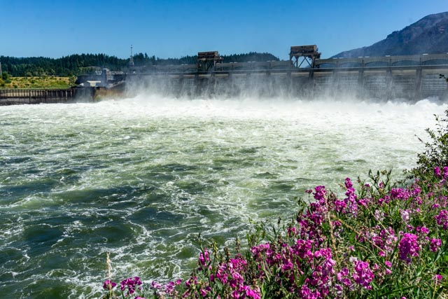
This is water being released from the dam. The spillway has a capacity of 1.6 million cubic feet of water per second! The Bonneville dam was named for Captain Benjamin Bonneville, a soldier, trader and explorer.

After visiting the various trout and sturgeon ponds, we walked over to this unique fountain. This area was built in the 1930s by the Army Corps of Engineers at a cost of $88 million for the first phase and $664 million for the more recent addition. Inflation
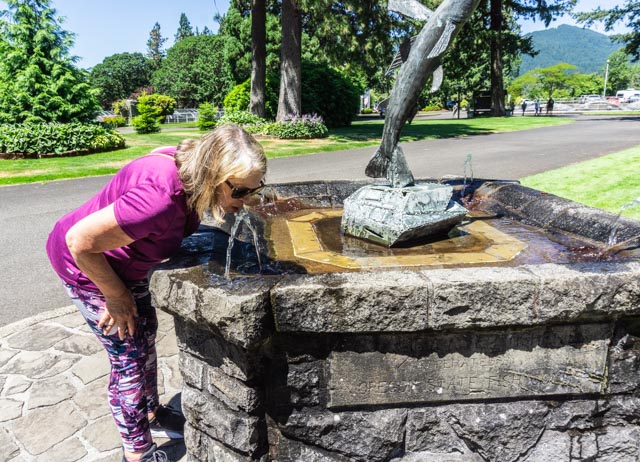
Cathy took a drink of the cold (I presume filtered) water from the fountain.

We made a run to Mt. Hood, the tallest peak in Oregon. Cindy and Barbara went up the chairlift while we visited the gift shop and had lunch.

This is looking south, with Mt. Jefferson in the distance.

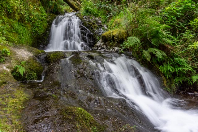
Cathy and I rode the motorcycle from camp to the old, original highway and stopped at most of the waterfalls along the canyon. It is much easier to park a motorcycle that a 40 foot motorhome towing a 20 foot truck! We stopped at Latourell Falls.

Here is another photo of Latourell Falls. Latourell is unique among the best-known Columbia Gorge waterfalls, in the way that it drops straight down from an overhanging basalt cliff. Most of those falls (even the famous Multomah Falls tumble to some degree).

The old “historic” highway was just a little narrower and a little more windy than the interstate below, but it was far more scenic.

This is typical of the bridges over the canyons and waterways in the gorge. I can’t remember what waterfall we walked to where we went below the bridge.
We walked down to the falls at Shepperd’s Dell.

We walked down to the cascade at Wahkeena Falls.
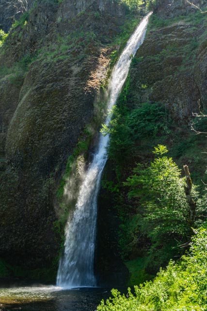
We stopped and took this photo of Horsetail Falls from the viewpoint. There were several people playing in the water.

This is the view looking north from Crown Point. Cathy is waiting patiently at Vista House.

This is the view looking south from Crown Point. I have to hurry, Cathy is STILL waiting at Vista House.
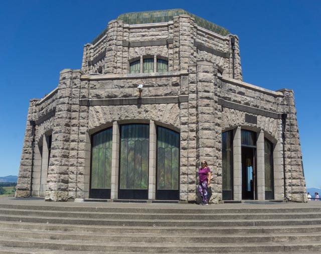
Oops, I forgot Cathy was waiting for me at Vista House on Crown Point.
