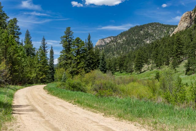
There was break in the weather so I took Cathy for a ride on the motorcycle to the Cow Creek trailhead located in the easternmost part of the park. It is the trail to Bridal Veil Falls.
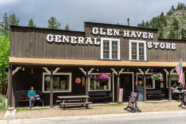
After coming back down we turned on Devils Gulch Road and went into the town of Glen Haven. After relaxing (Cathy is on the bench on the left) we continued on to Highway 34 and drove back into town for lunch.
I decided to take the bike to the top of the pass (almost 12,200 feet) and the weather seemed to turn as soon as I left camp. It began raining, then, as I continued on (I was already wet) it turned to sleet, then it turned to snow. At least snow was not wet. I was pretty cold when I reached the summit and looked forward to returning to the warmth of the motorhome.

Of course the traffic leaving the summit created a traffic jam and this was a no passing zone. I just knew if I pulled out to pass, there would be a ranger lurking somewhere. I was close to being frozen by the time I returned to camp.
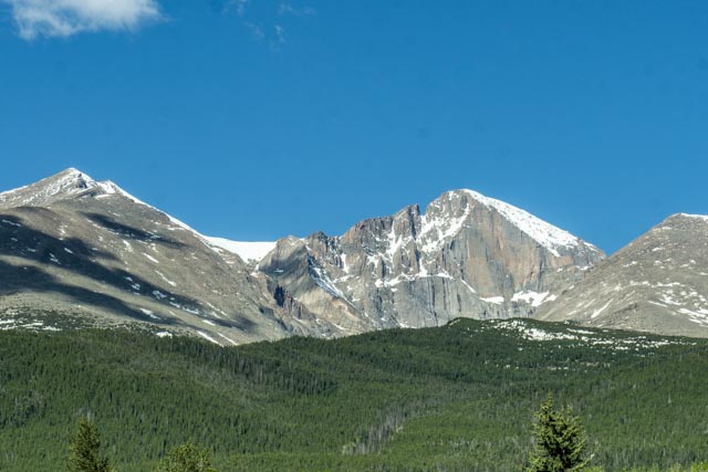
We headed, via backroads, to Buena Vista and stopped to take this photo of Longs Peak, the only 14,000 foot mountain in the park.

This is Clinton Lake, near the summit of the Fremont Pass.

Yes, the snow really does get high here. Check out the “Keep Out” sign on the tree in the center of this photo. As we continued on, it began snowing but cleared up as we were going through Leadville. We got to our camp near Buena Vista and the Owens arrived that evening.
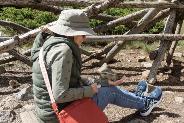
In the morning, we took a side trip to the ghost town of St. Elmo, one of our favorites. Kathy enjoyed feeding the chipmunks at St. Elmo. You can take a very rough 4×4 road from here to Tin Cup, another ghost town. There are loads of 4×4 trails and roads in this area.

Mike also go into the act. Chipmunks are hard to resist.
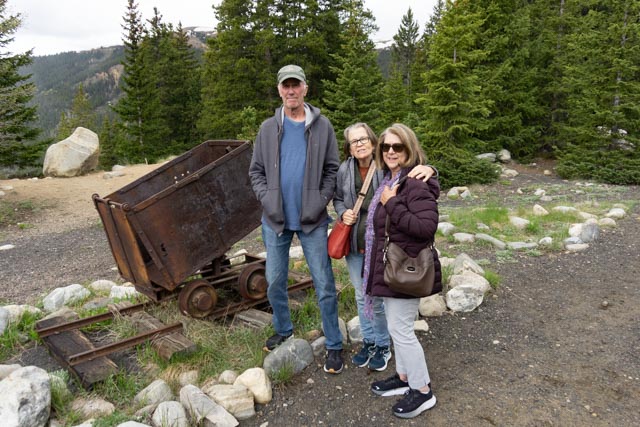
We took the Leadville Railroad up to Summit Pass. This is our group at the midpoint of the climb. It was an almost three-hour roundtrip with an altitude gain of about 1,000 feet. On a clear day you can see Mt. Massive and Mt. Elbert on the way down.

The next morning we drove up to Leadville then over to the trailhead to start our climb. Mike, on his way to summit Mt. Elbert, the tallest peak in the Rockies at 14,440 feet.

On the trail to Mt. Elbert. We have just left tree-line and still have several thousand feet to the top. Those are false summits in the distance.

This is where I pooped out. About 13,500 feet with two false summits ahead me before the top of Elbert. Mike made it to the top. Leadville can be seen dead center (the light area) of this photo. Yep, I wimped!
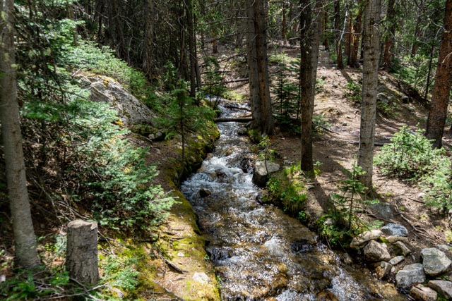
This was a man-made waterway, probably used for mining operations and to supply.

These mountain goats were feeding on the grasses on the roadside near Summit Lake Park. We had just met the snow plow coming down the grade clearing the road to the top. It snowed here last night.
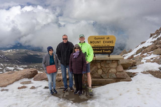
Our group posed at the summit of Mt. Evans, a little over 14,000 feet.

Our our way back to our camp, we took a detour over Loveland Pass as we had never been this way.
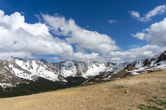
We climbed to the top of the hill and this was the view.

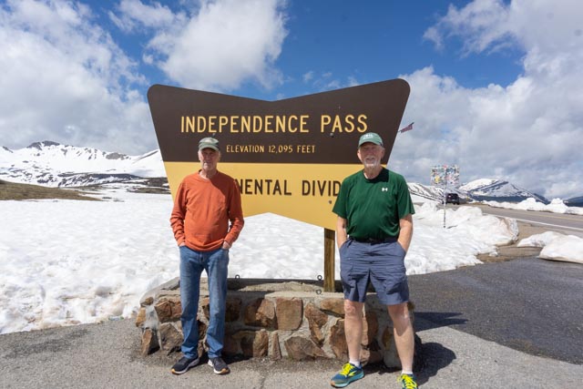
In the morning, we drove through Twin Lakes and then headed over Independence Pass towards Aspen. The elevation here is 12,095 feet
You gotta dress for the weather.

Mike and Kathy enjoyed downtown Aspen.

Cathy stopped at the 10th Mountain Division statue in Aspen. The 10th mountain was formed in WWII and they trained in Leadville.


The foliage in Aspen was brilliant.

Mike and I hung out at the ice caves. You can see the ice directly below Mike, between the rocks.
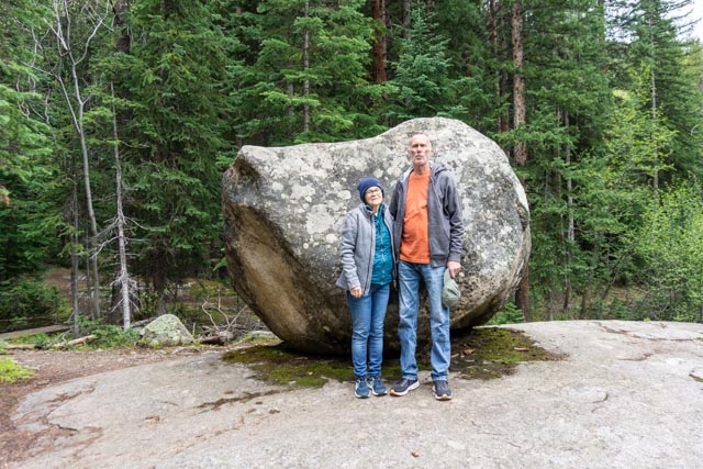
We had a little difficulty rolling this rock to the top but stopped long enough to take this photo. It was raining on the way back so we picked up a bicyclist on the way down to Twin Lakes. She stayed with us until we reached Buena Vista. It took two men and a boy to pick up her panniers. Just kidding, but they were heavy. She was on an extended trip and headed home to southern California.
