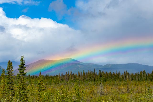
We saw this neat rainbow over Burwash Landing at Destruction Bay.
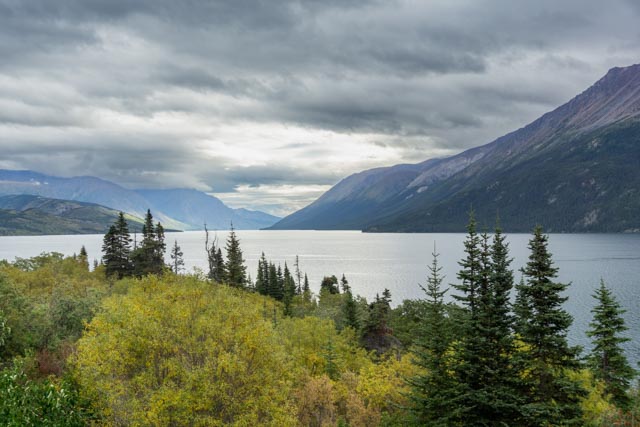
This is the Windy Arm of Tagish Lake near Carcross, between Whitehorse and Skagway.
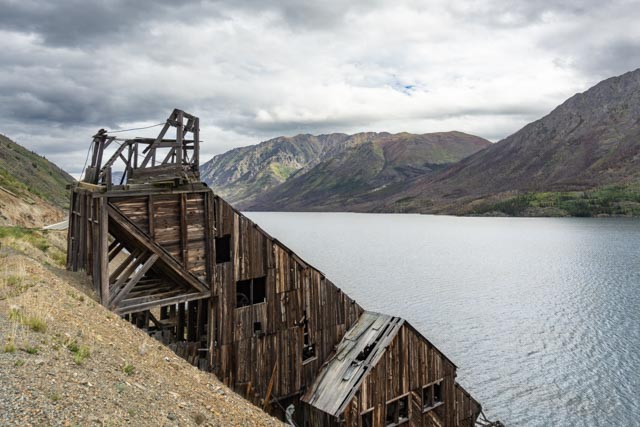
There were a lot of mining structures still standing lakeside, roadside and up the hill.
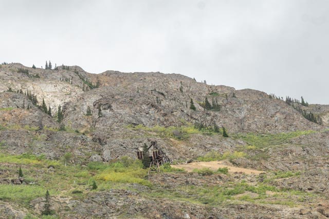
This is the remains of a mining operation uphill from the roadway.

This is Whirlpool Canyon, a little over 40 miles north of Liard Hot Springs. We stopped here earlier in our trip and this area was swirling with the logs and trees. It looks almost serene this time.
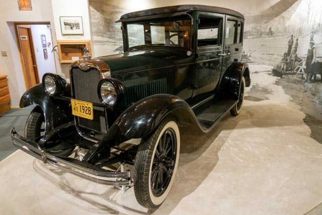
This 1928 Chevrolet was owned by George Johnson and was brought to Teslin by paddleboat, more than 13 years before the Alaskan Highway was built. The George Johnson Museum is a must-see in Teslin.
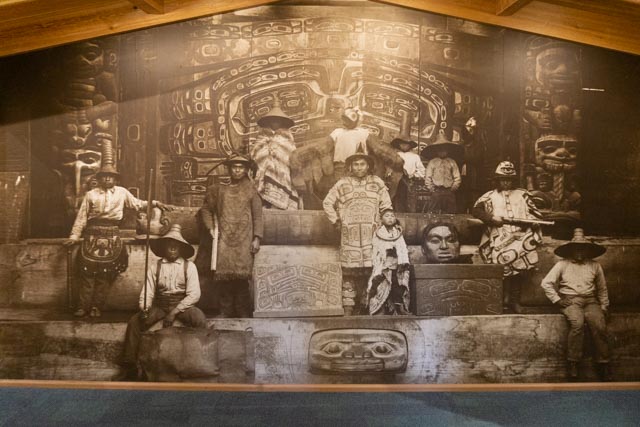
This photograph was promintely displayed in the George Johnson Museum. It is a photo of the original cedar panels in the Chilkat Indian Village at Klukwan, near Haines. These panels are unique and priceless. We were fortunate to see the originals at the Jilkaat Kwann Heritage Center on a previous trip
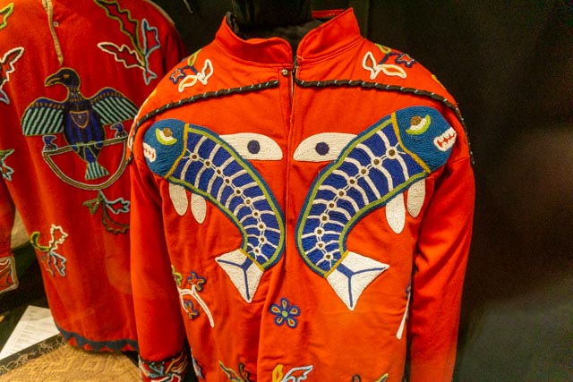
These are some of the original Chilkat clothing on display at the museum.
We decided to “rough it” at stay in a Yukon park on the Morley River for the evening. It looked like is would be a haven for moose, but we did not see one all night.
Yes, we really were “roughing it”
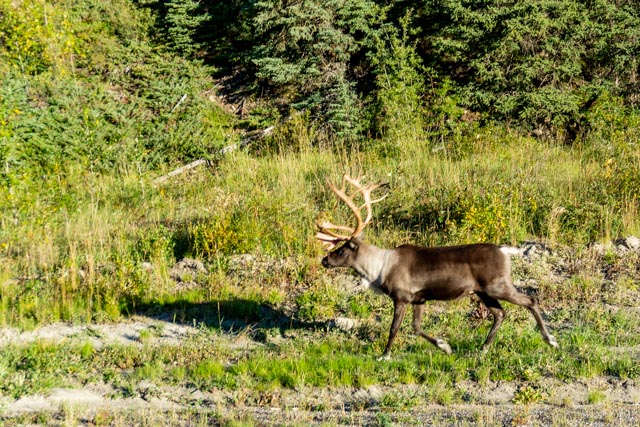
We saw this caribou, one of many walking roadside.
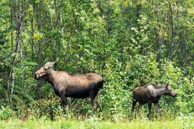
A momma moose and her moosette at their roadside diner.
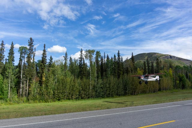
We had to stop on the road to let this airplane take off. This may seem strange in other places, but not here.
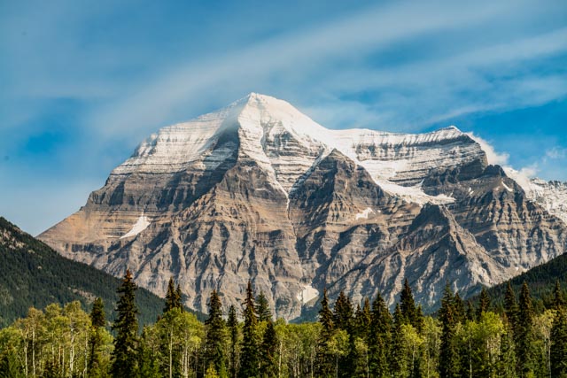
This is Mt. Robson, the highest peak in the Canadian Rockies at 12,972 feet. We caught it on a good day with very little smoke or haze. There is no scrambling route on this rock, its pure technical climbing.
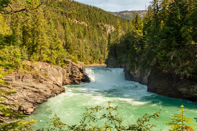
We took a short hike to view Overland Falls, just down a bit from Mt. Robson.
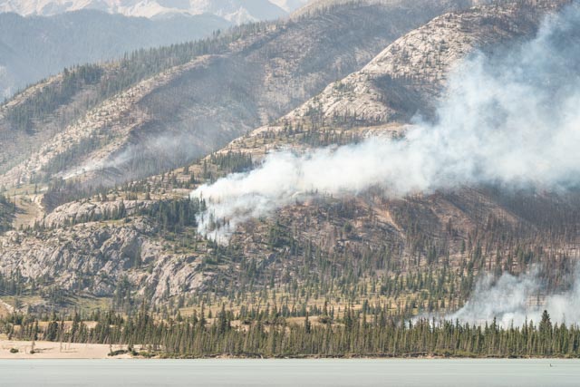
Jasper was suffering through multiple fires while we were there. The entire town was shut down and no services were available. It was a good thing we were staying in Hinton, just outside of the park. Because we could not do much in Jasper, we took a drive to see the Covill Glacier.
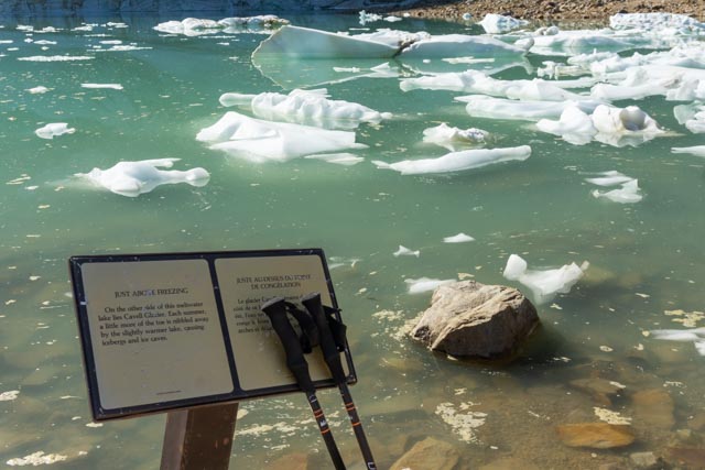
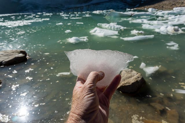
You are not supposed to hike down to the lake at the base of the glacier but why would they put signage lakeside?
I think I would like to share this with Martha Stewart.
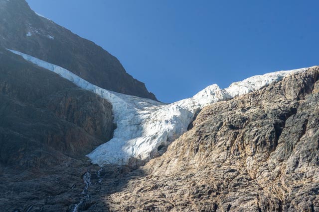
I took this photo of the Covill Glacier about midday. The sun was not going to help me at all.
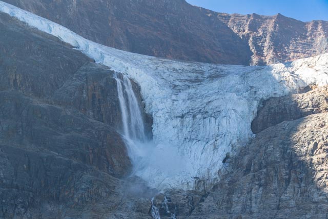
I was sitting on a moraine across from the glacier when the rumbling started and it got my attention. A portion of the ice on the left side facing wing broke off, sounding like rolling thunder. I assume it is similar to a tidewater glacier calving? I was heading up trail as I had heard that there was a grizzly sighting. There was REAL evidence (I almost stepped in it!) of a feeding grizzly and I met the two people who watched him/her gorge itself on the trailside blueberries.
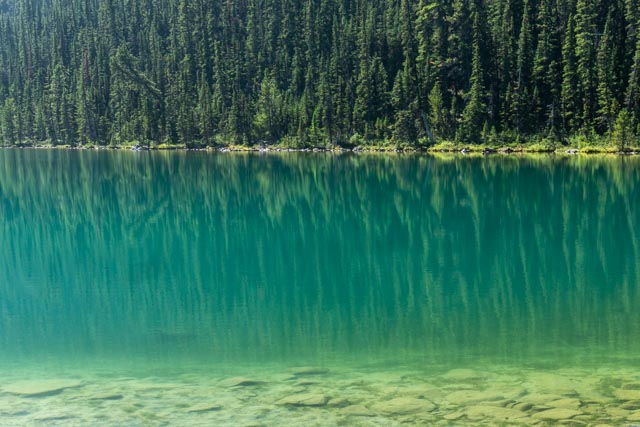
I hiked to this random lake downstream for the Covill Glacier.
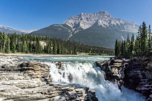
This is Athabasca Falls, the water originating at the Athabasca Glacier between Jasper and Banff.
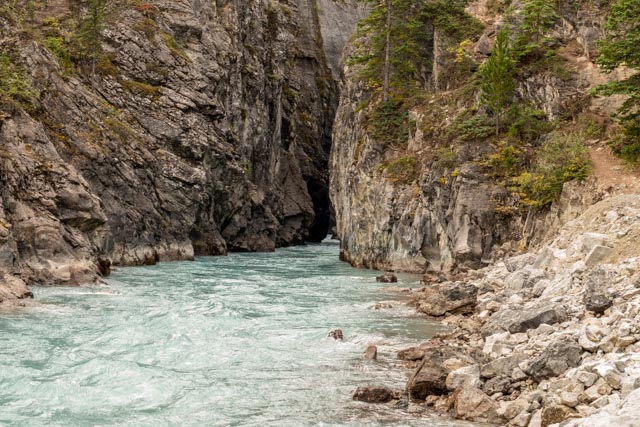
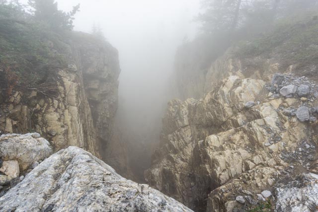
We stopped at a bend in the road and saw this creek exiting the rocks. The canyon was extremely narrow and the water was cold, deep and swift. Not great for exploring. I walked as close as I could and even tried a trail that went up the hill to the right but could not really see the canyon. But I did pick up a friend:
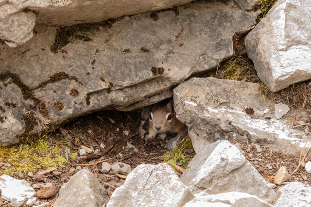
This little fella followed me around and wound up getting a piece of cookie that I accidentally dropped.
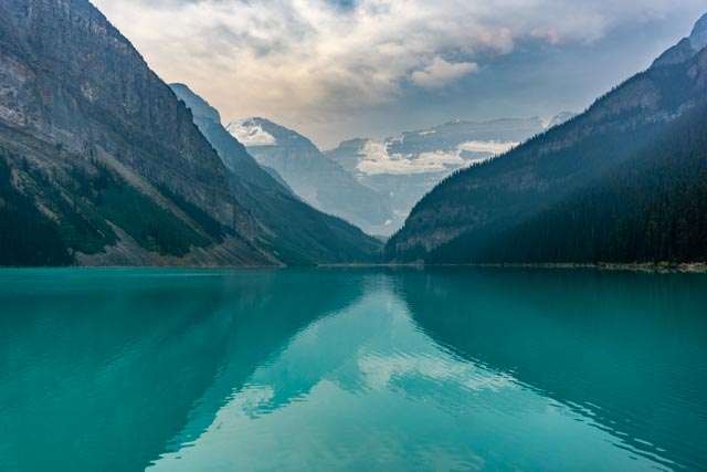
We waited for about an hour for the famous sunrise here but the cloud cover never parted. This is Lake Louise.
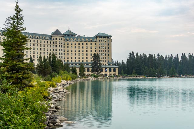
This is the Lake Louise Hotel. You used to be able to enter the facility but it is now designated for guests only. It was a little out of my budget.
This is one of a myriad of waterfalls in nearby Johnson Canyon. On a previous trip, Cathy and I hiked all the way up to the volcanic area several miles in. We walked by a grizzly on the way in . . . being very quiet.
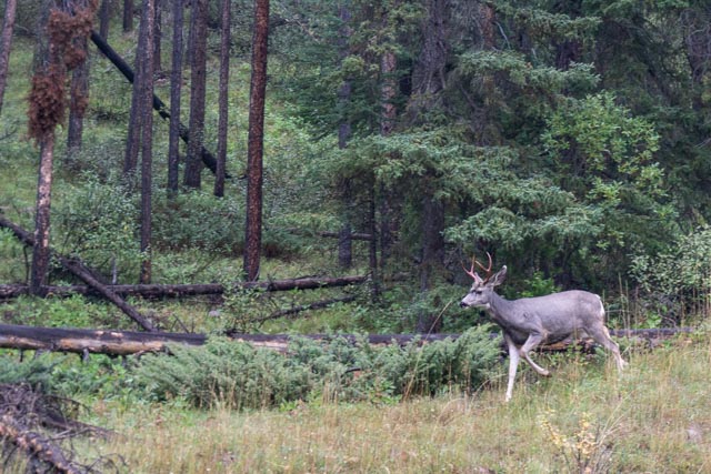
I saw this fella walking through the brush and stopped to take a photo. It is just a deer.
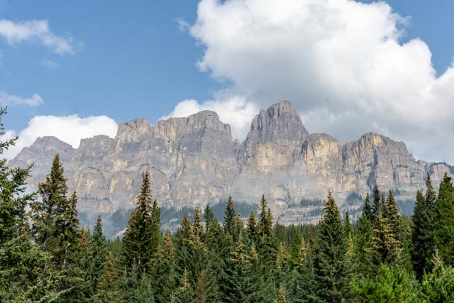
This is Castle Mountain. I spent all morning hiking on the right flank of the mountain.
This the start of the trail leading to the abandoned lookout station of Castle Mountain.
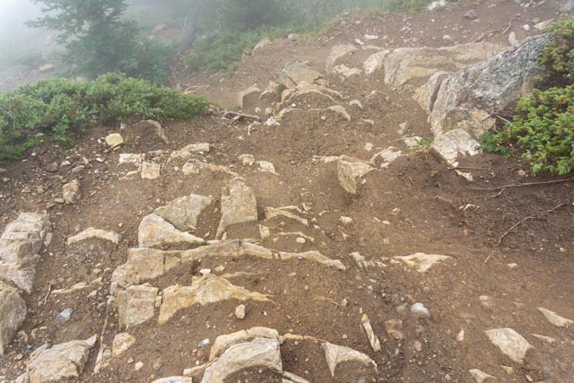
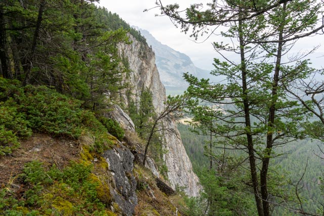
There were some dicy spots along the trail, which is not really for the faint of heart.

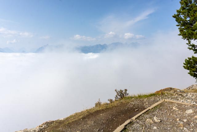
It was amazing as you exited the cloud cover and had this bright sun overhead. Banff is down there being rained on.
I reached the site of the abandoned lookout tower on Castle Rock.
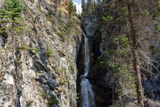
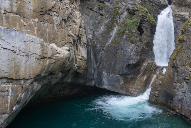
After hiking up to the lookout on Castle Rock, I decided to make the short hike to Silverton Falls.
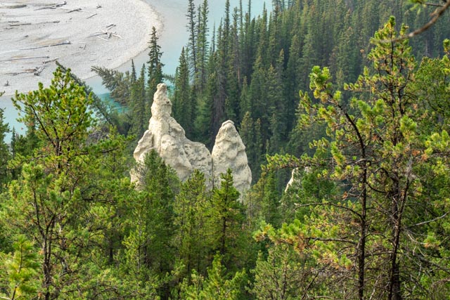
These are the hoodoos along the river outside of Banff. There were many of these structures carved by nature. Thousands of years of rain, snowmelt and wind carved deep gullies in the volcanic material below. These formations once were partially covered by caps of sod or hard rock material, acting a protective umbrellas, while erosion continued to take out the surrounding material. It is not really known where the term “hoodoo” comes from.

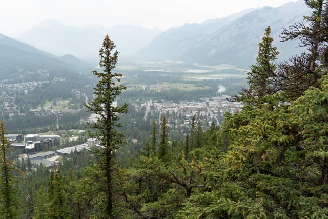
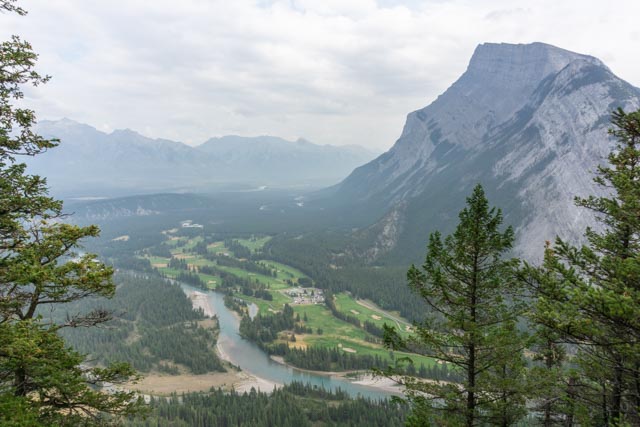
I took these photos on top of Tunnel Mountain. Left to right, starting at the top: The Banff Springs Hotel, the town of Banff, Looking through the trees at our camp down in the valley and the larger photo is of the golf course at the Hotel.
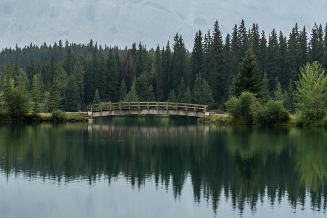
This is just a random shot of a bridge in one of the many parks surrounding Banff.
I started this trip with my wife, was met in Kenai by my nephew Brent for some hiking. Brent went home, Cathy flew home and my sister Barbara joined me in Anchorage for the return portion, leaving Anchorage, heading up to Dawson City, the Silver Trail, Ross River, Whitehorse, Skagway, Dawson City, Jasper and Banff. We ended this trip in Portland at my sister Myrna’s home. We had dinner with her, Barbara loaded her car, I prepared the motorhome and pulled out early in the morning. I made it back to Georgia in three LONG days.
