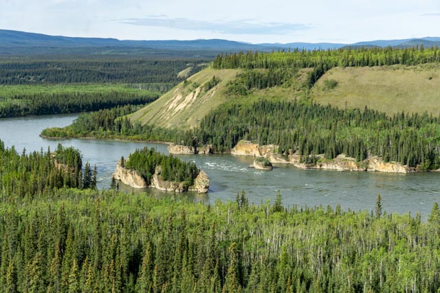
This is Five Finger Rapids on the Yukon River near Carmacks. It was a serious navigation hazard for the sternwheelers transporting the miners during the gold rush. The bare ridge across from the rapids was named “Woodcutters Range” in honor of the woodcutters who cut all of the timber here to power the fleet of sternwheelers from 1898 until 1955 on the Yukon River and its tributaries.
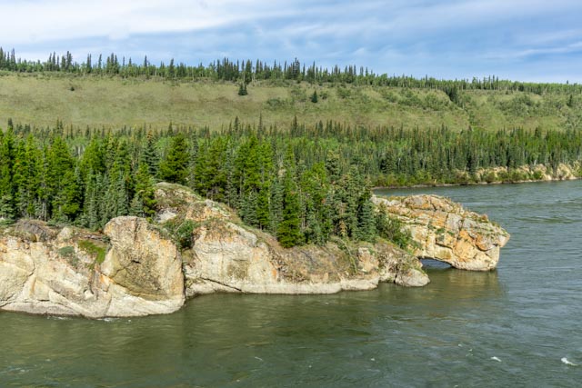
This is a closer view of the main channel. We descended about 219 steps and walked almost a mile over a very rocky path to get to this point.

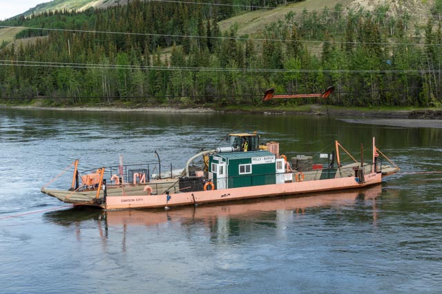
We had to bypass Top of the World Highway and take the long route to Dawson City. The ferry crossing the Yukon was out of order and being repaired. This is a pretty rare occurrence.
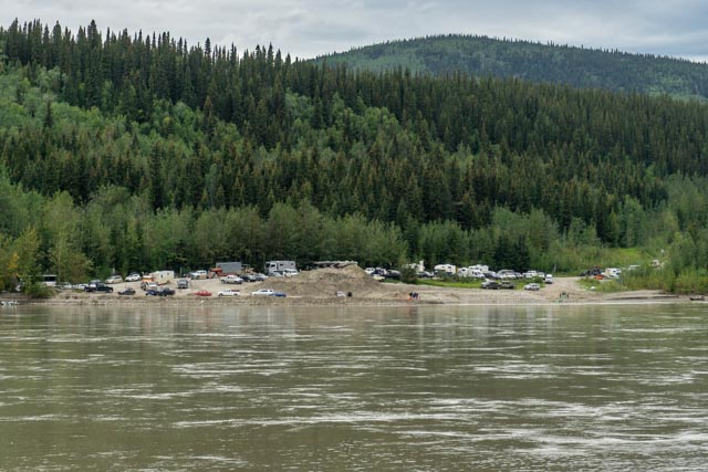
This is the buildup of tourists, workers and others waiting to cross the river. They were furnished water and food by the townspeople of Dawson City until the ferry began operating again.

This is a view of Dawson City take from the top of Midnight Dome. The dome is a favorite viewing site for the summer solstice in mid to late June.
An example of why you don’t build sidewalks (without proper prep work) on permafrost.
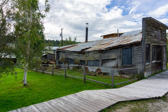
This building was hurriedly built without a proper foundation on the freezing soils.

This is the preparation of the documents necessary before I had my famous “sour toe” cocktail.

Yes, there is a real, severed human toe in the drink. Yum yum

A highly concentrated rain squall hit the hillside across the Yukon valley.
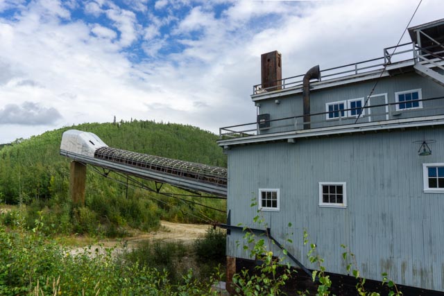
This gold dredge (#8) could process 1,200 tons of gravel per hour, 24 hours a day for 240 days per year. (It freezes sometimes in the north.) I am glad it is not still running or it would be in Georgia by now!

After spending a couple of days in Dawson City we headed up the Dempster Highway to Tombstone Territorial Park in the Yukon Territory. This was about a 50 mile drive on a dirt highway that can take you all the way to Tuktoyaktuk and the Arctic Ocean. We had originally planned on driving the 460 miles on the dirt road to the Arctic but the NorthWest Territory was closed to non-natives due to COVID. After traveling to Tombstone, I am kind of glad the area was closed. We made the short hike to the mountain they call Goldensides and saw a flock of ptarmigan running through the brush beside us.
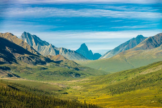
We moved to the trailhead for Mt. Monolith and I decided to hike up the trail towards it. It had rained and there was no one on the trail. I hiked about six miles in to capture this view of the valley.

There is a nice campsite at the base of these mountains but that would have been an all-day hike.
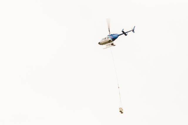
I did watch this helicopter moving water from the lake at the base to supply the Interpretive Center. This is a pretty remote area; no water, no power and no cell service for hundreds of miles.

This is a view looking back. I hiked from the valley beyond the first ridge in this photo.
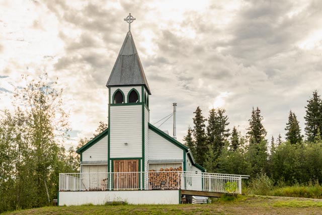
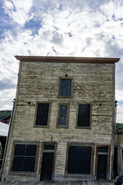
Leaving the Dawson City area, we took the Silver Trail route, from Stewart Crossing to Mayo and Keno City. This is the St. Mary’s Anglican Church, built in 1922 in Mayo. This was one of the few buildings that survived the flood of 1936. We drove the walking tour which identified and gave brief histories of structures that were built during the period of silver production, starting in the mid 1920s.
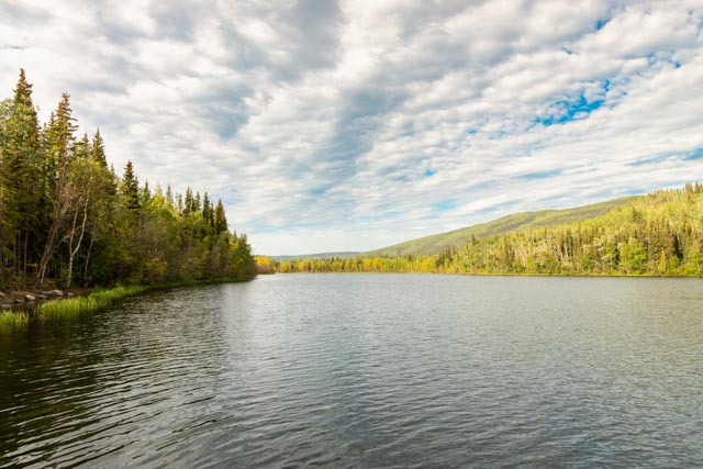
This is Five Mile Lake, a popular swimming area for locals. There is also a campground here and several floating diving platforms. It is located between Mayo and Keno City. We spent a couple of days on the Silver Trail then headed to the Faro and Ross River area.
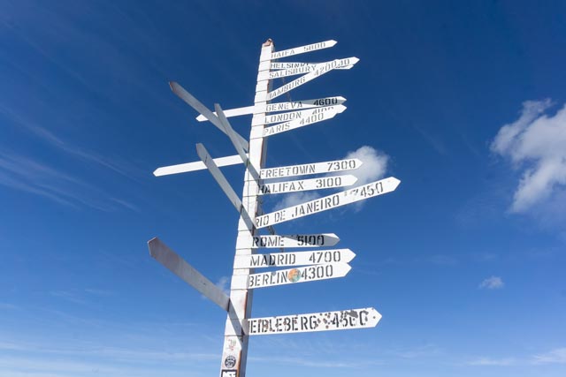
This is the famous “milepost” located on top of Keno Hill, out of Keno City.

This is the McQuesten Valley and the Ogilvie and Wernecke mountains from the viewpoint on Keno Hill. An interesting note: A DEW (Distant Early Warning) system was rapidly installed (without any notification of the city) on the ridge line, and was taken down more recently, again without any notice.

Across the canyon, you can see a miner’s cabin sitting of the semi-flat land.

This is the site of the worst disaster in Yukon riverboat history. In 1906 the riverboat SS Columbian was hauling tons of explosives to a coal mine downstream when it caught fire and blew up.
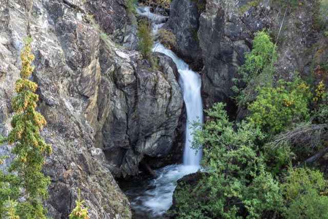
We spent a couple of days on the Silver Trail then headed to the Faro and Ross River area. This is Van Gorder Falls, a short hike beginning in the town of Faro. Van Gorder was a town pioneer, a gold-panner and a trapper who lived in the area at the turn of the century (1900s).
Faro sits in the Tintina Trench, a huge valley so prominent it is clearly visible in satellite photos.
This is the ferryboat crossing the Belly River at Ross River. We watched the boat pilot perform some interesting maintenance on the deck of the boat and scrambled down and talked with him.

Yes, he is trimming the deck with a chainsaw and the chunks are flowing away.

He was an Interesting person who gave me a tour of his pilothouse. Business was relatively slow as the road caters to off-the-grid types and small mines and ends at the NWT (North West Territory) border. It is mostly a 4×4 road.

There was a suspension bridge that had been converted to a pedestrian bridge crossing the river. An actual “bridge to nowhere” but we did have to walk across it anyway.

On the way back to Faro, we took a side trip recommended by the visitor center hostess. This is Lapie Canyon. You do not want to take children here, the trail is right on the edge of a fairly large drop to the river below. Most people drive by without even knowing this is here. I walked, climbed and scrambled a good part of it before heading back to the truck. Our next stop was Whitehorse where I met with officials for the Chilkoot Trail to get my hiking permit. Since I was the only one in orientation, the only one hiking, the rangers on top and RCMP (Royal Canadian Mounted Police) had been pulled out due to bears feeding, the trail had not been used in over a year and was overgrown, it was snowing on top, etc. I decided to forgo the hike and, after a night in Whitehorse we headed straight to Skagway.

But, a night still gave me some time to hike up the Yukon to the site of the Canyon City ghost (resupply) town that was in place for the Klondike stampeders.
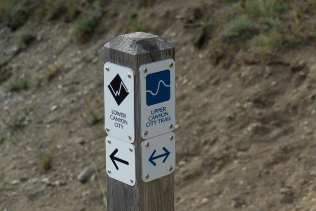
I took the Upper Canyon Trail to the townsite and the Lower Canyon Trail back. As I was the only person hiking I had to keep an eye out for wildlife.

Once we got set up in our downtown campsite, we walked into town and secured our tickets on the White Pass Railroad, which originally went from Skagway to Whitehorse, then from Skagway to Carcross, and now, due to COVID and the International border crossing, it turns around before entering Canada.

We rumbled by this original river crossing that failed.

This is what’s left of the alternate “Trail of 98” for those who did not want to take the shortcut over the Chilkoot Pass. Thousands of horses fell to their deaths along this trail and it is now closed to all. There is actually a canyon on this trail named “Dead Horse” canyon.

The ride was very organized and there was a historian giving details about the scenery and local history.

This is the drop-off point if you want to hike to the Denver Glacier. The railroad has hiker drop-offs here and at the Laughton Glacier trailheads.

I drove the motorcycle over the pass and turned around at the international border. It was raining and sprinkling all the way up and back. If you wait for the rain to stop, you might not get anything done.
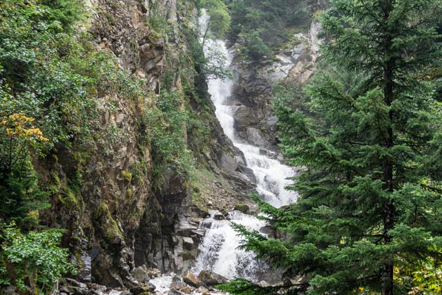
There were many waterfalls alongside the road leading to the pass.
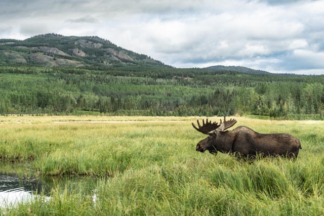
This is pretty good photo of a moose.
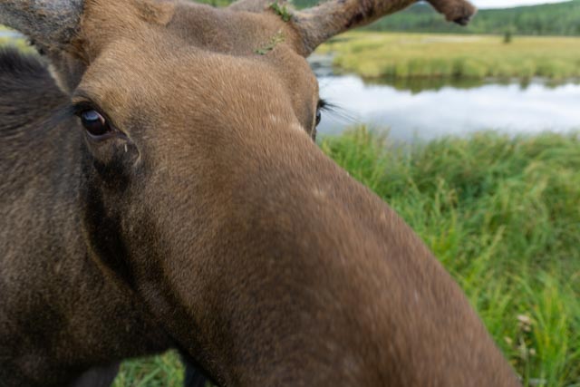
This was (probably) too close?
