
We took a drive south of Anchorage, with the intent of returning to hike to the Byron Glacier, which we spotted while visiting the Portage Glacier previously. We stopped at Windy Point to take a quick look at the receding tide. The buildup along the mountains at the upper right of this photo is the Alaska Railroad and the Sterling Highway.

I have seen this chair cabled to the rock and finally decided to climb up on the rock (it was low tide) and see if the view was any better from that vantage point. It was not, but it was challenging to climb up the moss-covered rocks to access the chair. We have watched surfers “surfing” the bore tides at this location previously. You have to keep your eyes on the tide tables to fully enjoy this area.

We drove towards Whittier and stopped at the entrance to the Anton Anderson Memorial Tunnel which at 2.5 miles, is the longest tunnel in North America, connecting Whittier with the Sterling Highway. It was built during WWII to allow the railroad safer access to the new military base in Whittier.
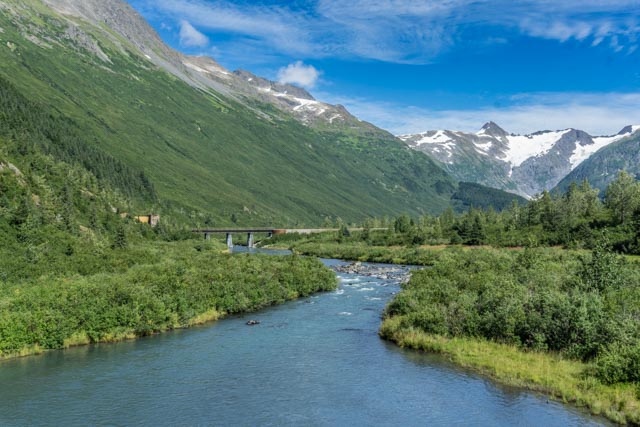
We stopped on the return to take a photo of Portage Creek. The creek is loaded with salmon.
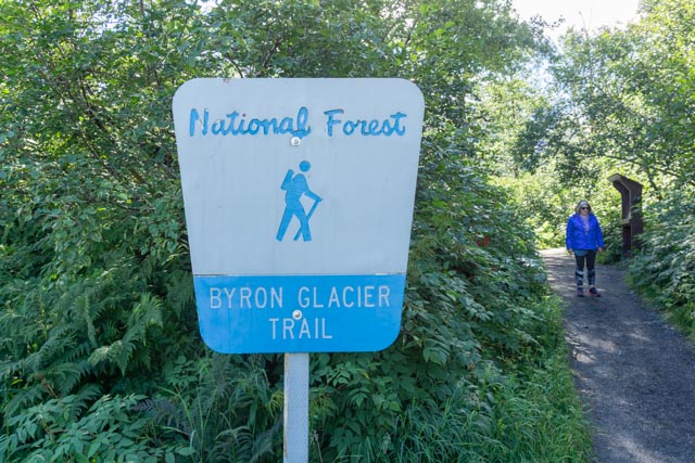
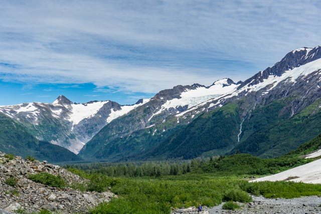
After photographing the Glacier from across the valley we parked and headed up the trail to the Byron Glacier. It was a relatively short hike with very little elevation gain. It was surprising how few people make the hike. You will notice there are no other people in our photos of the area.

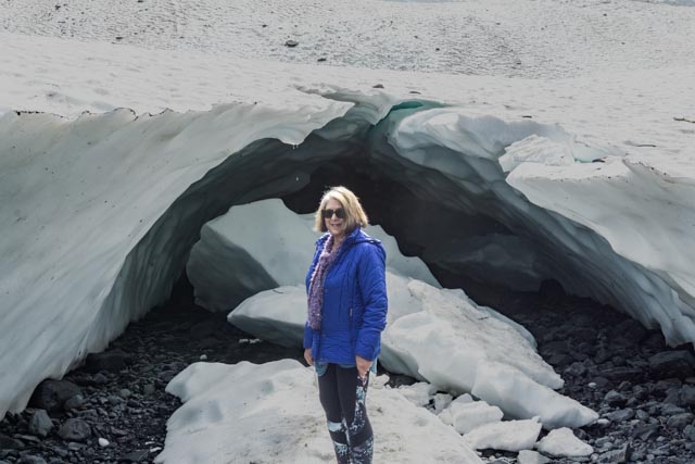
Cathy posed at the edge of the glacier, with the water flowing out of the mouth.
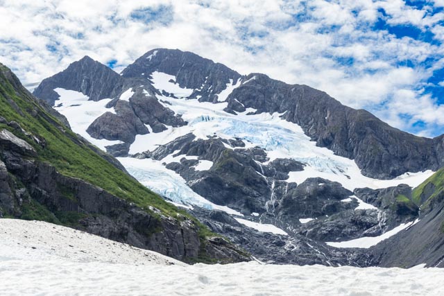
This is the Byron Glacier as seen from the area Cathy was standing in in the previous photo. We saw a group of climbers heading up to the base of the ice field up the mountain.

I am standing in a large crevice that has been open for several years There are probably only about 12 feet of snow and ice beneath me.
Cathy can’t keep away from the danger zones!

Here are a couple of chunks of ice that have broken off the face of the receding glacier.
This is the view looking downstream from the glacier. Portage Lake and Glacier are down in the valley below and to the right.

This is the view of the Mananuska Glacier, taken from the State Recreation Site on the Glenn Highway, located between Palmer and Glennallen, about 100 miles from Anchorage. The Chugach Mountains in this area are between 5,000 and 7,500 feet in elevation.
