We spent the evening in Watson Lake, specifically so we could see the Aurora show at the Northern Lights Centre. Some of the presentation was so far over my head that I fell asleep, but the Aurora part was very interesting. We have wanted to see this show for the previous two trips but it had been closed for various reasons.
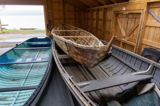
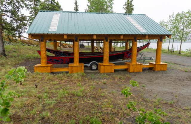
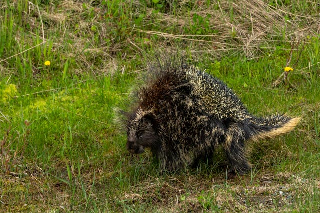
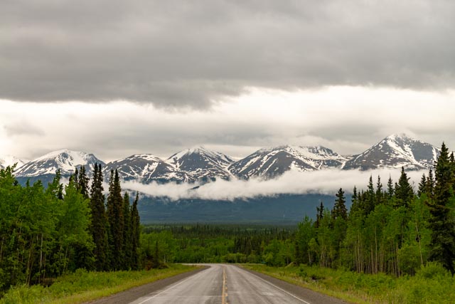
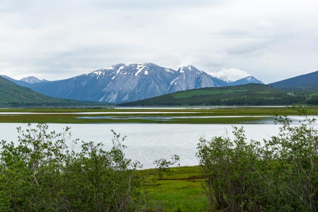
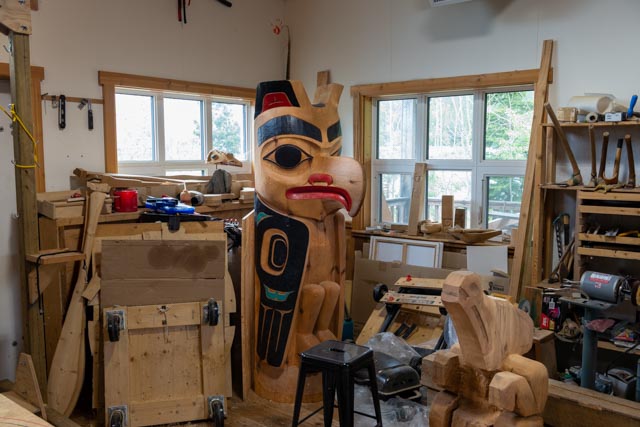
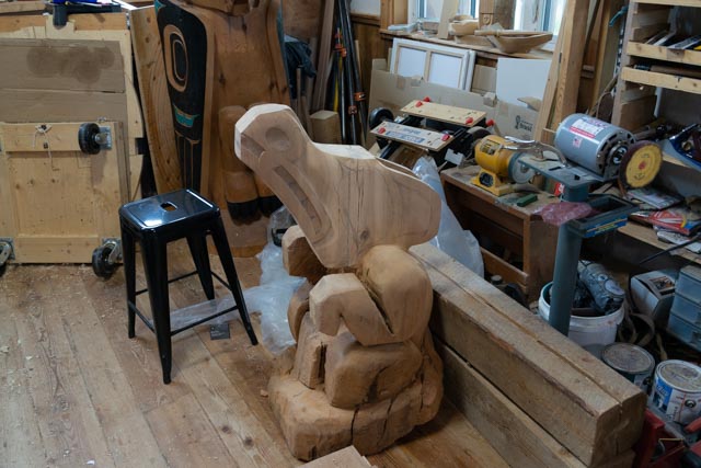
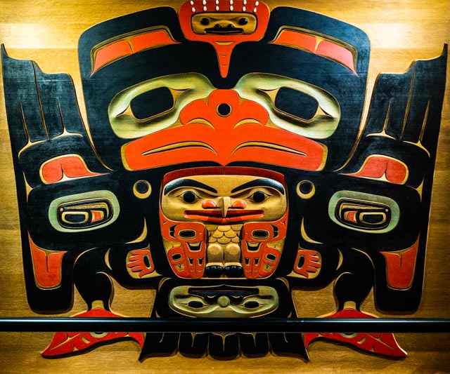
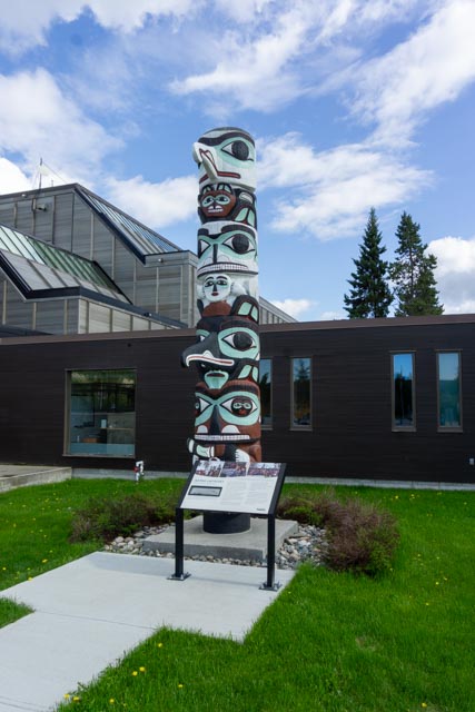
After Watson Lake, our next stop was in Teslin. We stopped for lunch at the Yukon Motel, just after the Nisutlin Bay Bridge. At 1,917 feet, it is the second longest water span on the Alaska Highway. We had not stopped here on previous trips but enjoyed a very good potato/bacon soup. It fit in nicely with the rainy weather. Next we stopped at the Teslin Tlingit Heritage Centre. Photos were not allowed within the center but they were okay outside. Cathy is bundled up, as it was cold.One of the many boats on display was made by Don Smarch in the later 1900s. We did not know if he was any relation to Keith Wolfe Smarch. Here is the view of Teslin Lake through the boathouse doors.A couple of more modern boats were stored under a roof alongside the main exhibit.The center had a neat way of draining the rain water. It was funneled into one channel and fell down as a waterfall into this bed of rock. I could not quite capture it.Between Teslin and Whitehorse, we hit snow. It was falling and sticking to the ground. I checked the elevation and we were at 3,000 feet. Once we went over the small summit, the elevation decreased and the snow turned to rain.We stopped at this marker identifying the site of the original Alaska Highway. You can still see the grading in the background.I spotted this guy munching in a depression alongside the road so I turned around and parked a block or so up the road and we snuck up on him. We were quiet and he did not seem to mind us. We managed to get a few photos before a couple in a Jeep pulled up and made a fuss, scaring him away.We spent the better part of one day in Carcross. The South Klondike Highway (HWY 2) was absolutely gorgeous due to recent snowfall.We stopped at Carcross Learning Centre upon entering Carcross. Established in 2017, the Learning Centre showcases the art, culture and history of the community and the Carcross/Tagish First Nation people. The building received an addition of seven new totem poles: a Story Pole, along with a Clan Pole for each for the six clans for Carcross/Tagish People. All of the totems were carved by Keith Wolfe Smarch.Cathy posed near a piece of artwork in the Learning Centre. The statue is made entirely of driftwood.This is the view behind the Learning Center.The Duchess was used on the 2.5 mile rail line between Taku Landing on Tagish Lake and Scotia Bay on Atlin Lake between 1900 and 1920. It was nicknamed the “Taku Tram”. Wait, whose driving the engine . . . Wayne?This is Lake Bennett with the Chilkoot Pass in the background. I will be limited this year to only the American side due to border conditions and I will have to come back to finish the Canadian side. Keith has offered to ferry me from Carcross to the Bennett trailhead at that time. It about an hour boat ride in a fast boat to the other end of the lake and there is no other access. The train that picks up Chilkoot hikers is not running because the border is closed at the pass for hikers.This is the rotating bridge crossing the river that flows between the two lakes. The tracks are rusty so it appears that the White Pass Railroad has not made it to Carcross so far this year.This photo of the waterway connecting the two lakes was taken from the recently installed pedestrian bridge, which runs parallel and upstream to the railroad crossing.The bike now rides in the back of the truck. Something about the motorcycle rack and a stump? We left the rack in several trashcans. Wayne is going to take it to Haines.In the early afternoon we arrived at Keith Wolfe Smarch’s studio. Keith is a world renowned Tlingit Master Carver. We met Keith a couple of years ago, on Indigenous Peoples Day in Whitehorse, during the unveiling of the Totem he restored at the Yukon Government Building. The totem above was in the last stages of being restored. Keith originally made the totem more than 40 years ago. Keith has also been commissioned to build totems for Parks Alaska to be placed in their facility on the Chilkoot Trail.This is a piece that is in process by Keith’s apprentice.I had a photo with the Master Carver.While in Whitehorse we visited the Yukon Beringia Interpretative Centre. This carving was just outside on the interpretive trail. The artist: Keith Wolfe Smarch.Cathy posed with the skeleton of a Steppe Bison. They were significantly larger than todays Plains Bison and even the Canadian Wood Bison. The last Steppe Bison disappeared about 400 years ago.When we were entering the facility, there was a mock-up of a giant beaver. I thought it was an advertising gimmick. We learned that were actually Giant Beavers, weighing up to 400 pounds and the size of bears.“Crow Makes the World”
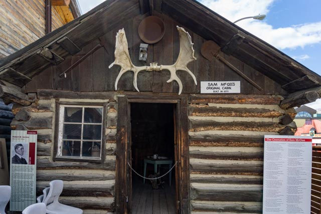
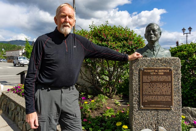
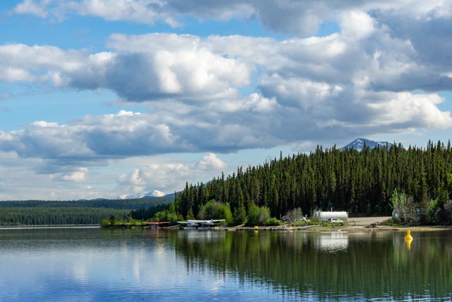
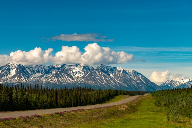
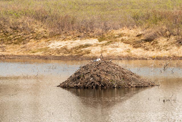
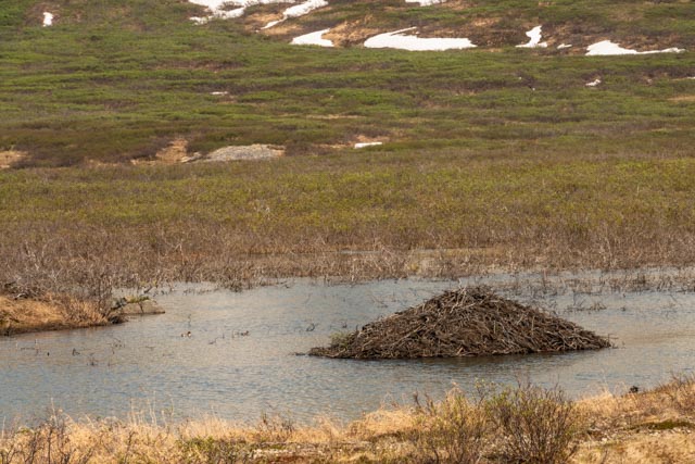
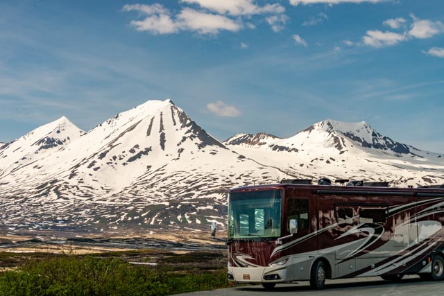
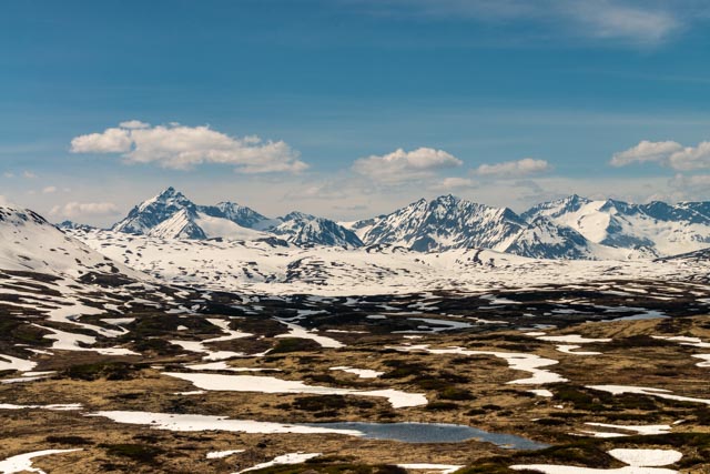
This carved cedar panel was originally created by Keith Wolfe Smarch and was recently resurfaced in his studio. We saw the before and after photos of it, someone had actually carved their name in it. It is now protected by the iron bar across the front.While in Whitehorse we visited the MacBride Museum, located in the downtown section. It was much larger than it appeared from the street. This is the Sam McGee original cabin. Sam became famous due to a poem by his friend Robert Service. The poem was titles “The Cremation of Sam McGee”. Sam did not die and was not cremated at the poem indicated. hmmmmThe interior of the ca 1900 cabin.The museum had many complete period exhibits, including this barfront. About the bar was a set of rooms, and nest to it was a recreated dance hall with piano and costumes you could pose with.I thought this map was interesting. It was made ca 1900 ands showed the active goldfields. Missing was most of the city’s that today are the main centers of commerce. You cannot see Anchorage, Fairbanks, but Skagway, Dawson City and Dyea are prominent. How times have changed.On a previous trip I posed whit the bust of Pierre Berton, one of my favorite authors (in fact I am currently reading his “The American Invasion of Canada” aka The War of 1812 in the US version. This time we found the bust of Robert Service. I have recently found a complete set of his poetry and I will now have to read it.We went to the site where we met Keith Smarch and watched him unload this totem. The next day we attanded the dedication ceremony and Jason, invited by Keith, made it to front and center in the photo (his is wearing a red sweatshirt). This is the official photo from the unveiling and I would think Jason is the only non-indigenous person in group! To his right is Keith Wolfe Smarch, and to his left (in the hat) is the government head of First Nations.The totem as it stands today. The information plaque in front has the group photo in the upper right.This is the building that has the totem.This is view of a floatplane in Schwatka Lake, Whitehorse.The spillway exiting Schwatka Lake into the Yukon River was overflowing due to recent heavy rains.Leaving Whitehorse, we headed to Haynes Junction where I tried to turn the rig around in a wide, two lane highway. There was no traffic in either direction so what the heck? Well, it doesn’t turn that tight and we wound up blocking one lane of the highway and all of the sudden there was a lot of traffic. I quickly unhitched the truck and Cathy drove it to a safe spot where we reconnected and off we went.Once we arrived at Haines Junction, Yukon we headed for Haines, Alaska. This is a shot above the trees of Kathleen Lake with the St. Elias Mountains of Kluane National Park in the background.This area is known as Rock Glacier. I hiked up the trail to the actual rock field and took some photos. I was alone at this point and walked past numerous grizzly warnings. I passed four hikers heading down and they were loudly talking so I felt pretty safe. Many years ago the glacier broke these rocks free from the nearby mountains and wound up moving the whole pile downhill. The remnants of the glacier was still melting under this rock pile as several small streams were emanating from the rocks. This rock field was a couple of hundred yards wide. I saw a few beaver lodges along the streams.Beaver LodgeAnother Beaver LodgeThe next four photos are indicative of the views we were presented as we drove the Haines Highway south to Haines. We stopped a lot and took way too much time. There were several campers, trailers and motorhomes parked with the occupants sitting in lawn chair enjoying the views. This is our first time in three trips here that we could actually see the nearby St. Elias Mountains.This is the last photograph we took on the way to Haines. We are headed for the USA/Canadian border and all photographing is prohibited at border crossings.


Sorry too read about the “incident “. At bd least the motorcycle is in one piece!!
LikeLike