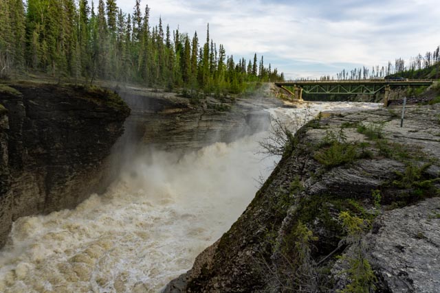
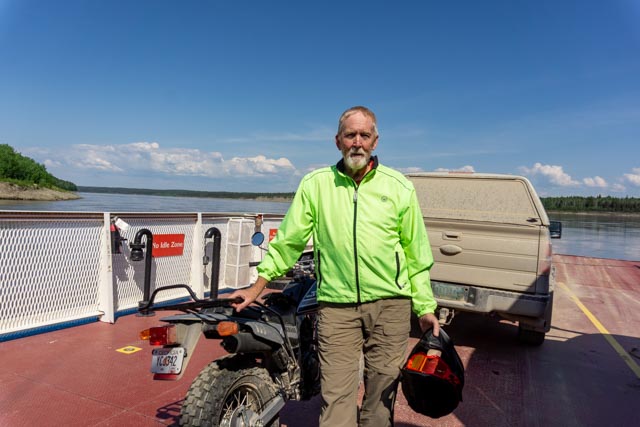
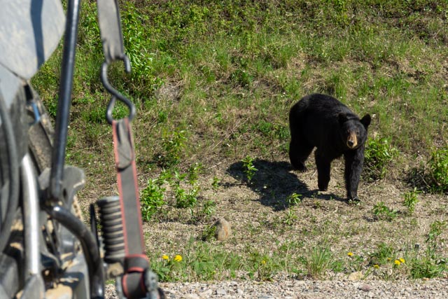
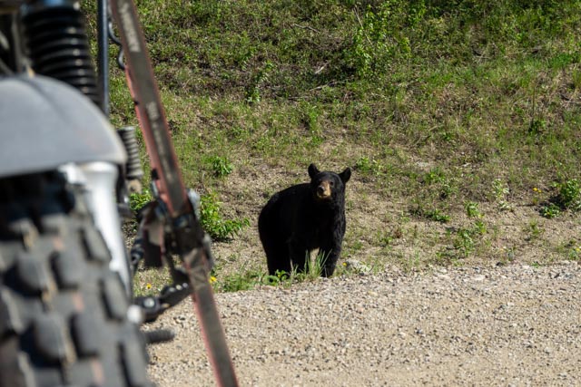
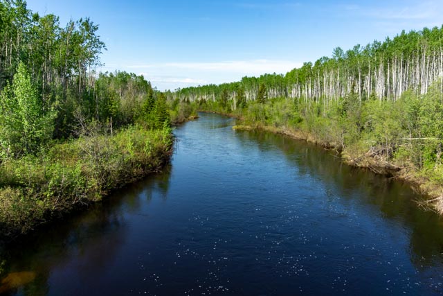
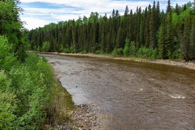
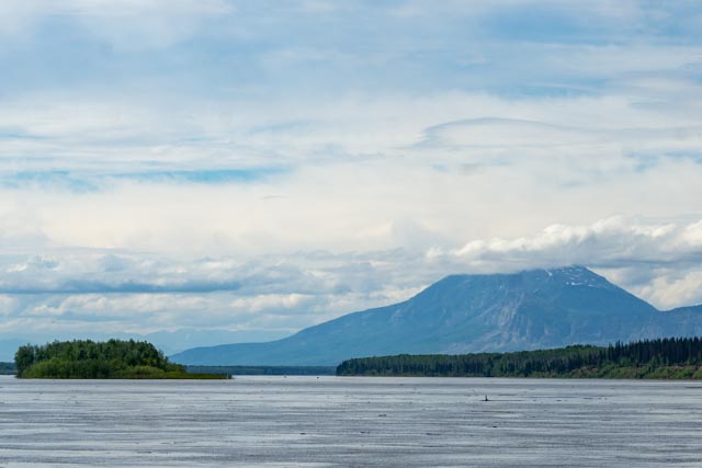
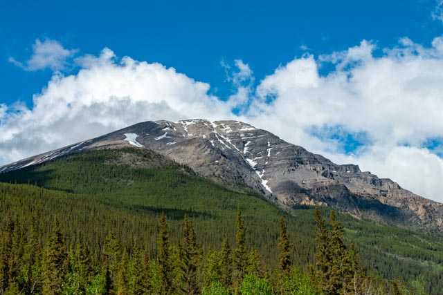
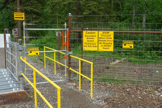
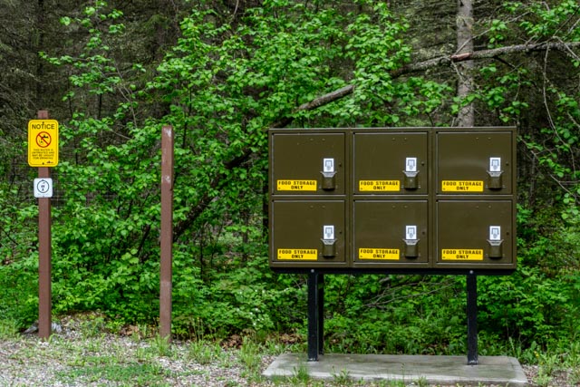
Leaving Yellowknife, we traveled the Waterfalls Route to Sambaa Deg Falls Territorial Park. There were just two campers at this site. This is the upper falls, a short hike upriver. Cathy was attacked by mosquitos so she went back to the motorhome before heading downstream to the the main attraction. This is Saamba Deh Falls. The photo does not do it justice. It was the most powerful waterfall I have ever seen. Scary powerful! I threw a log in the water just above the falls and it totally disappeared after going over the falls. There were several memorials on the opposite cliffs to those who had fallen in here.We made a side trip to Fort Simpson and I rode my motorcycle back towards Sambaa Deg, about 100 miles of dirt highway. Fort Simpson is located at the junction of the Liard River and the Mackenzie, thus we took the ferry across the Liard to reach the settlement. We had a Chinese lunch in this First Nations community (and it was pretty good)!This is one of the many emergency shelters positioned along the highway between Fort Providence and Fort Simpson. I must really get COLD here. About halfway back to Sambaa Deg it started to rain so we had to scramble to get the motorcycle back on the truck in the rain.The next morning we were headed for Nahanni Butte, all dirt and gravel roads. We stopped to watch this bear and I got out of the vehicle to get a couple of photos. He approached the truck and when he got to the truck I quickly walked back to the motorhome. He actually got up on the back of the truck to see what was there. At Checkpoint we made the turn towards Fort Liard and our next camp.Yes, there were bears everywhere. All we saw were black bears, the grizzly stay pretty much in the bush.Crossing the Poplar River in Yukon Territory is a colorful view.This is crossing the Blackstone River in Yukon Territory.This is Nahanni Butte, a prominent point in the landscape. The summit was cloud covered the entire time so we never got to really see the top. All of the land across the Liard River here is part of the Nahanni Territorial Park and holds a Dene settlement. The park is only reachable by a very long (79km) hike from Tungsten, off the Campbell Highway or by boat across the Liard. All access is controlled by First Nations. It is open to flight-seeing tours, and floatplanes (with appropriate permits). This is a World Heritage Site, due to its diverse landforms, waterways, wildlife, forests and First Nations history. There is a 315 foot waterfall in this park.After leaving Fort Liard, we were slowed somewhat by this herd of bison. We just waited until they decided to cross the road.Back on pavement and heading toward Liard Hot Springs I noticed a large porcupine just sitting along the roadside. I got out and followed the guy trying to get a photo but he kept walking, entered the woods and climbed this tree. You can just see him give me the thousand mile stare.It was starting to clear up a little so I took this photo of a braided river. We are in Northern British Columbia here.At another stop along the highway I noticed that we were parked between two snow-melt waterfalls. If we hadn’t stopped, I we would have never noticed these waterfalls, as they were located high up the cliffs.We stopped at a wide spot in the road the watch this river. The scenery is amazing.Here is another photo of the scenery along the highway.And another shot of the view.Wow, the Liard River Hot Springs has become electrified. Evidently there have been numerous intrusions, the whole park is surrounded by electric fencing, clearcuts in front of the fencing and electric cattle guards to keep animals from entering through gateways.This storage area for hikers and tent campers has been added.