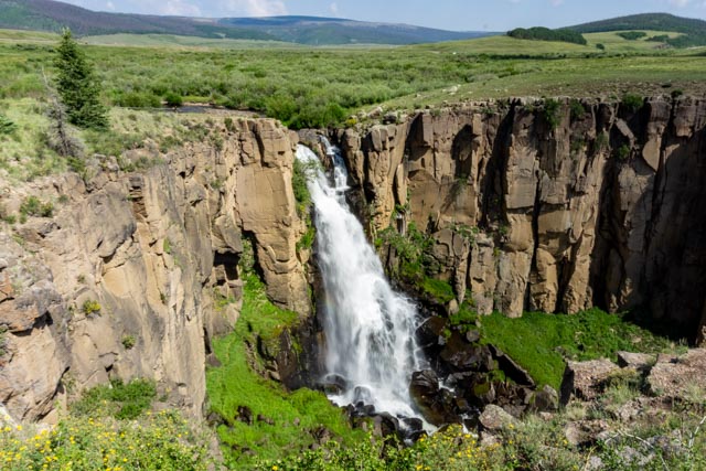
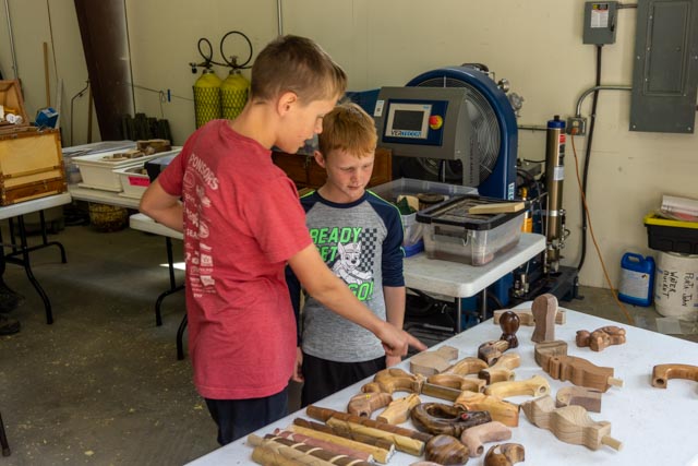
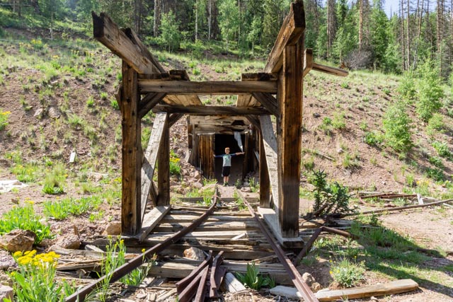
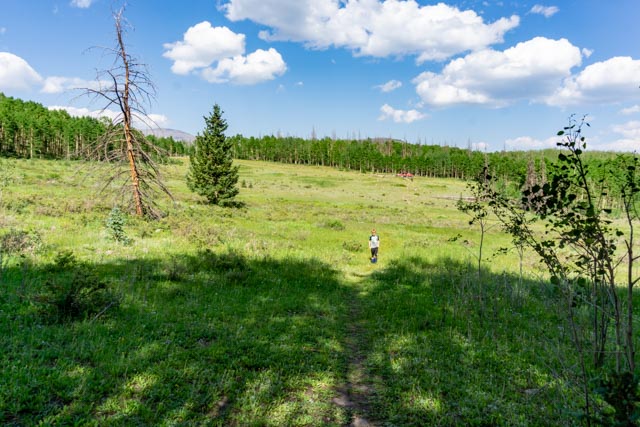
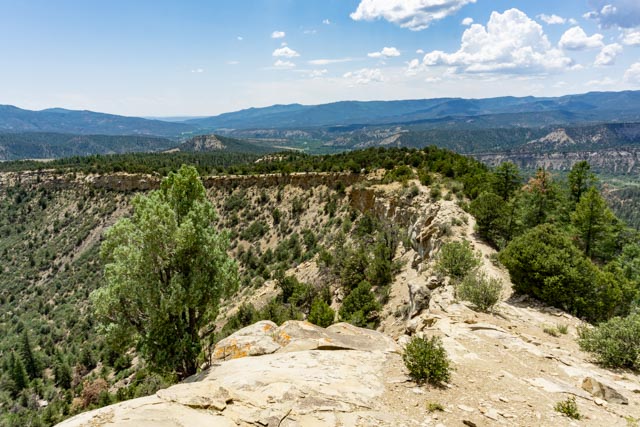
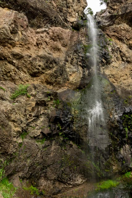
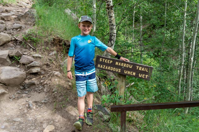
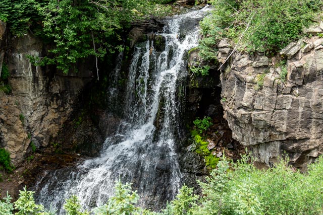
We stopped at North Clear Creek Falls on the way to Creed. It is about a mile off of the main road.This is a view of the canyon at the end of Main Street in Creede.We started up the canyon, but I noticed there was woodcarving event going on in the small community center. We stopped and Jason quickly made a friend. He was a little older than Jason but had started carving that morning. Evidently the Master carver travels the country teaching individuals how to carved wood. There were several people working on projects at his table and this young guy had been training for just a few hours. He was making a pretty intricate cane and his mother was also learning to carve. He spent over an hour working with Jason.This is one of the Creed fire houses. There are engines in the abandoned mining tunnel. This is a pretty cool (literally) way to keep the trucks. I don’t think there are many fire departments that keep their engines in tunnels!Just up the canyon we came across this abandoned mining related loading dock on Willow Creek.Some of the shoring that was done to keep the hillside from slipping away and allow surfaces for roadbeds. This combination of mines, on both sides of the road are in the Commodore Mine grouping.This is the remnant of a water flume leading either to or from the Commodore Mining Complex.Mines shown here are across West Willow Creek. There are mineshafts everywhere. The remnants of a mining operation are slowly fading away. The mine was located on the other side of the creek (left in the photo) and the loading dock is partially visible in the upper right corner of this photo. This area is know as Black Pitch.Just past the abandoned townsite of Weaver we came across the Amethyst Mine operations.More of the Amethyst Mine, a flume line and a rail bed are on the mountainside above the stream bed.This was one of two unmarked cabins across the road from the Amethyst mine.This was an abandoned miner’s home at the at the upper junction of East Willow Creek Rd.This is the shaft and very narrow gauge tracks leading into the Midwest Mine. Evidently this was used until probably the 50’s or 60’s. They still had an almost functional executive washroom.After turning at the beaver ponds and heading back downhill we came across what was left of the Park Regent mIne. There was no directional signage on the roads so I was about to take a wrong turn when a lady with maps set me straight. Maps are a wonderful thing! I walked here a bit and think I found the original mine shaft, but it was blocked with a pile of rocks.We took a side road to the Last Chance Mine, but it was privately owned and posted so we just turned around. I did stop and take a couple of photos looking down at the Amethyst Mine. There is still some active mining taking place in this area.This is the Bachelor Town Site. At one time there were about 1,500 people living here. What a view if they were interested in that . . . I walked across the meadow and found some old log homes in the Aspens. Jason heard that I actually found something and quickly joined me. Cathy is with our truck at the far treeline.Jason swinging on one of the fallen-down cabins at Bachelor.There were wild Iris everywhere. We just caught the tail end of the bloom. This is the gravesite of Bob Ford. He evidently is the one who shot Billy the Kid. ok?We continued on and found a camping spot roadside on the boundary of a wildlife conservation area near Wagon Wheel Gap, between Creed and South Fork on the Silver Thread, a Colorado Scenic and Historic Byway. I watched a coyote walking along the river and later in the evening watched an elk walking alongside the river. In the morning Jason learned the fine art of stirring up a ginormous ant mound.Jason also collected a pile of bones (which we chose to leave). We were finding a lot of bones under a large tree then realized the cat was probably storing and eating his meal in the tree. We did a quick look UP and went back to the motorhome.We got into Pagosa Springs in the evening. Reservations were hard to find at the last minute so we were in a space without utilities for two days. We did get to move on the third day to a better spot. During this time we took Jason to the Chimney Rock National Historic Site. This area was occupied by the Puebloan people from about 900AD to 1150AD. The weather was coming in and lightning was starting to show up on the radar so we had to hurry. We climbed to the top and listened to a docent having a discussion with another group.The construction of these buildings was very impressive, especially that it was built on top of this very steep hill and all by hand. They estimate that up to 1,000 people may have called this home. There are 91 structures that have been identified at this site so far.When the docent finished with the small group, he gave Jason a personal talk about moon cycles, the ancestral Publoan ties to astronomy, and how the buildings were aligned to follow the season and moon phases. He was a native born Canadian!This was the ridge leading from the parking area to the mountain top. You really can’t tell but there was lightning striking all around us on the way down. We were the last ones out!In the morning we took a quick drive up SR160 towards Wolf Creek Pass, to Treasure Falls. The trailhead starts at about 8,100 feet and the base of the falls is about 350 feet vertical along a quarter mile trail. Jason and I decided to take the more difficult route back. We took only one wrong turn but recovered easily and made it back to the truck unscathed. We fast tracked it down the mountain and Jason beat me to the bottom. I got whooped again!
In the morning we all took a ride to Lobo Pass which was billed as “as close to the top of the world as you can get by vehicle in this area”. It was a steep dirt road leading from the top of Wolf Creek Pass to the top of a nearby mountain. It also intersects the Continental Divide Trail. We were alone at the top and it was starting to rain so we decided to descent back to the the pavement at Wolf Creek Pass.Of course we stopped at this incredible viewpoint. I was told they filmed a scene from the movie “Vacation” here! We took a dirt road leading into the canyon on the right and found a campground (full), cabins (full) and some nice hiking trails and a fishing pond. It looked like a bunch of people that return, year after year. We went to the Rock Mountain Wildlife Park, located about five miles outside of Pagosa Springs on SR84. We were surprised at the amount of time they spent with us and their knowledge of animals. We walked with the lady below as she was feeding the animals nd she basically could answer any question asked of her. We saw a Grizley bear (from AK of course), A bobcat so close you could touch him, elk, wolves, coyotes, foxes, black bears, goats, a donkey, a Yak and an emu. The last three were donations but the rest were rescue animals. They were all in very large enclosures so they had plenty of room to romp in. Here, she brought out the very last emu egg that the resident emu laid. She let all of the children hold the egg, which would have made a heck of an omelet!
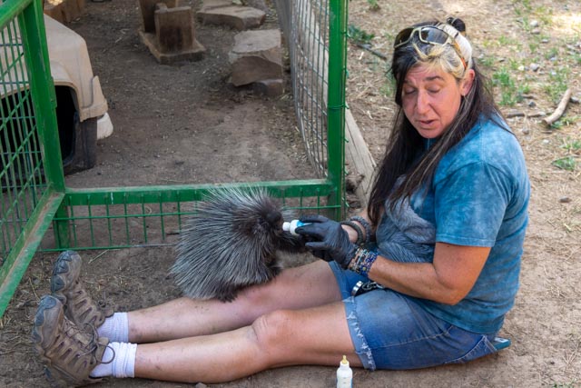
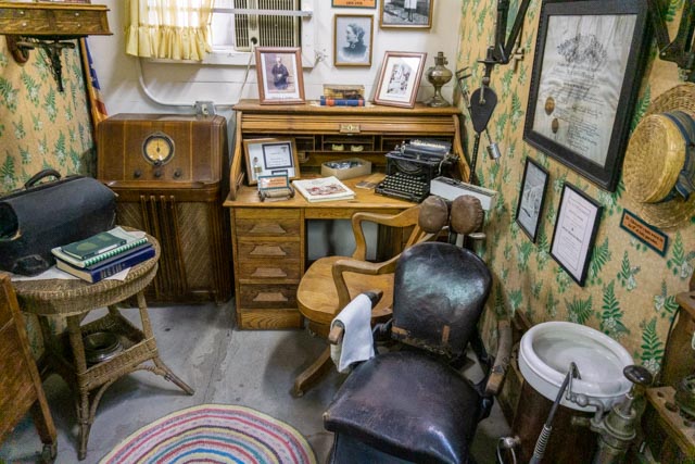
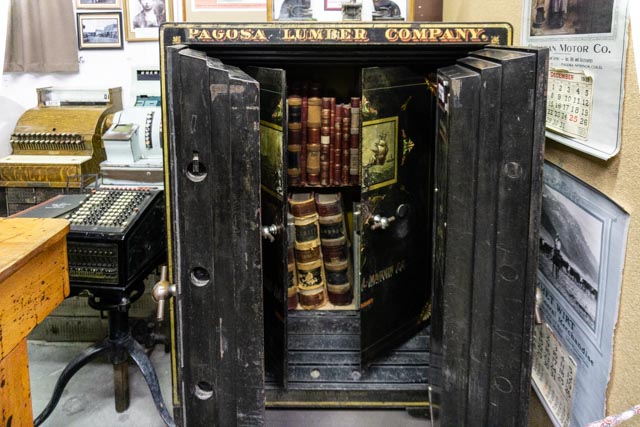
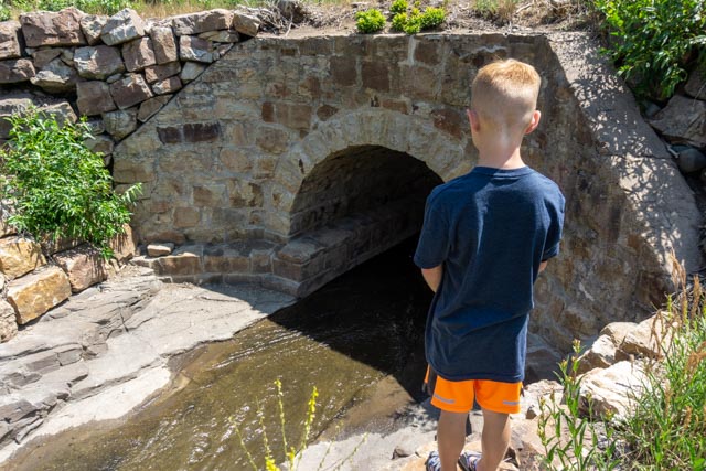
It was at least an equal to what we saw in AK! Especially the lady below. She hand fed the porcupine (and got quilled) and was very patient with the children.Overall, this park was at least as nice as the Alaska Wildlife Center we visit near Alyeska, AK. The lady above really made the adventure great. Her knowledge and affinity for the animals was incredible. Here she is hand feeding a porcupine. She did get accidently “quilled” when she directed it back into the enclosure but she was obviously the friend of the animals.We decided to try tubing on the San Juan River. In our first “white water” Jason got caught in the back flow and had to be pushed out by a fisherman. I was already downstream and you just can’t paddle tubes upstream. He quickly learned to accelerate in the whitewater so as not to get caught in the back flow.Jason and I were first on the river in the morning, a 10AM start! This was his first tubing run so he had a learning curve but was a pro by the third run, he left me in the dust.Jason getting way ahead of me. He is just going under the bridge and I am not even in sight!Jason tubing with swagger!We took a trip to the Pagosa Springs History Museum, an all volunteer San Juan Historical Society run operation which surprised us in both the number of exhibits and the depth of knowledge and available information. Best of all, it was free (donations accepted of course!) The majority of the items in this museum were locally sourced. After spending a significant part of my time going over the Ute history and interactions, the logging and ranching history, we continued on to the rest of the exhibits. This was a typical office setup from the turn of the century.Next, we saw a dentist office. I must be getting old because I remember the ceramic spittoon from Dr. Stabler’s office in Stockton. I still shiver when I visit the dentist!This was a neat example of a small, period school. Of course I checked the books to see if I had any! The maps we’re a little out of date!This was taken from the local lumber business. Back in the day, Pagosa Springs was a logging town in addition to the springs. The doors on this safe weighed over 600 lbs each!An example of a mid-30s kitchen. I remember the Hoosier cabinet and would love to have that wood-fired stove. It reminded me of the Handleys. This was very nice, small piano in a bedroom setting. I took Jason around back to show him the original water storage facility, lifting him up to the roof so he could see was it looked like. I can’t imagine how it held the weight of the water. This is the roof of the musuem.Jason looking at an old stone culvert under the old road. This area was fenced off (to keep the animals in?)I did ride my bicycle down Wolf Creek Pass, managing and to tuck in behind a tractor trailer rig for most of the 8+ mile descent. Trucks are limited to 25 MPH so it was pretty easy to tailgate the truck down the hill until we met Cathy with the truck parked at Treasure Falls. I did have to hit my brakes a few times to keep from going under the trailer! This ride was a little too squirrely for Jason to participate in, we were going down a four lane highway. I saw this waterfall roadside on the way down, and since you cannot see it from a car, we had a little trouble finding our way back to it. We parked and walked roadside for about a quarter mile so Cathy and Jason could see it.I saw a game trail so I followed it up the hill. I found this apparently original road marker which appeared to be marking the original roadway over the pass. The top had rotted off and was laying down at the base. It had not been disturbed in years!