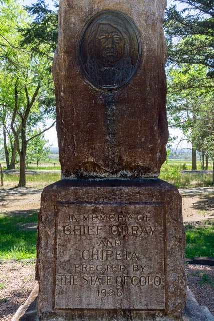
Once we set up camp in Montrose, alongside the Uncompahgre River, off Chipeta Road we headed to the Ute Indian Museum. The museum was recently remodeled and featured a lot of exhibits, a children’s area (which Jason really enjoyed) and set of short videos that featured elders speaking about history, culture and contemporary life of the Ute people.The museum sits on the grounds of Ouray and Chipeta’s home. Ouray, Chief of the Utes. The monument above is to commemorate both Chief Ouray and his wife Chipeta. Chief Ouray died on August 24, 1880 from untreated Bright’s disease while working to induce the Southern Utes to sign the Treaty of 1880 and to meet with commissioners from Washington regarding payment of the Utes’ money should the treaty be ratified. He was buried in a secret place along the Pine River. To this day it is not known conclusively where his remains are. It was estimated that at the time of Ouray’s death, there were over 1,000 Utes camped near him.Chipeta was referred to as “Queen of the Utes” and died on August 16, 1924 of chronic gastritis at the age of 81. She outlived her husband by 44 years.
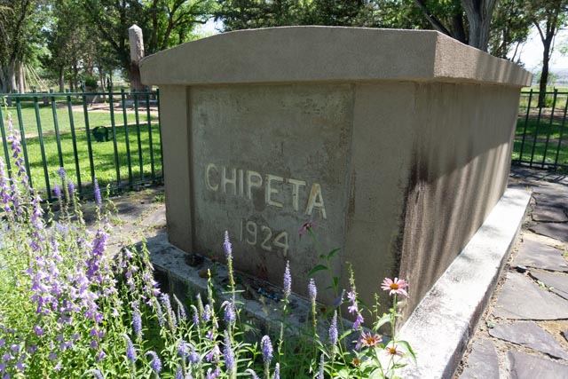
Chief John McCook, her brother, carried her body to an arroyo, wrapped in a blanket and performed the traditional burial. He was buried next to his sister.
Chipeta’s remains were moved to the Montrose site and reinterred, with over 5,000 people attending the services.
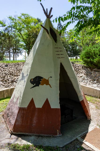
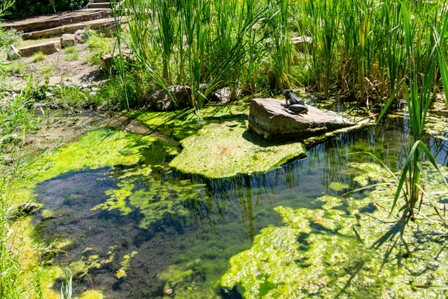
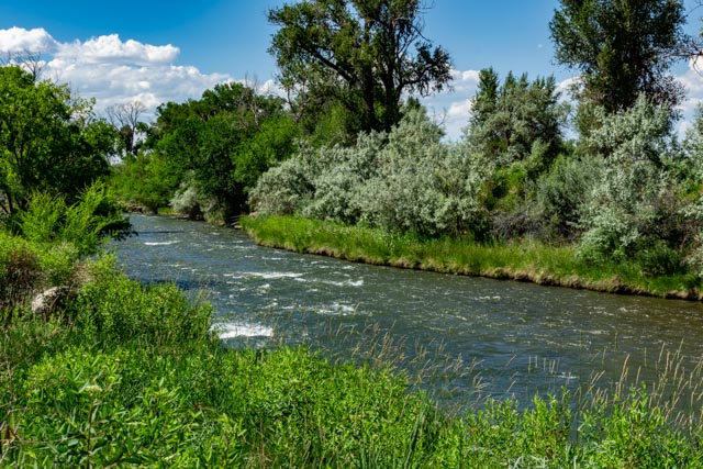
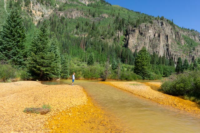
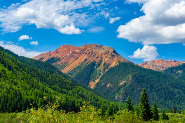
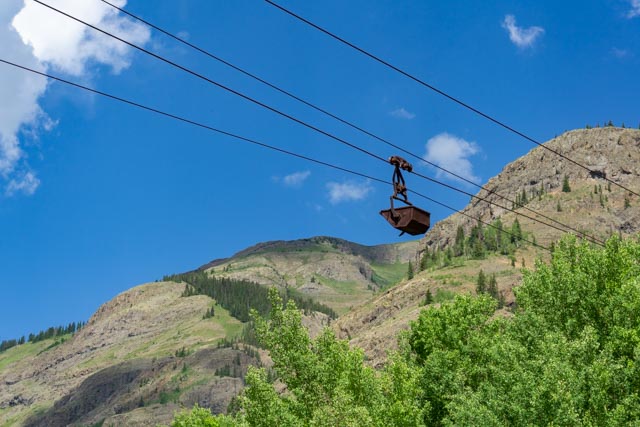
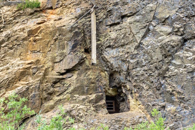
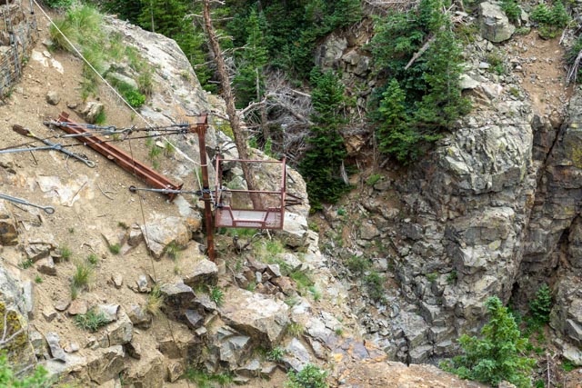
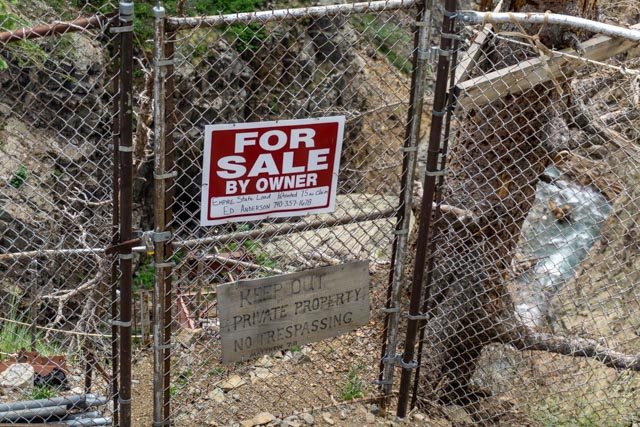
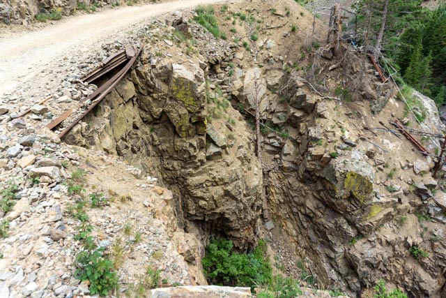
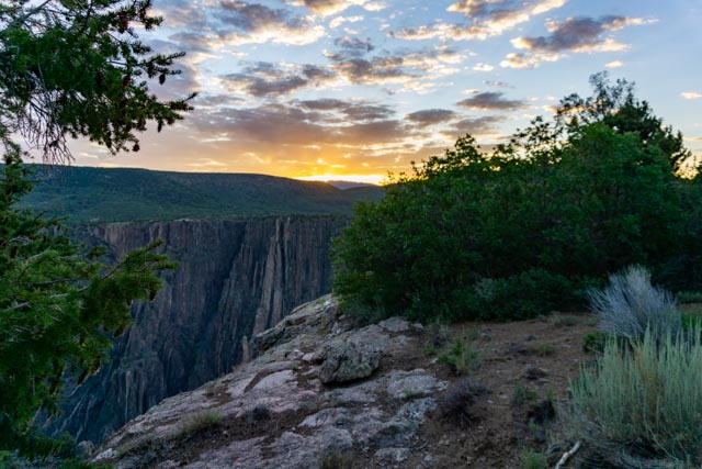
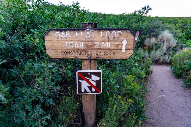
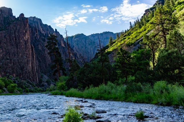
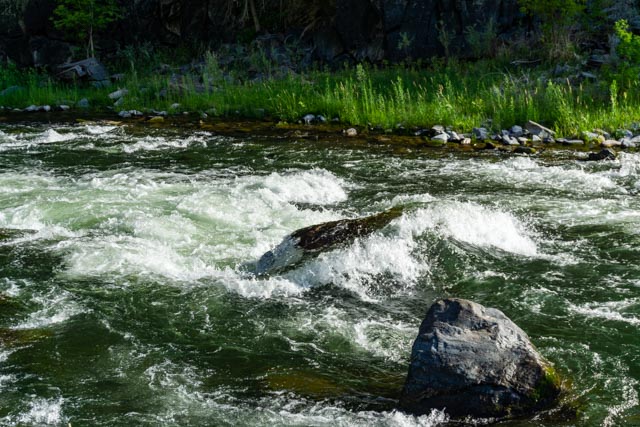
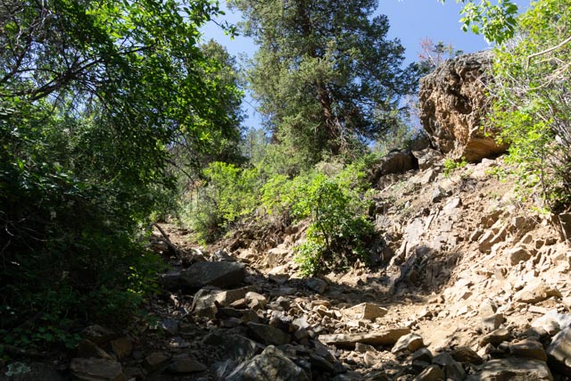
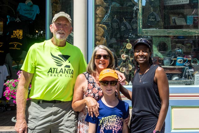
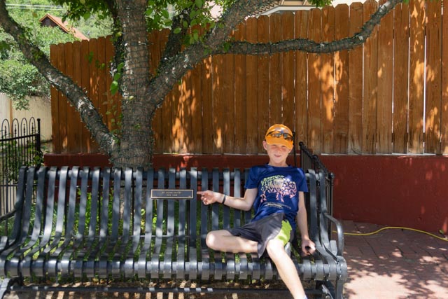
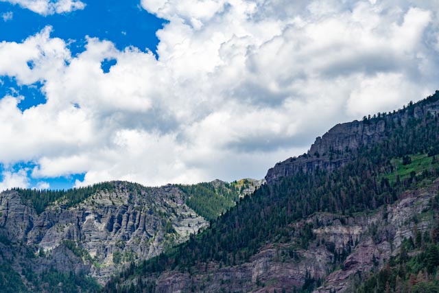
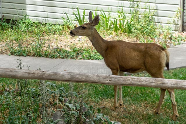
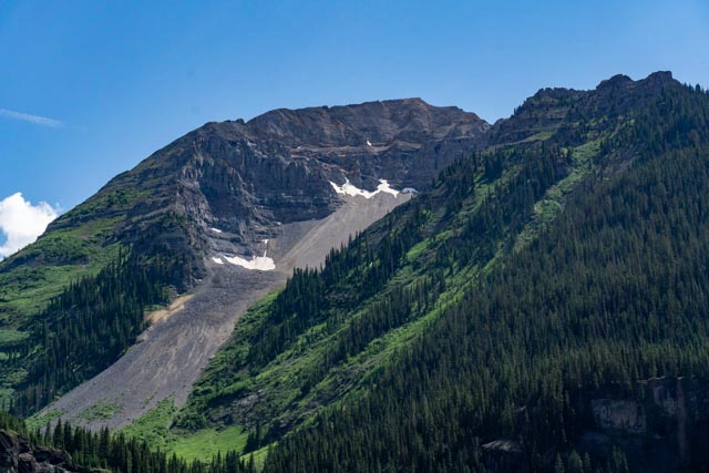
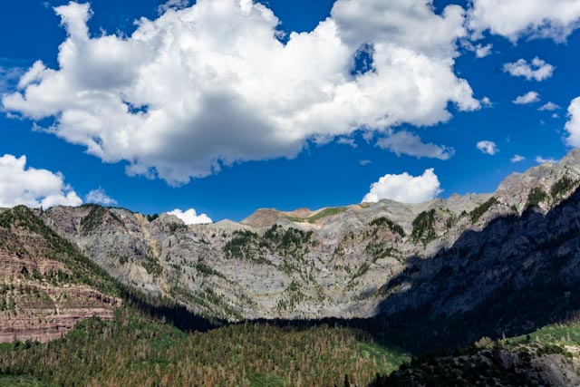
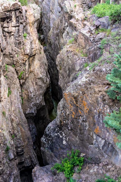
Chief Ouray’s alleged remains were moved to a reservation cemetery at Ignacio in 1925. There were no official attendance reports but over 350 cars filled with people were in the procession.The original spring from the Ouray home is still producing water. The spring is located in the concrete Tepee erected by the DAR in 1925. The water is directed to the small pond which is landscaped with native plants. (and a big frog)The Uncompahgre River flows by the Ute Museum and we are parked about a block or so downstream.This yellow river flows north to the Uncompahgre River just before Ouray. Mine tailings are coloring the stream and the water.This is another “Red Mountain” on the way to Silverton.Arrastra Gulch is where it all began. Gold was discovered across the Animas river and the Little Giant Mining Company was formed. To move the ore from the mines directly to the mill, a 10,100 foot tram line was built, the first ever to use steel towers. The mining companies pioneered new technologies in the Arrasta Gulch, setting new standards for the mining industry. Here some of the most complex aerial tram systems ever engineered were built – most in an era when industrial motorized machinery as we know it today did not exist. There we hard rock mines strewn all over the mountains. It is good that someone or group took the time to secure most of the mine entrances to avoid dangerous traps.This and the next photo are the remains of a mill on the Alpine Loop Scenic Byway (a fancy name for a 4×4 or OHV trail) near the townsite of Eureka..We were wondering what this hand trolly was for so I parked and walked around and down to discover it takes you across the Animas River, over a very deep gorge to some nice, but relatively inaccessible riverside property (or mining claims) that just needs a buyer. Believe me, I had no intentions of trying to go through that gate! None at all.It a good thing Cathy did not see this deteriorating roadbed. I sure would not want to be “hugging” the edge here!We drove through Silverton and and took a spin up Cunningham Gulch to find a picnic area. It was just a short hike to this waterfall. The clouds came in fast and it was sprinkling by the time we got back to the truck, then snowing between Silverton and Ouray on the “Million Dollar Highway”, billed as the most dangerous highway in the U.S. It had it all: it is steep, narrow, windy, has minimal guardrails and HUGH drop-offs, and today . . snow!I missed my first chance to go down into the Black Canyon so I waited for three hours the next day to make sure I would get one of the 14 available permits to make the climb. The one hour pre-hike safety talk evidently scared off almost half of the hikers as I only saw six people total for the group that went through safety with me. There is only one way down and one way out so I don’t think I missed anyone. I started at 6 AM to avoid the heat. I was the first to the bottom and spent my time by myself before climbing out.This trail doesn’t look too bad . . no wait, its only the trail to the climb.This was a neat, strategically place sign trailside just before we entered the wilderness.The trail topside looked pretty good. But this was still the Oak Flat Loop trail for flatlanders haha.Now the fun begins. Once the trail becomes a track, the scramble starts and the going got significantly steeper.Rocks, I hate rocks! Unfortunately, it only gets worse.This section is so steep they have installed about 240′ of chain so you can abseil (rappel) down. Unfortunately the camera does not capture the steepness.I am holding on with one hand and taking the photo with the other.This photo does not show the severe drop I am looking at. The rocks are all loose and slide down with you, though.Sometimes it gets hard to determine which way to go. We were told “as long as you are descending, you will be ok”.But be careful to look back to see what the “trail” looks like. You will want to use the same route going up that you took down. Getting lost going up is the biggest reason for the rescues.Yes, I made it down but my feet are killing me! It was an 1,800 foot vertical descent to the river, and now I have a 1,800 foot Class 3 climb out. UghI wish for a minute that I had brought my fishing rod, but it would have been broken before I reached the water. I can see why we were warned not to try to swim in this.The sun is rising so I have my 15 minutes of rest. Time to head back.I almost forgot to take a selfie to prove I made it. There is no one else here yet to take the photo.This formation was directly across the river from me. It would have been tempting to try to cross.I took many short breaks on the way up. You can see I am covered in dirt and the temperature is going to hit well over 100 degrees by the time I get out. I got bruised, bloody and dirty coming up. Made a good presentation for Cathy when I eventually arrived back at camp. My SatPhone did not work as the canyon walls were too steep for Satellite communication. I was told there would be absolutely no communication once you started on the wilderness track and they were right! I don’t remember all of this climbing on the way down; dang.One last look at the canyon from near the top. It was fun but I don’t think I will do that again.In the morning we went in to Ouray. I wanted to stop at a climbing shop to get details on the road into Mt. Sneffells which was going to be my first Class 3 scramble. There was still snow blocking the road so that was out but my climb out of the canyon yesterday was a Class 3. I guess I kinda nailed it! I was wearing the shirt in the photo and this young lady said hi! are you a member of the Atlanta track club? She turns out to be a former member, past winner of the Peachtree 10K, an was an Olympic Competitor in the 10,000M. She is now working at the Grand Canyon Health Center, treating injuries. It is a pretty small world and I am glad I was wearing the shirt!.Jason is pointing a plaque that shows that the St. Elmo Hotel sponsored this bench. Where are the chipmunks?The clouds are starting to form, as they seem to do every afternoon for a shower or two.There just happened be the library annual book sale this weekend. Because they liked Jason,they let us in about 15 minutes early to get first choice. We walked away with a bag of books!Another deer having lunch in someone’s front yard. I spotted these homes when driving to Yankee Boy Basin (the snowed-in trailhead for Mt. Sneffels) so we detoured towards the Imogene Pass to check them out. This was the main residence for the Plant Superintendent. Pretty nice home still.This was the offices for the mine, including the HR office.Imogene Pass leads from Upper Bird Road in Yankee Basin to Telluride. It is another of the 4×4 / OHV trails.A ore tugger leftover from the yesteryear. Thomas Walsh discovered gold near here in 1896 and this Lower Camp Bird Mining – Milling Complex was completed in 1898.There was an aerial tramway built to transport the gold ore from this mine down to the milling operation, a distance of about two miles. The operation was sold in 1902 to a British company: Camp Bird LTD. and they continued to build improvements in the early years of the 1900’s. The entire area is being scrubbed and reclaimed.You know you are getting on a rough road in the boonies when you see signs like these.The scenery continues to be unbelievable. you can see for miles (when its not raining).Jason needed a few minutes get the wiggles out.Nice gravel road on the edge of the canyon. The only thing that ruins it is meeting another car.This is the rock wall (they call it the amphitheater) behind Ouray. There is a trial that leads all the way around the town. I can’t imagine what it looks like going through the rock out there.This was originally a magazine for blasting equipment used in nearby mines. Now it is just a storage shed. A very substantial storage shed.There is a river down there. We went over this on a one-way bridge and I could not get anyone out of the car to look down at the river with me. On the other side, the valley somewhat levels for a bit and they spray water on the wall of this canyon during freeze up to allow for ice climbing. Not me.This waterfall is accessible via a city park located downtown. It is surprising how many people don’t take the time take a look (probably because it is a little uphill walk?) This is first time we have seen water flowing, on past trips it was dry.


I am glad you won’t be doing that hike again! Yikes!!!
LikeLike