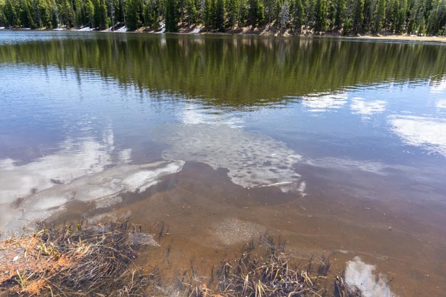
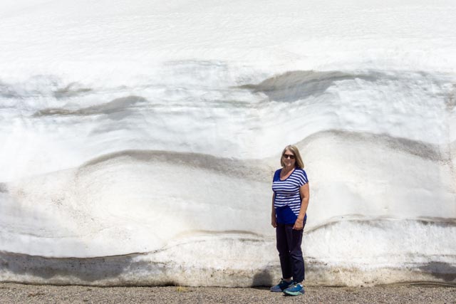
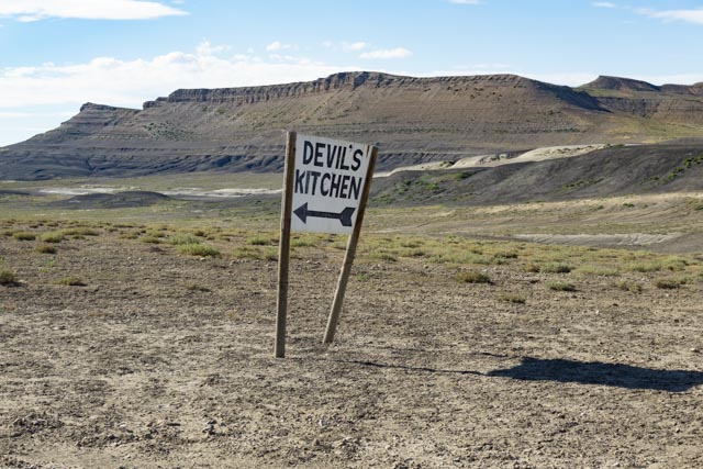
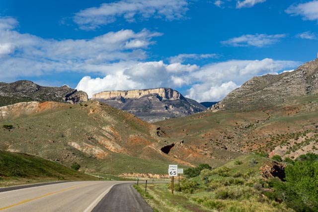
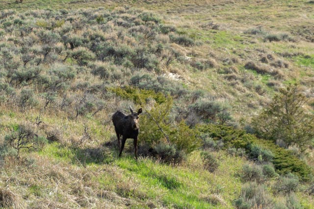
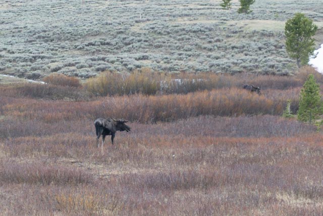
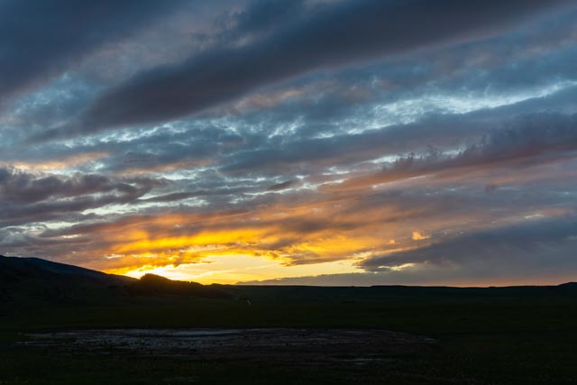
After a full day visiting various historical Forts and Native American sites, we decided to take a drive on some roads we have never traveled. First, we went north to Ranchetter, then headed West on Highway 14 then veered onto Alt14, the “Medicine Wheel Passage Scenic Byway” (which had just been cleared) towards Lovell. We stopped at this lake near the top because it was still partially frozen. I started a hike around the lake but got “bogged” down pretty quickly between the ice, snow and mud. Note: Since we decided to travel at the last moment, we (I) left all our maps, my GPS, and most of our travel plans at home. This trip would be a free-form, un-planned/scheduled adventure.This is an example of the roadside snow that we encountered. I was heading for the “Medicine Wheel” NHS in the Bighorn National Forest near the top of the pass, a little over 9,400 feet in elevation.As we approached the top of the pass we saw a grouping of snow machines playing in the snow. Of course we had to stop for a few minutes as I have really never seen one operating.Once reaching the trailhead for the Medicine Wheel ruins, we noticed there were several Sheriff and search and rescue type vehicles parked. Evidently there was a couple uptrail who had their dog stumble into a deep crevice. This rescue snow machine operator was stuck as the slope was too steep continue. Cathy turned back at this point . Even though the steepness doesn’t really show, a slip here could lead to an unpleasant glissade into the trees, hundreds of feet downslope.I continued on the “well-marked” trail to the ruins, a short hike of about 2 miles.After crossing several snowfields, I reached the ruins. There is a theory that the wheel is a copy of the Sundance Lodge of Crow legend, and was oriented to plot to the summer solstice sunrise. The only other people I encountered included the local sheriff and the rescue teams, about 12 people total, all prepared for an overnight rescue. As I walked around the upper end of the ruins, I was post-holing at about waist deep in the snow. This is right at treeline, about 11,500 feet.This is the sheriff team heading across the saddle towards the stranded couple.This is one of the rescue team members. He had a headlamp on his helmet for night work and a camera mounted to his shoulder. He was prepared to spend the night on the mountain. “Just another Sunday afternoon walk in the woods” according to him. Ya gotta love the volunteers!I returned along a snow machine track (note to self, stay out of the snow machine track, the snow is extremely soft and post-holing is hard work). I quickly learned to make my own tracks on the way back.Continuing on, we came across a small sign on a dirt road that said “Devils Kitchen”. Of course we had to drive to the area (no maps=no plans). What we found was pretty remarkable. This depression was totally “off-grid” and we were the only ones there. It continues to amaze us what is really out there to see!The “official” homemade sign on the dirt road.We did take some time to walk around the area as there was a lot colors and shapes to see.Back on pavement, we continued south to Greybull, turning east on the Bighorn Scenic Byway to return to our campsite near Sheridan.We stopped near Granite Pass to make the short walk to this waterfall.I was driving slowly talking with Cathy and remarking that we were not seeing many animals, especially the moose (we had just passed a “Moose” warning sign and we normally find these signs where there is no possibility of seeing the described animal(s), almost as if the animals can read also! As soon as I said that we will not be seeing any moose, I noticed this girl down in the hollow. We parked and I walked back to stare at her for awhile. We viewed a total of 11 moose on the loop, mostly in the later afternoon. This girl was along side the road just grazing along.This was our first Bullwinkle and he was protecting a female and a couple of moose-etts. We watched as the babies jumped the roadside fencing, then the mama and Bullwinkle just stepped over and leisurely crossed the road in front of us. I was bumbling with my camera and could not get a shot until they were safely in the brush across the road.This gal was just walking through the woods and I just had to take one more picture!As we neared the end of the loop, the sun was setting so I stopped and took this late shot across a small pond. As we were heading back to Sheridan, we spotted a dog running down the center line on I-25. We stopped and helped the dog into our truck, then called the owner to let him know we had her. We drove about 15 miles back to camp and the owner had one of his workers pick the dog up from us. It turns out the dog was a retired cougar and bear hunting dog and was recently mauled by a bear, ending it’s career. Now she is just a range dog.


You got some great pictures on this trip!
LikeLike