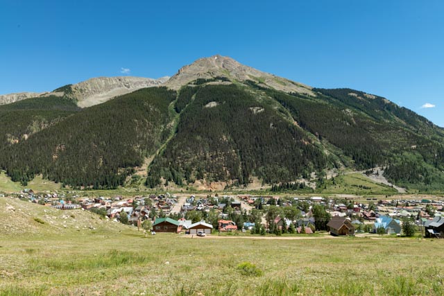
We decided to take a drive back to Silverton, about 60 miles away. We could not find a place to stay there so we had continued on to Lake City. Now we were in Montrose and the Silverton and Ouray area were back in reach.
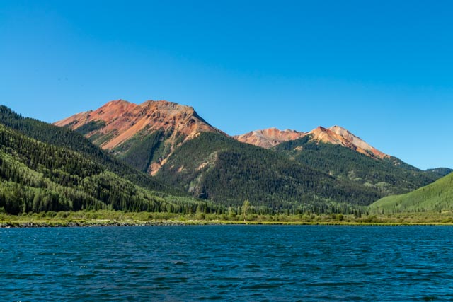
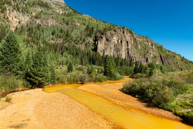
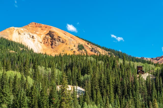
We stopped at this small reservoir just below Red Mountain Pass at 11,000 feet. We stopped here because the sun was just beginning to hit the water and we were intrigued by the yellow stream that was flowing on the other side of the highway. We had spotted the yellow creek a week earlier while heading to Lake City and vowed to return when we could park our truck and take a closer look.This yellow creek, Red Mountain Creek, is actually colored by mine tailings further up the canyon. I would hate to have to take a drink!We stopped to look at the headframe and other leftovers from the Yankee Girl Mine. Unlike other local mines, the shaft of this mine went straight down, to a depth of 1,200 feet. Ore from this mine assayed at up to $10,000 per ton making it one of the richest concentrations of silver ore in the United States. The mine closed in 1898 after sixteen years of operation due to a decrease in the value of silver. During its run, it produced over $100,000,000 of silver in today’s market value.
View 1 across from the mine
View 2 across from the mine
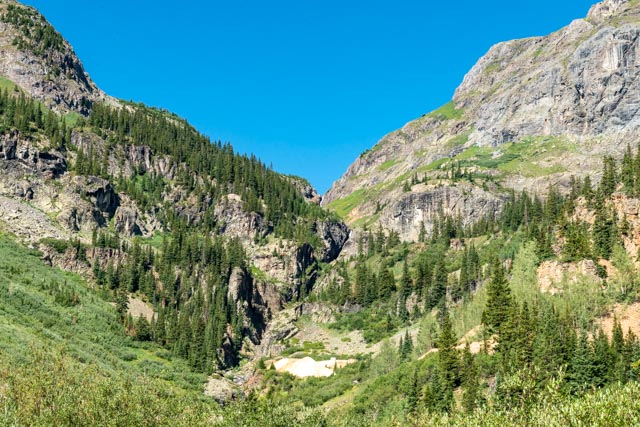
We took a dirt trail up to this canyon to see a mine. We were passed by an OHV and the dust storm it was creating so we stopped at this point to return to our truck.
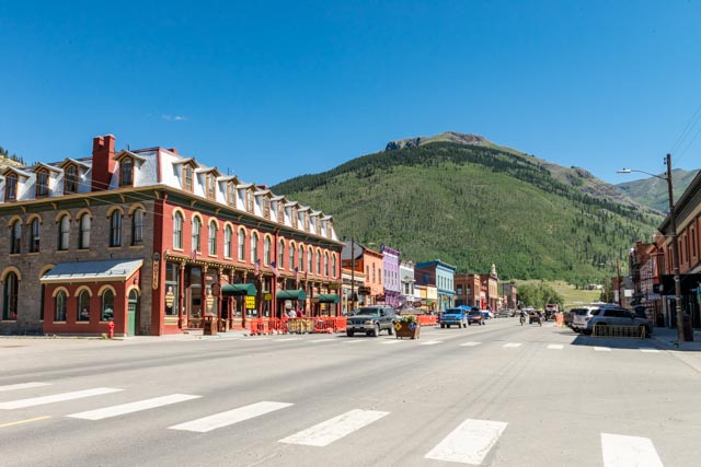
Silverton Main Street south
Silverton Main Street north
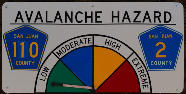
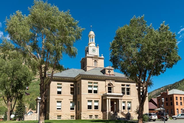
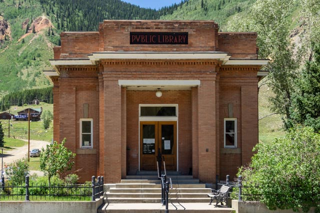
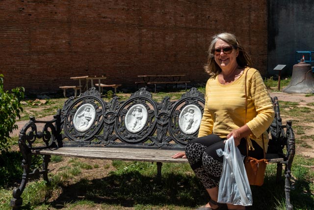
You don’t see a lot of these signs in Georgia. At least the hazard was “Low”, except for the rock slides!This is the County Courthouse.This is the Silverton City Hall building, built in 1908.We passed the Silverton library on the way up the mountain to the Miners’ Memorial.This is the Miners’ Memorial, also known as Christ of the Mines Shrine. We spotted it, high on the hillside from downtown and decided to drive to it. Of course I did not ask how to get there so we took about every road in town before finally determining that it can be reached from the main road about a half mile out of town.Cathy rested in the downtown city park on a vintage bench with pressed figures on the backrest. Yes, we did visit some of the local stores.Michigan rocks in Colorado? What the heck, we had to check it out, for Michelle’s sake.We enjoyed a lunch in the Lone Spur Cafe in Silverton. Evidently Wyatt Earp, Billy the Kid and Bat Masterson hung out here at one time. There is a bullet hole in the bar from Bat Masterson, evidently he was not as sharp as a shot as we were told.It seems like the wildlife is always watching us. This guy was directly over the table.
Looking back across the town at the avalanche runs
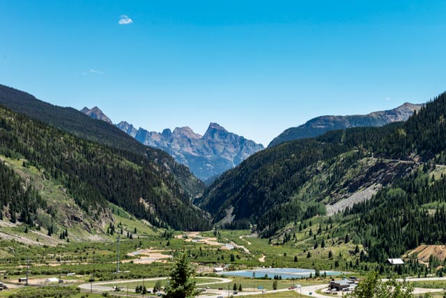
Looking back down the canyon south towards Purgatory
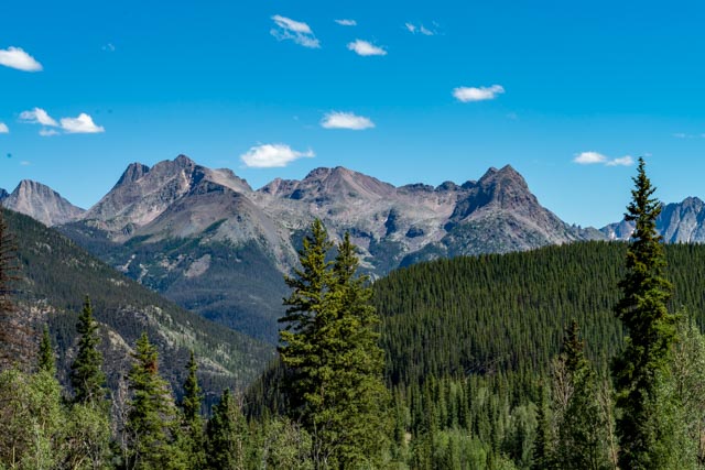
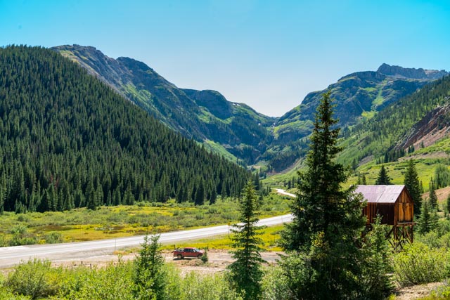
We drove down the highway towards Purgatory to get a photo of these 12,000-13,000 foot mountains. We could not stop with the motorhome as it was overcast and sprinkling when we came over the pass. At the Avalanche Research Center in Ouray, this section of road is identified as the most dangerous highway in the country, with steep drop offs and virtually no guardrails. There are over 150 known avalanche (and rockslide) runs in this area and the guardrails were getting destroyed so they were removed.On the way out of town we stopped again to take a closer look at this mine area. The actual mine was up the hill and this was the ore loading chute. I hiked up to the mine and saw a couple of old telephone poles but they had been stripped many years ago.Down the road further, I walked up to this waterfall that we had previously spotted to get a photo. After trying to balance on the rocks to keep dry, I quickly gave up and walked up the creek instead, it was a lot safer as the rocks were covered in moss and very slippery.We saw this red mountain, appropriately named “Red Mountain”. It seem there are a lot of “Red Mountains” in the area.Another red mountain with a mine located on a tailing pile. At his point it was getting late so we took a quick look and kept heading down the hill.This is the remnant of an avalanche from last winter. You can see the packed snow covered with the brush and trees that it took out on the way down the canyon. The snow pack and ice is about twenty feet deep at the base of this canyon with large chunks of ice strewn downstream. And for those sharp eyed persons, this is the same Red Mountain Creek as described in the second photo!This is an avalanche tunnel, built to protect the roadway from a high avalanche area.
After spending the better half of the day in Silverton, we headed back to Montrose, going through Ouray. Ouray was named after Ute Chief Ouray. I am going to have to learn a little more about the Utes in this area.
The combination Walsh Library and Ouray city administration building
The Ouray County courthouse
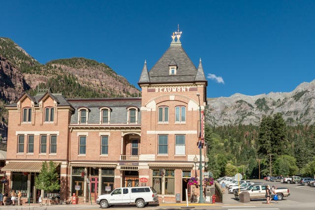
The historic Beaumont Hotel
Looking down the main street in Ouray
We were getting tired of shopping and walking so we headed back to our camp after a short visit. Ouray is an upscale Silverton and we preferred the overall atmosphere of Silverton. We did make a trip up the hill to see a waterfall but judging the amount of water running in the creek decided to not make the climb.