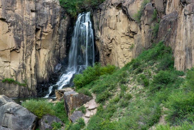
We started the day with breakfast at a local, recommended cafe. The cafe was attached to a small store and gas station. Overall, the meal was pretty good. After breakfast we took a drive south on CO149 towards Pagosa Springs. We could have saved hundreds of miles if we had known that we would be in Lake City after Pagosa Springs. Our first stop was at the North Clear Creek Falls, about a 30 mile drive. The falls were pretty neat so we decided to try and find South Clear Creek Falls. After driving about four miles on a steep, gravel road we asked directions and were directed several miles down the highway and finally wound up at the unmarked falls.
North Clear Creek Falls
North Clear Creek Falls
Trail to South Clear Creek
South Clear Creek Falls
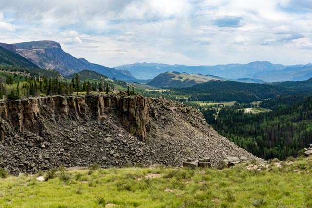
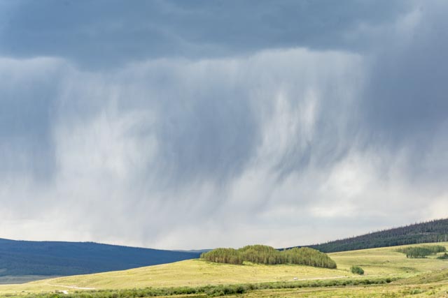
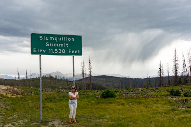
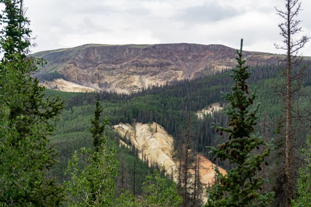
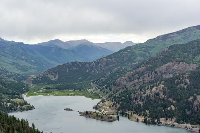
Here is the view of the Clear Creek cut, down to the valley below. We drove the dirt road to the valley only to discover the South Falls were miles away.Colorado Rockies often rain in the afternoon. It sprinkled off and on most of the day. This is a view looking down into Colorado’s largest wilderness area, the 499,771 acre Weminuche Wilderness. The peak that you can barely make out is the 13,821 foot Rio Grande Pyramid, the headwaters of the Rio Grand river. I took this photo from the truck as the rain was really coming down at this point.This is the San Juan Range in the distance and in the rain. The largest peak is Uncompahgre at 14,309 feet. To the right is Crystal Peak at 12,933 feet. To the left is the Matterhorn at 13,000+ feet, then Wetterhorn Peak at 14,015 feet. I plan on climbing Uncompahgre on my next trip if my knees hold up!Cathy posed, cold and shivering at Slumgullion Summit. The area behind her is currently being re-forested. Maybe there is rain in the forecast.This is Mesa Seco. 850 years ago thousands of tons of water saturated, earthen material broke away from the Mesa and slid nearly four miles into the valley below. The Slumgullion Earthflow dammed the Lake Fork of the Gunnison River and formed Lake San Cristobal, Colorado’s second largest natural lake. About 350 years ago another portion of the mesa began slowly oozing down the hillside, riding on the older slide. This newer flow covered about two and a half miles of the older flow. Geologists estimate the flow is continuing at about twenty feet a year.This is Lake San Cristobal as viewed from CO149.The island in the middle is currently on the market for $10 million. The roadway around the right side is CO20 and is paved until the far end of the lake (four miles), then it becomes gravel, then 4WD at about sixteen miles. It leads to Cinnamon Pass and the Handies, Redcloud and Sunshine Peak trailheads and eventually connects with Engineer Pass, leading back into Lake City.
An interesting incident occurred in here in late 1873: Alferd Packer was hired by a group of Utah prospectors to guide them through the San Juan Mountains. Months later, after a heavy snowfall Alferd arrived at the Los Pinos Indian Agency, alone, claiming he had become separated from his clients. A search party found the remains of the men, all of them were murdered and then butchered. Alferd had the appearance of being well-fed despite the conditions and promptly disappeared. He was found nine years later in Wyoming, was returned to Lake City, tried and convicted of murder and cannibalism and sentenced to death. His sentence was reduced and he was eventually paroled and released.