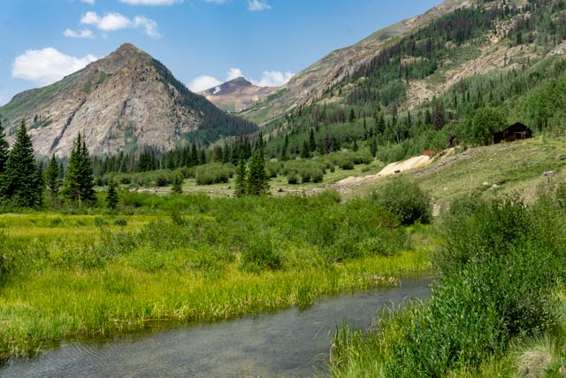
We left Pagosa Springs with the intention of staying in Colorado on our way to Spearfish, South Dakota, not anticipating that all RV parks would be full, especially with the Covid issue. I made the mistake of not making reservations for anywhere between Pagosa Springs and Spearfish. We tried Silverton, but everything was full, we tried Ouray but everything was full. We started making calls and found a spot in Lake City (someone had just canceled and they had one site). We continued on to Lake City on what turned out to be a 500+ mile day. Once in Lake City, we quickly discovered we liked the area. There are lots of mountains, creeks, mining and it is a historic small town!
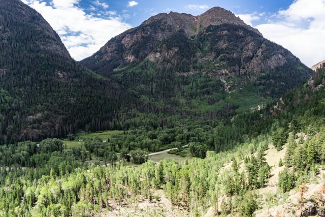
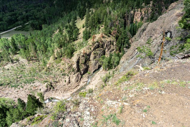
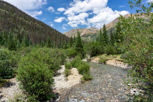
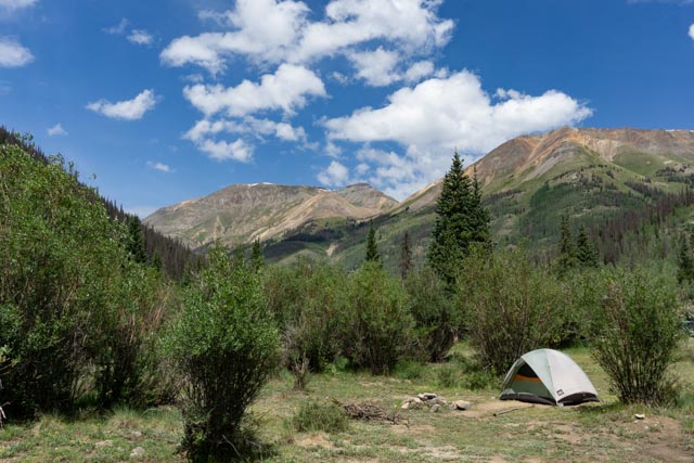
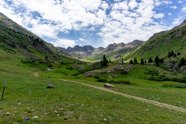
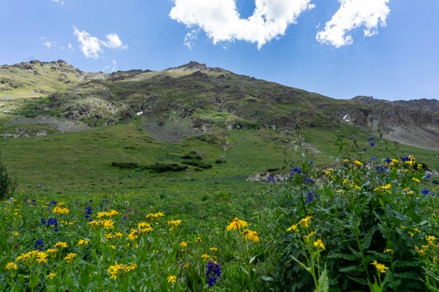
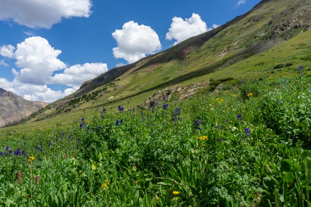
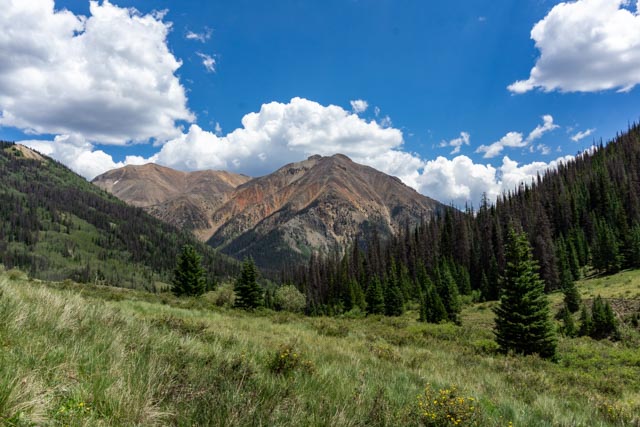
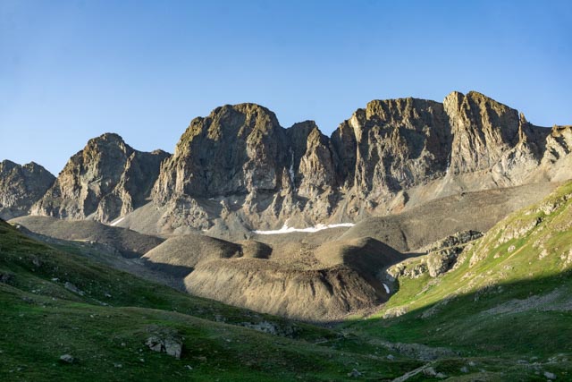
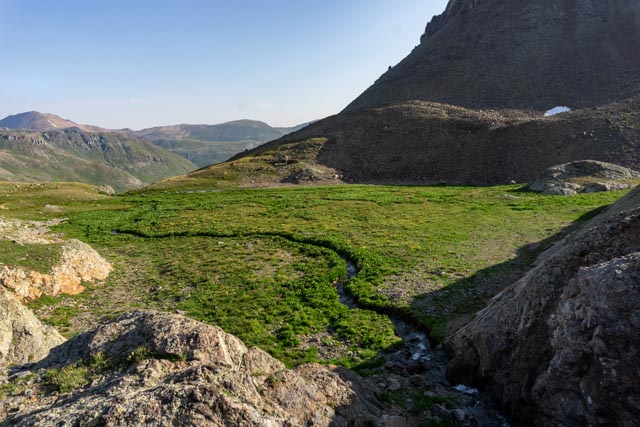
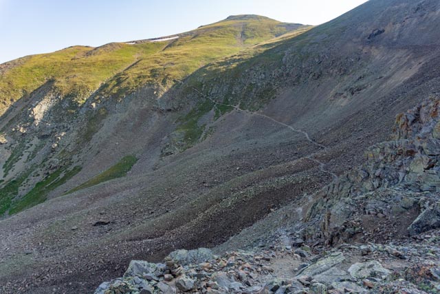
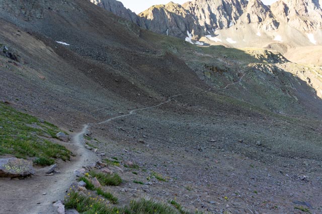
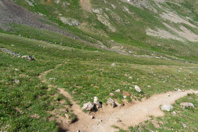
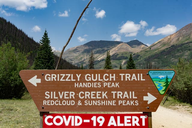
In the morning we decided to take a run up one of the nearby canyons, Cinnamon Pass, which connects with Engineer Pass to form the scenic “Alpine Loop”, an OHV trail which is about 120 miles in length and connects Lake City with Ouray and Silverton. We stopped at this wide spot on the trail to view the townsite of Sherman in the valley below. I nearly stepped on a rattlesnake when exiting the truck but the view of the valley was beautiful, although the town was no longer there. Sherman was platted in 1877 and featured streets sixty feet wide! Located at the confluence of the Gunnison River and Cottonwood Creek, it repeatedly flooded. A runoff control dam built upstream ruptured during a cloudburst and inundated the town, which did not survive the damage. You can still spot the three-tiered rock wall foundation of the Black Wonder Mill, which operated as late as 1897.Looking almost straight down you can see the river flowing through the very narrow canyon and the evidence of an avalanche that came down the chute beside me. We would pass dozens of these avalanche areas, viewing hundreds of trees blown down and trees snapped about 10 feet up from the base.This is the Lake Fork of the Gunnison River that is crossed to access the Grizzly Gulch trail to Handies Peak.There were a lot of climbers who camp at the trailhead. I spotted a lot of deer feeding in this area early the next morning on my way to American Basin.This is a photo of the road to the American Basin trailhead taken on our recon drive the day before the climb. I like to get my bearings of the trailhead before I attempt to reach it in the darkness of morning.While walking around I managed to capture these wildflowers which were in full bloom, making for a beautiful start up the trail.I walked up the creek a bit to see some more of the trial and came across this small waterfall. There would be many more on the hike the next day.I took a parting photo of the hillside wildflower show.Here is one of the many unnamed 12,000 ft. mountains surrounding Cinnamon Pass. We finished the day with a walking tour of the area. Below are some of the buildings in this 19th century mining town.
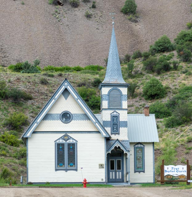
Babtist ca.1891
Catholic ca.1877
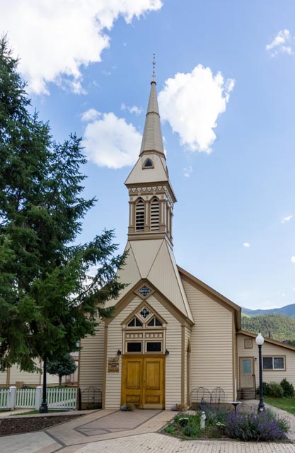
Presbyterian ca.1876
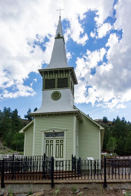
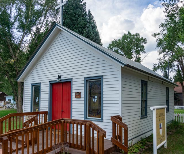
Episcopal ca.1876
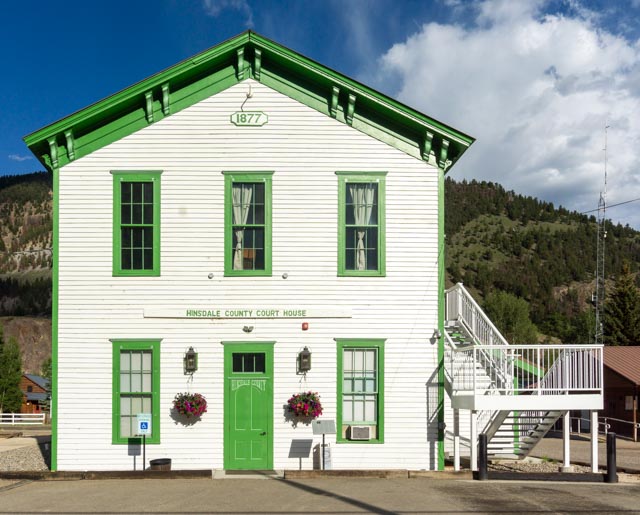
The Hillsdale County Court House ca.1877
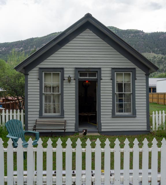
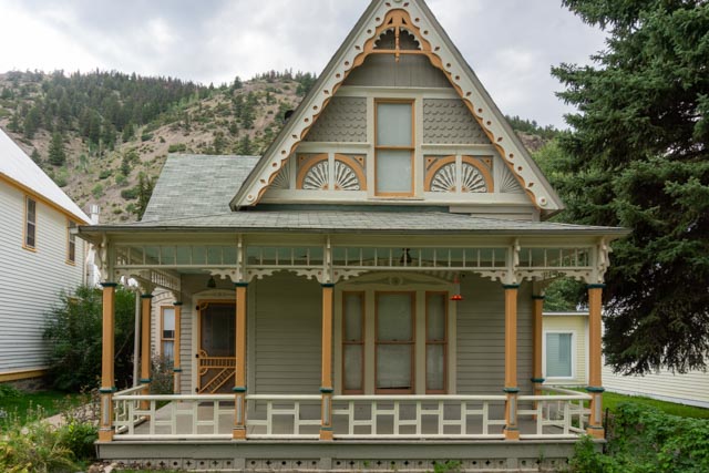
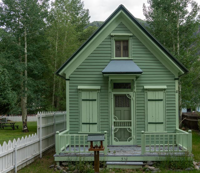
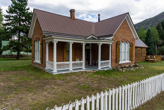
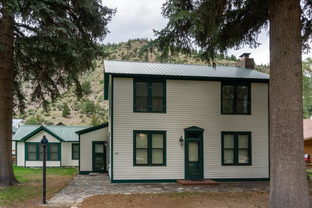
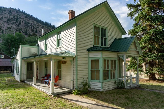
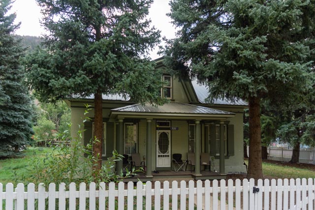
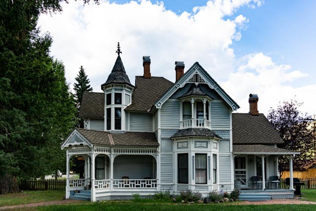
Homes ca.1876-1900
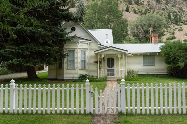
Homes ca.1876-1900
Homes ca.1876-1900
Homes ca.1876-1900
Homes ca.1876-1900
Homes ca.1876-1900
Homes ca.1876-1900
Homes ca.1876-1900
Homes ca.1876-1900
Homes ca.1876-1900
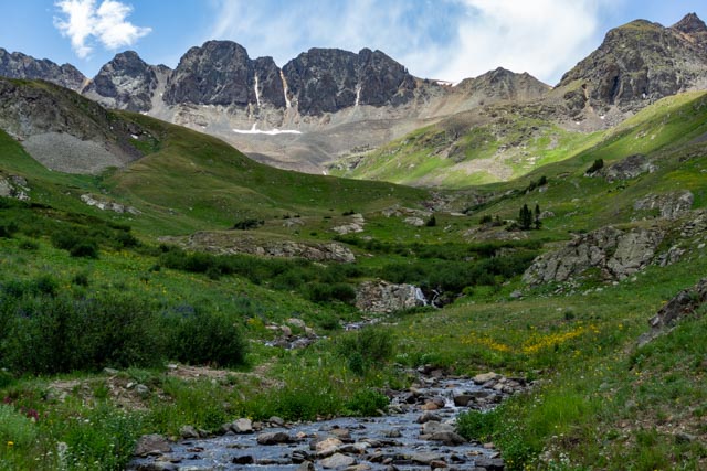
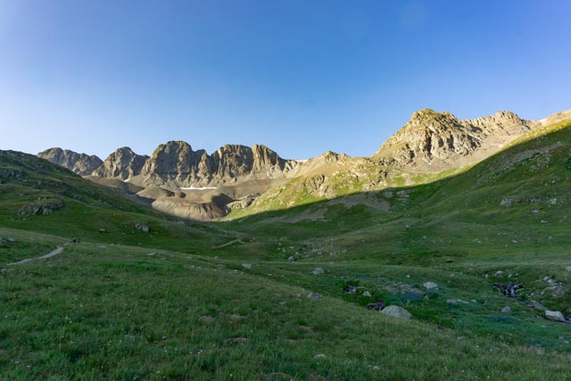
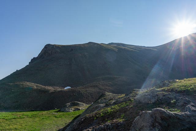
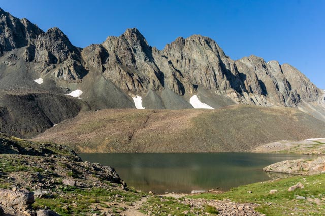
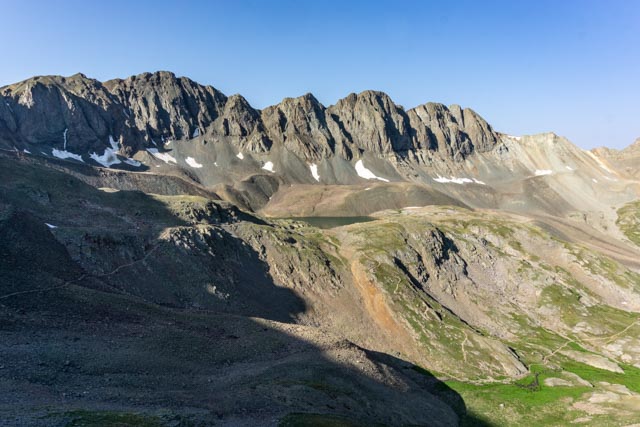
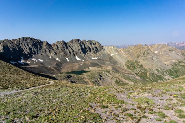
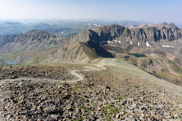
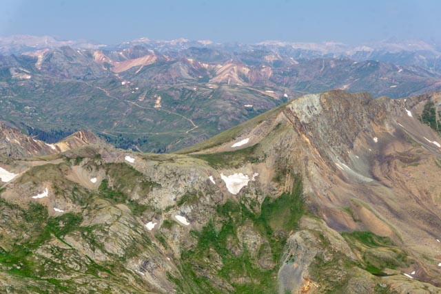
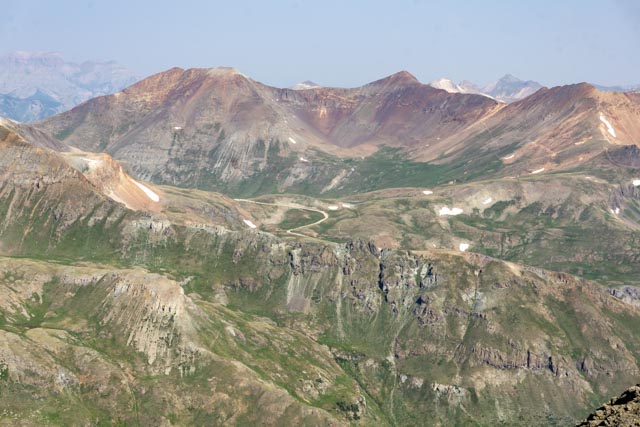
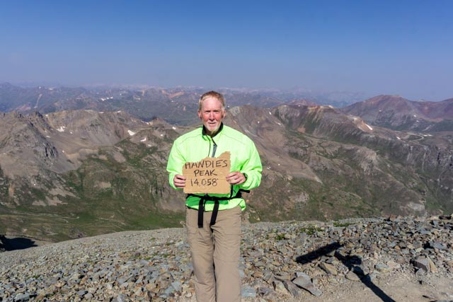
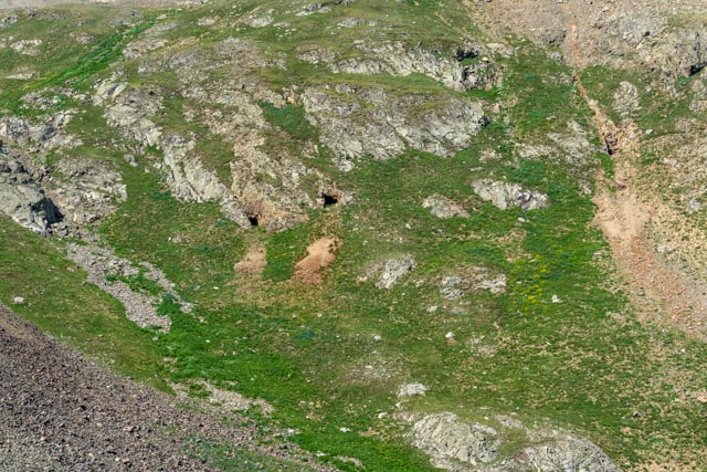
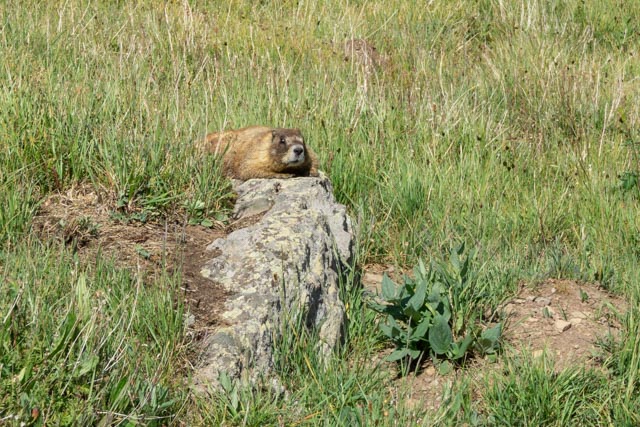
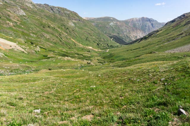
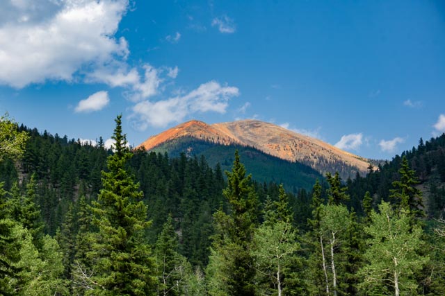
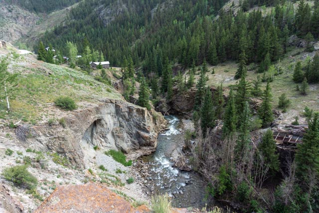
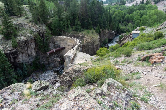
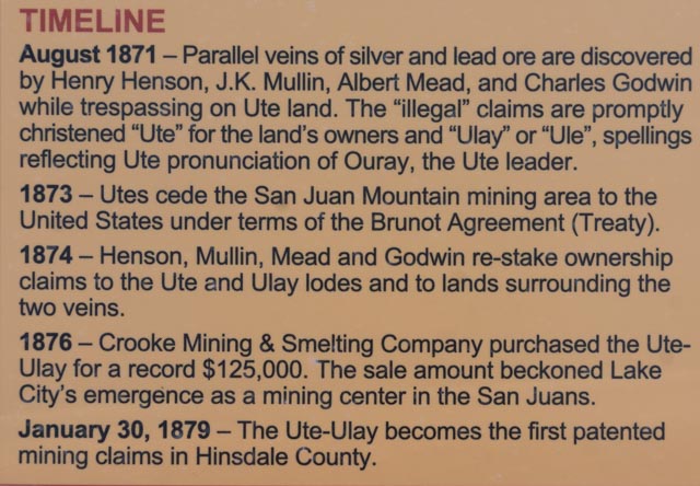
This is the view from the trailhead at American Basin. It was a 1.5 hour, 20 mile drive on a 4 wheel-drive road, across two streams and a couple of rock fields. I departed Lake City at 5:00AM and was on the trail at about 7:00. The sun was just starting to hit the tallest peaks of the ridge, (left to right) 13,588, 13,652, 12,924, 13,423 and 13,441 feet. My destination was Handies Peak to the left, off of the photo at 14,048 feet.This is one of many streams I crossed on the trail. The sun was hitting the tundra and the water was crystal clear. I expected to see mountain goats or at least some deer but only spotted marmots and pika.This is Handies false summit as the sun rises. The actual summit is about 500 feet higher and beyond this visible summit.This is Sloan Lake, located about halfway to the summit. I understand there were swimmers here the day before. It was a short detour off of the main trail but worth the climb.This is the infamous talus slope that I had to traverse. It doesn’t look too steep but actually had very a sharp downhill drop-off. It was about a quarter mile in length, starting with the rock field in the foreground and ended with a steep climb into the tundra at the base of Handies. This is the view looking back at the talus slope. I met some hikers taking this section very slowly on the return from the summit.This is a view looking back at Sloan Lake from the slopes of Handies.After hiking several switchbacks I reached the saddle connecting Handies with the crags above Sloan Lake.The final ascent to the top was very steep, in loose gravel and scattered with talus. It was very windy on this section of the climb but the top was almost in sight. You can barely see the two hikers I met at the trailhead just beginning to enter the saddle, heading up the extreme grade. I waited for them to summit.Here is a view from the summit, looking out at the mines near the town of Ouray. The road winding up the valley is the continuation of Cinnamon Pass road leading to Ouray. This road is for short wheelbase 4 wheel-drive and is run mostly by motorcycles and 4 wheel Polaris OHV type machines. I don’t think I would attempt going beyond the trailhead in my pickup!I took my obligatory photo with a remnant of someone’s cardboard sign. Redcloud, Sunshine, Wetterhorn and Uncompahre Peaks are to my left, out of the photo view. They are all 14ers, I will have to return! Redcloud and Sunshine are doable, we could not make it up the trail to the Uncompahre trailhead in our truck and Wetterhorn is rated a little too difficult, at least for me.On the return down the mountain, I stopped to talk with several climbers who were going to take the unsigned Grouse Gulch trail to the right which would take them in the wrong direction, away from Sloan Lake and Handies. It ran downhill for a while so it was tempting. They were a little disappointed when I showed them the trail, which went up through a rockfield. There was a group of four men here turning back once they realized this was less than halfway up!Looking across the basin, these open mines came into view. I guess they have never been sealed due to their inaccessibility. They may look accessible but it would require an almost vertical climb up hundreds of feet of loose rock to reach these.This guy romped through the brush alongside the trail with me for a hundred feet or so, heading for his sunning rock.Ah! The trailhead is in view, really. It is down at the very end of the canyon, in the notch. I finished the entire climb in less than 4 hours, acclimatization really does work!On my way back down I stopped to take a photo of this abandoned mine alongside the Lake Fork of the Gunnison River. There were several beaver dams in the area and I spotted many deer in this area just before sunrise.This is the trailhead for both Handies, to the left and Redcloud and Sunshine Peaks to the right. I ascended Handies via the Amerian basin trailhead six miles and 45 minutes up the road.I had to stop and take this photo of a mountaintop that was lit up by the sun, almost looking like it was on fire.After lunch we headed up to Engineer Pass, another OHV specific road. We stopped at the Ute-Ulay mine to take a minute to explore. The entire site is open but you are requested to stay out of the buildings. There is a lot of restoration work going on in this area. (Trespassing) Prospector Henry Henson filed the original claim for this mine in 1871 but could not take possession until the government “appropriated” the land from its owners, the Utes. Yes, the Crook brothers (real name) bought the holding for $125,000 in 1876 but sold the properties in 1880 for $1.2 million, a pretty good ROA! Henry became a state senator and later a judge. We did return to drive up the canyon to see the remains of the townsite several days later.This is what is left of the original dam built on the creek to funnel water, via a wooded flume to a waterwheel downstream which provided power to operate the mill.History, you’ve got to love it. When reading this timeline we were shocked to learn how blatant the pioneers were when literally stealing the wealth from the Native Americans (with the Government’s help) .
Well, almost stepping on a rattlesnake does not sound like fun to me! That looked like a rough hike. I really enjoyed looking at the old churches and homes. Did some of that in Albany and Corvallis on my last camp out. Hope you find accommodations from here on out!


Well, almost stepping on a rattlesnake does not sound like fun to me! That looked like a rough hike. I really enjoyed looking at the old churches and homes. Did some of that in Albany and Corvallis on my last camp out. Hope you find accommodations from here on out!
LikeLike