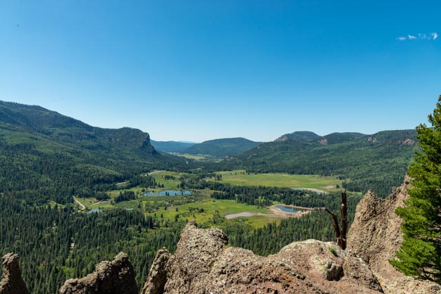
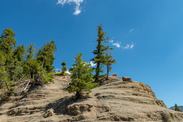
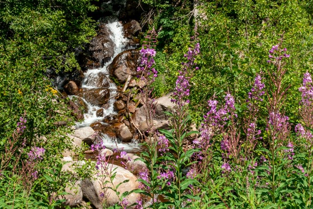
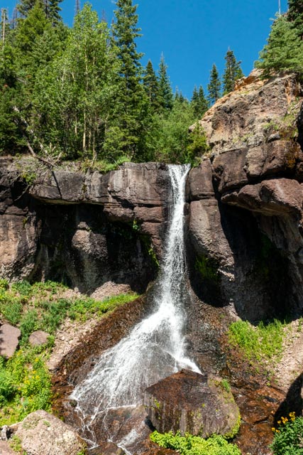
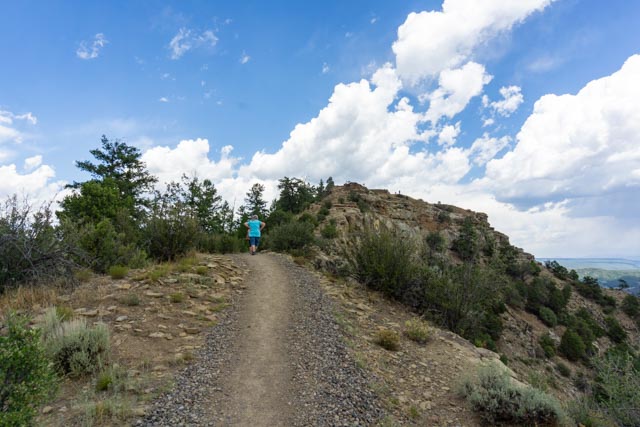
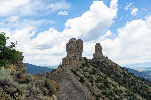
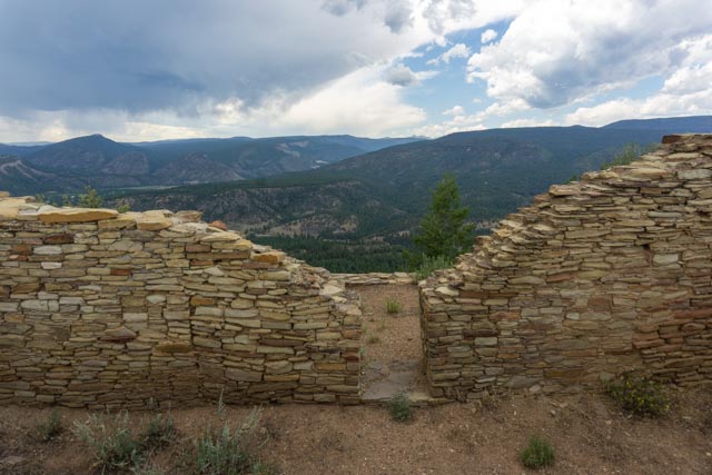
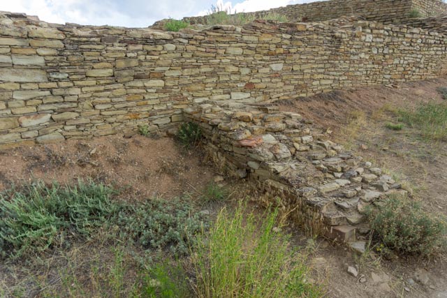
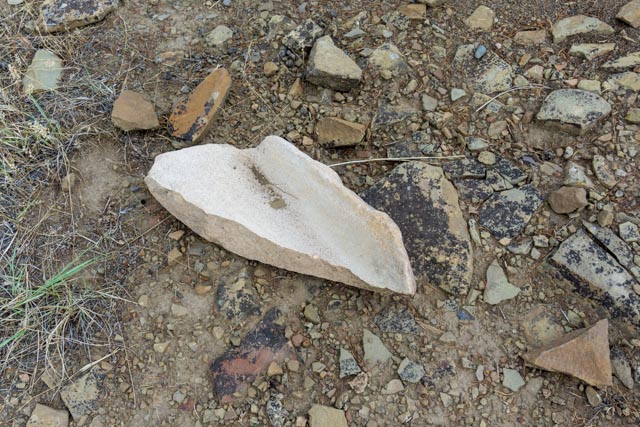
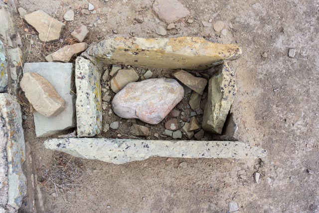
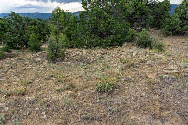
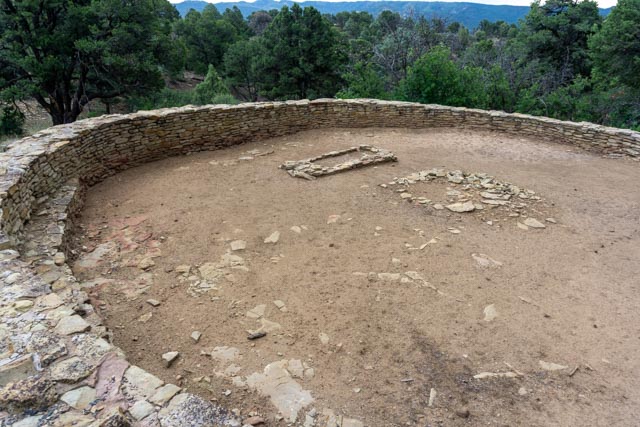
We drove up to Wolf Creek Pass (elevation 10,550 feet) and stopped at a couple of view points that we were unable to stop at with the motorhome. We stopped at a waterfall viewpoint but, being so early in the morning the snow had not started to melt so there was very little water dropping. We watched the chipmunks scamper about and talked with a couple from Austin, Texas. We drove on to this viewpoint which gave us a good view of the valley below. Pagosa Springs and our campground are located at the very upper end of this valley.This was the view of the hillside directly behind us at the parking area. This view is looking down the valley, through the crags. There were some people going around the fencing and trying to get out on the ledge to the right for a selfie. We chose not to hang around and watch the potential carnage. I had brought my bicycle along and decided to ride the highway down from the top of the pass, a distance of about eight miles with a 7% downhill grade.We stopped on the way up because I spotted this waterfall very near a emergency pullout. The wildflowers were in full bloom and the hillsides were beautiful.I climbed up a trail about 500 feet vertical and found this waterfall. I was glad to see fresh footprints as they indicated to me that others had made the climb. Unfortunately, crossing some fresh mud (looking out at the highway below), I noticed the footprints belonged to mountain goats. Oh well, the climb was worth it and the view was outstanding . Now I had to negotiate my way back down the very steep slope.Bicycling down the grade, I noticed these retaining walls. I have never seen walls so substantial and there were actually a couple of holes blown clear through! I made a couple of stops on the way down to photograph some small waterfalls but they were not really photo material.This is the valley that we saw from the viewpoint above. The mountain range in the background is the San Juans, with a height of mountains range up to 12,000 feet. There are some 14,000+ foot mountains in the range but they are not visible from here.After returning to camp for lunch we headed back out, stopping at the farmer’s market in Pagosa Springs. This dog caught our eye as she was laying there prim and proper with her back legs extended and her front legs crossed. She briefly uncrossed her front legs but quickly returned to this position.We then headed to the Chimney Rock National Monument, thirty miles out of town. We climbed the hill via the upper Great House Pueblo trail and enjoyed the views of the Piedra River Valley below.Our goal was to get as near as possible to the actual Chimney Rock. The trail up the hill was abut 2/3 of a mile in length but did have some elevation change, taking us to about 7,600 feet. We passed some previously excavated (and ruined) pit houses on the way up. These were excavated in 1921, before archaeologists really knew what preservation included.These are photos of the Great House, which overlooked the two kivas. Kivas were round, interior rooms that were built as ceremonial structures.In this kiva, you can see the intricate air ducts and ventilator shafts that made the interior comfortable in all types of weather.These rooms, attached to the kiva were probably used to store ritual items used in the ceremonies.The CCC built a Lookout Tower in 1940 for fire detection purposes. The tower was used until the mid 1950s and removed in 2010 so future lunar standstills would be visible from the main house. These very rare standstills, where the moon does not move much during its presence, occur every 18.6 years. The next standstill is probably going to occur in 2023. This Northern Major Lunar Standstill is visible between the two towers of rock. This community was part of a larger network with its hub at Chaco Canyon, nearly 100 miles southwest of here in New Mexico. People may have journeyed here to attend trade festivals, harvest local resources such as game animals, medicinal plants, clay for pottery, corn, timber, and other goods; and to participate in religious ceremonies centered around astronomical events.An ancient buttress is used to support the exterior wall.This is half of a stone used to grind corn and other foodstuffs. The women used a rock as a pedestal to grind the items into meal.This is a smaller version of the item above, but this was used to grind colored pebbles into a colored powder used to decorate pottery and other items.This is an untouched prehistoric pit house. There are hundreds of these located in the immediate area. Students are experimenting with ground penetrating sonar, similar to what we saw in Garden of the Gods, to look at a 3-D image of the structures without damaging the site. Unfortunately, this is a double-edged sword, without scientific excavation, there would be nothing for the museums and archaeologists to study.This Great Kiva was excavated in 1972 and measures 44 feet in diameter. Archaeologists refer to any kiva over 35 feet in diameter as “Great”. The structure in the middle may have been a fire pit but there is no evidence of a fire ever burning there. This kiva probably hosted social gatherings, meetings and religious ceremonies and is located on the lower Mesa Village trail.We were closely watched by these guys during our adventure at this site.
One of the highlights of this climb was getting to watch three peregrine falcons soar through the air above us. They nest in the stone pillars, first seen in 1974 and again in 1992 to recent. They were removed from the endangered species listing in 1999.