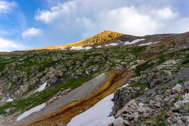
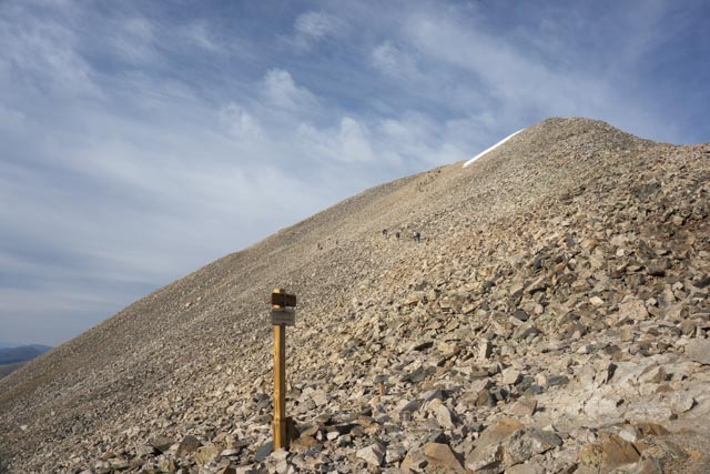
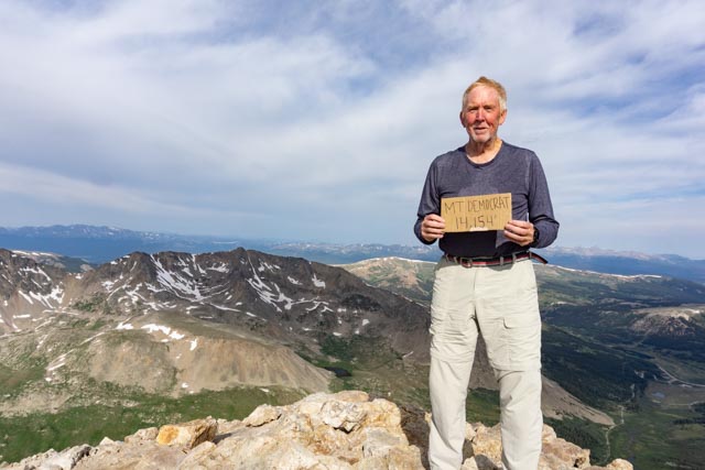
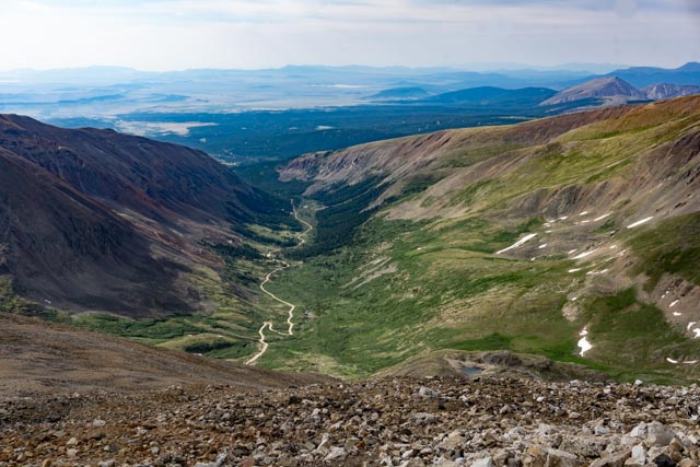
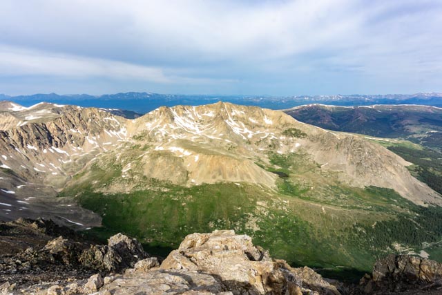
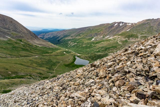
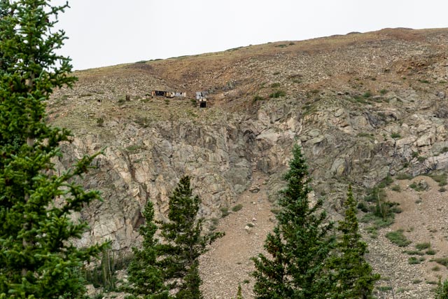
I left Manitou Springs at 3:00 AM and headed for the trailhead of Mount Democrat, near Alta. Driving the Manitou, I did not see another moving vehicle, it was a bit eerie. I drove about 85 miles on paved road, five miles on a dirt road and the final mile on a jeep road. I arrived and was ready to start my hike at 6:30; which was sunrise.Just as I left the meadow and started up the hill, this mine tailing came into view and the sun was starting to hit the mountain top.At times the trail above the saddle was a little hard to find. You just had to guess. Oh well, just another 2,000 feet vertical to go. The rocks appear grey here because the sun had not hit them yet. I ran into sunlight at 13,000 feet and realized I did not have my hat! I got just a little sunburned.When the sunlight hits the rocks they appear to change color. These are chunks of granite mixed with some iron ore. They were very sharp and I got a couple of cuts on my hands.I passed this mineshaft just as I reached the saddle. The area is riddled with gold mines, mining equipment and remnants of wooden structures.This is the view from the saddle, which joins Mount Democrat and Mount Cameron, Mount Lincoln and Mount Bross.After the saddle, the trail starts to get steeper.I had to cross a large scree field to get to the (false) summit. This can be treacherous.I made it to the top of this 14er in about two hours! Yes, that is sweat on by shirt from my pack, even in freezing weather.This is a look down at the trail coming up the canyon. The valley in the distance was completely dark when I passed through.This is the snowfield I had to traverse on the way to the top. It was located behind a false summit so it came as a surprise. I would say about 50% of the hikers did not go past the false summit. I find it hard to believe you can get within 200 feet vertical from the summit and not finish the drill.This is the view looking to the west from the summit.I stopped on the way down and took this photo of Kite Lake and the trailhead. You can see my truck parked at the skinny end of the lake (just kidding).This is all that remains of a mine I passed on the ascent. The gold tailings are in the background and the buildings were flattened by the snowfall. There were several communications poles with insulator possibilities but they had been picked clean. I looked just in case.This is a photo of Mount Democrat, with the trail in the foreground. This was well before the saddle where the trail turned to rock.This is the view approaching Kite Lake on the decent.I stopped to take a couple of photos of the mine buildings clinging to the sides of the mountains. I don’t know how these building have not slid down the mountain. They are about 500 feet above the valley floor.
I had to stop in the town of Alma on the way back and arrange to pay for parking at the trailhead. I traveled the 90 miles from camp without cash and found that there was a $5.00 parking fee at Kite Lake. I left a note in the pay slot and was not ticketed like many others, but stopped at City Hall to arrange payment. The two ladies working there were very surprised that someone would actually volunteer to pay. Apparently they get stiffed regularly. We wrote a check and placed it in the mail when I returned to camp.With the inclusion of Democrat, I have finished all six of the 14,000 foot mountains in this range.
Glad you called from this one! Personally, I didn’t see that it was a hike for anything but exercise. I guess I really hate walking on rocks! Glad you did it and that it’s checked off the list!!!


Glad you called from this one! Personally, I didn’t see that it was a hike for anything but exercise. I guess I really hate walking on rocks! Glad you did it and that it’s checked off the list!!!
LikeLike