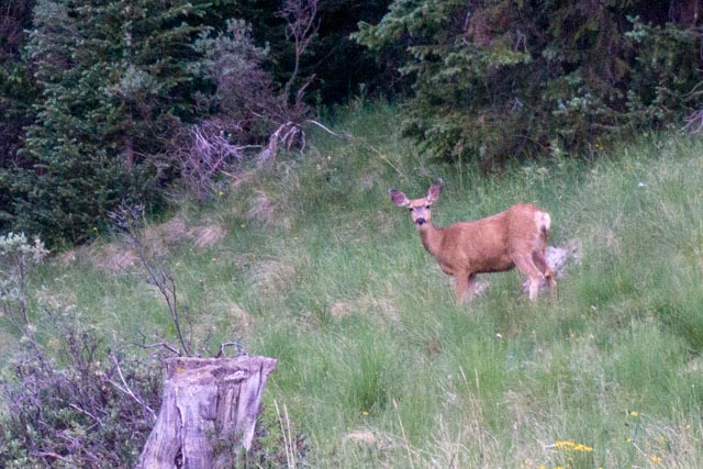
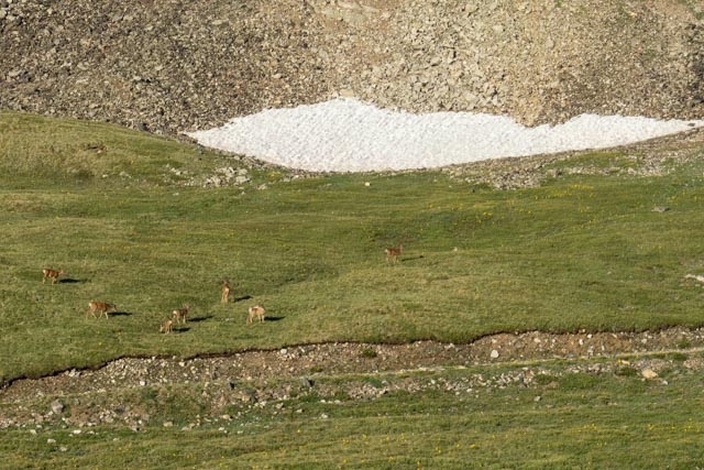
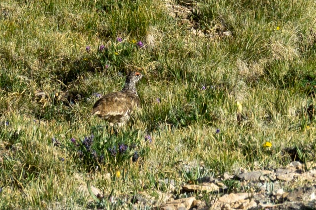
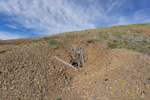
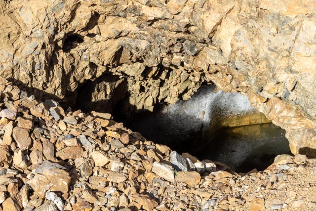
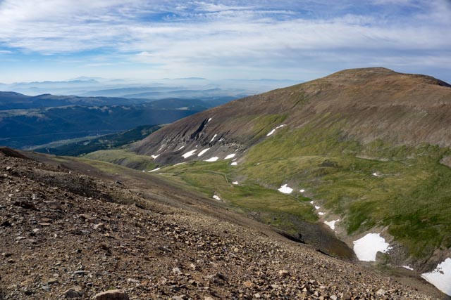
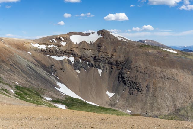
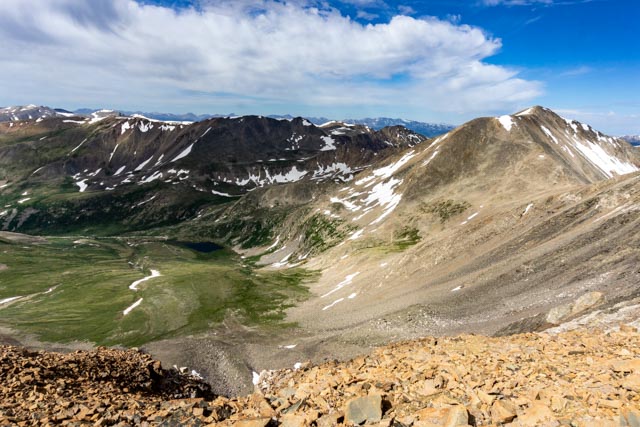
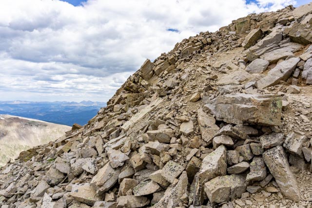
I drove to Alto, leaving camp at 4:30 AM to be at the trailhead around sunrise. I met this guy as I started up Crest Drive toward the lower two-wheel drive trailhead.I continued past the two-wheel drive trailhead for another 1.9 miles; very rough miles, very SLOW miles, with the truck in four-wheel drive low and the locker on. It still bounced and slid around a bit. By “SLOW”, I mean over an hour to make the trip!Once I parked the truck (there was plenty of room as I was the only one there), I proceeded up the mountain. I picked out this white-tailed ptarmigan in the grass.I passed several abandoned mines. This one had a vertical shaft.This one filled with water and was frozen.This one had a horizontal shaft.Looking back down the mountain, it appears there is really no “trail” which actually was the case. It was cross country to the top!I had to cross these snow fields to reach the top. They were deep and dangerous. I had to find another way.Looking back, you can see the truck at the “Y” in the road. Really! That is Mt. Bross directly across the Cameron Amphitheater.This is official marker at the top of Mt. Lincoln.Looking across Platte Gulch, Wheeler Lake is in view, behind it is a frozen unnamed lake. Wheeler lake is at 12,167 feet. You can hear the water roaring down the cascades at Wheeler from the top of Lincoln.This is the top of the scree field I climbed to reach the top of Lincoln. Snow covered what was a trail and forced me to go the Class Two route.The scree field pictured is located between the two largest snow fields visible here, at the very top of Lincoln. A slip could take you to the valley floor below.This is the regularly traveled trail leading down from Mt. Lincoln to Mt. Cameron, Mt. Bross and Mt. Democrat.Here is 14,148′ Mt. Democrat (to the right), 12,040′ Kite Lake (center left) and the Mt. Democrat trail. You can make out the switchbacks in the Class Two trail leading to the top of this mountain.I took a selfie on top of 14,172′ Mt. Bross. It was suddenly getting very cold and hail, sleet and snow began falling with 40+ MPH winds.This the view of Mt. Cameron from Mt. Bross. I continued to enjoy the winter weather on the 1.5 mile trek to Mt. Cameron.I found this cardboard sign and shared it with a student from Philadelphia. We took each other’s pictures.Now, I was looking towards Mt. Lincoln, again. Because I did not use common sense when I parked, I wound up climbing this mountain twice, using both the Class One route and the Class Two route. I guess I needed the exercise.Yep, I am still wearing my windbreaker.This is the easier, Class One trail up the mountain.I spent some time trying to figure out how I was going to get back to the truck without using the more difficult route. I found a game trail on the backside of the mountain and it kind of met up with another game trail then kind of met up with a track to the bottom. It had to be better than the scree field. I made it back to the truck in about 1.5 hours; hail, sleet, snow and now rain all the way. Going cross country without a trail increased the 6.6 mile projected climb to well over 8 miles! The line along the mountains in the background is Highway 9 heading to Breckenridge, about 10 miles north of here.I stopped in Alta to make a call and noticed this sign on a pot shop.
I finally “got” the pot sign that you mentioned! Funny. I hope you are finished with these climbs because those rocks look nasty. I never liked rocks or lava. Rocks hurt more mid you skip though!! Like your photography!
I finally “got” the pot sign that you mentioned! Funny. I hope you are finished with these climbs because those rocks look nasty. I never liked rocks or lava. Rocks hurt more mid you skip though!! Like your photography!


I finally “got” the pot sign that you mentioned! Funny. I hope you are finished with these climbs because those rocks look nasty. I never liked rocks or lava. Rocks hurt more mid you skip though!! Like your photography!
LikeLike
I finally “got” the pot sign that you mentioned! Funny. I hope you are finished with these climbs because those rocks look nasty. I never liked rocks or lava. Rocks hurt more mid you skip though!! Like your photography!
LikeLike