We took a ride on the Gunnella Pass Road to Mt. Bierdstadt trailhead this morning (leaving camp at 5:30 AM or so) and found this hike elevation profile at the trailhead.
Cathy and Jason decided not to make the climb. It was windy, cold and very, very rocky. They made a shorter hike on a nearby trail and hung out around the truck. Jason brought a “project” bag with things to do and Cathy brought a good book to read.
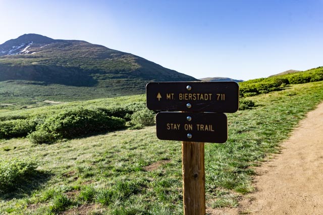
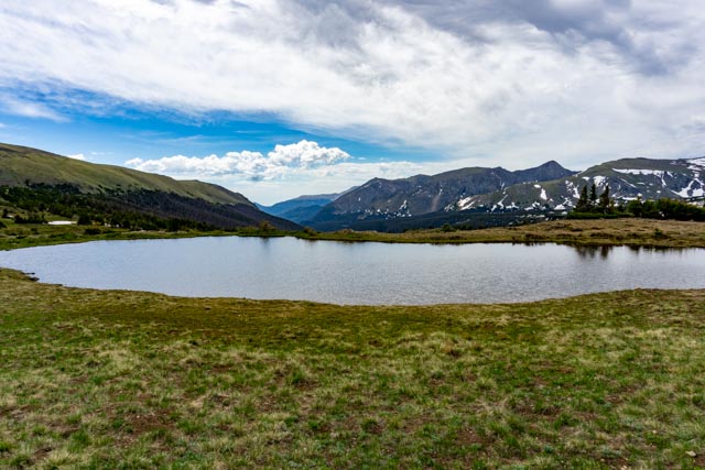
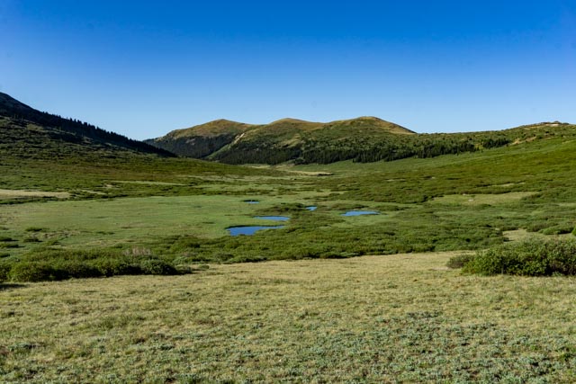
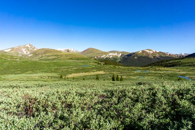
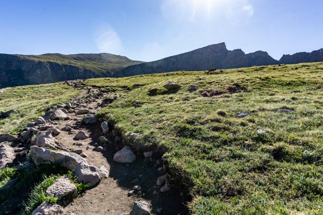
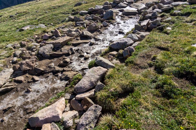
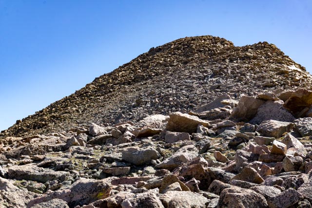
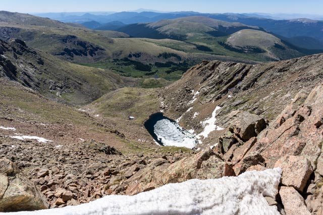
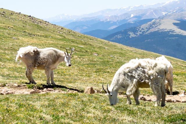
This marker directed hikers to the trail.Initially the trail crosses several marsh areas so these walkways were built to protect the fragile undergrowth.This is an unnamed pond located trailside on the way up the mountain.About a mile into the hike we had to cross this stream. There was no bridge so we had to use rocks which were wet and unstable. Some hikers got very wet crossing here. The air temperature at the trailhead was 37 degrees and the wind was furious. It was pretty cold and I actually wore a jacket the entire hike.Here is look back at the valley I had just climbed through. The entire hike was above tree-line! The trailhead, trail and parked cars have disappeared into the distance. The glacier-caused lakes were a stunning shade of blue.I took another look back at the valley I had climbed through. I wound my way through the brush on a well marked trail, remembering to always take the uphill fork.This is a look forward at the trail going uphill, steeply. We were about two miles from the summit at this point. The mountain is to the right of this photo, with the “Sawtooth” is at the extreme right.Due to the cold temperatures, the trail had frozen and wherever there was a water source, it was frozen. Most of the hikers went off trail to avoid the ice and never regained the trail. I later found out the trail had entered a rock field here and there is no “trail”.It looked easy-peezy from the trailhead but looks were certainly deceiving. The last mile was very difficult, at least for me. There was about a half-mile of scrambling and bouldering over jagged rocks just to reach the base. Once we reached the base, the fun began. This is the trail (or lack of). It was everyone for him/herself and bouldering was the name of the game. Sometimes you would jump rocks only to find there was no outlet and had to backtrack. I wound up going up near the snow line (visible in the upper left of the boulder field). It took me over an hour to ascend the last half-mile to the summit.I ascended the boulder field mostly along the line on snow seen in this photo. If you actually got into the snow, you would slide hundreds of feet to a jagged rock pile at the bottom of the canyon. I took a different route back down the mountain!This is a small pond that is located at the backside base of Mt. Bierdstadt. It is just coming out of the winter freeze. I located the U.S. Geological Survey Marker and photographed it. A couple saw me taking the photo and the young lady insisted that her boyfriend take a similar photo. I took a couple of pictures of them with their phone and they took this photo of me.This guy joined me for lunch on top of the mountain. He came running as soon as I opened a bag of jerky.On the way down the mountain we came across five mountain goats (three in the photo).It must be me because one always tends to single me out for a stare-down.Luckily, a couple of hikers were coming up the trail and the goats’ attention was diverted. I quickly made my way around them, giving them plenty of room.Sorry for the political rant. The government, in their wisdom has closed the only road to Mt. Evans, conveniently after the general store which sells souvenirs amongst other things. They are receiving NO revenue from the tourists in the prime tourist season while channeling the hikers and climbers to Mt. Bierstadt, which is actually joined with Evans by a wall called the Sawtooth. The Sawtooth is a Class 3 endeavor and there are very few who will attempt it.This mileage sign is located in the roadway just past the closure gates. The government has now made a Mt. Evans climb a 23.4 mile hike. IF they would open the road to Summit lake, they could both collect revenue for the summer AND allow climbers or hikers the opportunity to scale 14,000+ ft Mt Evans with a 5.4 mile hike (RT) from the Summit Lake trailhead. I guess I don’t understand the reasoning unless it is designed to punish someone.On the way home from our climb we happened upon this fire on the interstate. It closed all lanes and the emergency equipment had not arrived as this photo was taken. Eventually three fire and rescue trucks. It was comical how the people in the cars acted, including the Audi in front of us trying to block the shoulder as fire equipment was arriving.