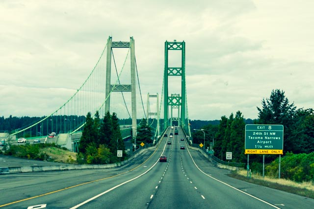
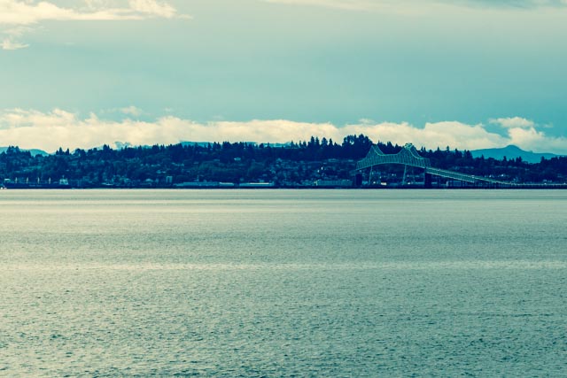
After leaving the Whidbey area north of Seattle, we headed south on I 5 to WA 16 which took us across the Tacoma Narrows Bridge. I took this shot from the driver’s seat, through the windshield, which had a few suicide bugs attached. There are some great scenes of this bridge coming apart in high winds on video but I believe the problem has been fixed long ago.
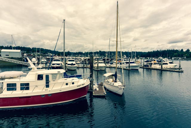
We stopped for an early lunch at Gig Harbor after searching a bit for a parking space. Parking can be challenging when you are over 65 feet long! This is the small boat docking at Gig Harbor.
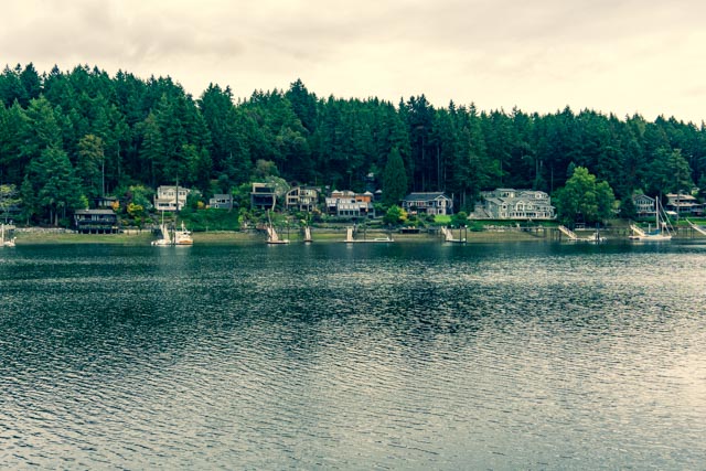
Looking across, we could see some of the homes we are researching for a summer home. NOT!
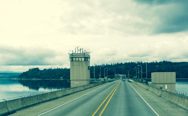
After lunch and a walk around town, we continued on, crossing Hood Canal. How often do you see a bridge with a radar station?
We stopped for a short visit at the S’Klallam Tribal Center near Sequim. There were many wood carvings, a Native Art shop, and a lodge that could be approached through a tunnel under the highway.
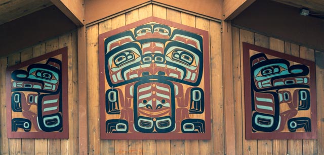
We found a couple of the totems interesting.


The passageway under the highway (notice the elaborate carving just above the entranceway) and the path on the other side lead to the lodge.
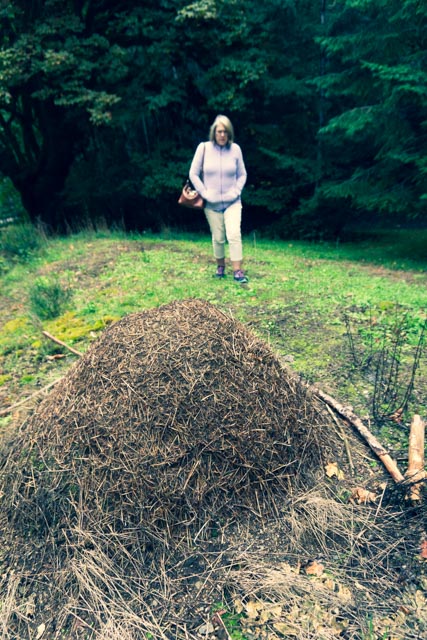
We noticed these large mounds roadside for several miles so of course, when we found the room to park, I had to investigate. They were giant anthills, some six feet tall. We approached this small one and it was a moving scene. I just had to poke this hill with a (very long) stick and stir the little buggers up. We left the scene very quickly!
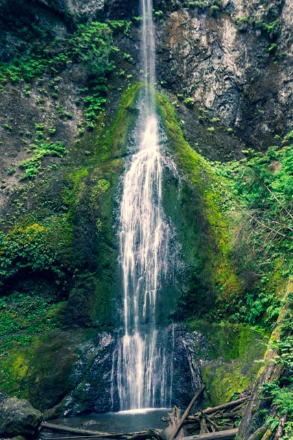
We spent the evening just outside of Port Angeles. We made a short drive into the Olympic National Park at Storm King. After visiting the Ranger Station to get our bearings, we decided to hike up Barnes Creek to Marymere Falls. I watched the water, hoping to see trout but couldn’t see anything along the way.
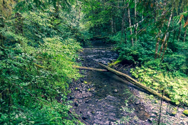
This was our first crossing of Barnes Creek. Our second crossing was via a log that had been flattened on one side with hand railing attached.


Our destination was Marymere Falls.
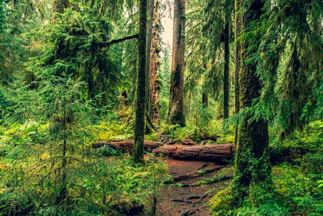
Some of the trees in this section of rain forest were extremely large.
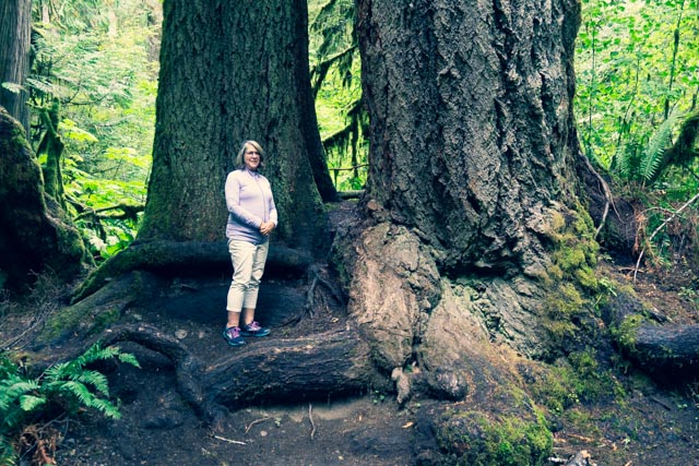
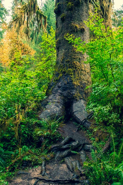
This intricate root system was at the base of this 12 foot diameter, 200+ foot tree.
We took a different trail on the return, heading towards the lodge at Crescent lake. We spotted this buck in the woods and spent a couple of minutes watching him forage through the brush.
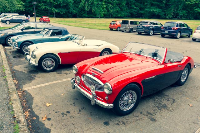
Arriving at the lodge, I spotted these three Triumphs, one each in red, white and blue in the parking lot!
We entered Lake Crescent Lodge, located on Lake Crescent.
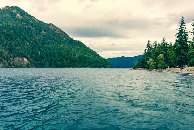
This is the view of Lake Crescent as seen from the loading dock at the lodge.
We still had some time and daylight left so we continued on to the Sol Duc Hot Springs area. We were following the Sol Duc River up the canyon to the hot springs and stopped to watch some spawning salmon navigate the Salmon Cascades rapids heading upstream.
The Lodge at Sol Duc was a destination for the hot springs visitors.
In the morning we decided to take the scenic route to the Hoh Rain Forest. This led us through Joyce, Lyre River and Pysht, before rejoining US 101 in Sappho. The total population of all these four towns together could not be more than 100.
After a 30 mile drive into the hot springs, we visited the Ranger Station then took one of the many trails through the forest. The greenery was amazing, the water in these shots was probably about four feet deep, under the blanket of green growth.
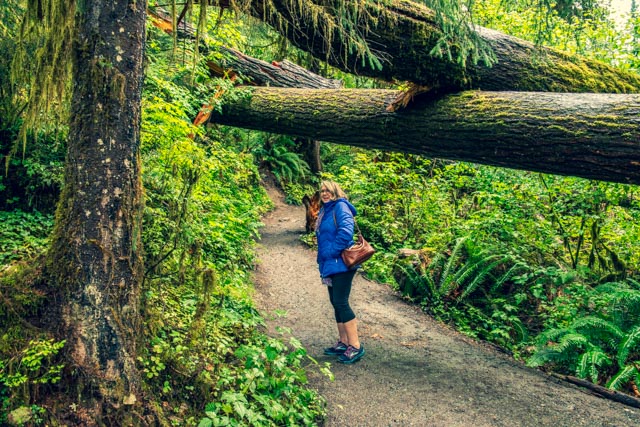
Cathy walked under a recent fallen log.
What would a rain forest be without the slugs? I saw this banana slug and its black partner trailside. They are about four inches long.
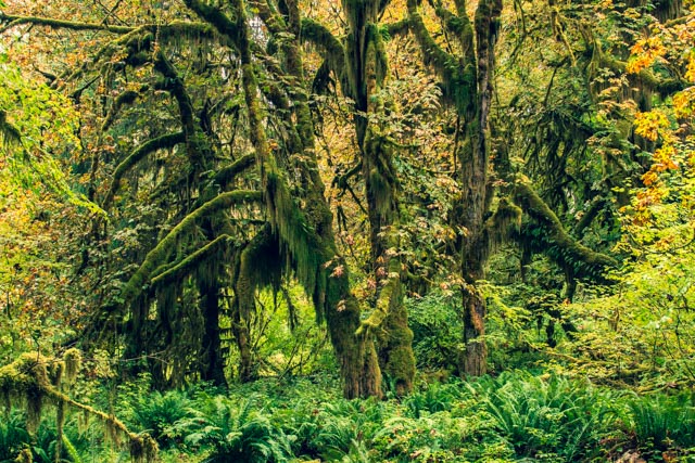
I took some more random shots of the rainforest.
There was a massive, ten foot diameter tree!
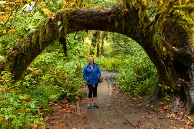
Cathy walked through a “natural” archway.
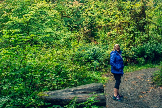
Cathy posed trailside in the lush forest.
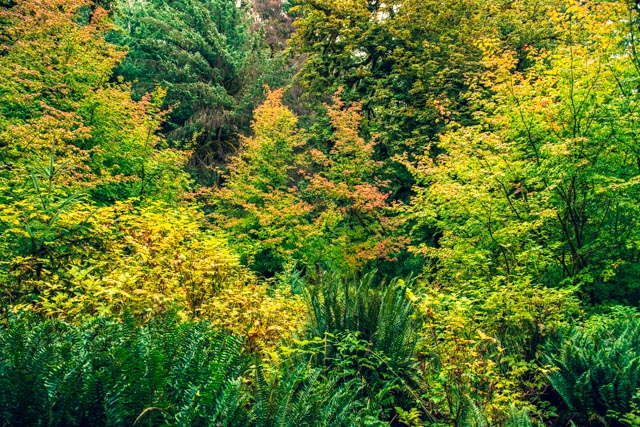
Some of the fall colors are popping out amongst the greenery.
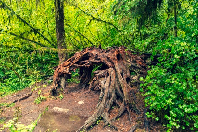
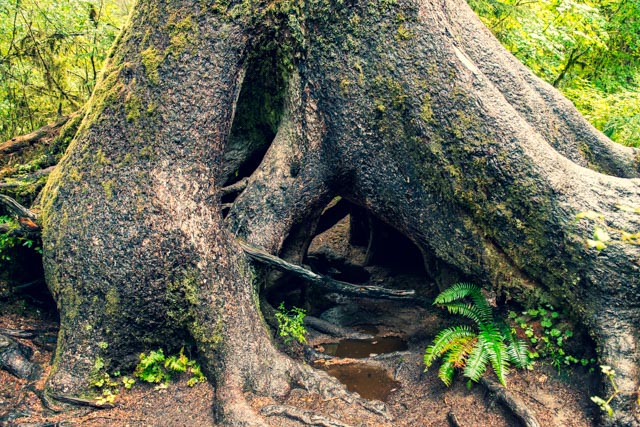
This giant tree has a space large enough to hide in amongst the root system.
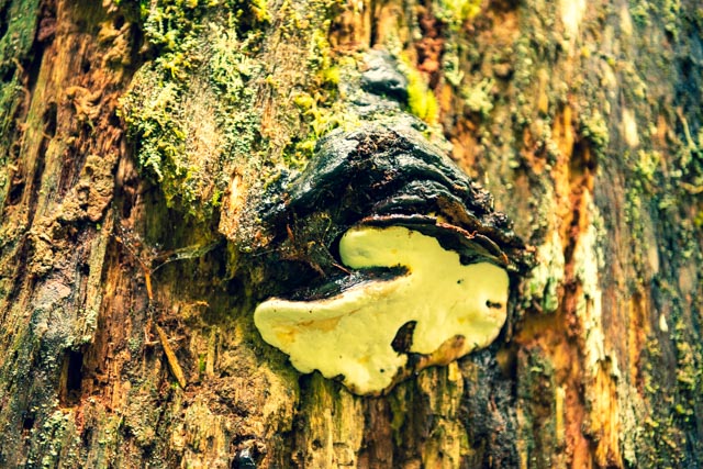
These giant mushroom type things were attached and growing on the sides of several of the larger trees.
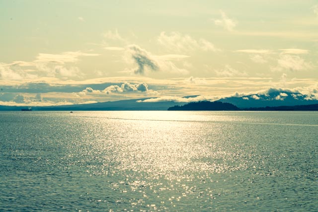
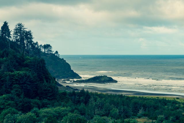
Leaving the rainforest, we continued towards Astoria through the famous towns of Humptulips, Cosmopolis, Nemah and Naselle, obviously taking the relative backroads. We stopped along the Washington side of the Columbia river near Megler to take in our first views of the river and of Astoria
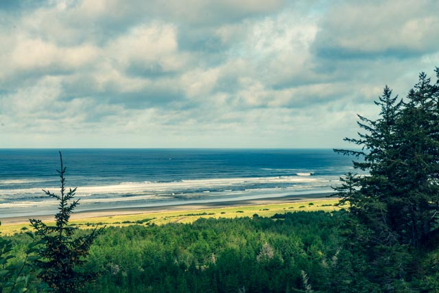
We were early so we continued on, passing the bridge entrance, to Cape Disappointment State Park and the town of Chinook. This is the view of the Pacific Ocean, just ouside of the mouth of the Columbia River.
We are spending a couple of days in Astoria at the Lewis & Clark RV Park. We are facing the woods, alongside a creek full of mallards. It is very beautiful here and the location makes for a great hub for our wandering.
We watched this pilot boat maneuver a container ship up stream on the river. While the river is extremely wide here, there are some pretty mean currents and sandbars to avoid.

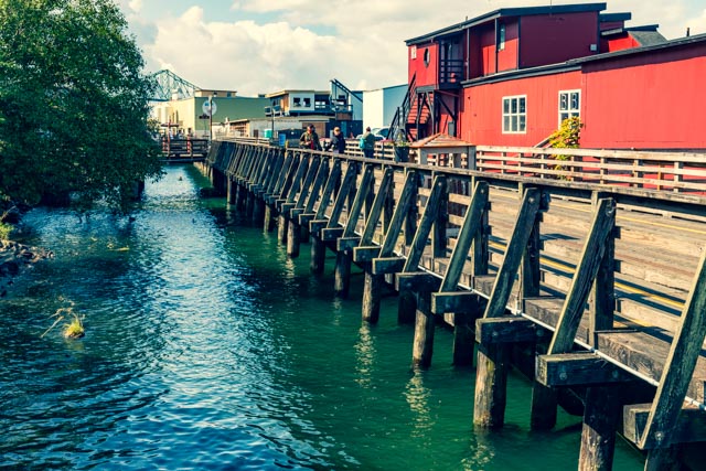
This is part of the downtown of Astoria. They are in the process of renovating this old dock. An electric trolly provides transportation from near the bridge in the distance to the center of town. Because the electrical lines have been remove some time in the past, the electric trolly pushes a second car containing a large generator, similar to a coal car on the steam engines.
The weather was beautiful so we went north to the town of Long Beach (mainly to visit a recommended bakery) and wound up on the beach. There were plenty of the gulls flying around, including this lazy one riding of the top of a car. We sensed this could be fun so we went back into town, bought a box of saltines and returned. They were literally eating the crackers out of my hand.
A sudden squall cut the fun short; you can see the waves being blown skyward an a couple of the shots below.
