After leaving Cassiar Highway, we headed due west to the town of Prince Rupert. This is the fishing harbor. Prince Rupert is a neat port city of about 12,500 in the North Coast rainforest. Located in the center of territory claimed by the Tsimshian First Nation, this region was one of North America’s most densely populated areas long before European explorers arrived. Both the British and Americans set up posts to trade sea otter pelts and wild salmon. The salmon sustained the Tsimshian for more than 10,000 years and drew the attention of dozens of salmon canneries in the 1800s. In the early 1900s, the Grand Trunk Railway selected the area as its Pacific terminus and the city of Prince Rupert was incorporated in 1910.

Cathy enjoyed the sunshine.

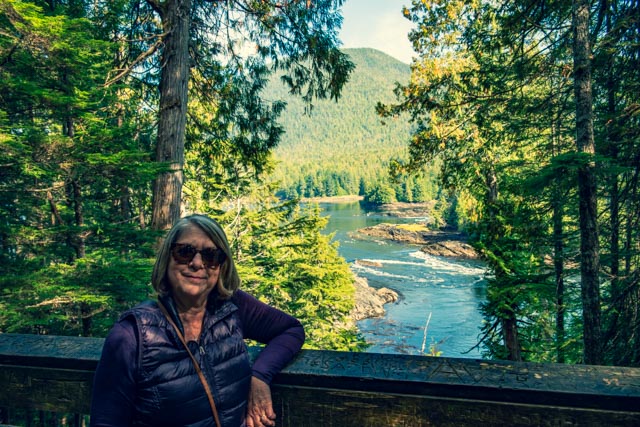
We took off in the morning to visit a site recommended to us by a young lady in the visitor center. We hiked to Butze Rapids, following a very nice, heavily wooded and sometimes steep trail from the trailhead to the viewpoint.

The vegetation varied from open and sunny (as in the picture above) to dark and dense as in this shot.

Cathy spotted this near the trail on the way down and we took this shot on the way back. The ‘shroom was pretty neat!

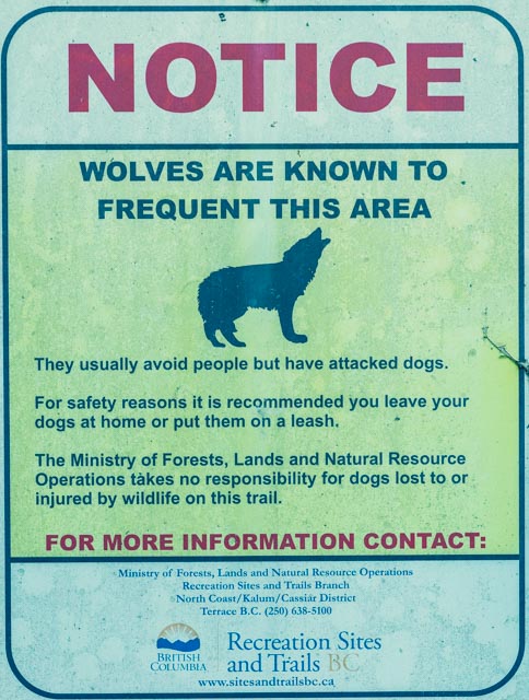
We saw this signage on the trail. I don’t ever remember seeing a “Wolf” warning sign being posted, anywhere. Normally you have little to no chance of seeing one of these guys. We unfortunately did not.
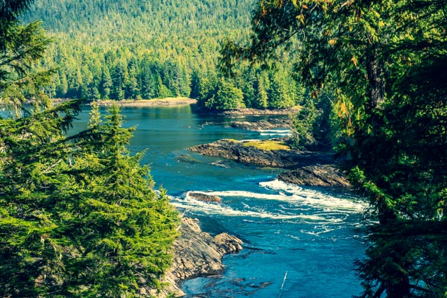
When we finally got to the viewpoint, the water was flowing right to left. The water flow at this point is driven by tides. Notice the little rock outcropping in the center of the waterway below.

As the water was still receding, we decided to hike on, find a place to have lunch and return a little later to see the water change direction. I took this photo of Cathy on the viewpoint, about an hour after the first shot. The water is now rushing in, from left to right.
Before we decided to make the climb out of the canyon, the water was roaring in, with the rock outcropping soon to be completely submerged.
Kayakers use this area to shoot the rapids using the current to propel them. Unfortunately, sometimes they get in trouble. We watched as a search and rescue plane continued circling the area for about an hour, then saw this Coast Guard rescue boat go inland and about an hour later come out of the estuary. We never did find out if the person they were looking for was found.


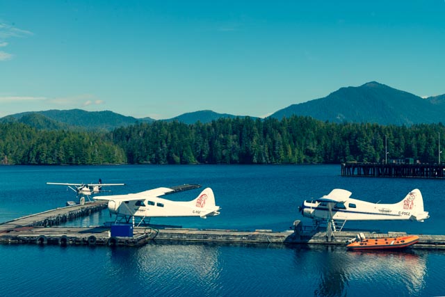
After coming out of the canyon and stopping by the visitor center to thank the young lady for directing us to the rapids, we continued to explore the area. This is the seaplane base at Seal Cove. No, we did not see any seals.
We hiked behind the town’s fish hatchery and came across this neat waterfall. The hatchery was closed as it was late in the afternoon.

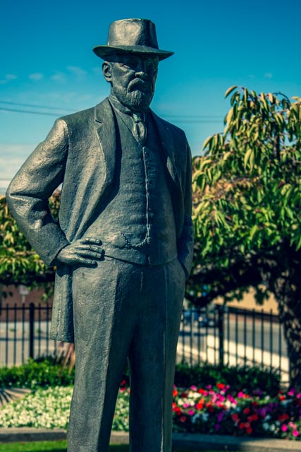
This is the statue of Charles Melville Hays, deemed the founder of Prince Rupert. He was the general manager of the Grand Truck Pacific Railroad in 1896 and became its president in 1902.
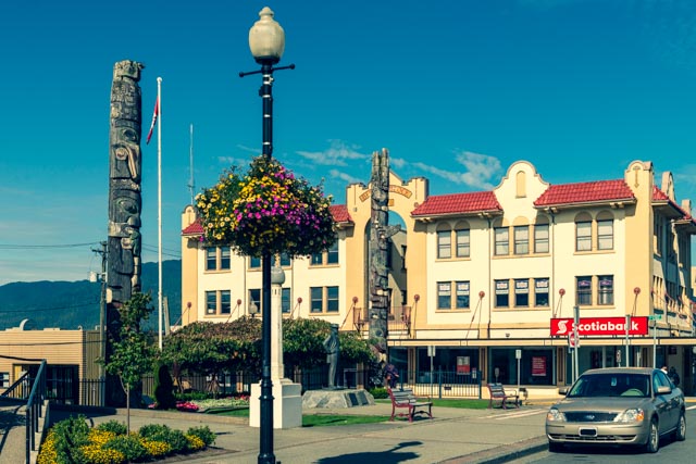
The city hall building was adorned by First Nations symbols in its architecture.

These two totem, located at the city hall building are of Haida origin. The Haida came from Haida Gwaii (formally the Queen Charlotte Islands).
Here is a closer view of the totems.
We spotted a couple of these black-tailed or mule deer walking about in relatively downtown Prince Rupert. We saw them again as we drove out of town in the morning.

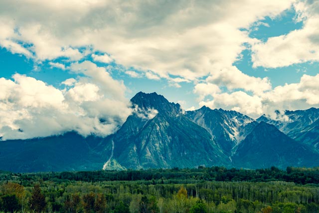
Leaving Prince Rupert, headed inland to the Hazeltons area, we traveled along the Skeena River and managed to pull off the highway to photograph the sunrise, mountains and fog rolling in.
We spent two nights in the Hazeltons area, home of the Gitxsan and Wet’suwet’en First Nations peoples for over 6,000 years. Our campground was located adjacent to the “Ksan” Historical Village and Museum.
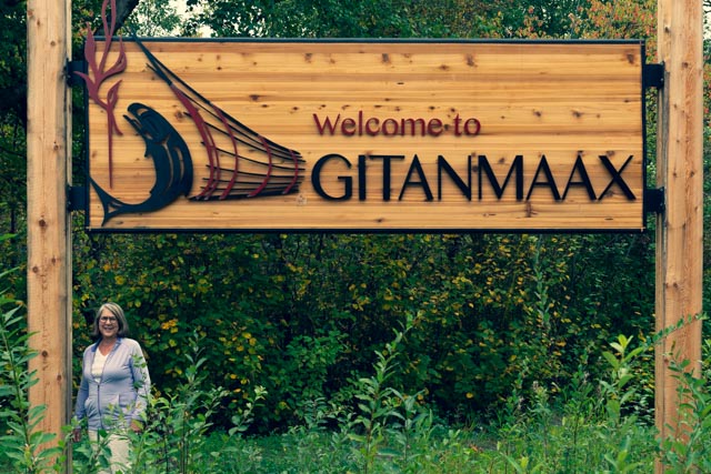
This is the recently renovated Salvation Army Church, located in Gitanmaxx.

We crossed the Hagwilget Suspension Bridge (one truck at a time), 262 feet above the Buckley River. This is a very narrow one-lane bridge.

I managed to dodge several logging trucks to get a couple of shots of the river below.
Cathy and I took a side trip to the Gitwangak Battle Hill National Historic Site. This site commemorates the struggle of Battle Hill, a fortified village occupied by the Gitwangak First Nation in the late 1700s and early 1800s. The fort was strategically located atop a hill with views of the valley and river. Gitwangak warriors would roll logs down the hill to stop attackers.

Cathy is on top of Battle Hill.

Below are a few of the wildflowers blooming on the top of Battle Hill.
This is the view of the river below the fortifications.

It was a bit of a climb up to the top of the hill. We counted 270 steps.
We spotted these totems “returning to the earth” in a field near Gitwangak, on the return from the Battle Hill.

There were several totems still standing in the town. We walked around a bit to take some photographs. There are over 50 standing totems in the immediate area.

Returning to camp, we photographed this totem at the Ksan entrance.

The Rocher de Boule Range was located directly behind the campground, with the 8,000 foot Hagwilget Peak clearly visible.