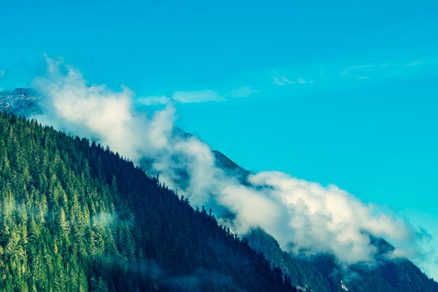
Leaving Palmer early in the morning, we headed (via the Glen Highway) towards Glennallen. After passing through Palmer, we saw our first surprise for the day, a moose calmly munching leaves near the town of Sutton. We slowed but did not stop, and continued up to the Matanuska Glacier and Eureka Summit. We stopped for road construction and when we started up again, we watched a lynx calmly cross the road directly in front of us. Then he/she stopped and began to return across the road again. To keep the cat from crossing the highway again, I sounded the air horn and he/she turned and trotted off into the bush. We managed to spot a second moose standing in a roadside pond just outside of the construction zone. We stopped once over the summit and took a couple of parting shots of the Chugach Mountains.


We traveled most of the day, through Tok and crossing into Canada at Beaver Creek. We set up a dry camp near Destruction Bay, alongside this little pond. It had a great view and the price was right. In the morning we continued through Destruction Bay and watched a grizzly bear cross the road in front of us. We pulled over and he walked right beside our motorhome. Real up close and personal!

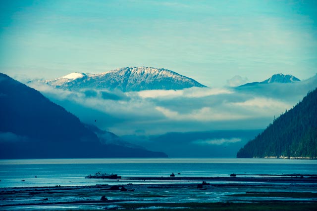
We pulled into a campsite (actually a turnout) bordering Blue Lakes, about 17 miles down the Cassiar Highway. We were a day ahead of schedule, so we moved to Watson Lake, back o the Alaska Highway for the next evening. Cathy photographed a red fox who was returning to her brood with a bird in her mouth.

The next morning, we met my sisters at the junction of the Alaska Highway and the Cassiar Highway, where we fueled up and began our 450 mile ride to Kitwanga on the Yellowhead Highway.
At Milepost 75.2 we stopped at Jade City. Jade City is not really a city but a business that specializes in jade products. Most of their product line is shipped overseas but they maintain a relatively large jade shop on site.

We spent a few minutes going through the shop and I took a couple of photos outside. Of course, I gravitated towards the machinery and spent some time with the jade cutters. The photo below is an example of the size fo the raw jade boulders that are mined here.

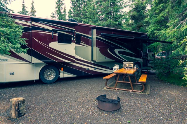
At Milepost 223 we pulled into Kinaskan Lake Provincial Park and found this campsite on Kinaskan Lake.
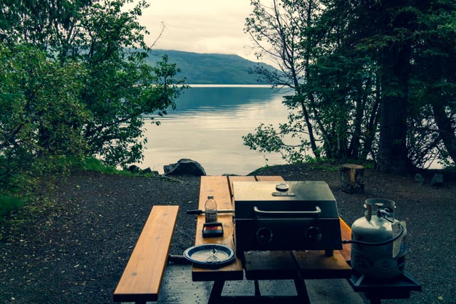
The lake was clear and beautiful, as viewed from our campsite.

This is our campsite as viewed from the lakeside.
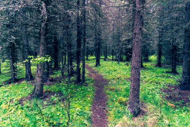
This is an example of the trails that lead through the heavily wooded area next to our camp. These sites were pretty secluded.
In the morning, we continued down the Cassiar, dodging bears (four) and made a stop at Bell 2. Bell 2 is north of Meziadian Junction, where Cassiar crosses the Bell-Irving River. It is a world-renowned heli-skiing operation in the winter months. It also has cabin rentals (turf covered no less), a lodge, restaurant, store and RV park. We learned that five helicopters operate here, delivering skiers to the thousand marked powder runs in the nearby mountains.
We left the Cassiar Highway and detoured about 40 miles down the Stewart-Hyder Access Road (Highway 37A, aka the Glacier Highway) to the border town of Stewart and set up our motorhomes before making a quick trip into town. Stewart sits at the head of Portland Canal, a steep, narrow ocean fjord that forms the boundary between British Columbia and Alaska. The current population is listed at about 500. In the 1920s the population in this area was over 10,000, with most people working the enormous and fabulously rich Premier gold and silver mine, the Big Missouri Mine and the Riverside Mine.
This is the entrance to the hotel and restaurant combination where we ate breakfast .

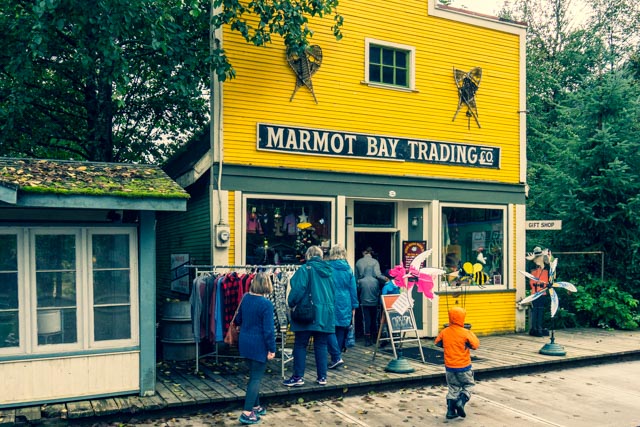
Cathy, Myrna and Barbara window shopped at the Marmot Bay Trading Company.
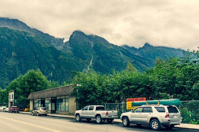
Across the street is a grocery store (mansard roof building) and the other two-story grocery store, with a bakery in the distance.
Cathy met this trooper and “got her picture made”. Lucky for her, as his head was knocked off by children the next day and is in for repairs.

We crossed the border into Hyder, Alaska in the morning. This is the signage that hangs over the road at the international border. Hyder is located about three kilometers from Stewart and sports a year-round population of about 60. Hyder is known as a destination for grizzly and black bear viewing during salmon spawning at the Fish Creek Wildlife Observation Site. We visited the site several times and never spotted a critter creekside. We did spot several black bears roadside on the way in to the site, on the return and on the way to view the glaciers.
The actual US-Canadian border, which zig-zags a little at the border. The stone building is known as storehouse #4, the Eagle Point Storehouse, and is Alaska’s first masonry building. It is located in Hyder, Alaska, just across the Canadian border. Hyder is the easternmost community in Alaska, located just across the mountains from Ketchikan.
 The This US border station was closed durning the Carter administration. The only checkpoint is when you return into Canada. There is virtually no law enforcement in Hyder (as a local resident told us “they don’t need it”). The RCMP was recently forbidden to cross the border to assist. There are no schools, no grocery stores but the US Post Office received mail for many Canadian citizens to enable quicker service.

Here is another attempt at a “selfie”. Hmmm

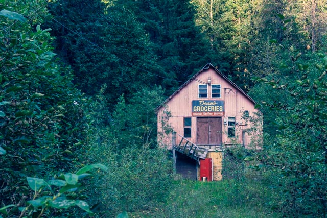
There is evidence of a past grocery store,
and other abandoned buildings.

This view is from the Seafood Express, the bus diner down the road towards the Canadian border. We had a late lunch here. The entire restaurant is made from an old transportation bus and the outdoor seating utilizes repurposed bus seats. The owners catch the fish and cook the fish, so whatever they are catching is what you will find on the menu.

The sun was beginning to set and the fog was coming in, making for some unique photo opportunities.
We looked back into the townsite of Hyder from the dock.

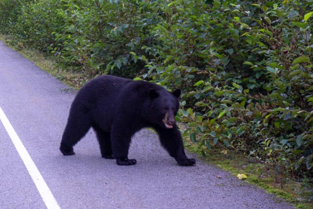
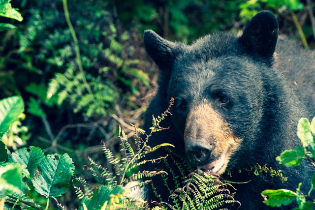
We photographed this fellow through the windshield (safe).

And this bear, we photographed through an open side window (not so safe).
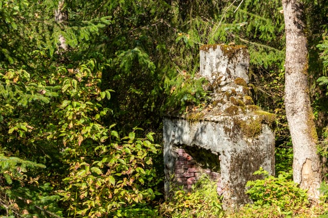
We spotted this chimney, apparently the remains of a cabin or lodge alongside Fish Creek, near the bear viewing area. I attempted to find out what it was but could not find any information from the local historians at the museum.
We spotted this bear scratching itself on a nearby power pole. He is giving us the stare down.

In the evening, three of us went for a short walk along the Estuary Boardwalk located adjacent to the Visitor Center. There were information boards explaining the flora and fauna along the way. I kind of like the photo of the small tree growth on the fallen tree. There were the remains of spawning salmon in this small waterway.

Beautiful
Sent from Yahoo Mail for iPhone
LikeLike
Thanks for the kind comments
LikeLike