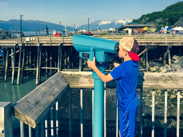
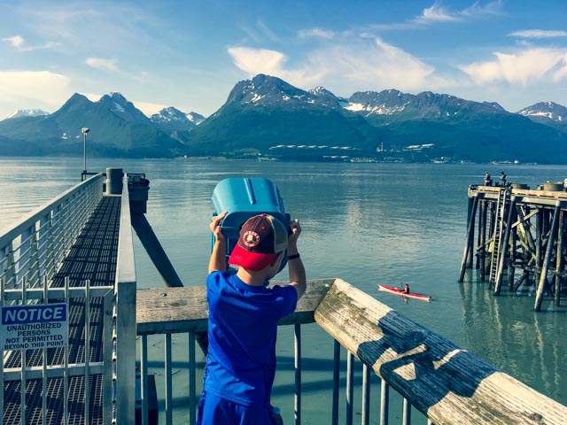
We are working with three cameras: my traditional 35mm, my mirrorless and Cathy’s I-Phone. I left these images off of the last posts not realizing that I failed to download them in a timely fashion. We arrived at the Uncle Salmon 4th of July 5K in Valdez a little early, so after picking up our numbers, we walked over to the wharf to see some of the booths that were being set up for the day’s activities. Jason, in race regalia, took a peek at the Alaskan Pipeline oil storage facilities across Prince William Sound. We plan on fishing just to the left of the storage facility that evening.
We asked another couple to take this group photo. The scenery was incredible during the run, the race temperature remained at around 65 degrees and there was no wind. I HATE wind. The course was outstanding and relatively flat, crossing the Mineral Creek River before doubling back to the finish in downtown. The incredible Chugach Mountains, the tallest coastal mountains in North America, rise from the sea to an elevation of 7,000 feet; they dominate the background.

After finishing, Jason went back to run in with Cathy. He is breaking away to avoid crossing the finish line again.

After relaxing the rest of the afternoon we went fishing the next morning. Bald eagles were flying overhead and perching on the pilings, and the Steller sea lions were in force, hunting the salmon, catching and downing them in one gulp. These sea lions are the largest of all sea lions and can weigh up to 1,245 pounds. There were about a dozen of these huge guys serenading us and swimming close by all morning. They sounded a lot like jet skies.
Here I am carrying about 60 pounds of salmon back up the rocks to our truck. Jason was the smart one, leave them for me to haul up the up! They were heavier than they looked.
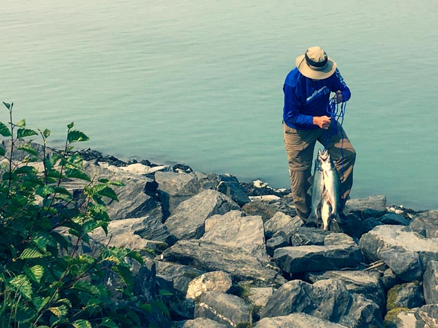
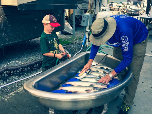
We laid the salmon out on the truck bed so Jason could get a look. He caught the first two of the morning, his 3rd and 4th of the trip. We had to re-spool his reel with 14 pound line as he hooked two the night before that snapped his eight pound line. With the heavier line, he had no trouble getting these guys to the net. Jason was also instrumental in using the landing net when I hooked one.

It was amazing how Jason could point out the fish HE caught. They all looked the same to me.

We are cleaning the fish before transferring them to the next table to turn them into fillets. We caught (landed) a total of 14 of these in two afternoons of fishing, with at least an equal amount getting off the hook before we could get them in the net. The first stringer went downriver with two salmon still on it. Two more actually bounced down the rocks and back into the water between the net and the new stringer. We could have easily limited out but we realized at some point we had to clean them.
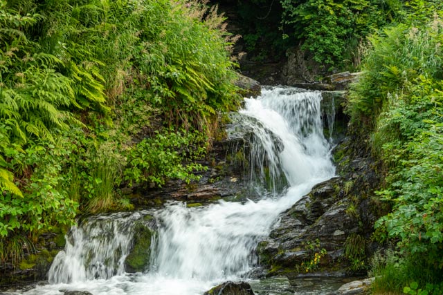
Later in the afternoon, we decided to take a drive up the Keystone Canyon to photograph the waterfalls. We started with this easy one, right next to our camp. It was early in the season, the bears will be feeding here in late July when the silver salmon begin their run.
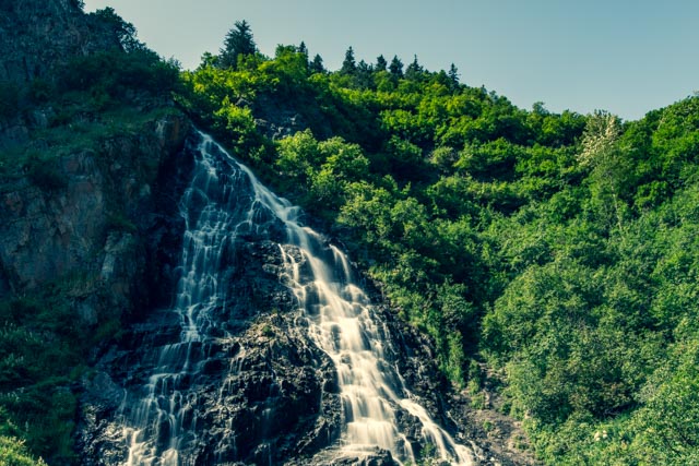
This is Horseshoe Falls, the first of many of the waterfalls visible roadside in the canyon.
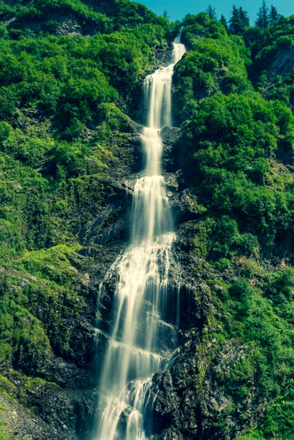
This is known as Bridal Veil Falls and is probably the tallest of the roadside falls. It drops into the Lowe River, which runs very swift and is a white-water rafting venue.
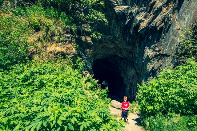
Three years ago we saw this tunnel and made the pledge, if we every returned we would walk through it.
This railroad tunnel was handcut into the solid rock and is all that is left of the “Railroad Era” when nine companies fought to take advantage of the short route from the coast to the copper mines at Kennecott. A feud interrupted progress of the project culminating in a gun battle. The railroad was never finished.
Jason led the way and we scrambled out of the other end while Cathy turned around and walked back to the truck through the tunnel. Jason, the competitor that he is, actually ran around the outside to try to beat her to the truck.
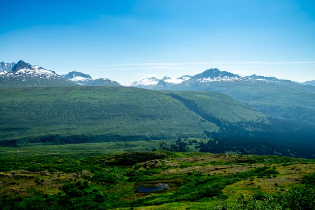
We continued up the highway, past the trailheads for the ‘Trail of 1899’, the newer, improved pack-trail and the original ‘Trail of 1898’ to Thompson Pass and Blueberry Lake. Looking across the valley from the top, we spotted this glacial moraine, evidence of a huge, ancient glacier, probably the one that created the depression that became the Port of Valdez and Prince William Sound. There are several depressions, caused by large melting hunks of ice, that have filled with water and have become little glacial ponds.
Jason and I climbed up to the top of the rocks to catch a glimpse of the Worthington Glacier and the Trail of 1998. The rock here is volcanic as this is part of the Pacific Ring of Fire.
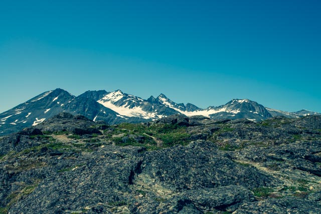

Jason is pointing to the Worthington Glacier. We had to stop on the highway to let a bear cross the road. He took his time and stared at us while he crossed. We also spotted pika and of course, more eagles.

We talked with a local (from Louisiana) who recommended that we take the drive / hike to the Valdez Glacier up Airport Road. We drove to the end of the road and continued to this small lake with icebergs floating about. I believe these were the first icebergs that Jason has witnessed. We had planned on taking out the kayak to get up close and personal but the wind picked up making it just a it dangerous. Maybe if the wind abates tomorrow. The Valdez Glacier is obscured by smoke in the valley directly behind the lake.


In the morning I went for an early walk and went through the Valdez Archway. The sunset here is about 11:30 pm and the sunrise is about 4:30 am. Thank God for blackout window covering.

The sky in the morning was beginning to fill with smoke from the many, lightning-caused Alaskan wildfires. This smoke is coming from the Swan Lakes fire on the Kenai peninsula.

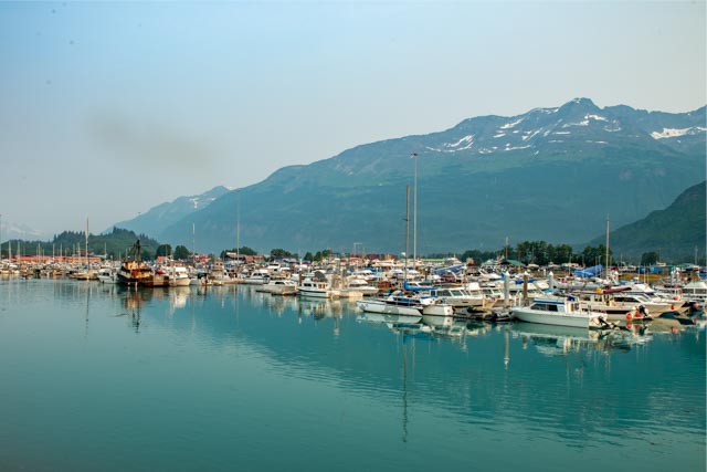
This is about 7:30 am and the sun is already climbing in the smoke filled sky. This is taken near the small boat harbor looking back to the container ship docks.

Below are wildflowers, looking out towards Duck Flats. Our campground is directly behind the trees at the base of the mountains.

The small boat harbor was full.