2019-05-14
These are just a sampling of the artifacts that were on display at our hotel, the Inkaterra Hacienda Urubamba. The fabric items are about 2,000 years old and were found in a desert region in Peru. The two dolls are about 800 years old, were unearthed locally and were sitting on the fireplace mantel in the dining room.
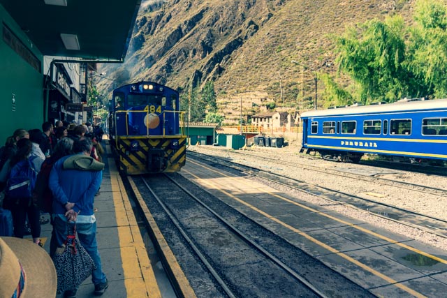
We are at the Urubamba rail station, and our Peru Railways train is approaching to take us to Machu Picchu. There was a railroad employee running in front of the train to make sure we were not in any danger of getting hit.
These are porters loading up to accompany hikers on the Inca Trail.

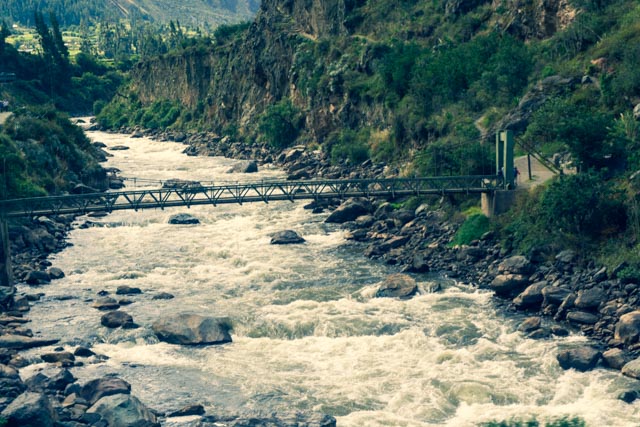
This is the first of many footbridges crossing the river on the way up to the sanctuary.
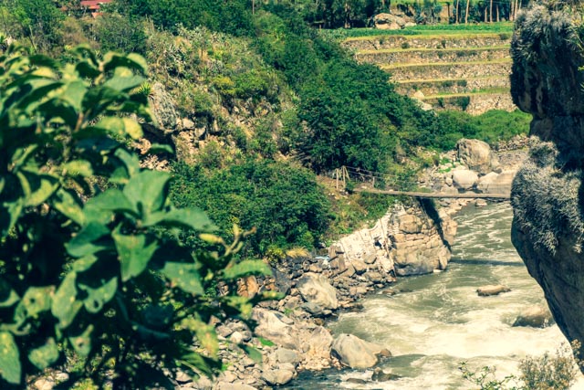
Another footbridge is visible from the tracks, this one being a little older.
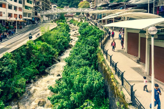
This is the former Aqua Caliente, recently renamed to Machu Picchu. There was an incredible marketplace to the right of this photo and many very good restaurants to the left of the river.
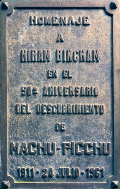
This is an example of (positive) revisionist history. While Hiram Bingham is credited with “discovering” Machu Picchu (1st plaque), he met the farmers who were living there at the time (2nd, newer plaque).
Machu Picchu was actually depicted on the maps of the day!
Hiram spent a total of five hours at the site, escorted by the farmer’s 10-year-old son who used the ruins as a playground. Hiram was looking for Vilcabamba, the Inca “City of Gold”, about 50 miles distant. Interest swelled when National Geographic saw his photographs and paid for him to lead another expedition to the site the next year.

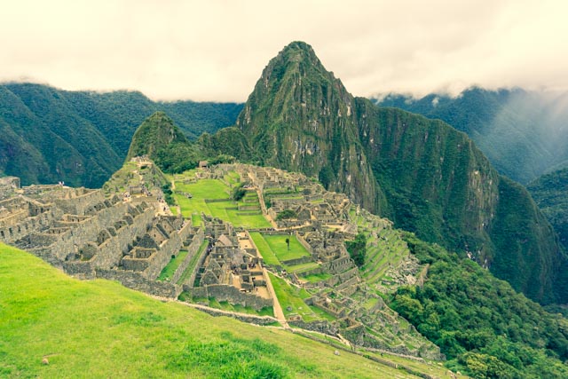
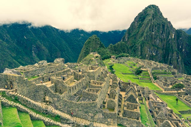
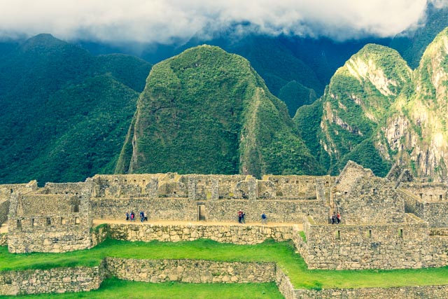
Our first view of Machu Picchu, with the towering Huayna Picchu behind the sanctuary. While we marvel at the structures, the real engineering was underground, where about 60% of the construction took place.
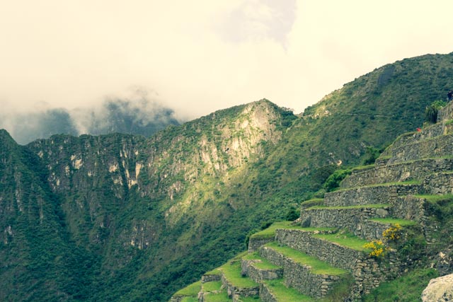
Huayna Picchu mountain (8,840 feet) is rising above the sanctuary in the background. We would be ascending the left side of this peak the tomorrow. I tried to see the “trail” but it really is not visible. Vidal, who will be ascending with us told the group to take a look at the mountain, to think about the climb and make the go/no-go decision in the morning.

These are the factories with the prisons in the distance. The flat area is the central square.

Cathy and me doing to obligatory photo.
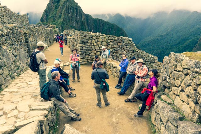
Cathy with one of our guides, Vidal Quispe overlooking the sanctuary.

The views were awesome, causing me to take repetitive photos.

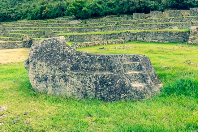
This is a stone known as the Funerary stone. It is still a mystery as to what this stone was used for. Theories include:
- a sacrificial altar and
- a place where the Inca nobility was mummified
This stone sits right next to the Watchman’s Hut in the agricultural district.
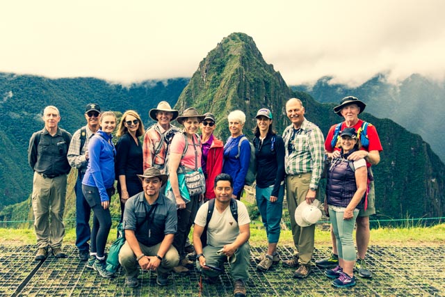
Our REI group with our guides, Diego and Vidal in front.
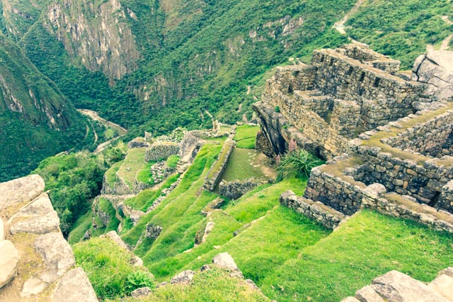
I took a couple of more photos of the sanctuary from a high point. The primary residential units are in the foreground.

Diego gave us a brief history of the structure we are standing on. I was away trying to get a shot of an elusive Viscacha, but he was too quick!
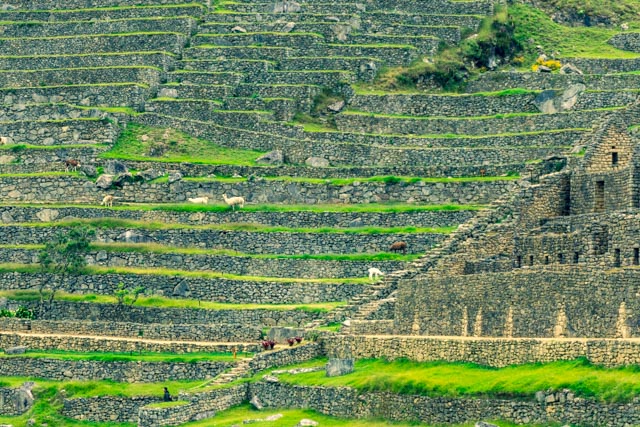
These terraces, being narrow, were probably installed primarily for erosion control and served as a planting area for food.
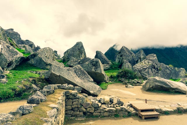
These are stones that were left in the quarry after construction. Almost all of the rock for these structures was quarried locally.
Another view of the factory area with steps leading down to the prisoner holding facility.

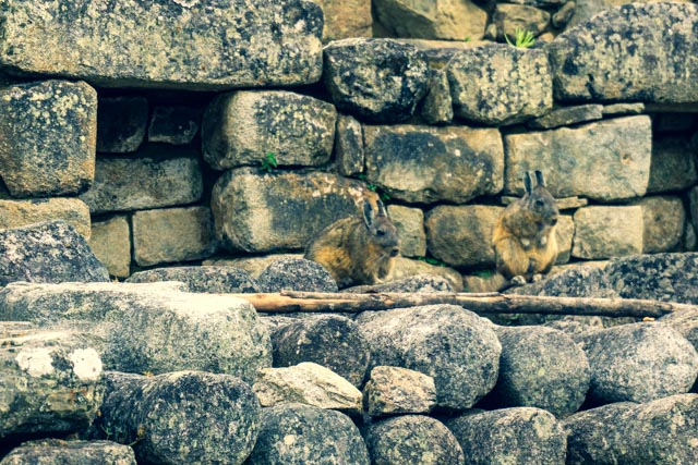
Two Tepeti (forest rabbits) were watching us from a ledge. They seem to blend in pretty well.
This tree was planted on the very spot where the only piece of gold was found at this sanctuary, a gold bracelet that had been buried. The Inca removed everything of value when they retreated further inland.

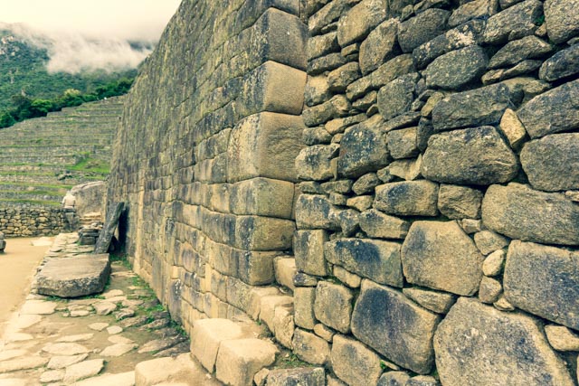
I tried to capture the workmanship change from the rough stones (in the foreground) used for storage or worker habitation and the finer stones in the background used for “persons of importance”.
The Incas were meticulous in installing water features throughout the sanctuary, with many intricately carved troughs directing the water flow.
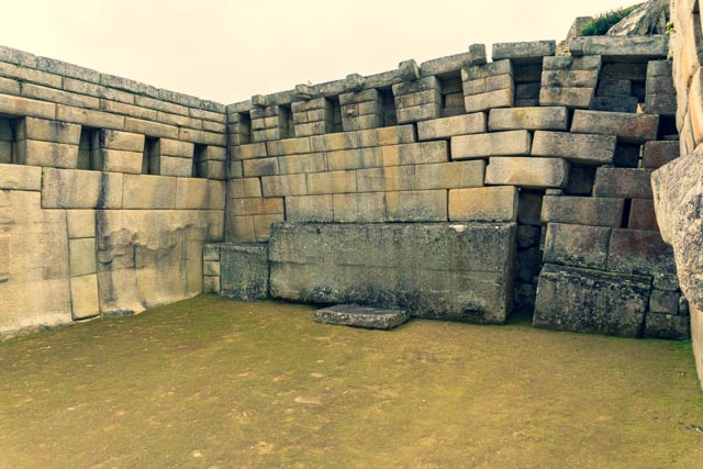
This is the semi-circular “Temple of the Sun”. Inca temples usually had the finest masonry, with hand-finished stones and rounded corners.
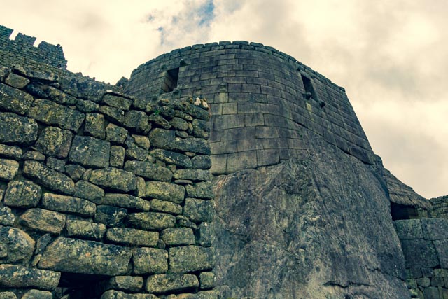
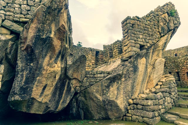
The right wall of this structure has sunk about two feet into the ground, which is surprising given the foundation was probably at least 15 feet deep and consisted of packed stones. Photos of this structure taken a hundred years ago look exactly the same.
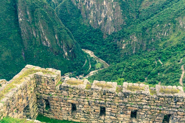
One of the many drainage channels carved into the rocks can be seen. The very elaborate and deliberate system of drainage allows this sanctuary to withstand torrential rains without damage.

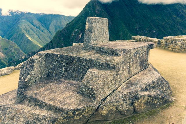
This stone is pointing due south and represents the shape of the Southern Cross constellation. The Southern Cross was/is used for navigation south of the equator, very similar to the North Star which is used north of the equator.
This rock carving is the only surviving intact Intihuatana, a device that was used for astronomical observations and ritual ceremonies. Machu Picchu’s Intihuatana was carved from a huge slab of rock, standing on the highest elevation within the Inca sanctuary. This part is often called the Sacred Plaza. It follows a tiered, pyramid-like setup, with a small rock needle at the top. Through its high elevation, it is thought to connect the different levels of the Inca mythology (Hana pacha, Kay pacha, Ukhu pacha; Spiritual World, Now, Underworld) in one focal point.
The four sides of the Intihuatana represent the four cardinal points (north, south, east, and west).
The primary function was astronomical. During the two equinoxes (March 21stand September 21st) the sun stands directly above the Intihuatana – creating no shadow whatsoever. This is only possible because the upper part of the Intihuatana stone has an inclination of around 13 degrees. The fact alone is marvelous, since similar stones in the area of Quito didn’t require this angle and hint at the grand depth of the astronomical knowledge of the Inca.
This is the probable factory area with the Ande mountains rising in the distance.
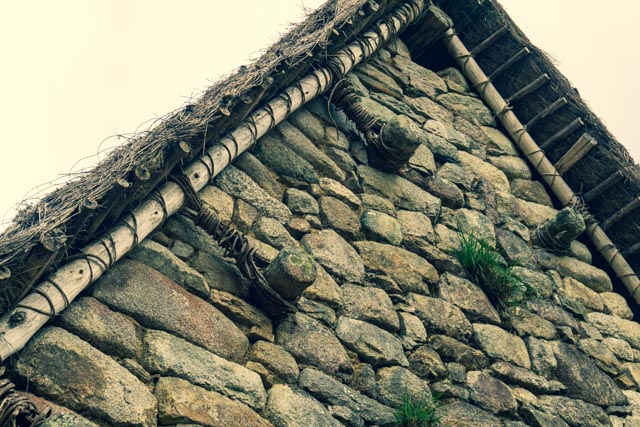
This is how the thatched roofs were attached to the stone structures. Stone attachment points are clearly visible on most of the structures. Wood was scarce in the region and had a very short lifespan due to the local climate. This building is located near the entrance point to Huayna Picchu Mountain.
These were probably more residential areas with a very steep drop-off to the Urubamba river.
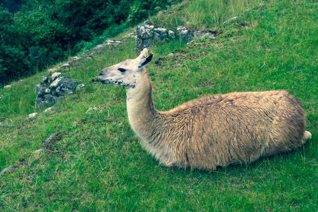
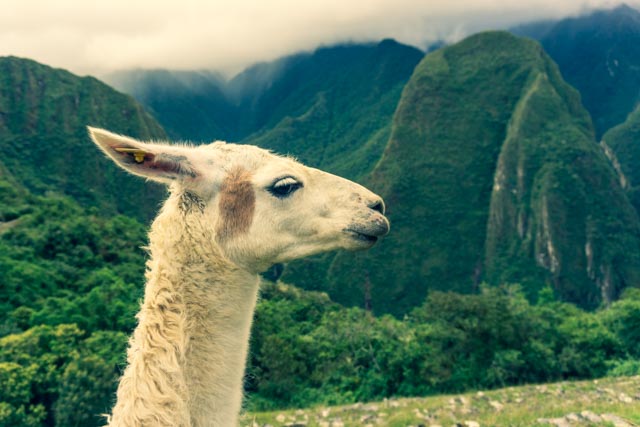
There were many llamas munching grass on the terraces.
This is the Templor del Condor or Condor Temple. The face of the condor is on the flat rock and the wings are depicted on the large rocks in the second photo.

He’s wearing my sweater!
Dr. Doolittle, aka Cathy, with the llamas.

