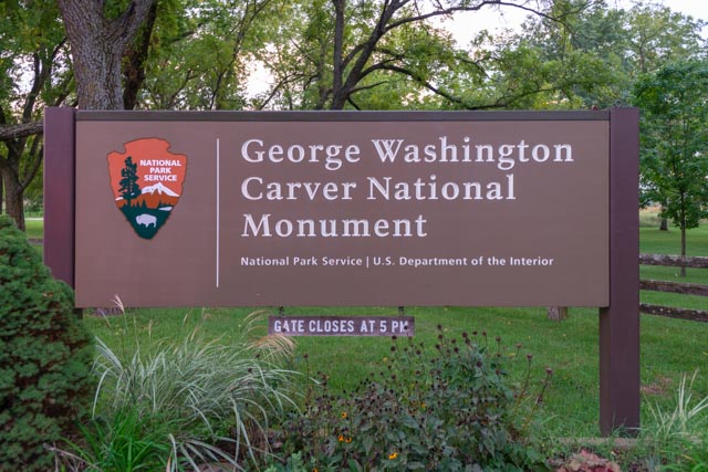
We stopped near Diamond, Missouri to visit the George Washington Carver National Monument. Unfortunately we arrived at dusk and were met with this sign. We decided we that we had driven too far down very narrow country roads and we were still going in. We were immediately met with grazing deer in the grassy areas behind the sign.
George Washington Carver was born into slavery near Diamond, MO, probably in 1864. He became an agricultural scientist and inventor who developed hundreds of products using peanuts, sweet potatoes and soybeans. Henry Ford became one of Carver’s close friends in the 1930s as they shared mutual interests of using agricultural products in industry (chemurgy). He built a replica of Carver’s birthplace in 1942 based on Carver’s recollections for his Greenfield Village, adjacent to the Henry Form Museum in Dearborn, Michigan. Carver spent most of his career at the Tuskegee Institute in Alabama.
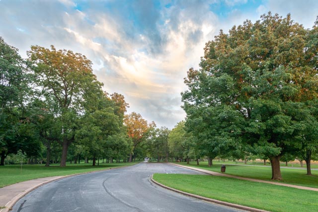
This is the view looking back down the entrance at our motor home parked in the roadway, in front of the locked gate. It was just a little walk to the monument.
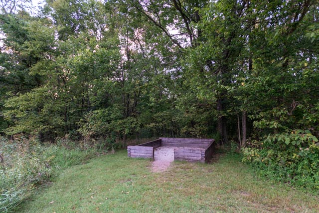
The represents the original foundation of Carver’s log cabin birthplace.
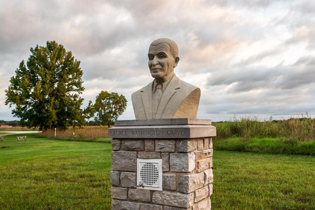
This bust of Carver was in a seating area, surrounded by plantings. I took this while resting on one of the benches.
While I was out and about, Cathy was reading these Carver quotations that are preserved on monuments in a garden near the visitors center.
The path led away from the bust with the sun setting. We were alone to walk the area, which included many acres of gardens and natural areas.

After getting back to the motor home, we continued on to Oklahoma, as my goal was several 500+ mile days to get to our next destination.
We did make it into Oklahoma, but it was late and dark so we spent the night in a rest area, along with a whole bunch of truckers. Our next stop was at the Osage Nation in Pawhuska, site of the infamous Osage murders as chronicled in David Grann’s recent book, “Killers of the Flower Moon – The Osage Murders and the Birth of the FBI”. We went to the Pawhuska Museum, but it was closed. Later we found out there was little/no mention of the murders in the 1930s, and we would find out that this “is not something that we talk about” as told to us by a government employee, a county employee, and a Osage merchant (more on this later).
We did see this apparatus in front of the museum, but couldn’t quite figure out what it was. It appears to be some sort of makeshift oil drilling apparatus.

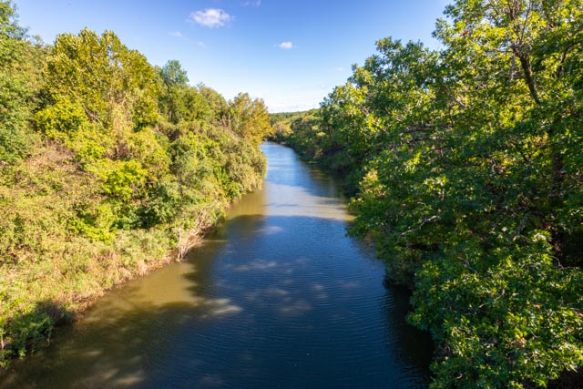
This swinging bridge over Bird Creek was built in 1926 and the 150 foot plank walkway is missing several planks and is pretty much in original condition. You really have to watch where you step! When the river was in flood stage, this was the only way into the town of Pawhuska. The second photo is a view of the river from the bridge, midspan.

The Pawhuska museum was dedicated primarily to the fact that the first Boy Scout Troop in America was established there.
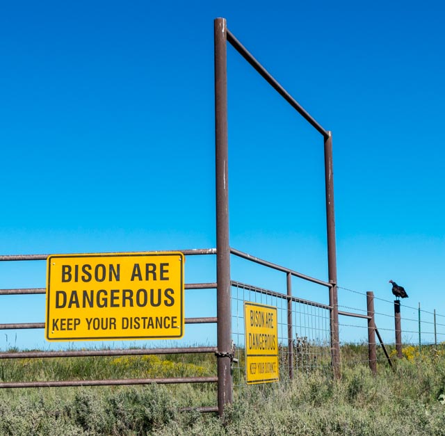
After walking the town, we headed 17 miles down a gravel road to the Tallgrass Prairie Preserve. This is a remnant of the original tallgrass that covered 14 states and 142 million acres. Less than 4% of original tallgrass remains and there are just under 40,000 acres here. We saw this sign but decided to take a walk in the grasses.
We followed this trail to find out where it led.

Here come the trailblazers. Luckily, we made it back to our truck and let them have their way.
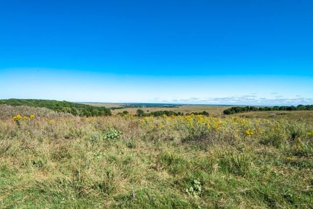
Here is a view of the tallgrass. This grass is over five feet tall and this preserve stretched to the horizon. This area has never been plowed or planted and we enjoyed our talk with a Osage docent. It was truly an education.
Next we stopped at the tribal/national headquarters of the Osage. This building houses eleven departments, including the Police, Tax Commissioner, Attorney General, Treasury Department, Human Resources, Housing Programs and Emergency Management. We also visited the tribal council facility downtown where council meetings were being conducted.
This is a recent addition to the grounds, a statue of Osage Chief Claremore, formally known as Gra-mo’n (Arrow Going Home). The tribal museum was behind me but it was also closed for the weekend.

These incredible stained glass windows in the octagon portion of the Immaculate Conception Church had a neat history. Created in Germany before the outbreak of World War I, the windows were stored in sand for the duration of the War. After the war, the windows were gifted to the Osage Chief by the King of France. The church stood throughout the war without windows. The windows portray members of the Osage Nation who were still alive at the time of their creation. Because they portrayed living persons, they required a Vatican dispensation to be made.
Unfortunately, again, it was a weekend and we missed the mass by a couple of hours, not realizing the significance of the windows and were unable to get inside.

This is the Shrine to St. Kateri, the first Native American Saint.
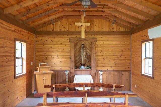
Below you can see some of the statuary on the grounds of the church. The statue of St. Francis was hand carved from a single piece of wood.


Before oil was discovered on Osage land, the town of Pawhuska was just a series of wooden buildings, most one story high. After the discover of oil, the town grew rapidly and was the center of wealth and commerce for the entire area.
There are the stairs leading from downtown to the City Hall.
It was very interesting that the Bureau of Indian Affairs building was dedicated and placed right next the to tribal offices. You have to read the book to see the irony in this.

While I was talking with a Osage merchant, Cathy was waiting in the car, parked by this former hotel. She overheard workers on the third floor talking with an official in front of our truck. The discussion was about them finding sealed in rooms during renovation of the building. They could not open them up without a certain person’s approval. This is very interesting considering the cover up of the murders.

We obtained directions (from an unnamed government worker) to a town that did not appear on our GPS or state maps where some of the atrocities took place and decided to drive through. We were warned by an (unnamed) Osage merchant NOT to get out of our car while passing through because people disappear there – still!
On our way back to camp, we stopped at Osage Hills State Park. While driving in, I spotted an old telephone line and decided to follow it to see if there was any glass left. I made it about three poles down the hillside when I nearly stepped on a five-foot black snake that was sunning itself on a rock. It was curled up and hissing loudly at me, and its face flared out, similar to a cobra. I stopped and asked a ranger what it was and she said it was a rat snake, and they flare the face when there are angry. Cathy was busy in the truck counting the deer feeding nearby.
We left early the next morning and headed for Arizona, crossing the panhandle of Texas, through New Mexico and, after more than 500 miles, into Arizona.
We passed many of these trucks carrying wind turbine parts. These three were stopped just before a left turn at the main intersection in the middle of a very small town. All of the pilot vehicles went ahead to control traffic so they could make the turn. There were also many trucks carrying the towers, which were in at least three pieces, with the bottom two wider than the travel lane.
We met Mike and Kathy Owen in Green Valley and toured the area for the first day, but, what do you do when drive several 500 miles days, back to back? Well, go hiking of course!
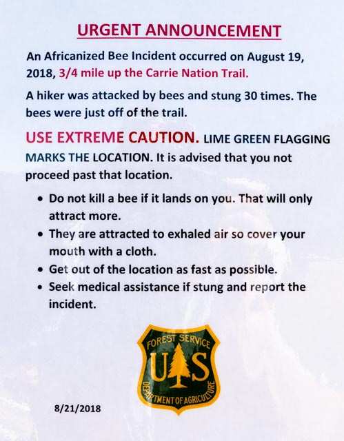
Mike talked me into a 12+ mile hike to the summit of Mount Wrightson. We hit the trail just before 7:00AM to beat most of the heat, and were enjoying the breeze on top at about 10:30. We did sidestep tons of evidence of black bear activity, some very recent, but in Arizona, apparently you have to look out for these killers also:
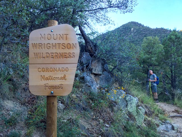
We are entering the Wilderness area.
Mike, are you having fun yet?
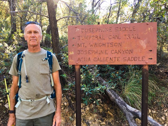
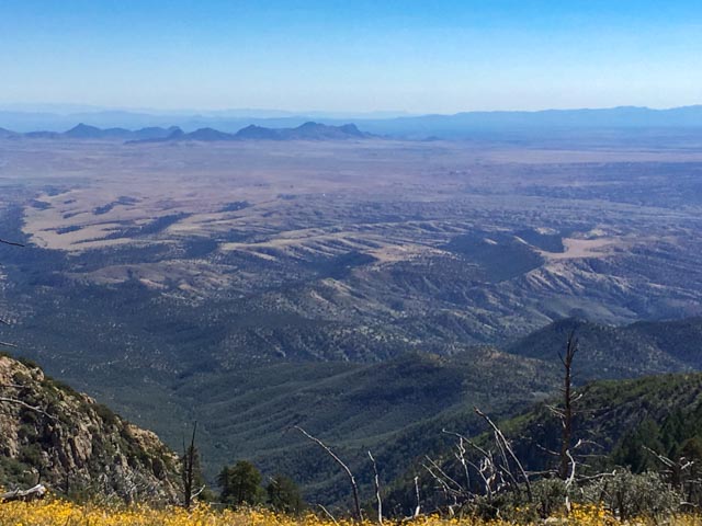
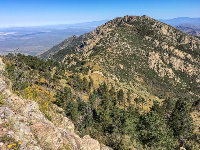
This is a photo of the view from the saddle, at about the five-mile mark. We still had a significant climb up the rock to the top.
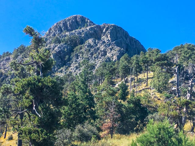
To summit this is our goal.
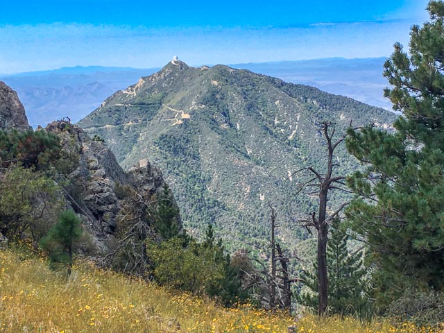
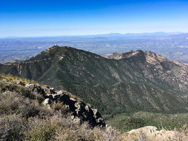
This view is looking back at the observatory on the nearby mountain from the saddle.
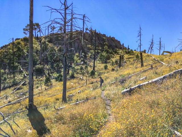
Now, it was a semi-easy walk through the flowers and remnants of a recent forest fire before heading up the rock. Mike is leading the way.
Getting a little higher, I took this photo of the saddle from the cliff-hanging trail.
We met this guy who posed for me. He was about nine inches long and was iridescent in the sunlight.
We are at the top and looking down at the observatory below.
A 9,434 foot mountain in the desert, near Tuscon!
