Dodge City and the Santa Fe Trail
The Santa Fe Trail was a 19th-century transportation route through central North America that connected Independence, Missouri with Santa Fe, New Mexico. Pioneered in 1821 by William Becknell, it served as a vital commercial highway until the introduction of the railroad to Santa Fe in 1880. Santa Fe was near the end of the El Camino Real de Tierra Adentro, which carried trade from Mexico City. We shadowed the trail, more or less from Colorado.
The French explorer Pedro Vial pioneered the route in 1792 and the Santa Fe Trail was established in 1828 to take advantage of new trade opportunities with Mexico, which had just won independence from Spain. The trail was used to haul manufactured goods from the state of Missouri in the United States to Santa Fe, which was in the northern Mexican state of Nuevo Mexico.
The route skirted the northern edge and crossed the north-western corner of Comancheria, the territory of the Comanches, who demanded compensation for granting passage to the trail, and represented another market for American traders. Comanche raiding farther south in Mexico isolated New Mexico, making it more dependent on the American trade, and provided the Comanches with a steady supply of horses for sale. By the 1840s, trail traffic along the Arkansas Valley was so heavy that bison herds could not reach important seasonal grazing land, contributing to their collapse, which in turn hastened the decline of Comanche power in the region.
The American army used the trail route in 1846 for the invasion of New Mexico during the Mexican–American War.
After the U.S. acquisition of the Southwest ending the war, the trail helped open the region to U.S. economic development and settlement, playing a vital role in the expansion of the U.S. into the lands it had acquired.
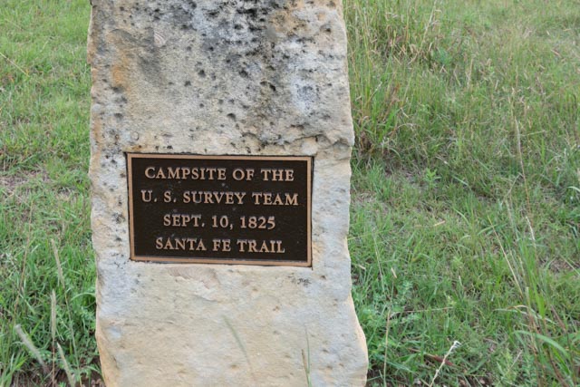
Camping near this location September 10, 1825, the Santa Fe Trail survey team remained through September 21 waiting for a courier with information from the U.S. Government as to how to proceed. They believed that the area west of the 100th meridian, which surveyor Joseph Brown mistakenly identified being at this point and south of the Arkansas River was Mexican territory where the survey team had no permission to enter.
Some quick research and a few key questions helped us find this marker, a half-mile down a nondescript dirt road. This marks the campsite of the U.S. Survey Team, September 10-21, 1825.
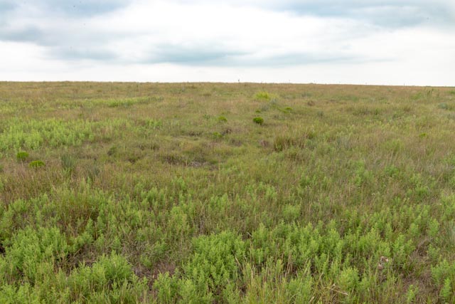
They may be hard to see in this photograph, but the tracks of wagons can be seen in the grass along the trail at this point, about nine miles west of present day Dodge City. It was apparent that the wagons traveled two or three wide through most of the trail, to avoid the muddy conditions and for safety concerns.
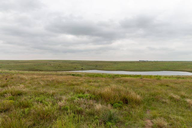
In the background, on the hill in the distance is the remains of the Asa Soule’s Eureka Irrigation Canal. It was Asa’s attempt to bring waters from the Arkansas river to the valley for irrigation. The project began in 1883 and lasted two years, with 96 miles of canal being cut. Due to (more than anticipated) water evaporation and a prolonged drought, the canal failed to provide the water necessary. Deemed “Soule’s Folly” the project was abandoned.
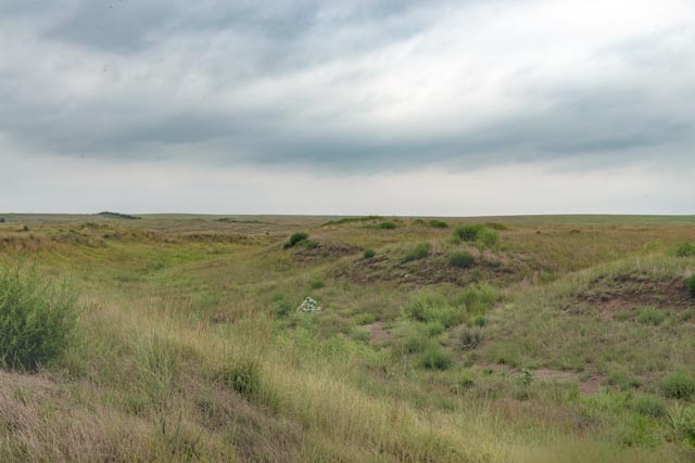
Cathy and I walked across the grass and came across this section of the canal. It was amazing, seeing this close-up and realizing all of the work in digging this was done by hand.
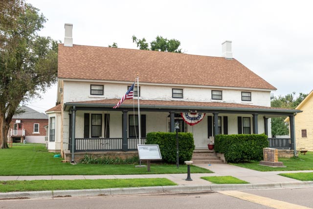
After visiting the remnants of the Santa Fe Trail, we drove north of Dodge City to Fort Dodge. Fort Dodge, established in 1865, was named for Maj. Gen. Grenville Dodge. It was a supply depot and base of operations against warring Plains Tribes. The fort was abandoned in 1882 and is currently being used as a state veterans’ home. This was the home of the fort’s commanding officer and his family. It is the oldest building in the facility.
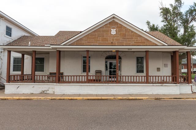
This is the fort’s hospital, built in 1868. This one story stone building had facilities for 12 beds and staff. The porch was added at a later date along with several other outbuildings.
As you can see, we made a conscious effort to avoid the commercialized Dodge City.
Dwight D. Eisenhower Presidential Library
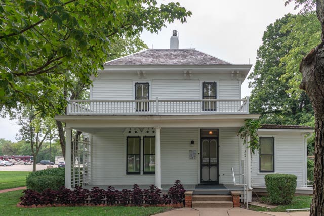
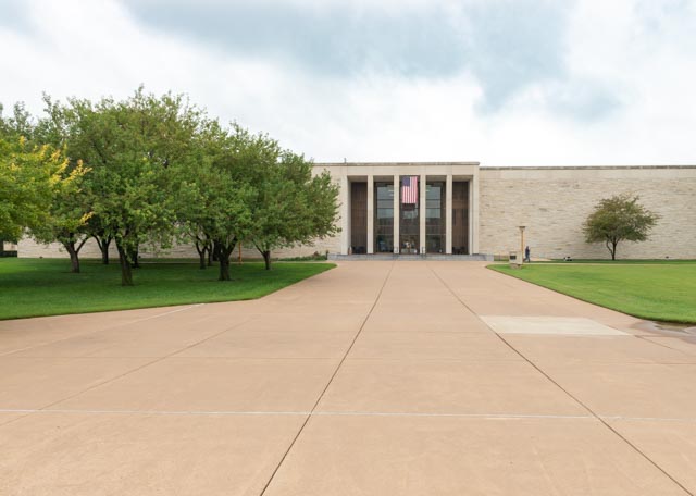
Leaving Dodge City, we headed to Abilene, Kansas. Our next stop will be the 22-acre site of the Dwight D. Eisenhower Presidential Library and Museum and boyhood home. Unfortunately, the museum was closed for improvements (we received a rain check for 2019) so we took the 15 minute tour of the home, then proceeded to the library, where several hundred items were placed in a temporary exhibit on the second floor, then on to the chapel.
The home, which is totally original, down to the silverware, was very small for the family, including three brothers and their grandfather. They actually added on several rooms, including a kitchen, a room for his grandfather and an indoor bathroom.
This is the presidential library, usually reserved for authorized “researchers” but home to a small, temporary exhibit. We spent several hours going through the displayed items.
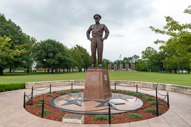
This is a 11-foot bronze statue of “Ike” in full army regalia located in the center of the campus. Behind him, at the far wall are pylons with verbiage about Dwight.
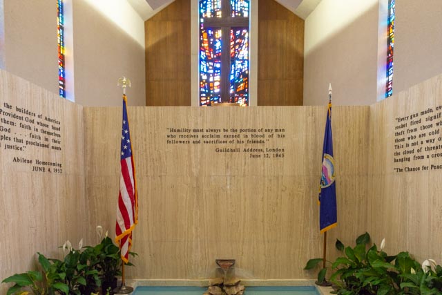
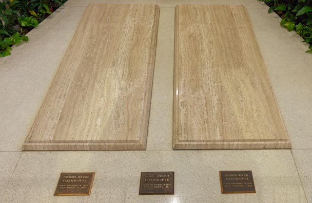
The view from the front of the “Place of Meditation” and final resting place of President Dwight D. Eisenhower, First Lady Mamie and their first-born son, Doud Dwight Eisenhower.
Inside the Place of Meditation.
The President, First Lady and son.
Leaving Abilene, we noticed that we were traveling on the first eight miles of the Eisenhower Interstate Highway System ever built, between Abilene and Independence. It was named the Eisenhower / Truman Memorial Highway. So . . . .our next stop now would be Independence, Missouri, about a 140 mile detour.
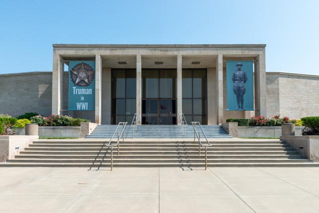
Harry S. Truman Presidential Library
After finding a place to park our motor home and truck at the Harry S. Truman Presidential Library and Museum, we proceeded to the building housing the museum. It was open! After a introductory video, we proceeded to the museum and spent the next half a day going through the exhibits. It is amazing what you don’t learn in school about a president.
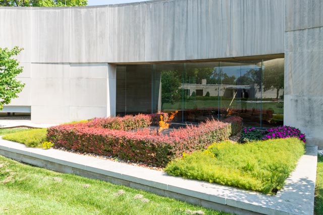
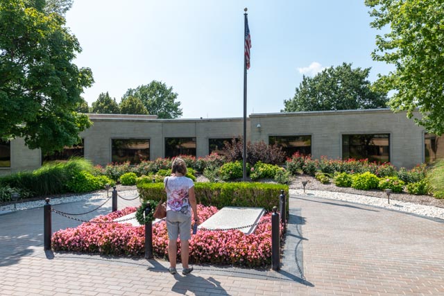
Truman ended WWII with the dropping of the world’s first atomic bombs, was instrumental in the formation of the UN, NATO and the Marshall Plan (which saved Europe after WWII), was credited with the Berlin airlift and kept us out of a hot war and in a “Cold War” with our communist foes. After spending hours in the museum, we ended our time with a walk in the central garden area, where there is an “Eternal Flame of Freedom” and is the final resting place of President Harry Truman and First Lady Bess Truman. Directly across from their graves are the graves of their daughter and her husband.
The “Eternal Flame of Freedom”
Cathy, standing at the gravesites of the Trumans.
The very last exhibit we saw was the actual office where President Truman spent his retirement years in Independence, developing the Truman Library and exposing young people to the importance of knowing their history and government, and dabbling in politics as an elder statesman. There was a great interactive display of his office, exactly how he left it. You could see the books that he read as a young person all the way through what he was reading later on in life. I saw this President Truman quote on the way out and found it inspiring.