On our way into Leadville this morning, we wanted to determine where the trailhead for Mount Massive was. We figured out where it was and Cathy spotted these in the field on the way to the road leading to Leadville.

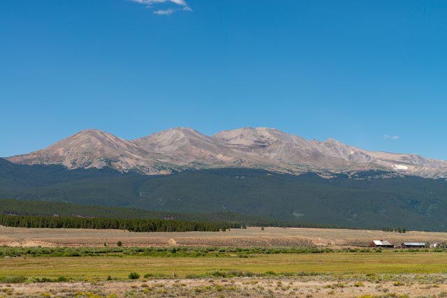
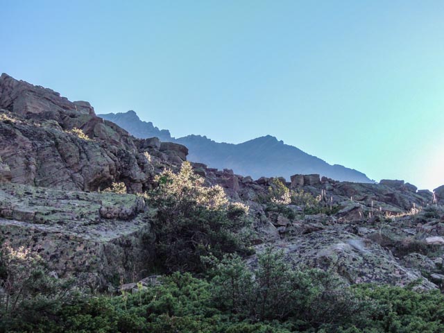
This is a morning view of Mount Massive. At 14,421 feet in elevation (officially), it is only 12 feet lower than Colorado’s highest peak, Mt. Elbert, whose trailhead is in the same canyon.
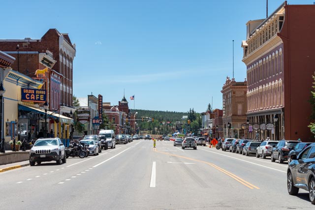
Entering Leadville, it immediately becomes obvious that there is something big going on.
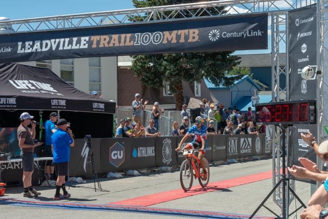
We were able to enjoy the finish of the Leadville Trail 100 Mountain Bike race. This is one of the premier trail bike races in the world! This is the winner, whose time is several minutes slower than last year’s time.

This is the reigning world champion, who finished second and immediately collapsed.

Third place went to an American, the first American to finish! Next week is the world-famous Leadville Trail 100 for runners and this week the running series “Summer Camp for Big Kids” – the Race Across the Rockies, a six-day, 120 miler with 20,000 feet of elevation gain is being held, with the event headquartered in our campground for the next two days. There are lots of activities to partake of.
We began to walk around and enjoy the town. I don’t believe dogs were allowed in the race but it looked like this guy was moving.

This is a few photos of the streets, the colorful houses, the old buildings (with cars parked everywhere). Most of the streets are very narrow because they were designed before the advent of the automobile.
Every gold rush era town must have a “Silver Dollar Saloon”. Unfortunately for the Gold Rush, the vendor next door was a sponsor of the race and was offering free Colorado hard liquor, beer and free eats! That HAD to cut into their business!

Next door…
If you are familiar with the epic “Paint Your Wagon” with Clint Eastwood, you will remember Horace Tabor, the goofy guy that Clint’s partner threw a knife at. He was also a character in “Death Valley Days”. Horace Tabor was real and lived in Leadville He made his riches by grubstaking two minors for free, and they both struck silver in the “Matchless” mine. He lost his wealth when the Silver Purchase Act, which put the country on the “Gold Standard”, was approved. (official version) actually when he and his wife lived lavishly, squandering his $10,000,000 in ten years, imagine what that was in today’s money? (locals version, which I believe is more truthful)
We drove out to see the mine that he owned and the log cabin where his second wife resided after his death.
Before his fall to poverty, Horace built this Opera House in Leadville. There is also a peak named after him near Leadville.

After a long day going through the stores and looking for that one antique that everyone else missed, we headed home. On the way back to Buena Vista, we passed these two very old dwellings .
I awoke at 4:00 a.m. on Sunday to make the drive to the Mount Massive trailhead. It is located over ten miles down a wheel-drive road, and it took about an hour and 1/4 to make the distance. It was pretty rough in places, with the truck scraping the rocks and the tires lifting off the road, sometimes three of the four! I arrived at the trailhead at 6:30 and found a parking place overhanging the creek. After a few minutes of set up, I headed up the mountain at 6:45. This is the first thing that I came across, a memorial to the crew of Army helicopter 26378 who perished on August 19, 1992 when their aircraft crashed on Mount Massive.

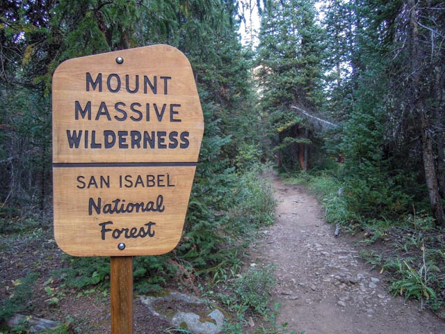
About a half mile up the trail I entered the wilderness. No permit necessary for a day hike!
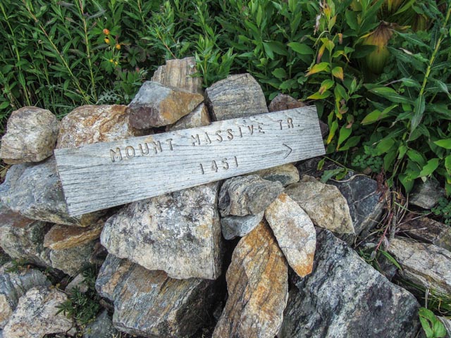
I almost missed this sign. I checked my map and it was legit. I was glad it pointed to the best trail up the mountain.
This is the trail! This is why Cathy doesn’t want to play anymore. It was like this the entire way to the top.
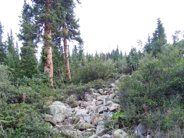
Fortunately the trail did widen a bit for a while.

The views on the way up were fantastic with the sun getting into the valleys and nearby peaks.
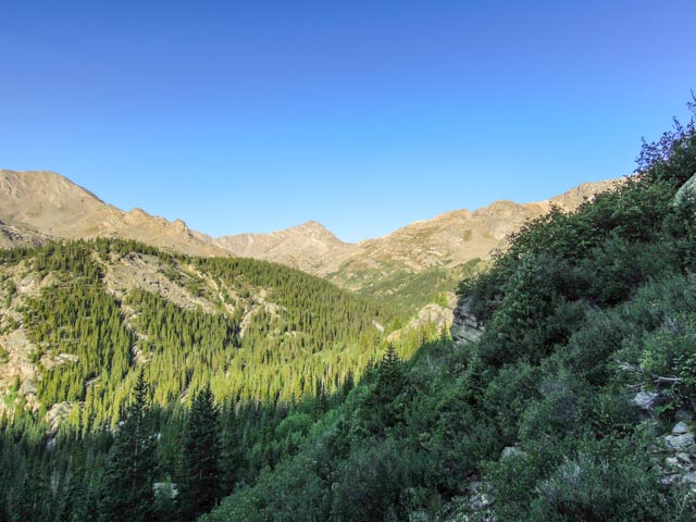
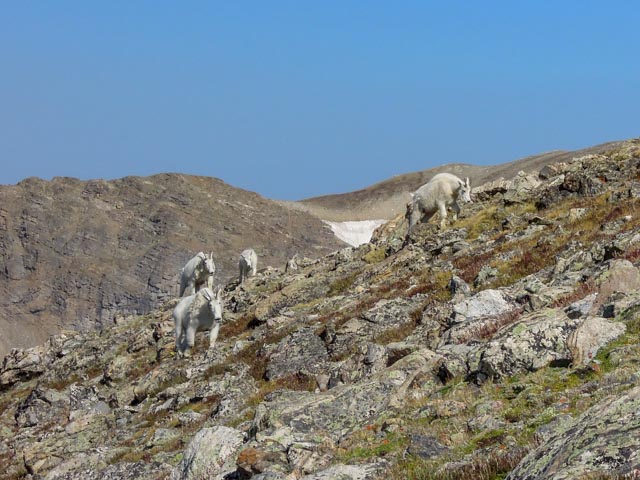
This is my first glimpse of the destination. It is the mountain range in the background, the highest point on the left. It looked much closer than it was. Also, there is some pretty neat terrain to climb over on the way.
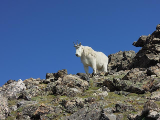
I looked up and deja vu. There were mountain goats heading my way, just like on Quandary Peak. This time I had fresh batteries in my camera. The lead goat is keeping his eye on me, as I was alone on the trail and history has shown me that these goats like to stay on the trail.
I had nowhere to go due to the steepness of the terrain, so I just sat down next the trail so I would not look intimating.
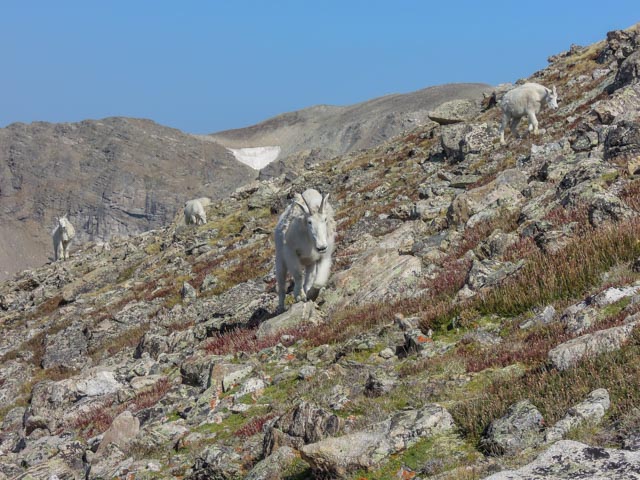
This is about as close as you would want to get to one of these big guys. He looked me in the eye and snorted!
Here is the mama goat and of course she had a kid with her.

Another big one kept me off the trail.

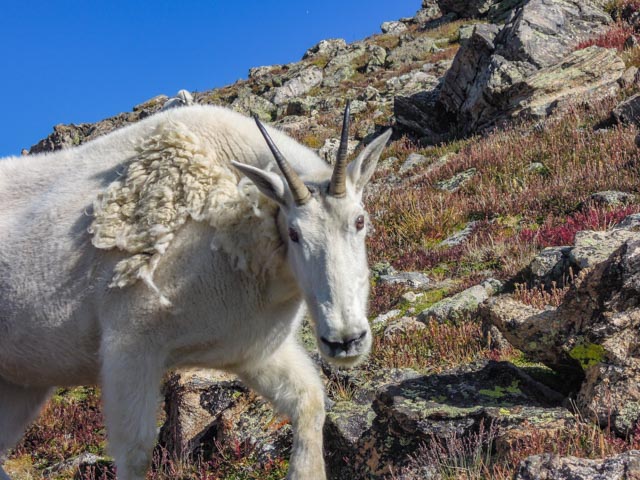
These guys have perfected the stare down. It worked, I did not move. The kid is right behind this one and they are very protective.

This guy went up the trail and continued to stare at me. He did a good job of keeping me from advancing up the hill.
Damn, the “stare” continues!

By now, several hikers had bunched up behind me. I told them the kid was in the hole to the left munching on something and the mama goat was protecting him/her, but one guy did not believe me and had to check it out. When he looked into the hole he came face to face with the kid and yelled an expletive.
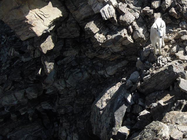
The goats reacted to a German Shepard barking and quickly jumped up onto this cliff. I didn’t know there even were a footholds there! The goats were all very adept at walking on these very narrow ledges. The rocks they were knocking off were falling hundreds of feet down. I know, there are a lot of ‘goat” photos but they were really neat!

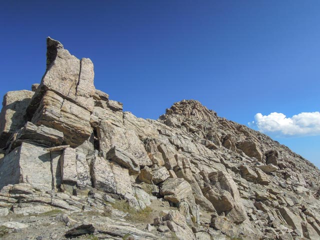
Once the trail cleared we rounded a corner and saw the trail to the summit. “Trail” is a very loose term here.
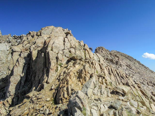
After we passed the previous cliffs (with pretty significant drop-offs) we got to scale these. To reach the actual top, I followed a knife-edged path to the rocks in the distance. After four of these, this is becoming almost routine.
That’s me with my dog (just kidding but it was a brown German Shepard type with blue eyes! Unfortunately, all the dogs on the summit (there were three) had to be lifted up, none could climb up on their own.
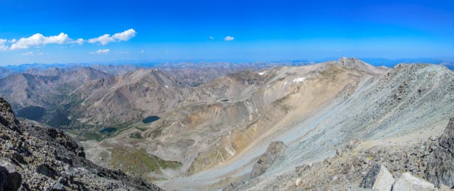
This is a panorama, looking west from the top.
On the way back down the mountain, by myself again, this guy came out to continue his stare. Fortunately there were only two of them and they stayed up the trail from me.

The trail cut through some bushes at the 12,000 foot area and went around a feature called the “Rockpile”. There was a marmot laying on the very top chirping his warning to other marmots, and some Costco peanuts found their way up there!

What a relief to find the trail again after five miles of hiking! I had only about four more miles to the truck! The maps and the USFS claim this trail is 6.8 miles. They are wrong.

14’r Count to date:
- Mount Evans 14,264 feet
- Quandary Peak 14,265 feet
- Mount Sherman 14,043 feet
- Mount Massive 14,421 feet
