Monday
We drove from Gypsum to the Estes Park, though the Rocky Mountain National Park on the Trail Ridge Road, the highest paved highway in America. The top of the pass is unmarked because the elevation sign gets stolen as soon as it is put up and the decision was made to quit fighting it. I believe the road reaches a little over 12,000 ft at the crest.
Cathy and I decided to take a “quick” hike up to the 12,000 ft elevation. It was very cold and windy at this height. The view of the surrounding terrain is one of tundra. In the distance are peaks that we were here to see.
This is Cathy, posing at about 12,000 feet with a tree that has managed to establish itself at this elevation. This tree may be hundreds of years old! Winter’s fierce wind seems to take physical shape in trees called krummholz, a Germain word meaning “crooked tree”. These gnarled, stunted trees are the result of cold temperatures and icy gales that sometimes reach speeds in excess of 150 mph.
Near treeline, cold temperatures cause trees to grow very slowly. Trees with trunks only a few inches in diameter may be several hundred years old. Powerful winter winds blast and dry out exposed branches and needles, further shaping the tree islands into miniature, but ancient forests.

Tuesday
We left camp at 6:30 in the morning to take the drive up the Old Fall River Road. Completed in 1920, Old Fall River Road was the first auto route in the park offering access to the alpine tundra. It follows a route long used by Native American tribes, including the Ute and Arapaho. It is officially a “motor nature trail”. Gravel and dirt, one way, uphill, with no guard rails and tight switchbacks, and vehicles are limited to 25 feet in length. NO trailers or recreational vehicles are allowed! Tight switchbacks? We had to do three-point turns on several. No guard rails? Straight down for hundreds of feet at points! The road was so narrow at places that there were wooden posts you had to drive through to insure your wheels would stay on the road! It was a very enjoyable, nine-mile drive with very little traffic. With our many stops, we made the trek up the deeply cut valley to the pass (at 11,706 feet) in about two hours. One of our first stops was to watch these mule deer bucks in the meadow.
Another of our many stops along the way was Chasm Falls, just a short downhill walk off the road.

We came around a corner and met two of these gals. They walked slowly up the road, then turned down into the woods, across the creek and out of sight. It was amazing how agile they were.
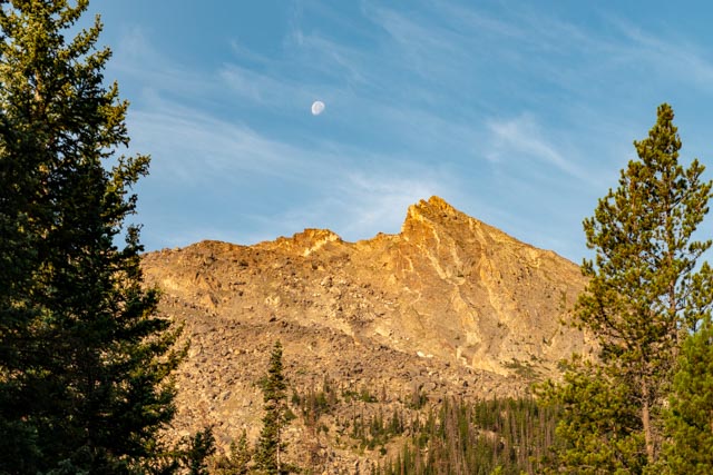
The sun was starting to shine on the mountains on the opposite side of the valley. This is Hallett Peak at 12,713 ft. It would be a ten-mile round-trip hike to reach the summit as the climb is rated “difficult” with an elevation gain of 3,324 ft.
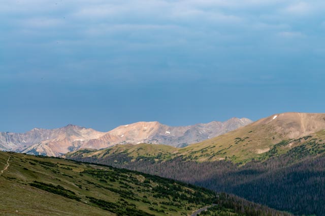
These are the mountains behind Chasm Lake, the lake itself sits at 11,803 ft. The lake would be a “moderate” climb at 8.4 miles round trip and an elevation gain of 2,456 ft. When we return to RMNP we will be better prepared to take a few more of these type of hikes.

Below you can see just one of many waterfalls in the cascading creek. There were very few places where we could actually see the water, most of the time it was hundreds of feet down in the gorge, but we could always hear it.

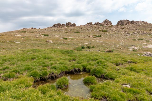
This is an unnamed glacial pond, located between the Chapin Creek Trailhead and the Alpine Visitor Center. This glacial carved alpine pond, sits at the base of a glacial cirque (visible in the upper left). This greenery around it is a result of seepage from the snow and the saturated soils in the immediate, somewhat depressed area.

There was a little beggar on the side of the road. He came out as we passed by. This was taken from inside the truck!

This is a glacial cirque, near the Alpine Center. This one gave “birth” to several glaciers. Several times during the last two million years, snow hundreds of feet deep accumulated on the top of this valley. The tremendous weight of the compacted snow caused the entire mass to move slowly down the mountain. As the glacier moved down the mountain, it scoped out this bowl-shaped cirque, leaving behind steep headwalls, a sloping valley floor and a broad u-shaped valley.

Wednesday
We were looking for an interesting hike to take and, in talking with the ranger at the Alpine Center, we decided on the Ute Trail. This is a relatively unmarked trail, with minimal parking and has historical significance. The trails starts uphill near a ridge nicknamed Tombstone Ridge. Our goal was to try to locate some prehistoric v-shaped stone entrapment pens, used by the Native Americans to gather game. These “pens” are about 6,000 years old and are known to be here but their whereabouts are not freely given, due to potential destruction of the historic sites. The Utes settled here about 6,000 years ago, the Apache in the mid 1500s, and the Arapaho around 1800. We manged to glean a “rough” area in which to look.
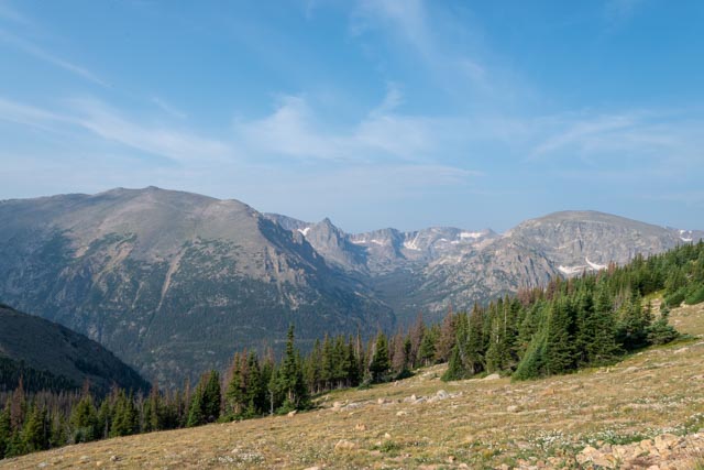
Starting up the trail, we were almost immediately by ourselves. Nearly all of the other hikers quit at the first viewpoint. In fact, we met two persons coming out and two going in. The views below are looking across Forest Canyon at the trailhead.

We dropped our jackets at about the one mile point on the hike as the morning chill had dissipated, we knew could pick them up on the way back. The trail was a pretty flat one, and easy to follow, but very rocky, with sharp volcanic rocks protruding everywhere, making it a real tripping hazard if you were looking at the scenery instead of the trail. The whole hike was above the treeline, which is about 11,500 feet. (Yes, our jackets were still where we left them and we carried them back down the hill.)

The reason for the hike . . . the game capture chutes from prehistoric indians. This was taken from the wide end of the stone fencing. It may be hard to spot, but we were told they were very hard to locate, even for experts. We felt very lucky to find this one, a little “off trail” which is frowned upon in the tundra. We were told that it would be “okay” for us to go off trail to search for these, I guess we seemed kinda honest. Or just old and harmless.

We turned around when the trail dipped steeply into a canyon about two miles in. At this point we were well above 12,000 feet in elevation. I walked over to two rock buttes that were pretty close. They were actually about a half-mile away. It was an interesting stroll through the rock (tripping) field and I did encounter several of the seepage type of wetlands.
This is the backside of “Tombstone Ridge”. Most only see this from the other side, deep down in the canyon on the Trail Ridge Road. This formation looks better when you work for the view!
Cathy met a friend on the way back from the top. Our destination was the small dome behind her. I also climbed the twin domes on to her left, they were almost a half-mile from the smaller dome. In the background are the three hikers who came up from the valley, and I followed them to the top of the two rock buttes.

I almost stepped on this guy. He was busy eating some roots trailside. He did not want to give me the time of day. Cathy went around him to try to distract him but he just ignored us. He did snort a little at me when I got too close (about a couple of feet).
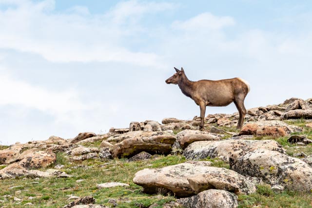
We were not paying attention ahead of us (paying more attention to the rocky trail) and stumbled onto a group of elk. They blended in to the hillside fairly well and were dead silent while watching us approach. There were at least 40 of them, with several big bucks overseeing the herd.


This big one kept her eye on us. As the herd began to move, she changed direction and walked directly toward us, causing us to retreat, there was really nowhere to obtain cover and we were virtually alone at this point on the trail, miles from our truck. She was doing her job, pushing us away from the herd and back up the trail. She continued walking directly at us until we were a good distance away, then held her ground until the herd passed before trotting to catch up which them. A little scary but damn, what an experience!
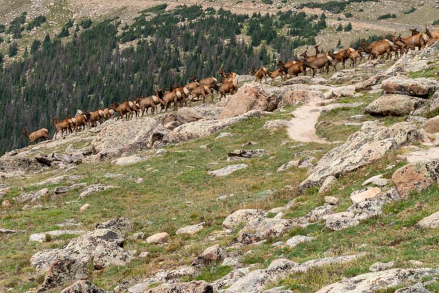
The herd crossed the trail in front of us. The bucks all changed to our side to escort them down the hill. They were pretty intimidating, but the big female (above) seemed to be the enforcer. We were still “backed” up the trail at this point! They moved down into the valley so fast I don’t think a human can keep up with them. It was effortless, they were silent and they never broke into a run, but they were completely out of sight within a minute.
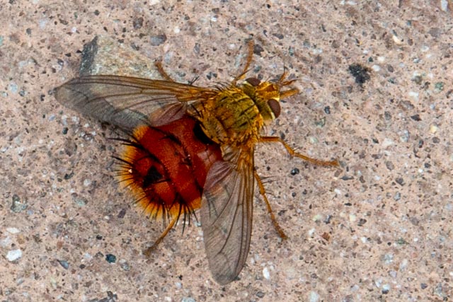
Back near the trailhead, Cathy spotted this “Bee-Like Techinid Fly” on the trail and yes, we were still looking down at the trail to avoid a fall.
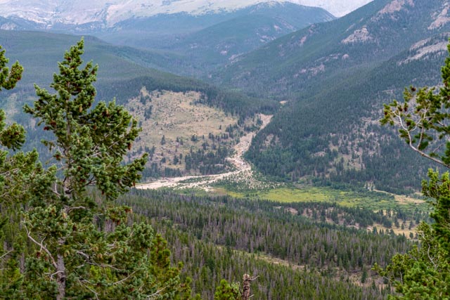
This is the view of the Alluvial Fan from up the hill. We are planning on climbing up the rocks in the morning to get a photo looking downstream. West Horseshoe Park is in the valley below the fan. Sheep Lakes is a main attraction in this park, as it is when the bighorn sheep come down the mountain in the background each evening (almost) to graze and drink from the two small lakes. There is a lot of restoration going on in this area, with acres of fencing in place to keep the elk at bay. It is amazing the difference a fence makes.
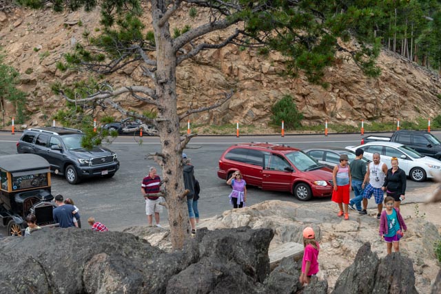
We headed back down the hill toward Estes Park and stopped at the Many Parks Curve, as we were able to find room to park our truck. Previously, when we passed this point we were in our MH. I climbed up on the rocks to take a shot of the valley below. I did not even realize I had done it until I saw Cathy waving from below.
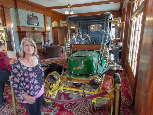
The gentleman with the Model T was very interesting. He had driven this car all over the country, including Washington, California and Maine and many times over the 12,000 feet passes in the Rockies. The car brakes were entirely in the transmission and there were no brakes on the wheels. He said he once had it up to 70 mph but was going downhill at the time. He and his wife really enjoyed talking about his old car.
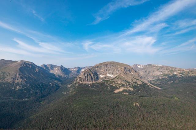
The view afforded at the many viewpoints include several notable mountains in the Gore Range. Moraine Park is the uppermost park, below Moraine is Upper Beaver Falls and the far left is Estes Park, mostly hidden behind the mountain. Mountains in the background include (L to R) Twin Sisters (11,428 feet), Lilly Mountain (9,786 feet), and Estes Cone (11,006 feet).

Thursday
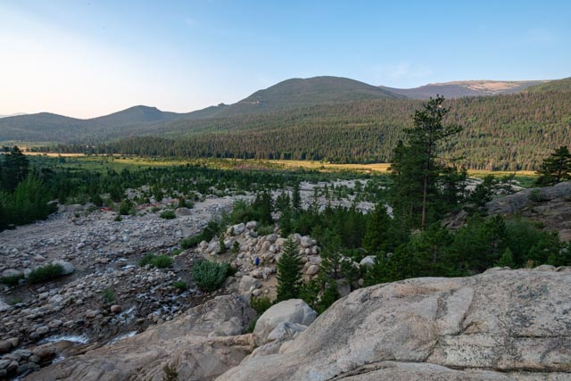
In the morning, we reached the base of the Alluvial Fan at 6:30. We were the only persons on the mountain, which was our goal. I climbed up a series of rocks to this viewpoint, actually a large overhanging boulder, overlooking the Roaring River and the riparian meadow created by the flow of the Fall River heading to the left, towards Sheep Lakes and Estes. The sun is starting to rise and is reaching the valley below.
A little history on the fan: On July 15, 1982 at 5:30 a.m. Lawn Lake broke through the terminal moraine that had held since the end of the last ice age, thousands of years ago. The release of 29 million gallons of water swept trees and car-sized boulders four miles down to the valley floor. In addition to tons of lighter rocks, gravel and sand created a 42-acre alluvial fan. A trash collector heard the waters crashing down Roaring River and called park rangers, who evacuated campers at Aspenglen campgrounds. Two were lost to the flood at the campground and one along Roaring River. Much of the flood’s force was weakened while submerging the meadows of Horseshoe Park, but it still had enough force to flood the town of Estes Park to a depth of six feet. Lake Estes to the east of town contained the floodwaters, preventing further damage. A second major flood in 2013 again damaged a lot of the infrastructure that was rebuilt after the 1982 break.
I climbed down to the water level, about halfway up the cascades to take this shot of one of many features in the slide area.

Working my way downstream, you can see the size of the boulders that were dislodged during the disaster.

This is the edge of the fan, looking down in the valley.

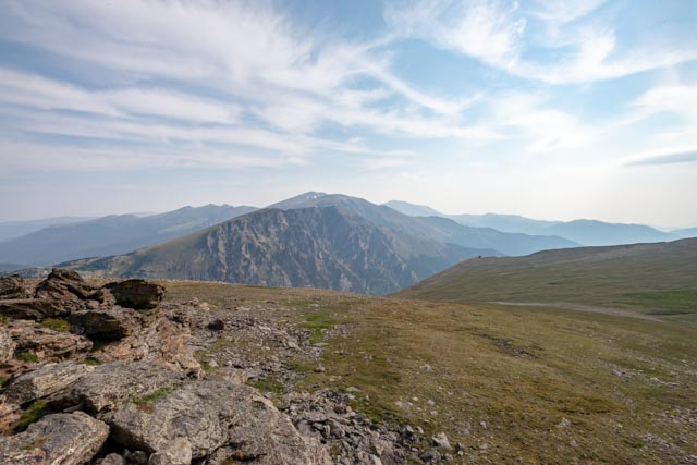
After climbing the rocks at the Alluvial Fan, we continued on Trail Ridge Road to Rock Cut and decided to take another hike . . . up! The scenery was fabulous as it was relatively clear in the morning. The clouds were heading in and the smoke from all the forest fires will again mar the sky by mid-day so we try to get these hikes in early.

This was the view from the top of the hill, at 12,300 feet, our highest trek so far. The green below us is tundra, similar to what is found in Siberia and Alaska.
I climbed up on the rock at the top and saw this neat feature. There were two other hikers deeply engaged in some type of yoga on this ledge. They did not seem to notice me.
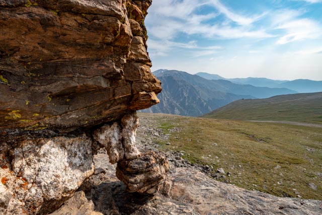
This is the lichen coated rock at the top.

I took the next three photos on the way back down the hill.
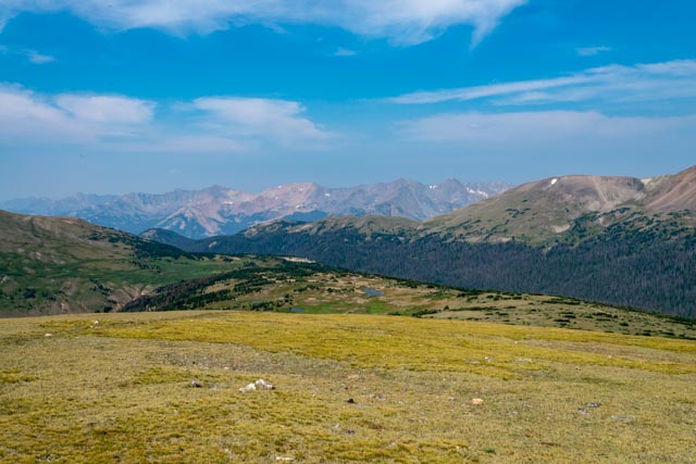


Once back in the warmth of our truck (it was very windy on top, the wind sometimes hits 150 mph on this alpine ridge, and the temperature drops five degrees for every 1,000 feet in elevation change, so yes, it was cold and windy!
We headed back down the mountain and stopped at an area called the Beaver Ponds. This riparian area was gorgeous and we were surprised that we did not notice the trailhead when passing it several times. The creek that the beavers dam up contains a native variety of cutthroat trout and is catch-and-release only.


I saw a fisherman come up through the brush a couple of days ago so I went down, through the neck-high brush to find this creek. I believe it is Fall Creek and it comes from the water in the Alluvial Fan. There were many 10 – 12″ cutthroat trout very visible in these waters, but it may be difficult to fly fish with all the tall brush.
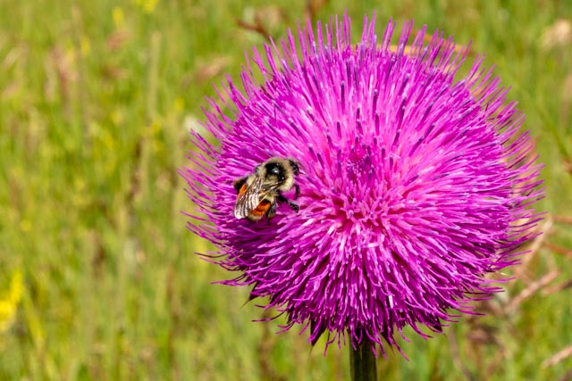
I came across the Bristle Thistle in a small clearing in the brush on the way out.
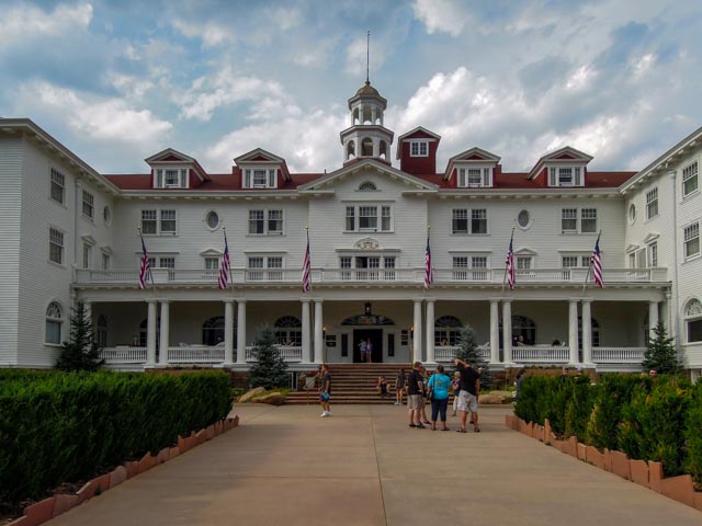
We decided to treat ourselves for dinner and made reservations at the Cascades Restaurant, located within The Stanley, a historic hotel and resort in Estes.
Cathy is standing next to a Steamer. I guess that answers my question who Stanley was.
The bar contained the largest selection of Bourbons and Whiskeys I have ever seen. The “good” ones were in a separate cabinet.
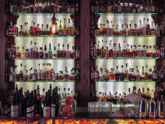
They also had a huge selection of Scotch. All told, there were over 1,000 whiskeys to choose from.

Cathy had chicken rosemary and I went “outside my box” and ordered elk loin raspberry.
The Lodge, restaurant and grounds were immaculate.
Cathy with the big guy, old man Stanley himself.

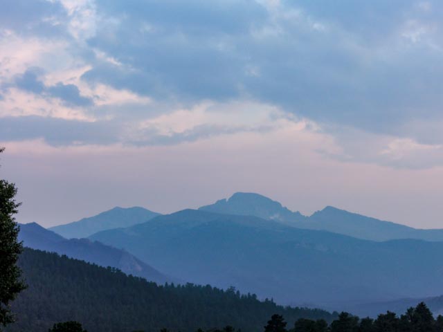
Back in camp, with raspberry turnovers in the oven and this view of the mountains in twilight out the front of the MH, we enjoyed the rest of the evening. Tomorrow we pick up our numbers and rest up for our first race Friday evening and second race, Saturday morning.