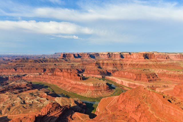
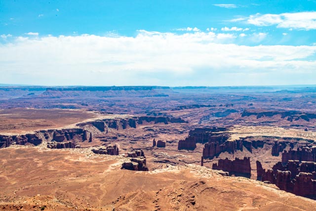
We traveled north on Highway 191 to Highway 313, which dead ends in Canyon-lands National Park. Deadhorse State Park is located off of the main highway on a side road. We arrived at about 8:00 a.m., so we had already missed the sunrise, and the sun was beginning to wash out the colors. A park ranger commented that this was the most hazy day (due to the western wildfires) that she had ever seen. Because of the difficult conditions, I experimented with HDR photography. Below is a combination of three photos.
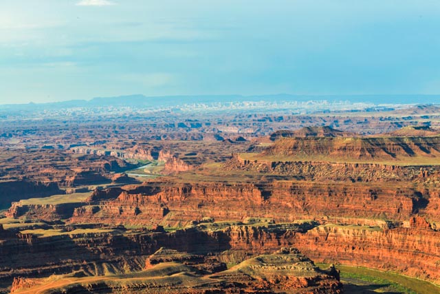
This is a combination of five photos, but the haze in the distance is still obscuring the mountain range about 35 miles away.
This is a hand-held panorama of the Green River snaking its way through the valley, about 1,400 feet below us, using six photos.

There was another person standing on the rock, overlooking the valley (over 1,000 ft) below. When he left, I was forced to do the same! Got to show the tats . . .
I did take one photo of the bend in the Green River with something other than a wide-angle . . . this is at 70mm. There were several kayakers camped on the island at the bottom left.

I had to take this shot of the cliffs. It is the first time I saw the specific periods of formation so clearly.
- Kayenta – Deposited during the Jurassic Period, 188 – 184 million years ago. River and flood plain deposit make up this formation. It is the thin, loose-looking layer on top.
- Wingate – Sandstone deposited during the Jurassic Period, 200 – 190 million years ago. An ancient desert containing windblown sand dunes formed this layer. This is the second layer, very hard and straight (vertical), and is the deepest layer of the five.
- Chinle – Deposited during the Triassic Period, 245 – 200 million years ago. Rivers, flood plains and lakes deposited the sediment found in the Chinle. This is the loose-looking material just below the vertical wall of Wingate.
- Moenkopi – Deposited during the Triassic Period, 251 – 245 million years ago. Vast tidal flats are responsible for the sediment left behind. This is the loose looking material with a white cast.
- Cutler – Deposited during the Permian Period, 285 – 270 million years ago. Rivers and coastal sand dunes formed this layer. This is the very uneven, irregular and rough-looking darker material at the bottom.
Below the Cutler is a combination of sediments that have eroded over the years from all of the above.

We exited Deadhorse Point and decided to continue on to Canyonlands National Park, just eight miles away.
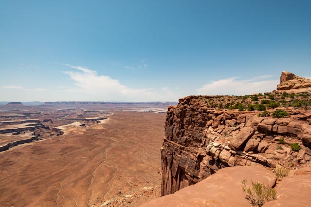
After a brief stop at the Island in the Sky visitor center, we walked to the Shafer Canyon overlook. This is a view of the valley below and the Shafer Trail going down to the White Rim Trail. The White Rim Trail is a true, 4×4 and mountain bike trail which winds for over a hundred desolate miles around the base of the cliffs, ending up at Mineral Road, aka Horsethief Trail, which rejoins the main road to Canyonlands several miles outside of the park. It is visible at the very bottom of the canyon, well below the cliff hanging Shafer Trail. Hmmm. It looked very interesting and may be included in plans for a future trip. The trail wraps tightly to the cliffs on the way to the bottom and can be seen in the distance from many vantage points. There are multiple features than can only be accessed by this trail, including some of North America’s most significant rock art (pictographs), ancient cliff dwellings, historic ruins at Fort Bottoms, Hardscabble Bottoms, Gooseneck Overlook, Musselman Arch and Airport Tower. I did get a foot hanging over the edge, but it was too far (straight) down to jump!
Continuing to the Green River viewing areas, we stopped at the Mesa Arch trailhead. We did not anticipate walking so much , especially in the now approaching 100+ degree heat. You can see the valley below the arch.

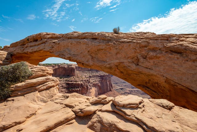
The White Rim Trail is visible running down the center of the valley below. Unfortunately, while taking these last two photos, I was busy watching the arch and the valley, but failed to notice the empty space between the two. When I looked down, I saw the desert floor, a thousand feet down right behind me. Situational awareness. . .

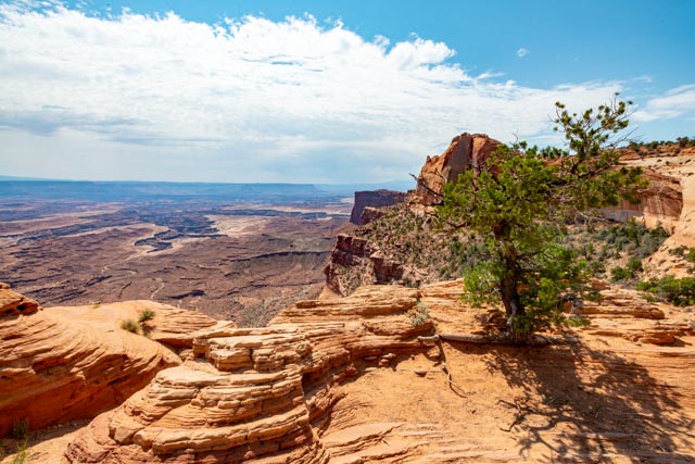
While I was taking the photographs of the arch, Cathy was enjoying the relative coolness of a nearby Pinyon Pine.

The view from the further-most paved area in the north park, Grand View Overlook. Below us is the Colorado River, which runs through Moab and is nearing its confluence with the Green River. Together, they will continue on to Page, AZ then the Grand Canyon. John Wesley Powell wrote his impressions of this region on his pioneering boat trip down the Green and Colorado rivers in 1869, “the landscape everywhere, away from the river, is of rock”.

Heading north from Grand View, we took the turn towards “Upheaval Dome”. We had no idea what to expect, but after a “short” hike, in the heat up a steep grade we made it to the rim. This feature remains somewhat of a mystery as to its origins. The rock layers are fractured and tilted forming a circular depression more than two miles wide. The original idea from scientists was a rising salt dome that cracked and tilted the rock over time. Recent findings support the theory that a violent impact from a meteorite instantly fractured the rock.
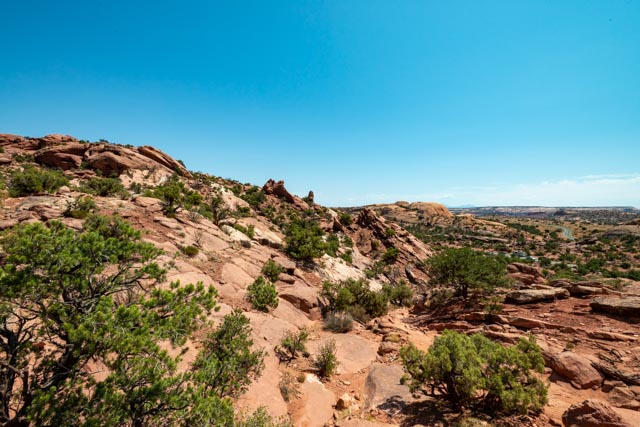
This is the view while climbing up to the dome.
From the top this is the view looking down into the center. The white substance is massive and is “rising” from the center. To give scale to this photo, the trail around the base of this circle is over eight miles in length! We watched a fellow hiker lose her lens cap, which rolled down the rock and over the edge by the tree below. I inched my way down there to see if by any chance I could retrieve it but there was a vertical cliff leading to the bottom. I called for Cathy to bring my camera down to me so I could take a photo. No Way. No How. I climbed back up and went back down with the camera to take the next shot. It may have not been worth it but I felt obligated.


Cathy at the top with the center of the dome just behind her.

After we climbed down from the dome we took a quick stop at the Green River Overlook. The river is meandering through this fairly level valley Yes, that is the White Rim Trail running through the area (along with several old and abandoned mining trails).

I did get a little close to the edge (actually hanging over the ledge in the second photo) to capture the sandy white substance located at the very bottom of these cliffs. I had to lay down and crawl as it was a shear drop and the wind was starting to swirl about.


We stopped to pick up some water and talked with our schoolteacher friend that we met at Shafer Canyon Overlook, again at Mesa Arch and now at the water fountain in the visitor center. He recently returned from a ten-year teaching stint in China and has spent time in Japan. He was very interesting in describing his time actually living in China for an extended period of time.
