Leaving the Carson City area and heading east, we came across this “Punch Bug”. This is for Jason, this automatically makes me the all-time winner, hands down!
Punch Bug!!
We headed for Utah via the “Loneliest Road in America”, Highway 50. Near Fallon we came across the Grimes Point Petroglyph area. We took a walking trail through some of the petroglyphs, and came across this “pit and groove” example, the oldest at Grimes Point at more than 7,000 years old. The basalt rocks and their patina made perfect murals for the rock art.
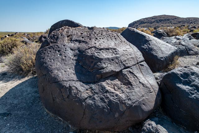
The following are examples of the more recent “Great Basin Pecked” style of petroglyphs, dating from about 1,000 BC to 1,500 AD.
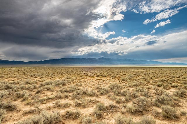
This area is apparently loaded with rattlesnakes, but it probably was a little to early in the morning to see any. There were plenty of warning signs posted. This area was a very large lake, Lake Lohantan of about 8,500 square miles of surface area at its peak, some 15,000 years ago, with a depth of 900 feet. You can see the “high water” mark on the hills in the extreme background. According to anthropologists, many hunter-gatherer societies such as those who lived here, had a spiritual leader called a shaman. During the hunt, the shaman was called upon to perform rituals to ensure the success of the hunt. The markings and others located in the Great Basin may be related to the ritual practices of the shaman. There is also evidence of rock pens used to funnel game into a tight areas to assist in the slaughter. At the time of these markings, the level of Lake Lohantan had dropped significantly, exposing Grimes Point as a peninsula, surrounded by water. To make this stop surreal, there were the latest, greatest fighter jets practicing take offs and landings at nearby Fallon Naval Air Station. They would fly over so fast the sound was about a mile behind them! They were fun to watch from these thousands of years old markings.

Continuing on, we were weaving in and out of the heavy traffic (not really on the Loneliest Highway)!

We came across Sand Mountain, visable from Mt. Rose, 86 miles away in the California Sierras. Sand Mountain is a sinuous transverse dune derived from ice age Lake Lohanton beach sand piled here from southwesternly trending winds. These dunes clearly marked the location of nearby Sand Springs, improved and mapped in 1858 as a potential Emigrant stop by Army Lt. James Simpson. Sand Springs later served as the location for the Sand Springs Pony Express station in 1860 and served as the terminous of the 1866 Fort Churchill and Sand Springs toll road. This is a side road and we did not take it to the dunes, they appear much closer than they were.

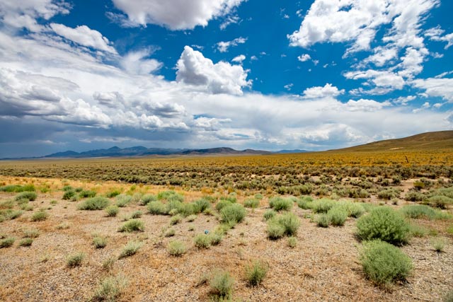
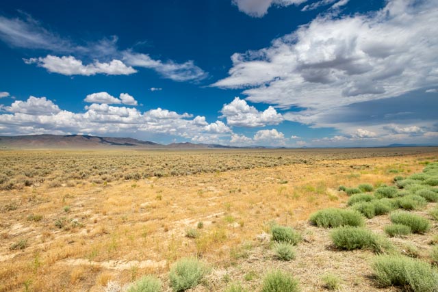
Views of the roadside, to the left and right. There is no sign of habitation. At one point there was a state sign warning that there would be “No Services” for the next 93 miles!
After going through Austin (Stokes Castle), Eureka (Eureka Opera House) and Ely (Historic Hotel Nevada), we stopped early, at about 5:00 p.m. alongside the road, about 15 miles southeast of Ely, between the ghost towns of Ward (facing west) and Taylor (facing east). We put out a couple of lawn chairs and watched the sun set over the Egan Range to the west.
Ward – The town of Ward was a silver town, booming from about 1876 to 1882. It had a peak population of 1,500 and was pretty lawless (but there was a fairly efficient vigilante committee that dealt out punishment when necessary). A million dollars of silver was extracted from a single chamber of the Ward mine. Better mining practices caused a resurgence in activities in 1906 and again in the 1960s.
Taylor – Both silver and gold were discovered in 1873 in what would become the town of Taylor. Taylor was a typical mining community, supported by two large mines, the Argus and the Monitor. In seven years the town grew to about 15,000 persons, supported seven saloons, three general stores, an opera house, a Wells Fargo office and many other businesses and became the center of social activity within the county. Mining continued intermittently until about 1919. At that time a 100 ton cyanide plant gave the town new life, but production plummeted when the price of silver dropped. WWII renewed mining activity for a short time. Local mines here produced about three million dollars of silver, gold, copper and lead.
We chose to take a dirt road for about six miles to another dirt road for another mile up a canyon to the Ward Charcoal Ovens. (You can see the road in the upper left of the above shot, stopping at the dark colored mountain range in the distance). We spent some time here, walking in and about the ovens. There were six ovens built here to reduce the local pine to charcoal. Charcoal burns much hotter than wood and the additional heat was necessary for the smelters in nearby Ward. These ovens operated from 1876 to 1879 (the silver boom years of the Ward mines).
It took about six acres of trees to fill one oven, or about 36 acres to fill the six. Each oven held 35 cords of wood which burned for a period of 12 days, producing about 50 bushels per cord, 1750 bushels per oven. The ovens are about 27 feet wide at the base and have a ceiling height of 30 feet. The door shown was about mid-height, there is about 15 feet of depth under the opening, which has subsequently been filled. There were no trees left standing for several miles surrounding these ovens. The Sierra Club would have had a fit! There are second-growth pine visable while walking the immediate area.
Here is the view from inside the oven, looking up at the 30 foot ceiling and out the front door. The actual “floor” was another 15 feet below this door.


This is the hill from which the stone for the ovens was quarried.

We walked north from the ovens, towards the town of Ward and came across this neat riparian (wetland), in the middle of this high desert! There was the sound of rushing water but we could not see it from this vantage so we walked downstream. I did give it an attempt here but there were thorns in the grass and I was wearing shorts, not a good combination.

Finally we were able to see the water. There were rainbow and brown trout in the cold waters of Willow Creek, which was pretty amazing considering the location. We saw a deer on the way in and a sign indicted there are elk, mule deer, bobcat and mountain lion in the immediate area.

We took a minute on the trail to view the valley below. Our motor home is parked at the base of the foothills in the far distance, about eight miles away. We could only make out a dark “dot” on the dirt road where it was parked. The mountain peak in the center of this photo is Mount Wheeler. At 13,063 feet, it is the second highest mountain in the state.
Continuing on from the Ward Ovens, we almost hit a low flying Nevada Blue Grouse, which was walking along the road before it took flight right in front of us, so close it was moved by the wind around our windshield. We were going about 65 mph and it would not have been good for either of us. It was a beautiful bird, though.
As we crossed into Utah, we noticed this immense dry lakebed in the distance. It looked like one end still held water, many miles ahead of us but alas, it turned out to be a mirage. The bed was snow-white but we did not get close enough to find out the composition.

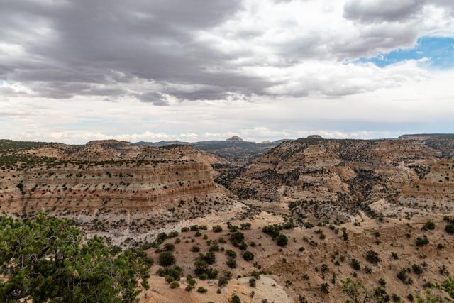
Castle Valley – In the 1870’s, Mormon Settlers came east across the Wasatch Plateau to the high mountain deserts and the San Rafael Swell. This was the last place that Mormon colonizer Brigham Young called for his people to settle. The landscape was incredible, the valley below is very deep, and the drop-off behind Cathy is hundreds of feet. The scale is unimaginable. You can see a natural “bridge ” feature to the right of Cathy and there is a closer shot in the next frame. The rocks behind her are not readily reachable because they jut up from the valley floor! We did enjoy the lightning in the distance but it was approaching from the north.
We made a stop at Devil’s Canyon, in the wind of the approaching storm. It did began to rain and the lightning was hitting around us at this point, but the canyon was gorgeous below. There were some Native Americans selling their turquoise and silver goods here but they rolled up their goods when the storm hit.