Sunday
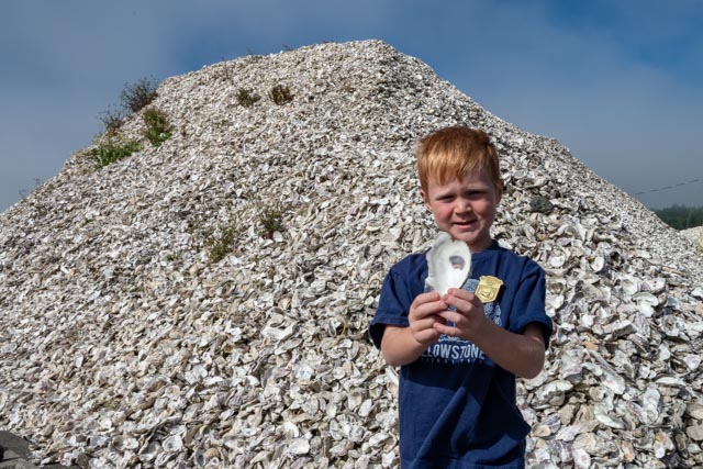
We finally convinced Jason to try an oyster before leaving Coos Bay. Boy, did he put down a bunch! That’s his pile of oyster shells behind him! (Just kidding).
Monday
We headed to a stop in Crescent City, just over the border from Brookings. The coastline in Oregon and Northern California is studded with rock outcroppings, left behind when the soil has been eroded, hastened by seismic events. You may be able to see our MH at the end of the guard rail. I parked and walked a bit inside the guard rail to get a photo of some rocks. The drop-off towards the ocean is vertical and about 75 feet to the first set of rocks that would “break your fall”.

The rocks I tried to capture, albeit with a wide-angle lens.
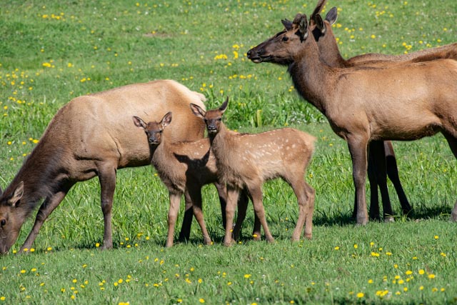
We set up camp near Crescent City and took a drive into town to get a look and get our bearing for the next morning. After having breakfast at a local diner, we drove north to the Oregon border and started backtracking to camp. We went out and about and came across these elk near the Smith River. This big guy was very protective over his small group of females and a couple of little ones.

Our next stop was the Del Norte County Historical Museum. This museum was, by far, the most complete museum we have ever seen for a small town. The townspeople were/ have been very generous in providing the materials to make this an incredible learning experience. We learned about the Brother Jonathan, a steamer that was lost off the coast here with a loss of over 200 lives, most of which have never been recovered. (We visited the Brother Jonathan Monument near Point St. George). The museum also houses the First Order Fresnel lens that once graced the St. George Reef Lighthouse This lens was 18 feet high and a fine example of 19th century engineering. There were also many documents and photos concerning the 1964 tsunami barrage that destroyed 29 city blocks and killed 11 persons. There was also a large collection of artifacts of the North Coast Tolowa and Yurok native people.
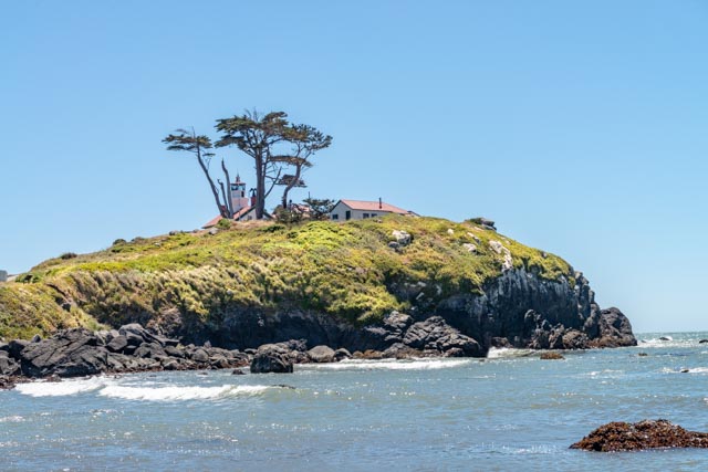
After the museum visit (which, due to the size of the collections, took a lot longer than we anticipated), we went to the Battery Point Lighthouse. We could not get to the facility however because the tides were rising. You can only get to the island at low tide! The husband and wife lighthouse keepers were stranded in the lighthouse during the series of tsunamis wrecked havoc on the mainland and swirled around the base of the lighthouse.
Cathy and Jason (center of photo) as seen from my advantage point high on a rock, being buffeted by very high winds.

I managed to find a tide pool for Jason. He is watching a couple of crabs scurrying about.
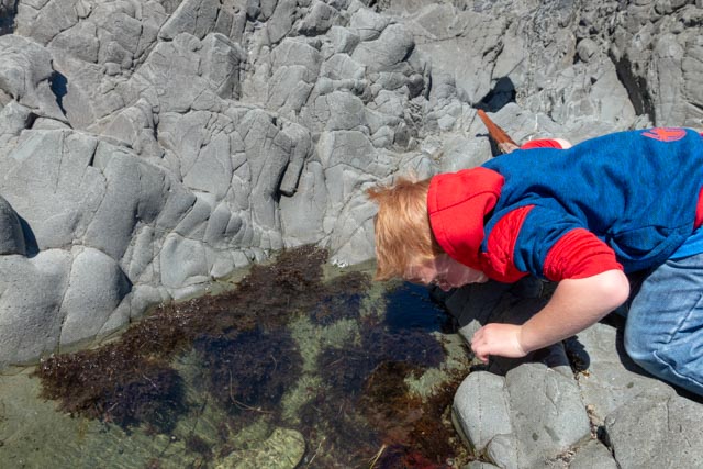
After the introduction to “tidepooling” Jason reverted to his favorite water sport . . throwing rocks. You can see the pathway to the lighthouse disappearing into the water in the background.

After visiting the Battery Point Lighthouse area we drove the scenic beach road to the north end of town to the St. George Reef Lighthouse. The lighthouse was located seven miles offshore and was replaced in 1975 by an automated buoy. Restoration is currently underway on the structure, but is only visible by air or sea, weather permitting and with NOAA permitting. Jason and I hiked to the area near the beach to attempt to get a glimpse, but the extremely high winds (actually blowing me over at one point) and the sandblasting caused us to turn around. My camera was coated with salt spray when we got back to the truck. The sea was wild!

Tuesday
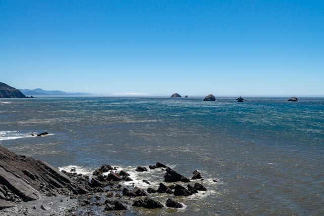
The next morning we pulled up stakes and continued on, down the coast to Garberville. We stopped for a few minutes due to road construction and captured these views of the sea.


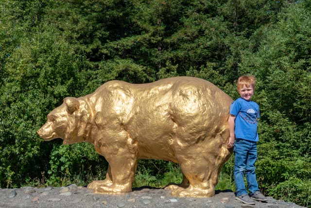
Crossing the Klamath River, Jason saw his first “California” bear so we stopped to get a shot. Jason was a little concerned when he saw a CHP turn around near us but he was interested in something more important!
Upon arrival in Garberville, we set up camp and immediately took a drive to Shelter Cove. The Briceland-Thorn Road is listed as “paved but very rough” and it took us a while to travel the 25 miles or so. We passed a cannabis nursery near Briceland that looked enticing . . . but we did not stop.
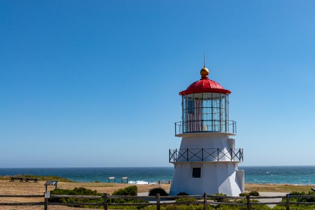
This is the Cape Mendocino Lighthouse, which has been relocated to Point Delgado. Even though it appears short for a lighthouse, it sits atop a 400 foot cliff, making it one of the tallest lighthouses in the country.
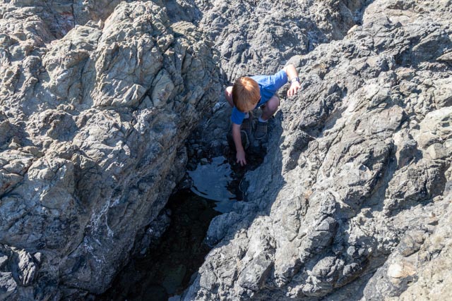
We made it down to sea level through a series of stairs and scrambling. The wind was still going strong but the tide pools were enticing.

Jason found crabs galore, one tide pool contained four! He also pulled some shelled creatures off of the rocks for a look, but returned them to their pool.
Across the water we were being closely watched by this collection of harbor seals and California sea lions. We saw dozens in total sunning on the very nearby rocks.

We were also being survailed by air . . . this was one of many storks that did fly-bys and Jason watched a red-tailed hawk soaring very low in the wind overhead.

Leaving Point Delgado, we wound our way to Black Sands beach in the King Range National Conservation Area. Point Delgado was at the end of the road southbound and this beachhead was at the terminus of the road northbound. I guess you don’t have to go to Hawaii to enjoy a black sand beach! All to ourselves!


