Nespelem
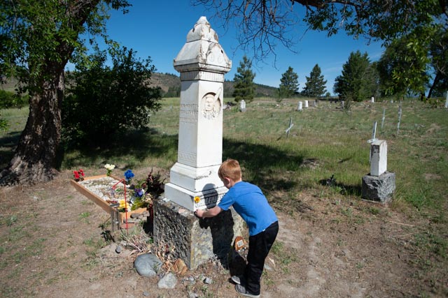
Our first priority once we arrive in Coulee was to make the trip to the Colville Tribes reservation. The Colville tribes number 12, with 11 being from the state of Washington with only the Nez Perce originating in Northeast Oregon, the Wallawa Valley to be specific. Previously we have camped near the town of Joseph and visited the Chief Joseph monument there. The reservation covers 2,300 square miles – about 1.4 million acres. We went to Nespelem in the morning and had difficulty locating the gravesite of Chief Joseph. To be honest, I expected the gravesite of one of this country’s greatest Native American Chiefs to me marked with a state or federal road sign. We finally stopped at a local service station and inquired. The attendant took us outside and pointed to where it was located, in a Catholic cemetery no less! Who would have thought? Just for clarification, I am a Chief Joseph / Nez Perce believer and fan.

The headstone was put in place by the Washington Historical Society a year after his death and was fairly unimposing. Not what I would call befitting the stature and accomplishments of the chief. The Nez Perce are unique in that they are the only tribe that the U.S. Army failed to capture.
While Chief Joseph’s father was still alive, the U.S. government had agreed to certain boundaries for the Nez Perce’s new reservation, but when gold was discovered on Indian land the government did not follow through on its promise. Instead, the size of the land was drastically decreased to just a portion of land in Idaho. The Nez Perce felt betrayed.
Refusing to relocate to a reservation and hoping to avoid bloodshed, Chief Joseph began a retreat that would go down in history. It is significant because many feel it began a downward spiral for the Native Americans in the West during the early nineteenth century. Their lives and their culture would be forever changed. The retreat of Chief Joseph towards Canada and the clashes with the U.S. Army attempting to halt their retreat have been called the Nez Perce War. The warriors traveled almost 1,170 miles during their retreat.
The journey began with 800 tribe members who had quite a bit of success in battling the U.S. Army. Chief Joseph was admired for his ability to lead his men and fight diligently even though greatly out numbered. However, the Army was systematically killing off his women and children along with his warriors. Those who were still being pursued were facing starvation.
Just short of the Canadian border, four months after the start of his retreat, Chief Joseph officially surrendered. In one of his many now famous quotes he told his people, “I am tired. My heart is sick and sad. From where the sun now stands I will fight no more forever.” He was almost within eyesight of the safety of Canadian soil.

His birth name was on the side of the monument.

Jason was looking at some of the “gifts” that have been left and he asked Cathy for a few coins so that he could leave something as well.
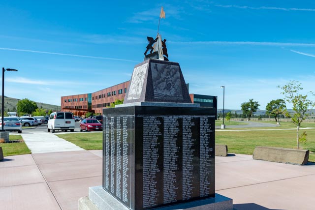
Once we left the cemetery we went to the Colvilles tribal headquarters on the Colville Indian Agency campus near Nespelem. The building in the background was pretty impressive at 155,000 sq. ft. as was this monument area where the Colvilles who sacrificed in the various U.S. wars are remembered.
Grand Coulee
After leaving Nespelem, we backtracked to the Grand Coulee Damsite (just had to throw that in). We overnighted in Grand Coulee, one of the four towns surround the dam. Electric City, Coulee Dam and Elmer City comprise the other three.
Grand Coulee dam is one of the largest concrete structures in the world, containing 12 million cubic yards of concrete. It is 550 feet in height and 500 feet wide at the base. It is the largest hydroelectric producer in the U.S., at 6,809 megawatts. Roosevelt Lake, behind the dam, extends 151 miles upstream to the Canadian border, has 660 miles of shoreline, a surface area of 82,000 acres and contains 9,562,000 acre-feet of water. Big as it is, “only” holds about 4 cubic miles of water, the original (Lake Missoula), millions of years ago at this location held over 500 cubic miles of water! Interesting note, due to recent heavy rainfall in the area, its level rose 8/10 of an inch the day we visited.
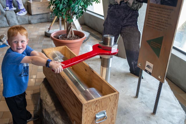
Enough with the details, it is a pretty impressive structure, albeit relatively unknown. Jason did have fun with some of the exhibits at the Visitor Center.

Jason decided to try the wrench. It may have been a little too much for him to handle.
While at the Visitor Center, we watched a movie about the construction of the dam. Actual construction started in 1933 and the first phase was completed in 1942. I fell asleep during the movie, though.
The Visitor Center was on a grassy knoll so Jason just had to roll down the hill . . . several times.
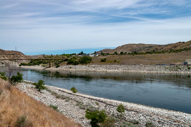
A view of the dam area from below the Visitor Center. The number three generating plant (added years after the original completion) is directly across the Columbia river.

Looking downstream toward the original bridge over the river.
Jason was goofing off on the old bridge. There are a series of placards discussing the history of the dam on both sides of the bridge. We walked both sides before trekking back to the Visitor Centerr, stopping at a park on the way back.

This is the spillway on the original structure. We watched a 30 minute laser light show that was projected on the dam at 10:00 p.m. The lasers used project out about 4,000 feet and produce images on nearly 300 feet in height. It is the largest outdoor laser light show in North America and is one of the largest laser projection systems in the world!

Leavenworth
Since we were a little ahead of schedule we decided to take the “long” way to Seattle, passing through the Grand Coulee, alongside the Banks Lake and crossing over Dry Falls, with its impressive canyons, stopping at a fruit stand near Orondo to pick up some apples and cherries, then continuing on to the German inspired village of Leavenworth. We set up camp at a very nice county park just outside of Wenatchee and drove into Leavenworth.
Cathy and Jason on one of the main downtown streets, looking for a restaurant that served weinerschnitzel.

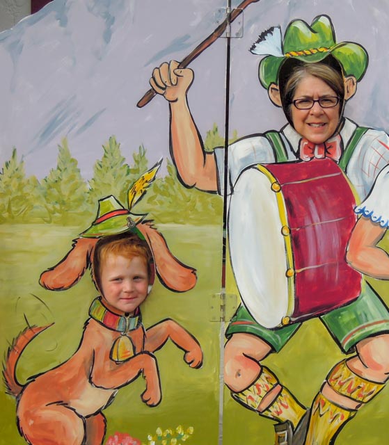
Leavenworth is very similar to the Georgia town of Helen, but upscale and on steroids and in an Alpine setting with both Nordic and Alpine skiing facilities nearby.

Here is one of many statues in downtown. We noticed the “do not climb on the statue” signage after we took this shot.
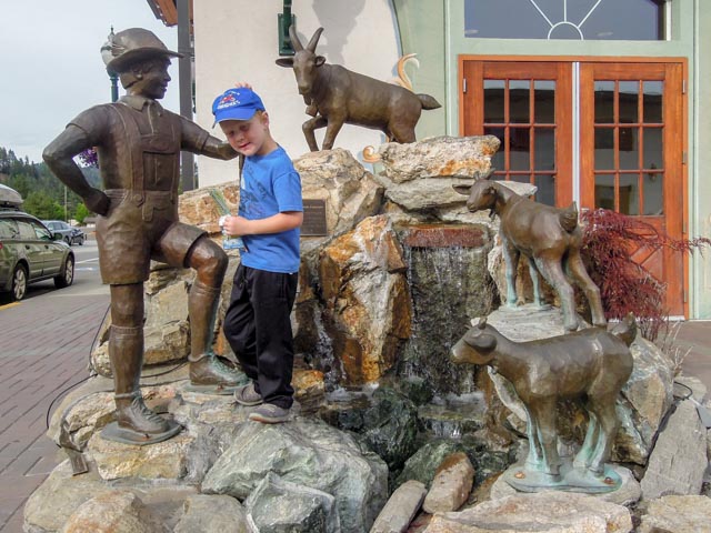
Me? Not in a million years. . .
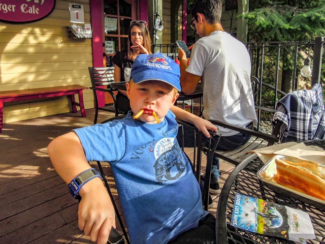
We found a hamburger joint that we all could enjoy. Jason liked the fries.
We went several miles up the canyon to the see the (Historic) National Fish Hatchery, which was put in place to replace the fisheries that the Coulee Dam destroyed. There is no fish ladder on the Grand Coulee Dam and the salmon fisheries that the Native American relied on stopped immediately when the river became diverted and blocked. There were several of these hatcheries placed on strategic rivers below the dam to try to offset the damage. They did/could not replace nature. The hatchery was closed for the evening (it was getting dark) and we saw several bucks while leaving. They were running beside us for this blurry shot.

Woodinville
We decided to continue up and over Stephens Pass, passing through the Cascades rather than going south to I-90. Granted, this way was a little longer (miles and time) but the views were outstanding. We saw saw-toothed, snow-covered peaks, crystal clear waterfalls, creeks, streams and wildlife such as deer and eagles along the way.
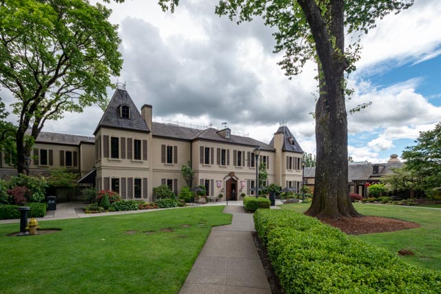
Once we made it to the western end of the canyon we turned south and took the infamous 405 to Woodinville, home of Chateau St. Michelle winery (and many, many other wineries). We pulled in and parked, then walked the gardens for an hour or so. By the time we made it to the hotel, they were trying to find the person who was blocking the receiving dock with their motor home. Oops, by the time I got back to move the MH, there were five tractor trailers backed up!
These are pictures of the gardens. There was a concrete, full width pool at the end of this lawn area. We saw bunnies and many grey squirrels (who were begging for food).

We heard a peacock so, following its call, we came across these five pools, with one of them holding a half-dozen trophy sized rainbow trout. That’s Jason, watching the bruisers on the left.
These are some of the walkways through the gardens.
The hotel (or lodge) of the Chateau is at the end of this walkway. There is a new tasting room with wine tasting galore to the right in this photo. The center is two stories high, with upstairs access limited to wine club members. From the ground level, that appeared to be where the really premium wines were being tasted. There were many types of wine available for tasting and/or purchase downstairs, though. I counted 12 different Chardonnays, about as many Cabernets, and that is before including the “Artist’s series. Wow.

Approaching the Hotel (lodge or whatever)
Jason found some sculptures to climb.

Just one of the planted areas near the parking lot.
There is also a top-of the line music venue here, similar to Chastain Park (Atlanta) with several big name artists scheduled to perform. Leaving Woodinville, we headed to Issaquah, just east of Seattle for several days.

I think Myrna and I might have eaten at that place in Leavenworth. It had different kind of sausages.
LikeLike